Plateau and Pic de Bure via the Joue du Loup chairlift

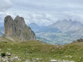
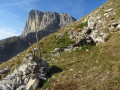
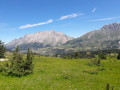
The easiest route to explore the Bure massif in summer, ascending via the ski resort’s chairlifts (open one day a week in July and August only). The plateau offers a lunar landscape with the observatory’s satellite dishes, and in clear weather, the view from the Pic de Bure is extraordinary.

The route is described here starting from La Joue du Loup, but there is a similar route starting from SuperDévoluy. Please note: this route is only accessible during the summer opening period of the ski lifts!

Details

103423391
Creation:
Last update:
Last review:
  • Walking
    Activity: Walking
  • ↔
    Distance: 8.05 mi
  • ◔
    Average duration: 5h 30 
  • ▲
    Difficulty: Moderate

  • ⚐
    Back to start: No
  • ↗
    Ascent: + 2,037 ft
  • ↘
    Descent: - 2,867 ft

  • ▲
    Highest point: 8,832 ft
  • ▼
    Lowest point: 6,463 ft

Photos

Description of the walk

Head to La Joue du Loup resort via the D937 then the D17 (Route des Stations). Park in the main car park at the resort entrance.
Take the Télémix des Fontettes to the right of the snow front. On arrival, head down to the left along a wide path to walk to the start of the Festoure chairlift and take it. The route starts at the top of this chairlift.

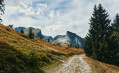
(S) Begin the ascent via the stony track that branches off to the left, heading east then south, following theGPR® route (yellow/red markings). Pass under a chairlift before a hairpin bend beneath the Sommarel rock, and reach the top of the Sommarel chairlift.

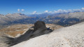
(1) Leave the track and head left up a path through the scree to reach the pass known as “La Fenêtre”, at the end of the Pierra d’Agnieres ski lift. Caution: this rocky section is a little tricky for those who are not used to it; a few wooden steps have been fitted.

(2) Continue to the right, following the GRP® route south-eastwards, to the Plateau de Bure Observatory.

(3) Turn left at the antennas, heading east-southeast, to follow the GRP® path which runs alongside the tracks used to move the antennas for about 1.4 km (almost to the end).

(4) Leave the tracks and take the GRP® path on the right, heading south-east then east-south-east, until you reach the junction with the path leading up to the Combe d’Aurouze.

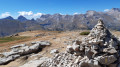
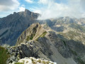
(5) Continue straight ahead, heading south-east, and leave the GRP® trail, which descends to the right. Follow the path which, after a few bends on a slightly steeper slope, leads to the summit of the Pic de Bure, marked by a large cairn and a wayfinding sign (partially damaged). Enjoy the 360° panorama: sweeping views across the whole of the Dévoluy, the peaks of the Écrins, part of the Vercors (Glandasse, etc.) all the way to Mont Ventoux!

(6) Head back down the path to the junction with the GRP®.

(5) Join the GRP® opposite, heading north-west; follow it all the way to the observatory you passed on the way up.

(3) Go round the buildings on the left and head up the path on the right, following the yellow/red markings and the cairns. Leave the path for a narrower track and reach the tricky section at the Pas de la Fenêtre, which you passed on the way out. Caution: the steep descent through the scree can be tricky and slightly exposed above a rocky outcrop.

(2) Follow the path in the opposite direction to the outward journey and rejoin the track.

(1) Descend the GRP® track heading north-east, pass the Sommarel chairlift terminus, then, in the shadow of the peak, take the small path on the left which cuts across the track’s hairpin bend. Pass under the chairlift and reach the Festoure chairlift terminus.

(S) Follow the piste which descends to the left and passes close to the top station of the Génépy chairlift.

(7) Head down the piste, heading north-east. Beneath the Festoure chairlift, take the bend to the left then to the right to follow the chairlift until you reach the edge of the meadow below it. Take another bend to the left, then one to the right, and you’ll reach a crossroads.

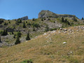
(8) Turn left to head down the grassy path which skirts around the left-hand side of Serres Lacroix. Pass above the start of the Génépy chairlift.

(9) Continue straight ahead, heading north-west up the western slope of Serres Lacroix.

(10) Turn right to leave the GRP®, heading north-east, and reach the top station of the Fontettes Télémix. The area features an orientation table and a picnic area.

(E) Take the Télémix back down to La Joue du Loup station.

Waypoints

  1. S : mi 0 - alt. 7,320 ft - Festoure chairlift top station
  2. 1 : mi 0.69 - alt. 7,946 ft - Crossing between the ski run and the GRP® trail - Pic du Sommarel (2385m)
  3. 2 : mi 0.93 - alt. 8,379 ft - Pas de la Fenêtre - Tête de la Cluse (2680m)
  4. 3 : mi 1.41 - alt. 8,369 ft - Plateau de Bure - Observatoire du Pic de Bure
  5. 4 : mi 2.19 - alt. 8,356 ft - Eastern end of the branch line tracks
  6. 5 : mi 2.37 - alt. 8,238 ft - Coude de La Selle – Carrefour Combe Aurouze
  7. 6 : mi 3.03 - alt. 8,773 ft - Summit - Pic de Bure
  8. 7 : mi 6.07 - alt. 7,257 ft - Junction at the top of the Génépy chairlift (elevation 2,214)
  9. 8 : mi 6.76 - alt. 6,841 ft - Crossroads – Vallon la Fille
  10. 9 : mi 7.37 - alt. 6,512 ft - Junction at the Génépy chairlift departure point (elevation 1,985)
  11. 10 : mi 7.96 - alt. 6,467 ft - Junction at the Fontettes leisure area
  12. E : mi 8.05 - alt. 6,463 ft - Top station of the Fontettes Télémix

Notes

Bring warm clothing (even in summer, as the wind often blows strongly on the plateau) and waterproofs (in case of storms). Also bring sun protection (high UV index).
High-altitude mountain environments are subject to rapidly changing weather conditions. Furthermore, access to the Plateau de Bure is strongly discouraged in uncertain weather. The summit of the Pic de Bure, the only high peak in the area, is prone to cloud cover. In foggy conditions, it is easy to get lost on the plateau, which is surrounded by very steep slopes and cliffs. The risk is also significant duringthunderstorms, as there is no shelter apart from the observatory buildings.

There are no sources of drinking water available along the route or on the plateau. It is essential to carry a sufficient supply of water, particularly in summer. Toilets, shops, restaurants, tourist accommodation and refreshment points are available at the resorts of La Joue du Loup and SuperDévoluy.

There is a picnic area near the top station of the Télémix des Fontettes (10), as well as near certain facilities within the resort.

The observatory buildings (3) are not open to the public.

(2) The Pas de la Fenêtre is undoubtedly the most technically challenging section of the route. The path runs through scree, on a fairly steep and vertiginous slope in places. It is still accessible to children used to walking in the mountains (aged around 8 to 10 and above), under adult supervision, provided they are wearing suitable footwear, especially for the descent.

The Bure Plateau is a fragile and unspoilt natural area. Please respect the environment by staying on the paths and keeping the mountain clean.
You may come across a few herds on the plateau. Please respect the animals and walk calmly around them without trying to approach them.

Ski lift operating hours (summer 2026): the ascent is available every Thursday morning in July and August from 8.30 am to 12 noon, departing from La Joue du Loup. This pedestrian pass allows you to ascend to an altitude of 2,200 m via the chairlifts: a paid ticket including 1 ascent + 1 descent (Fontettes from La Joue du Loup) + 1 morning ascent (Festoure). Online booking is essential and limited to 200 people.
Check the details directly on the resort’s website https://www.ledevoluy.com

This route passes through a protected area, which may be subject to special regulations:

Worth a visit

(2) The Pas de la Fenêtre takes its name from a natural arch carved into the limestone of the Dévoluy. This geological feature can be seen near the footpath.

(3)The Plateau de Bure Observatory is home to one of Europe’s largest radio astronomy instruments. The antennas ofthe IRAMinterferometer move along rails to adjust their observation configuration. Unlike an optical observatory (telescope), they detect the radio waves emitted by celestial objects.

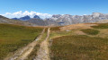
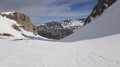
(4) Rising to an altitude of over 2,500 m, the Plateau de Bure is one of the most remarkable landscapes in the Dévoluy. This vast mineral wasteland, composed of heavily karstified Urgonian limestone, offers a setting often described as ‘lunar’.

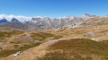
(6) From the summit of the Pic de Bure (2,709 m), the view stretches across the entire Dévoluy massif, the Écrins, the Vercors, the Champsaur, the Bochaine and, on a clear day, as far as Mont Ventoux.

Near the route

  • the SuperDévoluy resort, established in the 1960s, and La Joue du Loup;
  • the church of Saint-Étienne-en-Dévoluy and its rural heritage;
  • the Mère Église in Saint-Disdier, a remarkable 12th-century Romanesque church;
  • the Étroits Gorges;
  • the famous geological formations of the Dévoluy: the Obiou, the Grand Ferrand and the Bure cliffs;
  • the numerous traditional hamlets that bear witness to the rural architecture of the mountain range.

Other walks in the area

For more walks, use our search engine .

The GPS track and description are the property of this route's author. Please do not copy them without permission.