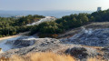
South of Larderello, you enter the ‘Devil’s Valley ’ (Aia dei Diavoli), an area affected by geothermal phenomena of volcanic origin characterised by endogenous steam seeping from the ground. Strange wisps of white steam rise from the wooded hills. In the past, with geothermal phenomena erupting violently from the ground accompanied by deafening noise and boiling mud, the region came to be known as Aia dei Diavoli. Today, however, due to exploitation by geothermal power stations, very few geothermal phenomena remain visible to the naked eye. The valley is characterised by the imposing cooling towers of the power stations and the glistening web of silver pipes stretching for hundreds of kilometres across hills and valleys. The energy companies, equipped with technologically advanced drilling rigs, extract steam from depths of hundreds of metres and channel it through these long metal pipes, which carry it from the borehole to the power stations’ generators. The white clouds that can be seen rising from the woods, on the other hand, are nothing other than the hundreds of geothermal power stations scattered across the hills, which together produce 10 per cent of the world’s geothermal energy!
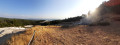
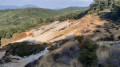
The areas where these phenomena occur are called ‘biancane’, due to the dominant white colour of the rocks. Hydrogen sulphide (H₂S), present in the high-pressure water vapour emissions, transforms limestone into gypsum; furthermore, the acidity of the emitted gases bleaches the jasper, which is normally red. From the very dense network of fractures in the rocks outcropping at the surface comes a continuous flow of vapour consisting, on average, of 95 per cent water vapour and 5 per cent various gases such as carbon dioxide, methane, ammonia, boric acid, hydrogen sulphide, hydrogen, nitrogen, radon and many others. Some features along the route:
- Bulicami: emissions of water and gas into small lakes of bubbling mud.
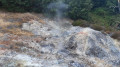
- Fumaroles: gas emissions consisting of water vapour, carbon dioxide and hydrogen sulphide. As they emerge from cracks in the ground, they cool on contact with the atmosphere, condensing into smoke.
- Lagoni: small natural hot-water pools or lakes fed at their base by a high-pressure natural vent, which enriches the water with mineral salts and boron.
- Solfatares: emissions of water vapour, carbon dioxide and hydrogen sulphide, the oxidation of which forms sulphur crystals that are deposited around their exit points on the surface.
The most interesting sites in this region are Larderello, with its geothermal museum and geothermal power stations; the Lagoni del Sasso, where one can see fumaroles (spontaneous steam vents); putizze (pools of boiling mud) and sulphur-scented thermal springs, as well as the ‘Il Bagno’ archaeological site, an ancient sacred thermal complex of Etruscan origin dedicated to healing deities.
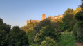
Sasso Pisano: the earliest historical records date back to 896. The extraction of minerals such as alum, sulphur and vitriol has had a significant influence on its history. In the Middle Ages, alum was in high demand, as it was used both in medicine as a haemostatic agent and in dyeing as a colour fixative. Disputed as early as 1204 between the bishops and the commune of Volterra, it was the scene in 1472 of the so-called ‘War of the Alum Works’, through which Florence definitively conquered the entire territory of Volterra. Today, it still retains the characteristics of a medieval fortress.
The Bagnone Baths, situated along the ancient road between Volterra and Populonia, are a sacred Etruscan thermal complex dating fromthe 3rd century BC, unique in northern Etruria. Some of the archaeological finds are preserved in the ‘Antiquarium’ in Sasso Pisano.
Finally, in the area of the village’s old wash houses, a small natural lagoon-style lake has been created, serving as the local swimming pool.
Larderello: the village was founded during the first half of the nineteenth century. Thanks to the entrepreneur François-Jacques de Larderel (1789–1858), it became one of Italy’s first industrial villages. The Enel Museum (free entry) offers the chance to learn more about geothermal energy and its natural phenomena. The exhibition begins in the Etruscan and Medieval periods, exploring the various uses of this resource, and culminates in industrial development and the modern challenge of renewable energy. It is also possible to attend a demonstration (for a fee) above the village, using a dedicated well. Drilled in 1956, this well is 740 metres deep, has a diameter of 9 5/8 inches and a flow rate of around 10 tonnes per hour at a temperature of 180°C. Fluid composition: 96 per cent water vapour, 4 per cent non-condensable gases.



 Country:
 City:
City:


 Visorando Member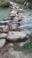

 Moderate
