Country:

 City:


Head to La Roche-des-Arnauds via the D994, then follow signs for the village centre. Continue on the D418, following the signs for ‘Les Roux – Les Baux’, for just under 2 km. At the large hairpin bend, turn left onto the Route Forestière de Matacharre (a dirt track but suitable for vehicles), which climbs gently north-westwards. After about 1.5 km, you’ll see two large cairns on the right, marking the start of a clearly visible path. Park in one of the few spaces to the right of the track.
It is also possible to avoid driving onto the track by parking to the right of the road, in the large hairpin bend to the right, and then walking up the Route Forestière (RF) de Matacharre.
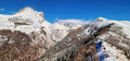
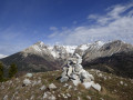
(S/E) Pass between the cairns to join the steeply ascending path, heading north-east, and climb up the ridge via numerous hairpin bends. Reach the Cuchon from the south, and continue along the ridge to the Tête de Vente-Cul. At the summit, admire the panoramic view and the large cairns.
(1) Continue along the path as it descends north-westwards to reach the nearby pass of the same name. Take the track heading north-north-east to reach the Col de Garcinel via a gentle slope.
(2) Carry on along track D8, which descends due north to Forest Road D7 at the Col de Conode, at the junction at Clot de Piarrou (elevation 1,624).
(3) Turn right, heading north, to climb the D7 track to the Col de Conode.
(4) Continue along the track for about 50 metres, then quickly turn off onto the small path on the left, heading north-west, at the edge of the forest. You will now leave the GRP® 94 Tour du Dévoluy. Cross the summit of the Bois de Loubet beneath the larch trees, and pass to the north of the Sommet des Templiers. Cross several ravines, passing through a mix of woodland, meadows and black earth. You will arrive at a grassy area at the foot of the large scree slope on the eastern face of the Bure plateau.
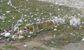
(5) Cross the Grangette de Conode stream and turn right, heading east, then north-east. Then make a wide left-hand bend, heading west, at Serre La Croix. Reach the Fontaine de Bure, at the foot of the scree. The spring forms a small pool, which is channelled to supply the herds’ drinking troughs.
(6) Turn back to return to the fork in the tracks at Clot de Piarrou (elevation 1624).
(3) Carry on straight ahead, south-west, to descend the track and reach the junction with the Matacharre track.
(7) Continue the descent straight ahead, heading south, until you reach a hairpin bend.
(8) Take the path straight ahead, heading south-south-east, which descends through the trees, cross the Eau Douce ravine, then emerge onto the Matacharre Forest Road.
(9) Follow the track down to the left, heading south-south-east, to return to the car park (S/E).
 Visorando Member

 Very difficult