Sentierelsa – Upper Val d’Elsa River Park

The Sentierelsa is a nature trail offering the chance to observe the flora and fauna of the River Elsa, particularly the many birds that find refuge there. This walk is also a journey through history, revealing evidence of the relationship between people and the river: the ‘gore’ (artificial canals) that once supplied Colle Val d’Elsa’s paper industry, the locks, an 18th-century mill, and the medieval bridge that allowed pilgrims and travellers to cross the river from the 11th century until the early 19th century.
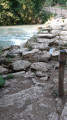
This family-friendly route follows the river and then crosses it several times via fords built on large boulders fitted with rope handrails.
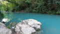
The route is renowned for its cool, shaded ‘enchanted spots’, and those where you can swim on hot summer’s days.
Alternative routes form a circular route towards the town centre, but the return trip along the riverbank remains the most enjoyable option.

Details

92787087
Creation:
Last update:
Last review:
  • Walking
    Activity: Walking
  • ↔
    Distance: 3.71 mi
  • ◔
    Average duration: 1h 50 
  • ▲
    Difficulty: Easy

  • ⚐
    Back to start: Yes
  • ↗
    Ascent: + 174 ft
  • ↘
    Descent: - 200 ft

  • ▲
    Highest point: 587 ft
  • ▼
    Lowest point: 417 ft

Photos

Description of the walk

Between Florence and Siena, take exit 4 ‘Colle di Val d’Elsa Sud’ on theFlorence motorway, then follow thePS541 towards Follonica. At the second roundabout, take the first exit towards Colle Vald’Elsa (Strada di San Marziale). At the next roundabout, after the Church of San Marziale, turn right onto Viale dei Mille and continue for about 200 metres. Finally, turn left onto Via Ciuffi Virgilio.
Park in the small car park on Via Ciuffi Virgilio (paid parking from April to October).

(S/E) Head towards Viale dei Mille and turn right to reach the entrance to the Sentierelsa, just before the Ponte di San Marziale.

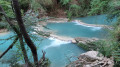
(1) Cross Viale dei Mille with care and follow the path down to the banks of the River Elsa. After about 200 m, you’ll reach a picnic area. Admire the lovely Cascata del Diborrato (a terraced waterfall forming a rocky pool) and the Grotta dell’Orso. Then continue along the river.

(2) Cross the River Elsa for the first time over the rocks (handrail) and continue through the forest.

(3) Cross again in the same way.

(4) Cross again in the same way.

(5) The arrival at the “Ponte di Spugna” marks the end of the nature trail. The remains of the old medieval bridge (Ponte di Spunga) are still visible nearby. Follow the path in the opposite direction to return to the starting point (S/E).

Waypoints

  1. S/E : mi 0 - alt. 584 ft - Car park on Via Ciuffi Virgilio
  2. 1 : mi 0.11 - alt. 564 ft - Park entrance – San Marziale (Viale dei Mille)
  3. 2 : mi 0.83 - alt. 479 ft - Guado di San Giorgio
  4. 3 : mi 1.37 - alt. 466 ft - Guado di Apollo
  5. 4 : mi 1.61 - alt. 436 ft - Guado degli equiseti
  6. 5 : mi 1.85 - alt. 449 ft - Park Entrance – Ponte di Spugna
  7. S/E : mi 3.71 - alt. 584 ft - Car park on Via Ciuffi Virgilio

Notes

It is also possible to start from the point (5) closer to the town centre (round trip).

The Sentierelsa is an easy, family-friendly walk of around 4 km (8 km return), with virtually no elevation gain.

The River Elsa is renowned for the clarity of its waters, and there are several spots where you can swim during the warmer months. These spots are very popular in summer.

The route follows the river the whole way and crosses it several times via paths built on boulders, often fitted with rope handrails. Depending on the water level, your feet may get slightly wet.

The route is largely shaded, making it an excellent destination in hot weather. Numerous pebble beaches, small waterfalls and natural pools invite you to take a break.

WARNING! Some crossings may be slippery. The path is generally accessible all year round but can become more challenging after heavy rain due to rising water levels.

Facilities:

  • Paid car park (April to October) at the start.
  • Several bars, cafés and restaurants in the historic centre of Colle Val d’Elsa.
  • Plenty of tourist accommodation in the town and surrounding area.
  • Picnic tables near the Cascata del Diborrato.
  • Water points and toilet facilities available in the town centre of Colle Val d’Elsa.

Worth a visit

The Sentierelsa trail is a remarkable example of Colle Val d’Elsa’s hydraulic heritage. Right at the start of the route, you’ll come across the Steccaia and the Callone Reale, two structures that were used to divert water from the Elsa River into the ‘gore’ – artificial canals that fed mills, forges and paper mills. This hydraulic system, essential to the town’s economic development, was modernised in the 17th century under Grand Duke Ferdinand I de’ Medici.

The Cascata del Diborrato, approximately 15 metres high, is one of the highlights of the walk. Its turquoise waters form a deep pool surrounded by lush vegetation.

Throughout the route, several information boards explain the site’s history, its biodiversity and the river’s former industrial uses. Notable sights include: the ‘Grotta dell’Orso’, the ‘Conchina’, the ‘Boulder Blanc’, the ‘Niche’ and the Esplanade des Faucons.

Also nearby are:

  • the historic centre of Colle Val d’Elsa, famous for its crystal production;
  • the Cathedral of Saints Alberto and Marziale;
  • the Colle Val d’Elsa Crystal Museum;
  • the ancient thermal springs in the Caldane area, known since Etruscan and Roman times;
  • the medieval villages of Monteriggioni and San Gimignano, situated a few kilometres away.

The river park is home to a wealth of biodiversity. With a little care, you can spot herons, kingfishers, ducks, dragonflies, amphibians and various freshwater fish.

For more walks, use our search engine .

The GPS track and description are the property of this route's author. Please do not copy them without permission.