Molines circular walk via Londonnière, Le Sellon and the Forêt du Roy

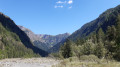
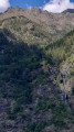
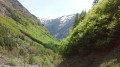
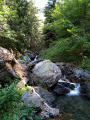
A pleasant circular walk around the Torrent de la Muande, in the Séveraissette valley at Molines-en-Champsaur. Almost entirely shaded along its entire route, this walk is particularly suitable during the summer heat. The climb is fairly gentle and pleasant as far as the Cabane de Londonnière. The footpath crosses several small streams before reaching the ruined hamlet of Sellon at the bottom of the valley. The return route takes you past the enchanting site of the Cabane de Suzaire, where huge boulders in the forest lend the place a unique charm, before descending beneath the Baisses de la Juberne.

A walk that allows you to discover one of the prettiest valleys in the Champsaur!

Details

101247599
Creation:
Last update:
Last review:
  • Walking
    Activity: Walking
  • ↔
    Distance: 9.01 mi
  • ◔
    Average duration: 6h 50 
  • ▲
    Difficulty: Moderate

  • ⚐
    Back to start: Yes
  • ↗
    Ascent: + 3,097 ft
  • ↘
    Descent: - 3,100 ft

  • ▲
    Highest point: 5,807 ft
  • ▼
    Lowest point: 4,009 ft

Photos

Description of the walk

From Saint-Bonnet-en-Champsaur, take the D23, then the D123 towards La Motte-en-Champsaur. Drive through the village and take the road to Molines-en-Champsaur; the car park is at an altitude of 1,220 m, reached after 4 km along a narrow road which may be temporarily blocked by flooding from the Torrent des Pins.
Park in the large car park on the right, about 500 m before the entrance to the village.

(S/E) From the car park, turn right, following the sign for “Départ des randonnées” (yellow markings). Walk upstream along the Séveraissette and then the Peyron Roux streams until you reach the village.

(1) Opposite the sign, turn left towards “Cabane de Peyron Roux”. Head back towards the village and take the road on the right just after the ONF lodge. Walk up through the village along the tarmac road, heading north-east. Pass in front of the church and reach the edge of the village, in the forest.

(2) Take the path on the right, still following signs for “Cabane de Peyron Roux” and the “Chemin de Ronde”, for about 100 metres until you reach another junction.

(3) Turn right and cross the Torrent de la Séveraissette via the bridge, heading east. You will then enter the Écrins National Park.

(4) Continue along the path straight ahead, heading south-east, and leave the “Col de Fontfroide – Cabane de Peyron Roux” route on your left. Cross the Torrent de Chagnard, pass through a beech forest, then begin the winding ascent (mostly in open terrain). Enjoy the view of the village of Molines, surrounded by its towering peaks.

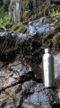
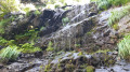
(5) Climb straight ahead, heading south-east, still ignoring the path on the left which leads to the Col de Fontfroide. Cross a small waterfall and go round the base of a cliff (short descent). Follow the path along the hillside, sometimes in the open, sometimes under the trees, towards the Cabane de Londonnière.

(6) Carry on straight ahead along the Chemin de Ronde”, still heading south-east, through a beech forest to reach the Cabane de Londonnière.

(7) Take the path that descends beside the fountain, towards Le Sellon – Le Roy. Ford the Torrent de Londonnière. The path, which then runs along the hillside heading south-east, is sometimes steep, particularly when crossing the Rvin de Ferrière. Cross several small streams before reaching a junction.

(8) Continue straight ahead, heading east, and climb up to the ruined hamlet of Sellon.

(9) Walk through the ruins of the hamlet, leaving the path leading up to the Cabane du Jas de Jartier on your left. Continue along the hillside, heading north-east, cross the Torrent du Colombier, then climb slightly upstream along a path that is poorly marked in places (due to the vegetation).

(10) Cross the Torrent de la Muande, then join the Torrent de l’Espére (or de la Selle).

(11) Turn right to cross the torrent that flows out of a steeply sloping gully. Climb along the hillside in the Vallon du Sellon, heading south-west, to enter the Mélèzin and continue the ascent, which is steep in places. Pass through a steep section, then descend slightly through the forest. Emerge at the boundary of the Écrins National Park and cross the Ruisseau de Riou Beyrou.

(12) Continue along the path straight ahead, heading west, and ignore the path on the left leading up to the Col de la Pisse. Join a track leading to the Route Forestière du Roy.

(13) Turn left to cross the Torrent de Viallet, heading west, ignoring the path on the right which descends towards the Ruines du Roy (a quicker return to Molines is possible by following the track on the right). The path climbs gently and crosses several small streams until it reaches the site of the Cabane de Suzaire. This large clearing is situated at the foot of the Barres de Suzaire cliffs.

(14) After the large boulders, climb slightly and take the path on the right, heading north-west, ignoring the path on the left which climbs towards the Col du Viallet (leading to the Chaillol 1600 ski resort), then, 100 metres further on, the path climbing towards the Col de l’Escalier (leading to Les Infournas Hauts). Continue along the circular path (yellow markings) through the forest, descending gently to the Torrent du Creux de l’Aigue.

(15) Turn right, heading north-west, ignoring the path on the left which climbs to the Col du Cendrié. Descend diagonally through the forest, crossing several streams.

(16) Continue straight ahead on the patrol path, heading north-west, descending until you reach the pebble-strewn bed of the Torrent de la Muande. Be careful: the path becomes less clearly marked as you approach the torrent bed, but the ford is signposted by a signpost.

(17) Ford the torrent, heading north-east, following the few cairns along the way. You’ll reach the Route Forestière du Roy, partly by sight.

(18) Follow the track back up to the village of Molines.

(1) Take the small path on the left, heading in the opposite direction, to reach the car park (S/E).


Waypoints

  1. S/E : mi 0 - alt. 4,012 ft - Molines-en-Champsaur car park - Séveraissette (torrent) - Affluent du Drac
  2. 1 : mi 0.34 - alt. 4,068 ft - Junction with the Route forestière du Roy
  3. 2 : mi 0.48 - alt. 4,127 ft - Junction with the Molines circuit
  4. 3 : mi 0.54 - alt. 4,170 ft - Footbridge over the Torrent de Peyron Roux - Séveraissette (torrent) - Affluent du Drac
  5. 4 : mi 0.66 - alt. 4,311 ft - Junction with the - Chagnard (torrent) - Affluent de la Séveraissette
  6. 5 : mi 1.09 - alt. 4,770 ft - Crossroads at Les Casses de Chagnard
  7. 6 : mi 1.83 - alt. 4,934 ft - Junction with the Route forestière du Roy
  8. 7 : mi 2.03 - alt. 5,016 ft - Cabane de Londonnière
  9. 8 : mi 3.23 - alt. 4,902 ft - Serpalier junction
  10. 9 : mi 3.48 - alt. 5,121 ft - Ruins of the hamlet of Sellon
  11. 10 : mi 3.67 - alt. 5,131 ft - Muande (torrent) - Affluent de la Séveraissette
  12. 11 : mi 3.79 - alt. 5,164 ft - Les Chazalets - Selle (torrent) - Affluent de la Muande
  13. 12 : mi 5.12 - alt. 5,446 ft - Junction with the Col de la Pisse path
  14. 13 : mi 5.22 - alt. 5,400 ft - Crossroads - Viallet (torrent) - Affluent du Riou Beyrou
  15. 14 : mi 5.74 - alt. 5,771 ft - Suzaire Hut
  16. 15 : mi 6.17 - alt. 5,607 ft - Col du Cendrié - Creux de l'Aigue (torrent) - Affluent de la Muande
  17. 16 : mi 7.45 - alt. 4,396 ft - Baisses de la Juberne junction – Col du Cendrié
  18. 17 : mi 8.07 - alt. 4,131 ft - Ford - Muande (torrent) - Affluent de la Séveraissette
  19. 18 : mi 8.31 - alt. 4,117 ft - Route forestière du Roy
  20. S/E : mi 9.01 - alt. 4,012 ft - Molines-en-Champsaur car park

Notes

Fountains in the village of Molines (1). The fountain at the Londonnière hut (7) is not always working. Several streams along the route.

Contemplative breaks are recommended at the Londonnière Hut (7), the ruins of Sellon (9) or the ruins of the Suzaire Hut (14).

Several fords can become tricky after heavy rain or during the snowmelt.

In the village of Molines-en-Champsaur: meals are available atthe Auberge Gaillard. Its garden, dotted with sun loungers and hammocks, offers a refreshing break after your walk!
As well as its renowned cuisine, the inn offers six rooms for those wishing to extend their stay in Molines-en-Champsaur. Whether for a meal or an overnight stay, booking is strongly recommended. Tel. 06 09 30 07 47 or 04 92 43 40 99 auberge-gaillard.fr

The Écrins massif is an exceptional area, open to all, boasting a rare natural, cultural and scenic heritage. To protect these treasures, the heart of the park is marked by blue-white-red flags, within which certain regulations must be observed. Please familiarise yourself with these regulations when planning your hike to help preserve this shared heritage, at https://www.ecrins-parcnational.fr

Shorter alternatives: at the Serpalier junction (8), it is possible to head back down towards the Torrent de la Muande

  • Return directly to the village via the Route forestière du Roy (elevation gain 500 m, total time 4 hours).
  • Continue on to the Torrent de Viallet (13), then rejoin the main route via the Cabane de Suzaire (elevation gain 960 m, total time 6h30).

Worth a visit

Where the Peyron Roux and Muande torrents join their crystal-clear waters, in the shadow of the Vieux Chaillol, Molines-en-Champsaur enjoys a setting of outstanding natural beauty. The village’s name is linked to the old mills that once stood there. Before the war, there were two families in Londonnière, two in Les Boyers, five in Le Roy, and five in Le Sellon (hamlets of Molines). Mass emigration to the United States, the two world wars of the 20th century and violent flooding of the torrents gradually emptied the village of its inhabitants, leaving the hamlets of Le Roy (at the confluence of the Riou-Beyrou and the Muande torrent), Sellon (which was the last to be abandoned), Londonnière and Les Boyers (well situated on the right bank, near Le Roy) at the mercy of the ravages of time. However, a few permanent residents still live in the village of Molines.
This gateway to the Écrins National Park serves as the starting point for numerous hikes.

(3) Just beyond the footbridge, a small hydroelectric power station was built during the Second World War by “Jeunesse et Montagne”. Founded in the wake of the 1940 debacle by a group of Air Force officers, this organisation – which served as a breeding ground for many Resistance fighters and future mountain guides – would give rise, a quarter of a century later, to the UCPA.

The Londonnière Hut (7) serves as an unstaffed refuge for walkers (a shelter equipped to sleep three people). Abandoned at the end ofthe 19th century, Londonnière (l’onda niera = ‘the black wave’ in Vivaro-Alpine Occitan, referring to the torrent that flows nearby) was one of the hamlets of Molines-en-Champsaur, clinging to the mountainside in the Vallon du Roy. The built environment is remarkable for the diversity of its constituent elements. These bear witness to the meticulous work of man in a well-exposed mountain location that was inhabited until 1874. The present-day house, converted into a shelter for walkers, occupies one of the two buildings of the former farm and comprises four vaulted rooms.Furthermore, a few features still bear witness to the site’s past, such as the mill’s stone millstone and numerous dry-stone structures.

(9) Le Sellon certainly lives up to its name: isolated, tucked away in the mountains, hidden from view. It is said to have been permanently abandoned following a major avalanche in 1916.

The hamletof “Le Roy” was known as “La Muande” until around 1780. There are numerous “muandes” in Champsaur-Valgaudemar; these are high-mountain valleys where herds were grazed and where shepherds had to spend the summer in makeshift shelters. These “muandes” gave rise to torrents which then flowed down into the valleys. However, legend has it that Louis XVI granted tax exemption to the hamlet’s inhabitants after it was ravaged by floodwaters. In gratitude, they are said to have renamed their village in his honour.

Other walks in the area

For more walks, use our search engine .

The GPS track and description are the property of this route's author. Please do not copy them without permission.