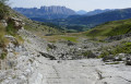
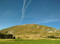
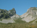
Route of the three passes in the Aune Forest

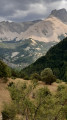
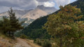
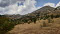
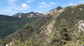
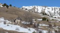
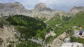
A circular route passing through three passes: the Col des Gières, the Col des Manges and the Col d’Aune. Mainly following shaded and fairly easy forest tracks, the route takes you through a wide variety of landscapes, from the mixed forest of Aune to the mountain pastures of Maniboux, all on the edge of the Dévoluy. As a bonus, there’s a beautiful panoramic view of the Crête des Bergers (Bure Massif) and the Petit Buëch Valley.

Details

89998848
Creation:
Last update:
Last review:
  • Walking
    Activity: Walking
  • ↔
    Distance: 6.46 mi
  • ◔
    Average duration: 4h 15 
  • ▲
    Difficulty: Moderate

  • ⚐
    Back to start: Yes
  • ↗
    Ascent: + 1,430 ft
  • ↘
    Descent: - 1,430 ft

  • ▲
    Highest point: 5,354 ft
  • ▼
    Lowest point: 3,990 ft

Description of the walk

From the D994 between Veynes and Gap, take the D937 towards Le Dévoluy. Just before the hairpin bends on the climb up to the Col du Festre, turn left to drive through the village of La Cluse via the D937B. Park in the car park at the western end of the village, just below the small hairpin bend.
To avoid a short walk along the track, you can drive along it and park in one of the few spaces on the left, just before the bridge.
It is also possible to take a coach towards Le Dévoluy, for example the Zou 515 service, departing from Veynes.

(S/E) From the car park, take the Route Forestière de la Forêt d’Aune and follow the GR®94 (marked in white and red) heading west. You’ll come to a junction with a bridge on your left.

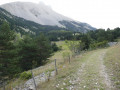
(1) Turn left to cross the bridge, then leave the GR®94 and take the track on the left which runs alongside the Torrent du Clos des Ânes, heading south-west. Head up through the Aune woodland, which is made up of beech and fir trees, until you reach a small junction 300 metres past the first hairpin bend.

(2) Turn right, heading south-west, to take the path through the forest.

(3) Take the path climbing to the left to join the nearby forest track. Follow it to the right to reach the junction at the hairpin bend.

(4) Turn left, heading north-east, to climb towards the Col des Gières along a ridge descending from La Remondière. Then turn south (viewpoint over the village of La Cluse below), and go through the gate. Please note: the path crosses summer pastureland; make sure you close gates and fences properly. Ignore the path leading down to the left and continue along the same track, which is almost flat, as it reaches the heights of the Ravin de l’Ubac. Make a short traverse eastwards to reach the Col des Gières. Admire the peaks of the Dévoluy and the Écrins. The Festoure is easy to climb from the north-east (a large grassy hump).

(5) Continue to the right along the track, heading south, on a gently ascending stretch through the short-grass alpine pastures, until you easily reach the Col des Manges. Observe the abundant wildlife in the meadows during the summer months (butterflies and grasshoppers) as well as the beautiful view of the Crête des Berger (Bure).

(6) Turn right, heading west, towards Plaine and the Col d’Aune. You’ll come to two old barns.

(7) Pass by the ruins of Plaine. The path becomes a trail which then climbs for 100 metres until it crosses the Crève-Corps ravine on the mountainside, joins the Côtes du Fau, and reaches the Font Bidouine spring (watering hole) in a ravine.

(8) Head up the opposite slope, heading north, towards the Col d’Aune. In the mountain pasture, the path is not always clearly marked: you’ll need to navigate by sight. Be careful: the path merges with the drovers' roads! Join a path coming from the left.

(9) Continue to the right, heading north-west, to cross the Font Bidouine ravine. Turn off towards the north-east and then north to reach the wide Col d’Aune. Enjoy the beautiful view of the Tête des Ormans, the Aiguille du Haut Bouffet and the Crête du Vallon. The Serre de Ramasset is easy to climb from the east (a large grassy hump).

(10) Head down to the left, towards the Torrent des Amésuras, to enter the deciduous forest until you reach the track. Stay firmly on the main path, heading north-west, ignoring the paths to the right and left. The descent has a few steep sections. You’ll come to a junction of paths.

(11) Continue along the main track, marked PR® Yellow, which takes a wide bend to the right before continuing its descent north-eastwards. You’ll reach a small clearing with fallen trees.

(12) Take the track on the left, heading north-west towards Boudelle (marked PR® Yellow). Cross the Torrent du Clos des Ânes, then the Pré la Pierre stream, before veering north-east across the meadow. Reach the Boudelle mountain pasture.

(13) Leave the path to go round the buildings on the right, following a circular loop that joins the Torrent des Ormans and the GR®94.

(14) Cross the stream and follow the edge of the trees, heading east. Continue descending across open ground, heading north-east. Pass through a short stretch of marl before reaching, via two hairpin bends, a path between two fields. Then continue along the path opposite to join the main route and cross the bridge over the Béoux.

(1) Turn right to head down the track and reach La Cluse (S/E).

Waypoints

  1. S/E : mi 0 - alt. 3,990 ft - Small pass car park – west of La Cluse
  2. 1 : mi 0.54 - alt. 4,055 ft - Junction of the circular loop. Bridge over the - Béoux (torrent) - Affluent du Petit Buëch
  3. 2 : mi 1.01 - alt. 4,272 ft - Path junction in the Aune forest
  4. 3 : mi 1.33 - alt. 4,534 ft - Junction of paths (below the track)
  5. 4 : mi 1.41 - alt. 4,567 ft - Forêt d’Aune junction (at the hairpin bend)
  6. 5 : mi 2.32 - alt. 4,865 ft - Col des Gières (1483m)
  7. 6 : mi 2.71 - alt. 4,872 ft - Col des Manges (1485m)
  8. 7 : mi 2.87 - alt. 4,826 ft - Ruins of the Plaine barns
  9. 8 : mi 3.69 - alt. 5,033 ft - Font Bidouine
  10. 9 : mi 3.9 - alt. 5,305 ft - Path junction – Font Bidouine Ravine
  11. 10 : mi 4.02 - alt. 5,354 ft - Col d Aune (1632m)
  12. 11 : mi 4.32 - alt. 4,977 ft - Junction of paths
  13. 12 : mi 4.62 - alt. 4,672 ft - Junction with the Torrent des Amésuras (R.F. Aune Forest)
  14. 13 : mi 5.09 - alt. 4,708 ft - Boudelle – GR®94 junction
  15. 14 : mi 5.22 - alt. 4,672 ft - Junction with the Torrent des Ormans
  16. S/E : mi 6.46 - alt. 3,996 ft - Small pass car park – west of La Cluse

Notes

Recommended time of year: spring, after the snow has melted and before the meadows turn yellow.

Fountain and lodge in the village of La Cluse (S/E): a stone fountain in the centre of the small village of La Cluse, opposite the chapel. A picnic area with toilets is situated near the car park. You can dip your feet in the Béoux torrent. During the summer season, the village is served by the ZOU 515 regional bus route, which connects Veynes to Le Dévoluy, amongst other places: timetable for the route.

A spring is located 200 m beyond the Col des Gières (5), at an altitude of approximately 1,409 m (however, its flow may be reduced during dry periods). There are no other reliable water sources along the route.

Additional accommodation, restaurants and shops can be found at the Col du Festre (approx. 4 km away) as well as at the resorts of La Joue du Loup and SuperDévoluy.

Alternative route for the return journey: at point (12), take the track on the right to reach point (4) directly.

Easy climb:

  • The grassy summit of La Festoure (1,535 m) from the Col des Gières (5): climb over the fence, then follow the grassy slope alongside the fence towards the summit. Beautiful views over the Dévoluy, the Bure massif, the Roc de Garnesier and the Petit Buëch valley.
  • The Serre de Ramasset (1,682 m) from the (10) Col d’Aune: an easy off-trail ascent up the grassy slopes to the east of the pass.

In August 2026: the forest track between (10) the Col d’Aune and the point (11) was rather rutted by the loggers’ heavy machinery.

Worth a visit

From the Col d’Aune, there is a sweeping panorama of the southern Dévoluy, the Garnesier mountain, the Tête des Ormans, the Aiguille du Haut Bouffet and the peaks bordering the upper Petit Buëch valley.

The Granges de Plaine (or Playne) bear witness to the historical importance of pastoralism in the Dévoluy. These old buildings served as seasonal dwellings for herders who took their flocks up to the mountain pastures during the summer (estives).

The Aune Forest forms a beautiful mosaic of beech, fir and Scots pine. It is home to a discreet array of wildlife, including roe deer, wild boar, woodpeckers and numerous birds of prey.

La Cluse is an ancient village situated on a natural pass that controls southern access to the Dévoluy. It is the only part of the Dévoluy that belongs to the Durance catchment area, via the Petit Buech, into which the Béoux flows. Its name derives from the Vivaro-Alpine Occitan word ‘Cluza’, meaning a narrow passage or gorge. The site’s strategic position has been recognised since the Middle Ages: the cartulary of Durbon Abbey mentions a ‘castrum de la Cluza’ in 1245. The village chapel and the old farmhouses reflect the traditional architecture of the Hautes-Alpes.

A few kilometres to the north, the Col du Festre is one of the main gateways to the Dévoluy massif, a valley offering numerous hiking trails accessible to a wide range of walkers.

Further into the Dévoluy, the remarkable sites of Mère-Église – one of the oldest churches in the French Alps – and the spectacular Gillardes springs are among the massif’s must-see attractions.

Always be cautious and plan ahead when you're outdoors. Visorando and the author of this route cannot be held responsible for any accidents occurring on this route.

The GR® and PR® markings are the intellectual property of the Fédération Française de Randonnée Pédestre.

Other walks in the area

For more walks, use our search engine .

The GPS track and description are the property of this route's author. Please do not copy them without permission.