Refine your search for walks in Landres
Landres walks
 Route des Fontaines
 Visorando Member
 2.49 mi
 +92 ft
 -72 ft
 1h 15
1h 15
 Easy
Easy
 Departure from Mercy-le-Bas (Meurthe-et-Moselle)
A beautiful walking route amongst the old stone buildings, tunnel fountains and the countryside.
Although described as a walking route, this route can also be tackled by mountain bike (in which case, adjust the starting point due to road signage; see description).
 Between Fontaines and Charpont
 5.88 mi
+322 ft
-318 ft
1.5 hrs
5.88 mi
+322 ft
-318 ft
1.5 hrs
 Moderate
Departure from Mercy-le-Bas (Meurthe-et-Moselle)
Moderate
Departure from Mercy-le-Bas (Meurthe-et-Moselle)
A route for fitness enthusiasts and walkers, for fans of beautiful photos, and lovers of peace and nature.
Mercéenne Valley
 5.68 mi
+243 ft
-269 ft
2h 50
Easy
Departure from Mercy-le-Bas (Meurthe-et-Moselle)
5.68 mi
+243 ft
-269 ft
2h 50
Easy
Departure from Mercy-le-Bas (Meurthe-et-Moselle)
Set in a very pretty rural setting with lush green valleys and a traditional village.
The Yellow Witch’s Walk
2.73 mi
+259 ft
-259 ft
1h 30
Moderate
Departure from Fillières (Meurthe-et-Moselle)
Famous for its Witches’ Festival, Fillières also offers lovely countryside and woodland walking trails. This walk through the woods will let you discover the charms of the Crusnes through the seasons.
The path is currently impassable due to fallen trees. Forestry work is not yet complete.
The Blue Witch’s Walk
3.77 mi
+240 ft
-230 ft
1h 55
Easy
Departure from Fillières (Meurthe-et-Moselle)
Famous for its Witches’ Festival, Fillières also offers lovely walking trails. This one combines a walk through the forest with country lanes. It runs alongside the River Crusnes and offers you peaceful spots to recharge your batteries in the heart of nature.
Amel Pond
 4.86 mi
+46 ft
-46 ft
2h 15
Easy
Departure from Senon (Meuse)
4.86 mi
+46 ft
-46 ft
2h 15
Easy
Departure from Senon (Meuse)
The Étang d’Amel, owned by the Conservatoire d’espaces naturels de Lorraine, was designated, along with the adjoining land, as a Regional Nature Reserve in 2006 by the Lorraine Regional Council.
The Étang d’Amel nature route, which runs through the villages of Senon and Amel-sur-l’Étang, features information boards and two observation points. This allows you to watch the birds without disturbing them.
 From Conflans-Jarny (station) to the Metz conurbation (Lorry-lès-Metz)
17.20 mi
+1,099 ft
-915 ft
2 hrs
Moderate
Departure from Jarny (Meurthe-et-Moselle)
The second part of the stage from Conflans-Jarny station is a route along small country roads back to Metz. The grounds of Moncel Castle near Jarny are an ideal spot for a break. From the Montvaux Valley, which we pass through, it is easy to reach the southern part of the Metz conurbation.
Bois Joeuf
 4.00 mi
+341 ft
-351 ft
2h 10
Easy
Departure from Jœuf (Meurthe-et-Moselle)
4.00 mi
+341 ft
-351 ft
2h 10
Easy
Departure from Jœuf (Meurthe-et-Moselle)
A family route suitable for all weathers, with or without your dog, fun with children, an easy and enjoyable short walk.
Long walk in the Moyeuvre-Grande State Forest
5.06 mi
+413 ft
-417 ft
2h 40
Easy
Departure from Moyeuvre-Grande (Moselle)
A circular route mainly through woodland, following an old forest road (closed to traffic) in the Moyeuvre-Grande State Forest, starting from the Tréhémont farm and passing through Moyeuvre-Petite. The final climb up to the plateau and the Tréhémont farm is quite a challenge: fairly steep and long.
The Tivoli Pond and the Mal au Ventre and Oubli springs.
 9.05 mi
+597 ft
-627 ft
4h 40
Moderate
Departure from Moyeuvre-Grande (Moselle)
9.05 mi
+597 ft
-627 ft
4h 40
Moderate
Departure from Moyeuvre-Grande (Moselle)
Forest hike from the Tréhémont farm and stables, following part ofthe GR®®5F trail, the Justemont trench to the Tivoli Pond, the Mal au Ventre spring and the Oubli spring, then returning via bridle paths through the Moyeuvre-Grande national forest.
Towards the Iron Mining Museum in Hayange
6.53 mi
+604 ft
-597 ft
3h 30
Moderate
Departure from Hayange (Moselle)
History of Northern Lorraine.
From Hayange, the "Cradle of Iron," to Neufchef, the Iron Mines Museum
Circular 10 km loop through the forests overlooking the "Fensch Valley".
Walk around Marspich, located near the steelworks
 Association / Club / Walk leader7.82 mi
+961 ft
-945 ft
4h 25
Moderate
Departure from Hayange (Moselle)
Association / Club / Walk leader7.82 mi
+961 ft
-945 ft
4h 25
Moderate
Departure from Hayange (Moselle)
A lovely walk passing through Volkrange, Beuvange-sous-Saint-Michel and back via Nilvange along shaded paths. A few steep climbs for experienced walkers.
Walk through the Lorraine Regional Park
 14.79 mi
+427 ft
-446 ft
7h 10
Moderate
Departure from Jarny (Meurthe-et-Moselle)
14.79 mi
+427 ft
-446 ft
7h 10
Moderate
Departure from Jarny (Meurthe-et-Moselle)
A walk in Jarnisy, in the land of the iron mines. You’ll walk through fields, woods and alongside marshes, and discover the eco-village of Ville-sur-Yron. You’ll be able to admire the village architecture, traditional Lorraine-style dwellings, the building materials used, and the history reflected in the landscape and the symbolic sites still visible today: the church, the mill, the wash house and the labourers’ cottage.
Along the Chiers between Lexy and Cons-la-Grandville
 6.30 mi
+433 ft
-456 ft
3h 15
Moderate
Departure from Lexy (Meurthe-et-Moselle)
6.30 mi
+433 ft
-456 ft
3h 15
Moderate
Departure from Lexy (Meurthe-et-Moselle)
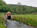
A walk along the Chiers, on a mainly tarmac-surfaced and easily accessible route. This walk takes you close to former industrial and production sites that are now disused. In the tranquillity of the forest, imagine the hum of activity from days gone by still echoing amongst the trees and the remnants of the past.
History and prehistory above Rombas
 5.56 mi
+722 ft
-732 ft
3h 10
Easy
Departure from Rombas (Moselle)
5.56 mi
+722 ft
-732 ft
3h 10
Easy
Departure from Rombas (Moselle)
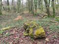
A circular route starting from Fond Saint-Martin, passing a geological site, a grave from the 1870 war, a viewpoint and sites linked to prehistory. There is a slight elevation gain on this route.
Circular walk around Fond Saint-Martin
2.24 mi
+358 ft
-361 ft
1h 20
Easy
Departure from Rombas (Moselle)
An easy, short walk, suitable for children aged 6 and over or as a gentle stroll, through the woodland around Fond Saint-Martin in Rombas.
The Drince Tower from Fond-Saint-Martin
 4.75 mi
+846 ft
-843 ft
2h 55
Easy
Departure from Rombas (Moselle)
4.75 mi
+846 ft
-843 ft
2h 55
Easy
Departure from Rombas (Moselle)
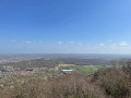
Hilly hike on the Côte de Drince with the Drince Tower and its spectacular view as the main attraction.
Mining heritage in Lasauvage and Fond-de-Gras
 13.12 mi
+1,142 ft
-1,135 ft
7h 00
13.12 mi
+1,142 ft
-1,135 ft
7h 00
 Difficult
Departure from Differdange (Luxembourg (Country))
Difficult
Departure from Differdange (Luxembourg (Country))
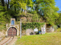
Lasauvage and Fond-de-Gras are must-see sites for understanding the mining history of this cross-border region.The railway line between Fond-de-Gras and Pétange was built in the 19th century to facilitate the transport of iron ore from the hills to the steelworks and foundries located on the plain.The narrow-gauge network, which can be seen in both Lasauvage and Fond-de-Gras, was used to transport the ore from the underground mine galleries to the transfer points.Fond-de-Gras, formerly known as the Lamadelaine industrial station, has now become a living museum of the region’s mining and industrial past and houses magnificent relics from days gone by. It is also the home of the ‘Train 1900’ and ‘Minièresbunn’ (underground) tourist trains, which operate mainly at weekends and on public holidays from May to September.
Notre-Dame du Chêne from Œutrange
 4.05 mi
+676 ft
-676 ft
2h 25
Easy
Departure from Thionville (Moselle)
4.05 mi
+676 ft
-676 ft
2h 25
Easy
Departure from Thionville (Moselle)
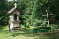
This circular walk starts from the village of Œutrange and takes you to the peaks of the Moselle hillside to the Notre-Dame du Chêne oratory.
Terres Rouges between Esch-sur-Alzette and Kayl
 11.33 mi
+1,079 ft
-1,106 ft
6h 10
Moderate
Departure from Esch-sur-Alzette (Luxembourg (Country))
11.33 mi
+1,079 ft
-1,106 ft
6h 10
Moderate
Departure from Esch-sur-Alzette (Luxembourg (Country))
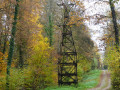
This magnificent walk takes you on a journey of discovery through the former mining sites operated by the A.R.B.E.D between Esch-sur-Alzette, Schifflange and Kayl. It is offered by the CFL (Luxembourg's railway company) as part of its Hike & Rail range of hiking trails from station to station and has been slightly modified by us at the start and finish.
Tour de Drince, starting from Pierrevillers
 2.97 mi
+554 ft
-551 ft
1h 50
Easy
Departure from Pierrevillers (Moselle)
2.97 mi
+554 ft
-551 ft
1h 50
Easy
Departure from Pierrevillers (Moselle)
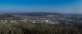
A circular route leading to the Tour de Drince (viewpoint), starting from the car park at the Pierrevillers community hall. Please note: the route is very muddy in winter.
The Mines in Differdange
 10.53 mi
+1,004 ft
-1,020 ft
5h 45
Moderate
Departure from Differdange (Luxembourg (Country))
10.53 mi
+1,004 ft
-1,020 ft
5h 45
Moderate
Departure from Differdange (Luxembourg (Country))
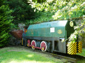
The mines, the mines of yesterday, the iron mines... this is the main theme of this hike.Fond-de-Gras is the most informative site on this subject: it was the station where narrow-gauge trains converged to unload iron ore into standard-gauge wagons bound for the steelworks and blast furnaces of Pétange, Differdange and others in Belgium and Germany.
Le Trou du Beau Bois
6.48 mi
+397 ft
-390 ft
3h 20
Moderate
Departure from Aubange (Province de Luxembourg)
This route straddles a linguistic border, the one that divides Belgian Lorraine into two cultural zones.
To the west lies the Gaume, characterised by Gaumais, a Lorraine dialect of Latin origin.
To the east, the Pays d’Arlon is characterised by a Germanic dialect, Moselle Franconian.
The place-names, sometimes Latin and sometimes Germanic, allow you to trace the course of this cultural boundary.
Halanzy – Habay-la-Neuve
 14.09 mi
+991 ft
-568 ft
7h 20
Difficult
Departure from Aubange (Province de Luxembourg)
14.09 mi
+991 ft
-568 ft
7h 20
Difficult
Departure from Aubange (Province de Luxembourg)
As the weather is set to be rainy with thunderstorms all day, I’m sticking to the main roads – even the major routes – to get to my destination for the day, Habay-la-Neuve, as quickly as possible. I’m staying in a hotel in the town. The stop (E) is therefore at my discretion.
In the footsteps of the iron miners
 11.60 mi
+1,585 ft
-1,568 ft
6h 45
Moderate
Departure from Musson (Province de Luxembourg)
11.60 mi
+1,585 ft
-1,568 ft
6h 45
Moderate
Departure from Musson (Province de Luxembourg)
This very natural route takes you on a journey of discovery through the wooded hills on the border between the Batte (Belgium) and Coulmy (France) valleys.Anyone with even a passing interest in the region's industrial history will also discover its mining and steel-making past, highlighted by the Transfrontier Iron Mines Trail and a number of information panels along the route.The trail passes by some of the iron mines that brought prosperity to the region in the 19th and 20th centuries, as well as the Musson slag heap, which over time collected all the slag from the mines on the Musson and Halanzy sides. Now cleaned up, it has been turned into a nature reserve managed by the DNF (Nature and Forestry Division).
Orchid walk in Châtel-Saint-Germain
 Local authority5.36 mi
+994 ft
-1,119 ft
3h 20
Moderate
Departure from Châtel-Saint-Germain (Moselle)
Local authority5.36 mi
+994 ft
-1,119 ft
3h 20
Moderate
Departure from Châtel-Saint-Germain (Moselle)
From Square du Tagnon, the route climbs towards the historic site of Mont Saint-Germain, then joins the Route de Guerre and the Route de Vernéville. It passes through the Bois des Bannaires, goes past the 1870 monument and the Ferme Saint-Hubert, then continues towards the Ferme de Moscou and the Hêtre des Batailles. The descent towards Châtel follows the Chemin de Gravelotte, before returning to Square du Tagnon via Rue Bonne-Fontaine.
The Perdrix Walk in Châtel-Saint-Germain
 4.44 mi
+472 ft
-797 ft
2h 25
Easy
Departure from Châtel-Saint-Germain (Moselle)
4.44 mi
+472 ft
-797 ft
2h 25
Easy
Departure from Châtel-Saint-Germain (Moselle)
From the Square du Tagnon, the route climbs towards the schools then joins the Route de Guerre and the ancient Roman road, formerly known as the Chaussée de France. It passes close to Fort Jeanne-d’Arc, skirts the site, then offers an unobstructed view of Metz before crossing the Bois du Reposoir. The descent is via the Chemin de Gravelotte, where you can see a remarkable service tree. The return route follows Rue de Cléry and Rue de Bonne-Fontaine back to the starting point.
The Buse Walk in Châtel-Saint-Germain
6.33 mi
+1,083 ft
-1,217 ft
3h 50
Moderate
Departure from Châtel-Saint-Germain (Moselle)
From Square du Tagnon, the route climbs towards the historic site of Mont Saint-Germain, then joins the Haie des Échevins and the Fort de Guise military road. After passing through Montvaux, the route follows the Route de Guerre through the forests of Forey and Flutôt, then descends along the edge of the woods towards Châtel. The final stretch takes you past the railway line, the Chemin des Fourrières and Place Bompard, before following the stream back to Square du Tagnon.
Nature and heritage around Châtel-Saint-Germain
 8.47 mi
+853 ft
-850 ft
4h 40
Moderate
Departure from Châtel-Saint-Germain (Moselle)
8.47 mi
+853 ft
-850 ft
4h 40
Moderate
Departure from Châtel-Saint-Germain (Moselle)
A superb walk in the woods of Châtel-Saint-Germain and Rozérieulles.
Walk through the enchanting ruins on the heights of Châtel, pass by the Jeanne d'Arc and François de Guise Fortified Groups built by the Germans, and admire the magnificent Hêtre des Batailles (Battle Beech) and a few graves from the 1870 war.
The Fox Walk in Châtel-Saint-Germain
5.21 mi
+702 ft
-873 ft
3h 00
Easy
Departure from Châtel-Saint-Germain (Moselle)
From the town hall, the route follows Rue du Ruisseau then climbs via Rue Jean d’Apremont, Rue de Cléry and Rue du Rebénot before joining Chemin des Goules and Route de Guerre. The route crosses the woods, passes near Captain Apchié’s grave, runs alongside Fort Jeanne-d’Arc and the old graves linked to the fighting of 1870. It continues towards the Moscou farm and the hamlet of Le Reposoir, then descends towards Châtel via the Square du Tagnon, Rue de Bonne-Fontaine and Ruelle de Gravelotte to return to the town hall.
Hêtre des Batailles, starting from Châtel-Saint-Germain
5.57 mi
+479 ft
-479 ft
3h 00
Easy
Departure from Châtel-Saint-Germain (Moselle)
A circular walk starting from Châtel-Saint-Germain, taking in the ruins of the abbey, the castle ruins and the protohistoric fortification, then the Leipzig farm on the plateau, and finally the Hêtre des Batailles, a remarkable tree (over 170 years old!).
The Pheasant Walk in Châtel-Saint-Germain
4.41 mi
+525 ft
-495 ft
2h 30
Easy
Departure from Châtel-Saint-Germain (Moselle)
From the town hall, the walk leads to the Square du Saulcy and then to the Promenade de Montvaux, a former railway line. The botanical trail then leads to the Route de Guerre and passes through the forests of Forey and Flutôt, where there is a remarkable service tree. At the edge of the woods, a path leads back down towards the Chemin de Lorry. Passing by the Saint-Georges farm, the descent along the Chemin de Vazelle offers a view of an old lime kiln before returning to the town hall via the Rue de Lorry.
The Lièvre Walk in Châtel-Saint-Germain
5.22 mi
+600 ft
-577 ft
2h 55
Moderate
Departure from Châtel-Saint-Germain (Moselle)
From the town hall, the route follows the stream then climbs towards Rue Jean d’Apremont and the footpath linking Châtel to Rozérieulles. It joins the Route de Guerre, crosses the Bois du Reposoir and passes close to the Mont Saint-Germain site before descending towards the Montvaux valley. The return route takes you via the Pas d’Âne, then through the village and along the Chemin des Fourrières.
The 360 steps of Châtel-Saint-Germain
5.89 mi
+928 ft
-928 ft
3h 30
Moderate
Departure from Châtel-Saint-Germain (Moselle)
A walk around Châtel-Saint-Germain, exploring the remains of the fortifications surrounding the city of Metz, including the famous 360 steps of a gigantic staircase! The highlight is the archaeological site at Châtel and its sarcophagi. And, as always, the forest, with a stretch exposed to the wind on the plateau.
The ‘Hêtre des Batailles’ walk in Châtel-Saint-Germain
3.92 mi
+463 ft
-600 ft
2h 10
Easy
Departure from Châtel-Saint-Germain (Moselle)
The route forms a circular path starting from the town hall: it passes by the wash house on the Ruisseau de Montvaux, climbs towards the archaeological site of Mont Saint-Germain, crosses the Bois du Reposoir to the Moscou farm, reaches the Hêtre des Batailles, then descends back towards the village, passing a remarkable service tree and rejoining the large wash house before returning to the starting point.
The Deer Walk in Châtel-Saint-Germain
6.52 mi
+781 ft
-758 ft
3h 40
Moderate
Departure from Châtel-Saint-Germain (Moselle)
From the town hall, the route heads towards Lessy then climbs towards the Saint-Georges farm, offering a view over the Moselle valley. It continues along the edge of the woods to the Route de Guerre and the small viaduct, then follows the Ruisseau de Montvaux before crossing the RD643 and climbing the 360-step staircase. The path then passes by the Leipzig farm and the Mont Saint-Germain site before heading back down towards Châtel via the wash house, the Chemin des Fourrières and the Rue de Lorry.
Route des fermes in Châtel-Saint-Germain
11.73 mi
+1,893 ft
-1,916 ft
7h 05
Moderate
Departure from Châtel-Saint-Germain (Moselle)
From the town hall, the route follows Rue de Lorry then the old railway line before joining the Botanical Trail. It then takes Route de Guerre down towards the Ruisseau de Montvaux. The path crosses the RD643 and heads back up towards Amanvillers, continuing on to the Montigny-la-Grange farm, then runs alongside the farms on the plateau and the Leipzig industrial estate. It then joins the Haie des Échevins, the Mont Saint-Germain site, and descends back towards the village via the Chemin de la Taye, the wash house and the Chemin des Fourrières, before returning to the town hall.
Bettembourg – Vieille Hage Farm
46.43 mi
+1,932 ft
-1,732 ft
10 hrs
Difficult
Departure from Bettembourg (Luxembourg (Country))
From the Grand Duchy of Luxembourg, this route heads to Arlon, the capital of the Belgian province of Luxembourg, before passing through the villages of northern Gaume. Away from the main roads, it follows cycle paths, country lanes and tracks reserved for farm machinery, as well as a few rideable footpaths. There are several suggested stops to choose from, so you’ll need to pick a few to complete the stage in a single day!
The battle beech tree
 7.56 mi
+581 ft
-568 ft
4h 00
Easy
Departure from Rozérieulles (Moselle)
7.56 mi
+581 ft
-568 ft
4h 00
Easy
Departure from Rozérieulles (Moselle)
A walk with varied landscapes. A gentle route through forest, grassland and cultivated areas. This route is strongly imbued with a former military presence.
The Battle Beech (1870)
 6.19 mi
+479 ft
-479 ft
3h 15
Moderate
Departure from Rozérieulles (Moselle)
6.19 mi
+479 ft
-479 ft
3h 15
Moderate
Departure from Rozérieulles (Moselle)
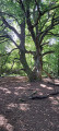
Head up through the woodland along the Route de Guerre to the battlefields of 1870, then walk round the Moscou farm to see the ‘Hêtre des Batailles’ (Battle Beech), which is around 200 years old and has naturally propagated by layering. Head back down via the Route du Fort Jeanne d’Arc.
Vaux - Les Sept Nains (fortifications)
 7.43 mi
+463 ft
-459 ft
2 hrs
Moderate
Departure from Vaux (Moselle) (Moselle)
7.43 mi
+463 ft
-459 ft
2 hrs
Moderate
Departure from Vaux (Moselle) (Moselle)
A mountain bike ride between Vaux and Gravelotte through an area fortified by the Germans between 1912 and 1916 to protect Metz. Remember that at that time (from 1870 until 1918), Alsace and Moselle were part of the German Empire.
On the hills above Ancy in Ars-sur-Moselle
4.95 mi
+577 ft
-577 ft
2h 45
Easy
Departure from Ars-sur-Moselle (Moselle)
The walk takes you mainly through woodland and orchards.