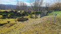
The Deer Walk in Châtel-Saint-Germain

From the town hall, the route heads towards Lessy then climbs towards the Saint-Georges farm, offering a view over the Moselle valley. It continues along the edge of the woods to the Route de Guerre and the small viaduct, then follows the Ruisseau de Montvaux before crossing the RD643 and climbing the 360-step staircase. The path then passes by the Leipzig farm and the Mont Saint-Germain site before heading back down towards Châtel via the wash house, the Chemin des Fourrières and the Rue de Lorry.

Details

90943569
Creation:
Last update:
Last review:
  • Walking
    Activity: Walking
  • ↔
    Distance: 6.52 mi
  • ◔
    Average duration: 3h 40 
  • ▲
    Difficulty: Moderate

  • ⚐
    Back to start: Yes
  • ↗
    Ascent: + 781 ft
  • ↘
    Descent: - 758 ft

  • ▲
    Highest point: 1,161 ft
  • ▼
    Lowest point: 669 ft

Description of the walk

Starting point: Châtel-Saint-Germain town hall.

(S/E) Turn right towards Lessy. At the junction by the large lime tree, turn left and pass under the old railway line.

(1) Near Lessy Town Hall, close to the fortified church, take Rue de la Côte on the left, towards Ferme Saint-Georges. Follow the tarmac road.

(2) You can reach the viewpoint over the Moselle valley at the entrance to the plateau by taking the footpath on the right. Alternatively, carry on along the road towards the crossroads near the farm.

(3) Carry on straight ahead along the Chemin de Lorry.

(4) Turn left onto the footpath that leads into the woods. Continue along the edge of the woods until you reach the Route de Guerre, near the Notre-Dame du Gros Chêne Chapel.

(5) Cross the road.

(6) Follow the path – an old military railway line – to the small viaduct. Take the path leading down to the left. Pass under the old railway line.

(7) Before the ford, take the path on the right, along the Ruisseau de Montvaux, to a small bridge (note the remains of the wash house at Ferme Saint-Vincent upstream of the bridge).

(8) Cross the stream, then, at the end of the path, cross the RD643 road. Climb the 360-step staircase opposite. At the top of the stairs, continue straight on along the path until you reach the road. Follow it to the left until you reach the crossroads.

(9) Continue to the right towards the Ferme de Leipzig.

(10) Take the Route de Vernéville on the left until you reach the car park. Cross the car park and continue to the right along the Route de Guerre, which leads to the Mont Saint-Germain archaeological site.

(11) Go through the gate and across the lawn. Walk round the pine-covered hill and turn left onto the Chemin de la Taye, which leads to the village. At the bottom of Rue du Mont Saint-Germain, cross the RD643 road.

(12) Continue to the right until you reach the wash house by the stream. After the sports hall car park, carry on to the right onto the Chemin des Fourrières. At the end of the track, follow Rue de Lorry to the right towards the town hall (S/E).

Waypoints

  1. S/E : mi 0 - alt. 669 ft - Châtel-Saint-Germain Town Hall
  2. 1 : mi 0.58 - alt. 820 ft - Lessy Town Hall
  3. 2 : mi 0.99 - alt. 997 ft - Viewpoint over the Moselle Valley - Moselle (la)
  4. 3 : mi 1.82 - alt. 1,129 ft - Crossroads near St Georges Farm
  5. 4 : mi 2.32 - alt. 1,142 ft - Shortcut
  6. 5 : mi 2.85 - alt. 1,106 ft - War route
  7. 6 : mi 3.09 - alt. 1,086 ft - Small viaduct
  8. 7 : mi 3.53 - alt. 791 ft - Ford - Ruisseau de Montvaux (cours d'eau) - Affluent du Fosse des Vieilles Eaux
  9. 8 : mi 3.73 - alt. 823 ft - Remains of the wash house at St-Vincent Farm - Ruisseau de Montvaux (cours d'eau) - Affluent du Fosse des Vieilles Eaux
  10. 9 : mi 4.11 - alt. 1,076 ft - Crossroads
  11. 10 : mi 4.7 - alt. 1,073 ft - Leipzig Farm
  12. 11 : mi 5.77 - alt. 1,020 ft - Lawn at the entrance to the Mont St-Germain site
  13. 12 : mi 6.28 - alt. 676 ft - Wash house on the - Ruisseau de Montvaux (cours d'eau) - Affluent du Fosse des Vieilles Eaux
  14. S/E : mi 6.52 - alt. 669 ft - Châtel-Saint-Germain Town Hall

Notes

There are several car parks near the start of the walk.

Worth a visit

Mont Saint Germain archaeological site: information about the site is available on the town hall’s website and at the town hall.

Other walks in the area

For more walks, use our search engine .

The GPS track and description are the property of this route's author. Please do not copy them without permission.