Country:
 City:
City:



Start at Mercy-le-Bas, Place Sainte Anne (junction of the D24 and D643).
(S) Head towards Saint Supplet, following the D24 for a few hundred metres through the village. Take the second left; you’ll pass the church, then turn right into a narrow alley (due south). Carry on straight ahead until you reach a cross street. Turn right – it’s quite a steep descent. At the bottom of this street is the first stop: a tunnel fountain.
Then carry on straight ahead, passing the chalet, until you reach the D24 at a right angle; cross it. Pass a few more houses and take the forest track. 300 metres further on, on your left: visit the second tunnel fountain, in the heart of the forest.
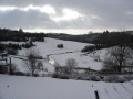
Continue straight on: there’s a fork in the road 100 metres ahead (carry on straight ahead; don’t turn left) and stay on this track towards the forest. Take a good look to your left to take in the view (panorama), then head down into the forest. Be careful – hold on tight to the handlebars! At the bottom, you can admire the valley floor alongside the river ‘La Pienne’. The path leads out into a clearing on the edge of the woods. Before heading back into the forest, it splits: one branch leads down into the meadow. Follow the path through the meadow towards the ‘Trouée Forestière’ by the water’s edge, a metal footbridge that allows you to cross (very easy to find).
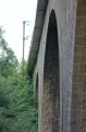
(1) After the footbridge, head back up (by mountain bike for the more adventurous, on foot for everyone else) through the forest for 200 metres. You’ll reach the “Charpon” forest track. Turn right. Below, you’ll pass under a superb railway viaduct, spanning the road and the river.
(2) After this viaduct, you’ll pass between the walls of the old “Moulin de Charpon”, then, after a footbridge, the road curves sharply and you’ll reach a crossroads.
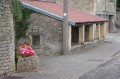
(3) Turn right and head up towards Boismont. Be warned: it’s a continuous climb all the way to the village and the hill is long. After the church, turn right and head down to the wash house. You can rest there whilst admiring and photographing the view. Then carry on straight ahead. You’ll join the D643 (formerly the RN43). Turn right and head towards Mercy-le-Bas. In the village, on the flat stretch, just before the “Cantine de la Mine” café.
(4) Turn right into the narrow lane, then left at the end. 150 metres further on, at a house flanked by tall hedges (you can’t miss it), take the path on the right until you reach a road running perpendicular to it. Turn left and head towards the village. As you enter the village, between the houses, you’ll see a Stop sign. Turn left and walk up towards Place Sainte Anne, the starting point, in front of the chapel of the same name (E).
Enjoy your walk.

 Visorando Member