Mercéenne Valley

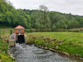
Set in a very pretty rural setting with lush green valleys and a traditional village.

Details

2715
Creation:
Last update:
Last review:
  • Walking
    Activity: Walking
  • ↔
    Distance: 5.68 mi
  • ◔
    Average duration: 2h 50 
  • ▲
    Difficulty: Easy

  • ⚐
    Back to start: Yes
  • ↗
    Ascent: + 243 ft
  • ↘
    Descent: - 269 ft

  • ▲
    Highest point: 984 ft
  • ▼
    Lowest point: 837 ft
  • ⚐ Country: France
  • ⚐ City: Mercy-le-Bas (54960)
  • ⚑
    Start/End: N 49.384846° / E 5.754654°
  • ❏
    IGN map(s): Ref. 3211E, 3311O
  • Hour-by-hour weather

Photos

Description of the walk

This walk can be done on foot, by mountain bike or (by bicycle with children). It is an easy walk.

(S) Start at Place Sainte-Anne (chapel and bus shelter) at the junction between the Rd24 and the Rd643 (formerly the RN43). Head towards Xivry-Circourt (south).

(1) At the entrance to Xivry-Circourt, before the first houses, turn right. Continue straight on between the first houses; you’ll cross two small bridges. At the end, turn right, following the stream (north). Leave the village by heading uphill. You’re now on a tarmac local road heading towards St-Supplet, following a flat stretch for several kilometres.

(2) Just before St-Supplet, at the junction with the Rd24, turn right and head down towards the village of Mercy-le-Bas (it’s worth not taking the first right straight away, but carrying on to the centre of the village and taking the second right, to climb the ‘steep bit’ up to the church). Be careful, it’s a steep climb! In front of the church, there are two options on foot: either cross the cemetery (using the steps) and come out at the other end onto the Rd24 – this is safer – or, in front of the church, turn left onto the Rd24 (be careful: there’s a narrow, blind bend uphill; keep well to the side). You’ll reach Mercy-le-Bas, pass through the village, and arrive back at the starting point, Place Sainte-Anne (E).

Waypoints

  1. S/E : mi 0 - alt. 965 ft - Place Sainte-Anne
  2. 1 : mi 2.07 - alt. 899 ft - Turn right at the entrance to Xivry-Circourt. Bridges over the - Piennes (rivière)
  3. 2 : mi 4.56 - alt. 876 ft - Take the second road on the right in St-Supplet
  4. S/E : mi 5.68 - alt. 965 ft - Place Sainte-Anne

Notes

Shelter: bus shelter on Place Sainte-Anne at the start.

Worth a visit

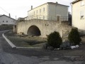
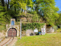
In Mercy-le-Bas, you can ask to see the “Fontaine tunnel” and the “Fontenette” (practically on the route) – both very typical.
A log cabin on Rue de la Fontaine with a magnificent panoramic view of the Pienne valley.

Reviews and comments

3.8 / 5
Based on 4 reviews

Reliability of the description
3.8 / 5
Ease of following the route
4 / 5
Route interest
3.5 / 5
Mike57190
Mike57190

Overall rating : 4.7 / 5

Date of your route : Nov 24, 2019
Reliability of the description : ★★★★☆ Good
Ease of following the route : ★★★★★ Very good
Route interest : ★★★★★ Very good

A really lovely landscape – the only downside is the first 3 km, which run alongside the road. Fortunately, there’s not much traffic on Sundays, but the cars still brush past us.

Machine-translated

Marie-Claude1954
Marie-Claude1954
• Edited:

Overall rating : 3.7 / 5

Date of your route : Nov 05, 2018
Reliability of the description : ★★★★☆ Good
Ease of following the route : ★★★★☆ Good
Route interest : ★★★☆☆ Average

The route between Mercy-le-Bas and Xivry-Circourt runs alongside the road; there’s a lot of traffic (cars, lorries and tractors), which is very annoying. Afterwards, we headed back towards Mercy-le-Bas via Saint-Supplet on a tarmac-surfaced local road (not a country lane at all) – which is a shame. The scenery is pleasant and the villages are interesting – well worth a visit.

Machine-translated

grandin
grandin ★
• Edited:

Our authors sometimes use existing signposting to clarify their route descriptions, but when using a Visorando page, it is important to bear in mind that any signposting on the ground is optional, and you should rely solely on the map and the route description to find your way. To hike on signposted routes, please contact your local tourist information offices.

Machine-translated

danylhe
danylhe

It’s a shame there’s no coordination between the various people in charge of the walks.
It’s the walkers who end up bearing the brunt of this.

Machine-translated

grandin
grandin ★

danylhe

This walk is completely independent of any signposting that may exist on the ground. Visorando does not signpost its walks!

Machine-translated

danylhe
danylhe

Overall rating : 3 / 5

Date of your route : Aug 20, 2018
Reliability of the description : ★★★☆☆ Average
Ease of following the route : ★★★☆☆ Average
Route interest : ★★★☆☆ Average

The route on the map no longer corresponds to the markings on the ground
part of the route follows a very fast-flowing county road
which makes it safe for a group

Machine-translated

The user account associated with this content has been deleted.

Other walks in the area

For more walks, use our search engine .

The GPS track and description are the property of this route's author. Please do not copy them without permission.