Country:
 City:
City:


Start from the Fond Saint-Martin car park, Chemin de la Croix Navée, in Rombas.
(S/E) Head south and climb towards the pond. Walk along the left-hand side of the pond, then pass between the playground and the refreshment kiosk.
(1) Behind the refreshment bar, turn right. The path climbs and makes a wide circular loop, passing two path junctions on the right.
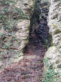
(2) Climb a short, steep slope to the right. Join a level path and follow it to the right (south). Above the path lies the Roches site. The path eventually descends and leads to a junction.
(3) Take the wide stony path continuing southwards. Walk for some time, heading south, then south-south-west. Just before a gate and thefirst houses of Malancourt-la-Montagne, turn left and head uphill. At the junction that appears immediately, turn right.
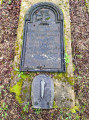
(4) At the T-junction, turn left. Note, at the side of the path, the grave of a soldier from the 1870 war. After about a hundred metres, turn sharply right and you will soon come out onto a track.
(5) Follow this track to the left. It is straight and marked with yellow posts (indicating an underground gas pipe); keep heading east-north-east until you join theGR®®5F.
(6) Follow theGR®® to the left (red and white markings) as it winds through the forest until you reach a crossroads.
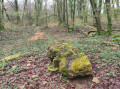
(7) Take the first path on the left (leaving theGR®®) and immediately let a path branch off to the right. Walk along an earthwork on your right: this marked the fortification of a Celtic oppidum by isolating the end of the plateau (a blocked spur). Pass the Dolmen de la Pierre qui Tourne on your right and arrive at a junction.
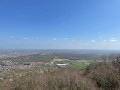
(8) Then turn right and cross the earthwork. At the Fork in the road shortly afterwards, veer to the right (north-east). Join a path coming from the right and follow it to the left. Walk north-east to a junction where you rejoin theGR®®5. Then follow this to the left to reach the Tour de Drince.
(9) Turn right and follow the winding path down below the tower. At the bottom, take a level path to the left (marked with a Blue Ring) and continue along the hillside.
(10) At the end of the path, turn right. After about 150 m, take the first path on the left (Blue Ring andGR®®5F). Head downhill, staying on the main signposted path and ignoring the side paths.
(11) You’ll come out onto a small road; follow it to the right past a riding centre. Turn left onto this road, below the dual carriageway. Pass the football ground, turn left and you’ll soon reach the car park (S/E).

 Visorando Member
 Moderate