Route des Fontaines

A beautiful walking route amongst the old stone buildings, tunnel fountains and the countryside.
Although described as a walking route, this route can also be tackled by mountain bike (in which case, adjust the starting point due to road signage; see description).

Details

2718
Creation:
Last update:
Last review:
  • Walking
    Activity: Walking
  • ↔
    Distance: 2.49 mi
  • ◔
    Average duration: 1h 15 
  • ▲
    Difficulty: Easy

  • ⚐
    Back to start: Yes
  • ↗
    Ascent: + 92 ft
  • ↘
    Descent: - 72 ft

  • ▲
    Highest point: 984 ft
  • ▼
    Lowest point: 889 ft

Photos

Description of the walk

Start and finish at Place Sainte-Anne, at the junction of the CD 643 (formerly the RN 43) and the D 24.

(S) Set off southwards, towards Xivry-Circourt/Briey.

(1) Take the second right, then go straight on.
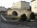
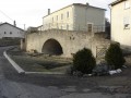
Further down, pass the first tunnel-fountain. Continue and cross the D 24.

(2) Carry on straight ahead between the houses. After 100 m, take the track leading towards the forest. 200 m further on, on your left below, under the large lime trees, is the second tunnel fountain known as “Fontenette”. Then continue along this track, straight ahead (do not turn left down the path). About 200 to 300 m further on, just before the edge of the forest, the track enters the woods and forms a fork in the road.

(3) Turn right and head uphill. You’ll return to the plain. At the end of the tarmac road, turn left, then further on, take the first right towards the village.

(4) Staying on this path, at the corner of the first house, turn left, between gardens and houses (north). At the end, turn right. You’ll reach the former RN 43. Turn right, then head south back to the starting point (E).

For mountain bikes, head in the same direction at the start but take the first right after the car repair garage, then turn left, cross the farmyard, and turn left again. At the end, you’ll rejoin the route by turning right.

Waypoints

  1. S/E : mi 0 - alt. 961 ft - Set off southwards, towards Xivry-Circourt
  2. 1 : mi 0.1 - alt. 955 ft - Take the second right, then go straight on
  3. 2 : mi 0.48 - alt. 899 ft - Continue straight ahead between the houses. Walk alongside the - Piennes (rivière)
  4. 3 : mi 0.79 - alt. 912 ft - Turn right as you go uphill
  5. 4 : mi 1.73 - alt. 984 ft - Turn left, between gardens and houses
  6. S/E : mi 2.49 - alt. 961 ft - Car park at the start

Notes

Water points: the fountains.
Shelter: Place Sainte-Anne (a bus shelter) and the fountains.

Worth a visit

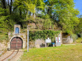
Two very pretty, traditional fountains, known as ‘tunnel fountains’.
The first, in the heart of the village, is magnificent and has been restored. Stunning photos guaranteed. Do try taking a shot from the inside looking out – a great backlit effect is guaranteed with a good SLR-type camera.
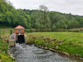
A little further on (about 150 metres from this first fountain), there’s a superb log cabin on your left, offering a magnificent view of the Pienne Valley below. A truly beautiful panorama, even – and especially – in winter when it’s snowing. In the forest, just past the village, is the second tunnel fountain, known as “Fontenette”, which looks superb in its natural state, right in the heart of the woods. It’s a quiet, cool spot in summer, beneath the hundred-year-old lime trees.
Make the most of being in the old village (at the start) to explore the area around the church, its square and the nearby PETITJEAN farmyard. Try playing with the echoes between the walls of this square in winter, when the ground reverberates with your footsteps: it’s quite surprising!

Reviews and comments

4.6 / 5
Based on 3 reviews

Reliability of the description
4.7 / 5
Ease of following the route
4.7 / 5
Route interest
4.3 / 5
SebHan
SebHan

Overall rating : 4.3 / 5

Date of your route : Oct 09, 2021
Reliability of the description : ★★★★☆ Good
Ease of following the route : ★★★★★ Very good
Route interest : ★★★★☆ Good
Very busy route : No

A lovely little walk with no difficulty at all.

Machine-translated

christine di blasi
christine di blasi

Overall rating : 5 / 5

Date of your route : Jun 03, 2019
Reliability of the description : ★★★★★ Very good
Ease of following the route : ★★★★★ Very good
Route interest : ★★★★★ Very good

A short but very interesting circular walk. A lovely village to explore. The fountains are well worth a visit.

Machine-translated

Moniquegoupil
Moniquegoupil

Overall rating : 4.3 / 5

Date of your route : Mar 09, 2016
Reliability of the description : ★★★★★ Very good
Ease of following the route : ★★★★☆ Good
Route interest : ★★★★☆ Good

A lovely route for nature lovers!

Machine-translated

Nono
Nono ★
LEROUTARD
LEROUTARD

If you enjoy photography, I’d also recommend the “Entre Fontaines et Charpon” route, starting from MERCY-le-BAS. Suitable for mountain bikers. Be sure to follow the guide carefully!

Machine-translated

Other walks in the area

For more walks, use our search engine .

The GPS track and description are the property of this route's author. Please do not copy them without permission.