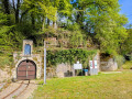
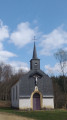
Le Trou du Beau Bois

This route straddles a linguistic border, the one that divides Belgian Lorraine into two cultural zones.
To the west lies the Gaume, characterised by Gaumais, a Lorraine dialect of Latin origin.
To the east, the Pays d’Arlon is characterised by a Germanic dialect, Moselle Franconian.
The place-names, sometimes Latin and sometimes Germanic, allow you to trace the course of this cultural boundary.

Details

895036
Creation:
Last update:
Last review:
  • Walking
    Activity: Walking
  • ↔
    Distance: 6.48 mi
  • ◔
    Average duration: 3h 20 
  • ▲
    Difficulty: Moderate

  • ⚐
    Back to start: Yes
  • ↗
    Ascent: + 397 ft
  • ↘
    Descent: - 390 ft

  • ▲
    Highest point: 1,148 ft
  • ▼
    Lowest point: 817 ft

Description of the walk

The walk starts from the Grand-Place in Halanzy (plentiful parking available).

(S/E) Take Rue Saint-Rémy, which leads uphill towards the church. After about a hundred metres, turn left onto Rue de la Ferme, which runs through the historic centre of the village.

(1) Cross Rue du Cimetière and, directly opposite, take a small path which quickly becomes a narrow track running along the rear of the properties on Rue du Cimetière. At the end of the track, turn left onto Rue du Cimetière for about ten metres, then turn left onto Rue de Buissons.

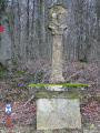
(2) At the end, turn left onto Rue du Moulin (take care: as there are no pavements, traffic can be dangerous). Pass beneath an imposing wayside cross.

(3) At the crossroads, turn right onto Rue de l’Abîme towards Battincourt and walk alongside the River Batte on your right for about fifty metres.

(4) At the junction, turn left onto a path closed to motor traffic on Sundays. Go round a pond on the left.

(5) In a gentle left-hand bend, about 100 metres before a right-hand bend, take a small grassy path. Cross a small bridge and follow the path to the left. As you emerge from the woods, continue across the meadow.

(6) Follow a stony path to the left. At the Fork in the road that appears shortly afterwards, turn left.

(7) At the junction, turn left onto a straight track that crosses the Chenoi.

(8) At the end (way of the cross), turn left onto the Halanzy–Rachecourt road. After about 500 metres, enter the woods on your right and follow the path. About ten metres before the edge of the woods, turn left onto a narrow track which leads you, on emerging from the woods, to a tarmac farm track.

(9) Follow this track between the fields and then along the edge of the woodland. Cross through a wood and continue between the fields.

(10) At the end, turn right onto the Chemin de la Batte. Pass the Croix Barolat.

(11) About 300m after the cross, turn left onto a concrete road. After crossing La Batte, the road climbs quite steeply to join Rue des Ateliers. Just after No. 10, turn left onto a small path leading to Rue de Nickbas. Follow this street to the right to return to the starting point (S/E).

Waypoints

  1. S/E : mi 0 - alt. 860 ft - Grand-Place de Halanzy
  2. 1 : mi 0.16 - alt. 883 ft - Rue du Cimetière
  3. 2 : mi 0.66 - alt. 922 ft - Rue du Moulin
  4. 3 : mi 0.94 - alt. 843 ft - Rue de l’Abîme
  5. 4 : mi 1.13 - alt. 856 ft - Start of the trail
  6. 5 : mi 1.87 - alt. 925 ft - Grassy path
  7. 6 : mi 2.6 - alt. 1,073 ft - Gravel path
  8. 7 : mi 3.08 - alt. 1,125 ft - Turn left at the junction
  9. 8 : mi 3.75 - alt. 1,076 ft - Calvaire
  10. 9 : mi 4.34 - alt. 1,030 ft - Bois Pertot – Gravel track
  11. 10 : mi 5.11 - alt. 823 ft - Chemin de la Batte
  12. 11 : mi 5.51 - alt. 820 ft - Concrete road
  13. S/E : mi 6.48 - alt. 860 ft - Grand-Place in Halanzy

Notes

In wet weather, certain sections of this walk can be very muddy (mainly between points (5) and (6)): walkers should dress accordingly.

Worth a visit

(S/E) On the Grand-Place, opposite the former town hall, you will find an electric locomotive and its iron ore wagons, which serve as a reminder of the town’s mining past.
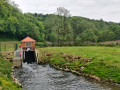
An imposing wayside cross: Christ on the cross flanked by his mother Mary and the apostle John (painted bronze statues) and, just below, the old Halanzy mill, powered by a branch of the River Batte.

(8) Calvary.
The Barolat Cross, erected at the spot where Raymond Barolat was shot on 10 May 1940. A soldier on leave, walking back from Rachecourt to rejoin his unit, Raymond was caught up in a round-up along with the few residents of Rue de Nickbas. When Raymond attempted to escape, he was shot dead without warning by German soldiers.

Reviews and comments

3.6 / 5
Based on 4 reviews

Reliability of the description
3.3 / 5
Ease of following the route
3.3 / 5
Route interest
4.3 / 5
kiki70
kiki70

Overall rating : 3.3 / 5

Date of your route : Jul 03, 2023
Reliability of the description : ★★★☆☆ Average
Ease of following the route : ★★★☆☆ Average
Route interest : ★★★★☆ Good
Very busy route : No

We enjoyed this walk, although we were unable to complete the whole route despite using an app. Three changes should be made: right at the start, at point 1, the little path on Rue du Cimetière no longer exists (due to building works); at point 5, it is no longer possible to cross through a meadow – there is a plantation of conifers and the area is so overgrown that there is no way through. You have to follow the timber track and rejoin the path between points 7 and 8. Finally, on Rue des Ateliers at the very end of the walk, the path after number 10 no longer exists – it’s been built over. Apart from these minor issues, we really enjoyed it.

Machine-translated

JeanFlorennes
JeanFlorennes

Overall rating : 3.3 / 5

Date of your route : Nov 12, 2022
Reliability of the description : ★★★☆☆ Average
Ease of following the route : ★★☆☆☆ Disappointing
Route interest : ★★★★★ Very good
Very busy route : No

The signposting wasn’t very clear, so there was a lot of uncertainty about which way to go.
I was disappointed with the description, but very pleased with this walk and the lovely discoveries: the scenery, woods and fields.

Machine-translated

DEDHAL
DEDHAL

Warning removed!

Thank you!

Machine-translated

lazzerini
lazzerini

Hello,

I see that it still states, at the start of the description, that this walk is not accessible.
These two lines should be removed, as the walk has been open since May 2020, as mentioned in my previous post.

Kind regards

Machine-translated

grandin
grandin ★

Thank you, Carla!

Machine-translated

lazzerini
lazzerini

Hello,
I’m writing to let you know that, as of today, 15 May 2020,the ban on entering the forest due to African swine fever has been lifted.
Enjoy your walk.

Machine-translated

luc.staquet
luc.staquet

Overall rating : 4.3 / 5

Date of your route : Jul 18, 2019
Reliability of the description : ★★★★☆ Good
Ease of following the route : ★★★★★ Very good
Route interest : ★★★★☆ Good

Unfortunately, this is a tricky area at the moment (until at least the end of August 2019).
An official order has forced us to turn back and resume the route further on.
The entire section through the forest is currently off-limits (under penalty of a fine).

Machine-translated

Bayooo19
Bayooo19

Overall rating : 3.3 / 5

Date of your route : Oct 27, 2018
Reliability of the description : ★★★☆☆ Average
Ease of following the route : ★★★☆☆ Average
Route interest : ★★★★☆ Good

It wasn’t very clear where the field to cross was or which stony path to take. I never found it...🤔

Machine-translated

lazzerini
lazzerini
grandin
grandin ★

Same as above. Warning added to the description

Machine-translated

lazzerini
lazzerini

Hello,
Just to let you know
There is a major outbreak of African swine fever in the hiking area.
There is a total ban on movement within an area of at least 63,000 hectares until 14 October 2018
See the map of the area:
http://www.lalibre.be/actu/belgique/pest...

Machine-translated

Other walks in the area

For more walks, use our search engine .

The GPS track and description are the property of this route's author. Please do not copy them without permission.