Country:
 City:
City:


Start from the car park at Pilâtre de Rozier Secondary School, Rue Pierre de Coubertin.
(S/E) Facing the secondary school, turn left onto Rue Pierre de Coubertin, continue to the end of this street and turn right onto Rue du Temple, which passes in front of the cemetery. It continues as a footpath.
(1) Turn left onto the small path, then right onto the first path marked on the map as “Côte en Vaux”, and join a wider track. Turn right again.
(2) Turn left onto the path that enters the forest, and join theGR®5, marked with red and white stripes. Cross theGR®5and take the path directly opposite.
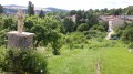
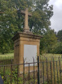
(3) Turn left onto the path leading downhill. Turn right, then left, to reach the wayside cross at the junction with the Route de Gorze. Do not follow this road, but take the small path leading downhill to the left of the wayside cross (228m). Follow it for about ten metres and turn left again onto a small path. Carry on to another wayside cross (230m). Go straight on, then turn left to reach a wash house.
(4) Walk past this washhouse and take the first street on the right.
(5) Turn right onto theGR®5, which leads downhill, and join Rue de la Fontaine. Turn left onto Rue Bernard Toussaint
(6) Take the path on your left, still marked with red and white stripes (GR®5). Walk past the ruins of a Roman reservoir and the aqueduct dating from the 2nd century.
(7). Continue along the red and white marked path. Turn left, then right, following the signposted path to reach Rue de la Ferrée.
(8) Turn left. This street turns into a narrow path. Continue straight ahead along this path.
(1) Turn right and head back to the car park by following the path you took at the start in the opposite direction (S/E).


 Visorando Member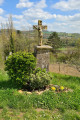
 Moderate