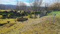
Hêtre des Batailles, starting from Châtel-Saint-Germain

A circular walk starting from Châtel-Saint-Germain, taking in the ruins of the abbey, the castle ruins and the protohistoric fortification, then the Leipzig farm on the plateau, and finally the Hêtre des Batailles, a remarkable tree (over 170 years old!).

Details

18924054
Creation:
Last update:
Last review:
  • Walking
    Activity: Walking
  • ↔
    Distance: 5.57 mi
  • ◔
    Average duration: 3h 00 
  • ▲
    Difficulty: Easy

  • ⚐
    Back to start: Yes
  • ↗
    Ascent: + 479 ft
  • ↘
    Descent: - 479 ft

  • ▲
    Highest point: 1,119 ft
  • ▼
    Lowest point: 656 ft

Description of the walk

Park in front of the town hall.

(S/E) Via Rue Jeanne d’Arc, turn left towards the stream and turn right, following it along. At the end of the path, head left back up onto the main road, Rue de Verdun.

(1) Cross it carefully, take Route de Vernéville and pass a car park on your left.

(2) Turn off onto a fairly steep path on the right, reach a flat section where the path turns sharply to the left and continue climbing steeply. Pass the abbey ruins and reach a road, which you follow to the left.

(3) At the T-junction, turn right onto the path running almost along the edge of the Bois Communal de Châtel and reach a road near the François de Guise Fortified Complex.

(4) Follow it to the left until you reach Leipzig Farm. Turn left onto the Route de Vernéville (a quiet road).

(5) Before the T-junction, turn right onto the old Route de Guerre and head into the forest. Stay on the main track.

(6) At a junction with several paths, turn sharply right onto a small track and head for the Hêtre des Batailles.

(7) Retrace your steps back to the crossroads

(6) Turn right and take the path leading downhill directly ahead. A few dozen metres further on, turn left and follow the slightly steep path down to the Cléry district in Châtel-Saint-Germain.

(8) Turn left into Rue de Cléry, followed by Rue de la Bonne Fontaine. Turn right into Ruelle de Verdun to come out onto Rue de Verdun.

(9) Head left, then turn into Rue Jeanne d’Arc to reach the town hall (S/E).

Waypoints

  1. S/E : mi 0 - alt. 666 ft - Town Hall
  2. 1 : mi 0.19 - alt. 673 ft - Crossing Rue de Verdun
  3. 2 : mi 0.31 - alt. 715 ft - Junction onto a footpath
  4. 3 : mi 1.07 - alt. 1,010 ft - Field path on the right
  5. 4 : mi 1.93 - alt. 1,119 ft - François de Guise Fortified Complex
  6. 5 : mi 3.11 - alt. 1,037 ft - Route de Guerre
  7. 6 : mi 4.01 - alt. 1,070 ft - Crossroads leading to the Hêtre des Batailles
  8. 7 : mi 4.33 - alt. 1,119 ft - Hêtre des Batailles
  9. 8 : mi 5.24 - alt. 686 ft - Rue de Cléry
  10. 9 : mi 5.48 - alt. 659 ft - Rue de Verdun
  11. S/E : mi 5.57 - alt. 666 ft - Town Hall

Notes

Wear walking shoes; the path can be muddy in winter on the plateau from the Route de Guerre.

Worth a visit

Find out more about the Hêtre des Batailles by following this link

Reviews and comments

3.9 / 5
Based on 3 reviews

Reliability of the description
4 / 5
Ease of following the route
3.7 / 5
Route interest
4 / 5
Sylvie du cinquantesept

Overall rating : 4.3 / 5

Date of your route : Feb 24, 2025
Reliability of the description : ★★★★☆ Good
Ease of following the route : ★★★★☆ Good
Route interest : ★★★★★ Very good
Very busy route : No

A really lovely walk that took 2 hours 30 minutes. The path is a bit steep at the start of the walk but not particularly difficult. Avoid doing this in wet weather as the stones are slippery under the fallen leaves towards the end of the route on the descent. Beautiful, varied scenery and definite historical interest as you pass through the archaeological site. Thank you for this route!

Machine-translated

germic57
germic57

Overall rating : 4 / 5

Date of your route : Aug 13, 2024
Reliability of the description : ★★★★☆ Good
Ease of following the route : ★★★★☆ Good
Route interest : ★★★★☆ Good
Very busy route : No

We went on this walk during a heatwave, so we cut out part of the route across the large, sun-baked wasteland between points 3, 4 and 5 to head straight to the ‘Beech of the Battles’ and then take a detour through the forest to the Jeanne d’Arc fortified complex; we then returned to pick up the descent to Cléry at point 6. A lovely walk with plenty of shade, but the climb up to Mont Saint-Germain is gruelling in the heat: you really need to set off whilst it’s still cool!!!

Machine-translated

Elyx
Elyx

Overall rating : 3.3 / 5

Date of your route : Jul 18, 2022
Reliability of the description : ★★★★☆ Good
Ease of following the route : ★★★☆☆ Average
Route interest : ★★★☆☆ Average
Very busy route : No

Hike completed on 18 July 2022 in 1 hour 40 minutes.
An interesting first section through the archaeological site (after a steep climb!).
The second section (around the sunflower field and farm) is easy but not very interesting – a flat stretch of road in the sun.
The final section through the woodland is more pleasant, with the beech tree well worth a look.

Machine-translated

Other walks in the area

For more walks, use our search engine .

The GPS track and description are the property of this route's author. Please do not copy them without permission.