Walk through the Lorraine Regional Park

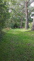
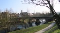
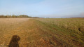
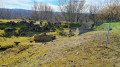
A walk in Jarnisy, in the land of the iron mines. You’ll walk through fields, woods and alongside marshes, and discover the eco-village of Ville-sur-Yron. You’ll be able to admire the village architecture, traditional Lorraine-style dwellings, the building materials used, and the history reflected in the landscape and the symbolic sites still visible today: the church, the mill, the wash house and the labourers’ cottage.

Details

111661
Creation:
Last update:
Last review:
  • Walking
    Activity: Walking
  • ↔
    Distance: 14.79 mi
  • ◔
    Average duration: 7h 10 
  • ▲
    Difficulty: Moderate

  • ⚐
    Back to start: Yes
  • ↗
    Ascent: + 427 ft
  • ↘
    Descent: - 446 ft

  • ▲
    Highest point: 843 ft
  • ▼
    Lowest point: 617 ft
  • ⚐ Country: France
  • ⚐ City: Jarny (54800)
  • ⚑
    Start/End: N 49.148391° / E 5.890743°
  • ❏
    IGN map(s): Ref. 3312E, 3312O
  • Hour-by-hour weather

Photos

Description of the walk

Start at the car park in front of Moncel Castle, Rue E. Bouchotte in Jarny.

(S) Enter the château courtyard and take the path to the right of the château; walk past a pond (on your left) and continue to the left, following the edge of a larger pond. 50 metres after the pond, turn right onto a path that leads you to a blue gate near a river. Go through the gate or through the blue door next to it.

(1) When you reach a main road, turn right onto it. After 200 metres, cross the D952 and continue straight on along Rue de Bruville. Carry on straight ahead, cross the railway line and, after the roundabout, take Rue des Écoles. Carry on straight ahead; at the third street on the right, turn into Rue Jean Moulin and follow it along the left-hand pavement to No. 28.

(2) At No. 28, turn left onto the path running alongside the Droitemont marsh and follow this path through the meadows for 1.8 km.

(3) Turn left, crossing a small bridge, and continue straight ahead along the path through the fields for 1.1 km.

(4) When you reach the D132, turn left and follow this road for 900 metres, walking along the left-hand verge.

(5) At the junction, turn left towards Jarny. Walk past a pond (on your right) and cross a bridge. Pass through the first hamlet and, at the entrance to the second hamlet, take the path on the right at a right angle. Follow this dirt track through the fields for 1.7 km.

(6) At the junction with the D132, turn left and follow it for 300 metres; halfway up the hill, take the path on the right. Continue straight on for 700 metres, then turn left onto a wide, uphill path (there’s a large cypress tree at the top of the hill). Head down towards Ville-sur-Yvron and enter the village.

(7) Turn left onto Rue Bachot, pass the village hall (on the left) and carry on straight along the Rue Principale (make sure to stay on the right-hand pavement). After No. 43, turn right onto the path leading down towards the River Yron. When you reach the river, turn right and follow it (picnic table) until you rejoin the Rue Principale before the bridge. Go past the bridge and turn right (restaurant) into Rue de l’Yron. Carry on straight ahead, passing an old mill and the church (on the right). At the end of the street, turn left into Rue de Metz. Follow this street as it curves to the left. Walk alongside the castle (on the right) and turn slightly right onto the road to Ferme de la Grange.

(8) Follow the small tarmac road to the Ferme de la Grange. Go past the farm and follow the main track to the right, then straight on before crossing the railway line. Alternate between left and right to join the D952.

(9) Cross the D952, take the path opposite and enter the woods. Cross the small stream over the little wooden bridge and enter the woodland. Follow a wide track straight ahead and, at the end, turn right, then left and then right again to reach a wide track through the fields leading to Bruville. Enter Bruville via Rue de la Fontaine. In the centre of the village, turn left onto the D13.

(10) Take the small road on the right towards Urcourt; follow this road for 700 metres, then take the dirt track that climbs to the left and leads to the entrance to Doncourt-lès-Conflans.

(11) Turn left into Rue Prévert, then, after the stadium, turn left onto Rue Pagnol. At the end of this cul-de-sac, take the small passageway that leads to Chemin des Amours. Turn right, then left after 50 metres to reach the D603, Rue Bruque. Turn left and follow this road along the left-hand pavement. Walk through the whole village along Rue Dubois to No. 16 (almost at the edge of the village, heading towards Jarny).

(12) Turn left, go through the gate and take the dirt track which leads you near the pond. At the entrance to the pond, turn right and follow this track straight on, running alongside the pond and a small stream (on the left) and the fields (on the right) for 2.2 km.

(13) When you reach the D603, turn left onto the path running parallel to the main road; continue until you reach the roundabout, then turn left onto Rue Bouchotte, which, via the pavement on the left, takes you straight back to your starting point, the Château de Moncel (E).


Waypoints

  1. S/E : mi 0 - alt. 669 ft - Car park in front of Moncel Castle
  2. 1 : mi 0.45 - alt. 646 ft - Exit the park through the blue gate
  3. 2 : mi 1.35 - alt. 643 ft - At the end of Rue J. Moulin, turn left
  4. 3 : mi 2.45 - alt. 623 ft - Cross the small bridge on the left - Yron (rivière)
  5. 4 : mi 3.13 - alt. 659 ft - On the D132, turn left. Near the - Longeau (rivière)
  6. 5 : mi 3.66 - alt. 659 ft - Leave the D132 by turning left towards Jarny
  7. 6 : mi 5.5 - alt. 656 ft - Return to the D132 and turn left
  8. 7 : mi 6.5 - alt. 686 ft - On entering Ville-sur-Yron, turn left
  9. 8 : mi 7.56 - alt. 669 ft - Turn right towards the Ferme de la Grange
  10. 9 : mi 9.08 - alt. 735 ft - Carry straight on along the D952
  11. 10 : mi 10.47 - alt. 738 ft - Turn right towards Urcourt
  12. 11 : mi 11.49 - alt. 840 ft - Turn left into Rue Pagnol
  13. 12 : mi 12.29 - alt. 791 ft - At No. 16, turn left
  14. 13 : mi 14 - alt. 669 ft - On reaching the D603, turn left
  15. S/E : mi 14.79 - alt. 669 ft - Car park in front of Moncel Castle

Notes

Picnic spots in Ville-sur-Yron near the River Yron.
“La Toque Lorraine” restaurant in Ville-sur-Yron.

Worth a visit

The 12th-century Château de Moncel, converted into a stately home in the 19th century.
Ville-sur-Yron eco-village: a walking route marked by twelve information panels.
Late May in Ville-sur-Yron: International Documentary Film Festival on Rural Life.

Reviews and comments

3.8 / 5
Based on 3 reviews

Reliability of the description
3.5 / 5
Ease of following the route
4.3 / 5
Route interest
3.7 / 5
Christecol
Christecol

Overall rating : 4 / 5

Date of your route : Aug 09, 2021
Reliability of the description : Not used / Not applicable
Ease of following the route : ★★★★★ Very good
Route interest : ★★★☆☆ Average
Very busy route : No

The route involves a lot of tarmac (it’s hard to avoid it) and crossing flat fields. I don’t know if it was down to tiredness, but I felt as though I was getting bored.
Even so, there are still a few lovely spots to pass through, such as the Droitaumont marshes or the eco-village of Ville-sur-Yron, for example.

Machine-translated

daddy_54
daddy_54

Overall rating : 3.7 / 5

Date of your route : May 19, 2020
Reliability of the description : ★★★☆☆ Average
Ease of following the route : ★★★★☆ Good
Route interest : ★★★★☆ Good
Very busy route : No

A rather interesting route, but not one to tackle on a scorching hot day, as most of the route runs through fields with no trees… so there’s very little shade.
The start was already quite tricky as the trailhead was inaccessible due to the castle being closed. I had to take a path 50 metres further on, opposite the riding school, which goes round the castle.
Stages 7 and 8 were confusing as there’s no longer a No. 43 or a Rue Principale. To walk round the village of Ville-sur-Yvron as indicated in the description, you need to go as far as number 10 and take the path next to the electricity substation. Alternatively, you can take a shortcut via the Petit-Haut path and, once you reach the road, turn right – you’ll already be able to see the bridge you need to cross. On leaving the village, as you pass behind the cemetery, the path leading to the small wood is poorly signposted. After walking for 100 metres, you’ll come to a fork in the path. You need to go left. If you go right, you’ll pass a metal structure commemorating the 1870 war and come to a small road; if you go left, you’ll reach the D952. I had to walk nearly 2 km along the road towards Jarny to get back onto the Petit-Haut path (an extra 2 km on a 23-km hike is no small matter). Otherwise, no problems – the description is fairly reliable. However, more precise signposting along the path is needed, especially in places where you’re likely to get lost (when faced with a choice between two directions).

Machine-translated

AlainQUE
AlainQUE

Overall rating : 4 / 5

Date of your route : Jul 28, 2019
Reliability of the description : ★★★★☆ Good
Ease of following the route : ★★★★☆ Good
Route interest : ★★★★☆ Good

A pleasant walk.

Machine-translated

Other walks in the area

For more walks, use our search engine .

The GPS track and description are the property of this route's author. Please do not copy them without permission.