Country:
 City:
City:


Park your car in front of the cemetery. The walk starts at the Fillières civil cemetery. A map of the trails is provided on the back of the map of the Battle of Fillières.
(S/E) Opposite the cemetery, head north-east along the footpath on your left, which runs between the chalet and the field. It is marked in blue.
(1) At the wayside cross on your left, take the country lane to the right before the large grey house.
(2) Enter the woods, following the blue markings, and head generally southwards.
(3) Take the path on the left before you reach Crusnes.
Follow it to the main road, following the blue signposts.
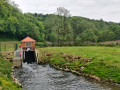
(4) Cross the road and follow it for a few metres before heading down to the left to the water retention basin. Walk alongside it, then continue along the forest track, following the blue markings.
(5) Leave the woods at Prés Lamoureux and walk alongside the copses on your left until you reach the country lane. Turn left onto this country lane, which leads back to the village.
(6) At the crossroads at the entrance to the village, cross the Grande Rue and head towards the small square in front of you.
Then turn left onto Chemin de la Cure and return to the original crossroads by the wayside cross.
(1) Continue along the path opposite in the opposite direction and head for the cemetery (S/E).


 Visorando Member
 Moderate
 Difficult