The Lièvre Walk in Châtel-Saint-Germain

From the town hall, the route follows the stream then climbs towards Rue Jean d’Apremont and the footpath linking Châtel to Rozérieulles. It joins the Route de Guerre, crosses the Bois du Reposoir and passes close to the Mont Saint-Germain site before descending towards the Montvaux valley. The return route takes you via the Pas d’Âne, then through the village and along the Chemin des Fourrières.

Details

88865010
Creation:
Last update:
Last review:
  • Walking
    Activity: Walking
  • ↔
    Distance: 5.22 mi
  • ◔
    Average duration: 2h 55 
  • ▲
    Difficulty: Moderate

  • ⚐
    Back to start: Yes
  • ↗
    Ascent: + 600 ft
  • ↘
    Descent: - 577 ft

  • ▲
    Highest point: 1,063 ft
  • ▼
    Lowest point: 650 ft

Description of the walk

The walk is signposted with a hare logo. Link here

(S/E) Starting from the Place de la Mairie, take Rue Jeanne d’Arc on the right.

(1) Follow the stream to the left and continue to the Chemin des Dames. Turn right.

(2) Cross Rue de Verdun by turning right and head up Rue Jean d’Apremont on the left – named after the Bishop of Metz who built the fortified castle at Mont Saint-Germain.

(3) Turn left onto Rue de Cléry, then continue along Rue des Chauvaux.

(4) Continue along the Chatel–Rozérieulles footpath.

(5) Before reaching the houses in Rozérieulles, turn right onto Route de Guerre. Follow this road through the Bois du Reposoir, crossing the Chemin des Goules.

(6) Carry straight on at the junction. Pass the Chemin de Gravelotte and then reach the Chemin de Moscou.

(7) Carry on straight ahead until you reach the Route de Vernéville. Turn right and cross the car park.

(8) Continue straight ahead along the Route de Guerre. Pass the path leading to the Mont Saint-Germain historic monument and head down towards the Montvaux valley.

(9) To the left, above, look out for the Roche à Fayé (Roche aux Fées). Head to the right along the tarmac ‘Route militaire’ (military road) to Fort de Guise.

(10) Take the path on the right to reach Châtel via the Pas d’Âne, a remnant of the Amanvillers track dating from before the construction of the main road from Rozérieulles to Calais in the 19th century.

(11) In the village, stay on the pavement on the right until you reach the calvary. Cross the road, pass through the Square du Saulcy and take the Chemin des Fourrières. At the end of the path, turn right onto Rue de Lorry towards the town hall (S/E).

Waypoints

  1. S/E : mi 0 - alt. 781 ft - Town Hall Square
  2. 1 : mi 0.06 - alt. 656 ft - Ruisseau de Montvaux (cours d'eau) - Affluent du Fosse des Vieilles Eaux
  3. 2 : mi 0.32 - alt. 653 ft - Rue de Verdun
  4. 3 : mi 0.42 - alt. 689 ft - Rue de Cléry
  5. 4 : mi 0.93 - alt. 682 ft - Châtel–Rozérieulles link path
  6. 5 : mi 1.05 - alt. 709 ft - Route de Guerre
  7. 6 : mi 1.47 - alt. 820 ft - Chemin des Goules
  8. 7 : mi 2.8 - alt. 1,056 ft - Chemin de Moscou
  9. 8 : mi 3.17 - alt. 1,014 ft - Car park
  10. 9 : mi 3.5 - alt. 896 ft - Roche à Fayé (Roche aux Fées)
  11. 10 : mi 3.89 - alt. 814 ft - Trail - Ruisseau de Montvaux (cours d'eau) - Affluent du Fosse des Vieilles Eaux
  12. 11 : mi 4.83 - alt. 699 ft - Entrance to Châtel
  13. S/E : mi 5.22 - alt. 804 ft - Town Hall Square

Notes

Car parks nearby.

Worth a visit

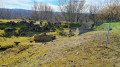
Mont Saint-Germain archaeological site: information about the site is available on the town hall’s website and at the town hall.

Other walks in the area

For more walks, use our search engine .

The GPS track and description are the property of this route's author. Please do not copy them without permission.