Country:
 City:
City:


Starting point: Square du Tagnon.
(S/E) Take the Route de Vernéville to the left for about 50 metres and cross the ditch on the right.
(1) Take the Sentier du Prieuré. At thefirst bend, continue to the right.
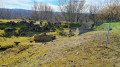
(2) Walk towards, then across, Mont Saint-Germain (viewpoint, necropolis, ruins of the former church of Châtel-Amanvillers, the priory, Jean d’Apremont’s castle and ancient fortifications at the Butte des Pins). Cross the limestone meadow. Take the Route de Guerre on the left.
(3) Just before the car park, take the Haie des Échevins on the right.
(4) At the junction with the Route Militaire du Fort de Guise, turn right onto this tarmac road and follow it to the Route de la Vallée de Montvaux.
(5) Cross the RD643, then the tennis club car park. Continue past the information sign on the Route de Guerre.
(6) Cross the old railway line (there’s a picnic spot at a place known as ‘Halte de Montvaux’), and continue along the Route de Guerre, heading uphill through the Forey or Graoully State Forest, then the Flutôt Municipal Forest.
(7) At the crossroads, before the turn-off for “Le Gros Chêne – chapelle” and just before the pine forest, take the path on the right which runs along the edge of the woodland.
(8) Before leaving the woodland, take the path on the right and stay along the edge of the Bois de Forey. Follow this path, which is marked by white boundary stones.
(9) Begin the descent towards the village. At the junction of several paths, take the one on the right and continue downhill to the edge of the railway line. Take the path on the right, then quickly turn left.
(10) Cross the railway line. Head down towards the Chemin des Fourrières near the sports hall. Turn left, then, after 50 metres, turn right towards Place Bompard.
(11) Walk along the stream to the right. Cross Rue de Verdun to reach Square du Tagnon (S/E).

 Local authority
 Easy
Easy 
 Visorando Member