Country:
 City:
City:


Starting point: Square du Tagnon.
(S/E) Walk up the Route de Vernéville for about 50 metres and cross the small ditch on the right.
(1) Take the Priory Path and, at the first bend, continue to the right.
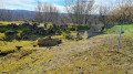
(2) Walk towards the Mont Saint-Germain site, a listed historic monument (viewpoint, necropolis, ruins of the former church of Châtel-Amanvillers, the priory, Jean d’Apremont’s castle and ancient fortifications at the Butte des Pins). Cross the site and the limestone lawn (ideal for orchids), pass the junction and take the ‘route de guerre’ to the left.
(3) At the car park, take the Route de Vernéville on the right and pass the Ferme de Leipzig.
(4) Before the Ferme de la Folie, turn left onto the Chemin des Bannaires. Enter the woods by turning left, cross the Grand Bannaire, then follow the Pré Charraux and finally the Petit Bannaire.
(5) Join the Chemin de Chantrenne and turn left towards the Ferme Saint Hubert.
(6) A monument to the Battle of 1870 stands at the mouth of a sunken lane; to the right of the monument is the ‘taie au renard’. It marks the Génivaux ascent towards the plateau. This route was used by the Prussians, by the American army in 1944, and may well have been used by the Romans too.
(7) Walk past the Ferme Saint-Hubert,
(8) At the junction on the left, head towards the Ferme de Moscou and walk along the boundary of the Fort de Jeanne d’Arc. Continue straight on, passing the poultry farm.
(9) Approach the Hêtre des Batailles site. Follow the path to the junction with the Route de Guerre (keep slightly to the left). Cross the Route de Guerre.
(10) Head down towards Châtel on the left via the Chemin de Gravelotte. Please note: this section of the route includes a slightly technical section.
(11) Walk alongside the cemetery to Rue Bonne Fontaine. Take the path on the left at the corner of the cemetery to return to Square du Tagnon (S/E).

 Local authority
 Easy
Easy 
 Visorando Member