


Refine your search for walks in Boveresse
Boveresse walks


 The Glacière de Monlési and the Corridor aux Loups in the Val de Travers
 Visorando Member

 11.63 mi
 +1,916 ft
 -1,906 ft
 7h 00
 Moderate
 Departure from Boveresse (Canton of Neuchâtel)
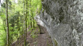
Set off to explore the Glacière de Monlési and the Corridor aux Loups, a wide, well-secured rock ledge. The Corridor aux Loups is a path carved by nature into a rocky outcrop; this long ledge has been eroded to such an extent that you can walk along it. Access poses no major difficulty; a chain runs the entire length of the corridor and four sets of steps – around 140 in total – are provided to make the walk easier. There is no evidence of a pack of wolves here, though some claim that this mysterious path leads to a place where witches and wizards used to meet. Spine-tingling!
A very well-signposted walk.
Môtiers: The Poëta-Raisse Gorges
 6.38 mi
+1,850 ft
-1,844 ft
4h 35
Moderate
Departure from Môtiers (Canton of Neuchâtel)
Rousseau once wrote «I have, opposite my windows, a beautiful waterfall which from the mountain top, plunges from a rocky escarpment into the valley, with a sound heard for miles around, especially when waters are high». From waterfall to waterfall, alongside these impressively steep gorges which once inspired fear (poëta from the latin putidus meaning "altered, fetid"), this trail will lead you through a delightful hike through rocks and water.
Corridor aux Loups and Glacière de Monlesi
 10.73 mi
+1,942 ft
-1,955 ft
6h 35
Moderate
Departure from Couvet (Canton of Neuchâtel)
A circular walk starting from the village of Couvet in the Val-de-Travers. The route passes through the Corridor-au-Loup, a geological curiosity, and La Glacière de Monlési, a protected nature reserve and a unique geological phenomenon. The cave is a karst sinkhole containing three shafts, leading to a large chamber filled with ice where ice stalagmites and stalactites can be found.
Short trip to Mont Châteleu
 4.33 mi
+774 ft
-784 ft
2h 40
 Easy
Departure from Grand'Combe-Châteleu (Doubs)
A short detour via the summit of Val de Morteau with a splendid view of the Alps (weather permitting).
Mont Châteleu, which is inconspicuous when approached from this side, hidden by vegetation, offers a splendid panorama with its two orientation tables. On one side, there is a magnificent view of the Alps and below, from the second table, a view of Les Gras and, further away, Les Rochers du Cerf.
 The Châteleu circular.
 3.56 mi
+610 ft
-623 ft
3 hrs
Moderate
Departure from Grand'Combe-Châteleu (Doubs)
Circular snowshoe tour through the snow-covered expanses of the Franco-Swiss Jura.
Les Rochers du Cerf from Les Gras
 8.04 mi
+1,191 ft
-1,171 ft
4h 45
Moderate
Departure from Les Gras (Doubs)
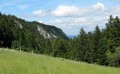
From Les Gras, you will climb through beautiful, clear forests to the Rochers du Cerf ridge trail and its many viewpoints over the discreet Théverot valley, Mont Châteleu and the Swiss mountains. Return via the Swiss pastures and their concert of cowbells.
Mont Châteleu
 8.22 mi
+1,631 ft
-1,631 ft
5h 10
Moderate
Departure from Les Gras (Doubs)
Passing through beautiful pine forests, you will walk along a small gorge, home to waterfalls where the rotation of pebbles has carved the soft rock over thousands of years, forming basins known as chaudières in our Haut-Doubs region. Then, passing isolated farms nestled in the hollows of the pastures and surrounded by our good old Montbéliard cows, you will reach a panorama stretching south-west over the Chasseron, the Suchet, the Gras topped by the Rochers du Cerf, Switzerland to the south and, in fine weather, Mont Blanc.
Les Rochats - Sainte-Croix
 11.42 mi
+2,152 ft
-2,388 ft
7h 10
Moderate
Departure from Provence (Vaud)
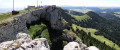
The goal for this second stage is to climb Chasseron. This rocky cliff offers breathtaking views of Lake Neuchâtel and, further south, Lake Geneva. You will also enjoy views of numerous Alpine peaks in the distance, rising up from the horizon.
Les Rochats - Noiraigue
 8.01 mi
+1,122 ft
-2,566 ft
4h 40
 Difficult
Departure from Provence (Vaud)
Sixth stage, from Les Rousses to Lake Constance via the Jura ridges. From Les Rochats, the route climbs gently through pastures and wooded areas. You then arrive at the impressive Creux du Van rock cirque. From the heights, the view of Lake Neuchâtel is splendid. Then, taking the Sentier des Quatorze Contours trail, you descend towards Noiraigue, surrounded by two natural wonders: the Creux du Van rock cirque and the Areuse Gorges.
The Cascades des Chaudieres and Le Nid du Fol waterfalls starting from Les Gras
6.09 mi
+938 ft
-942 ft
3h 35
Moderate
Departure from Les Gras (Doubs)
There are several points of interest to discover on this hike:
- what water can do in our Jura mountains,
- our beautiful mid-mountain landscapes with forests and pastures,
- the beautiful forests of the Haut-Doubs.
Creux du Van, from dairy farm to dairy farm
 7.33 mi
+902 ft
-896 ft
4h 10
Moderate
Departure from Provence (Vaud)
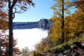
A superb hike in an iconic site in the Swiss Jura, accessible to most people. You will encounter some not-so-wild wildlife, including ibex and chamois. Magnificent flora and landscapes and superb views. Not to mention the dairy farms where you can stop for food and refreshments.
The Cerf rocks
 Association / Club / Walk leader
 7.13 mi
+879 ft
-843 ft
4h 05
Moderate
Departure from Hauterive-la-Fresse (Doubs)
This route will take you from the forest to the cliff via the pastures of the Haut Doubs.
La Côte du Cerf
 6.37 mi
+843 ft
-820 ft
3h 40
Moderate
Departure from Hauterive-la-Fresse (Doubs)
From the old, isolated farmhouse of La Perdrix, right in the heart of Le Sauget, you’ll reach the hamlet of La Fresse and climb towards the ridge of Les Rochers du Cerf, a picturesque rocky path dotted with gentians, boundary stones and numerous views over the secluded Théverot valley, Mont Châteleu and the Swiss mountains.
The Mont Derrière Path
 4.18 mi
+617 ft
-646 ft
2h 30
Easy
Departure from Grand'Combe-Châteleu (Doubs)
A pleasant little walk through the woods of Mont Gaudichot. Enjoy the lovely views here along a well-marked but fairly natural path, which can be slippery in places in wet weather.
Noiraigue - Vue des Alpes
 14.53 mi
+3,573 ft
-1,765 ft
9h 50
Difficult
Departure from Noiraigue (Canton of Neuchâtel)
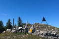
Seventh stage from Les Rousses to Lake Constance via the Jura ridges. From Noiraigue, the route begins with a steady climb before joining a varied trail that runs along a ridge dotted with viewpoints and clearings. Le Creux du Van, Lake Neuchâtel and, on a clear day, the Alps with Mont Blanc accompany you on your way to the Tablettes viewpoint. The hike continues towards the Tête de Ran (1,422 m), offering breathtaking views of the Alps, Lake Neuchâtel and La Chaux-de-Fonds. Finally, a short descent takes you to the Col de la Vue des Alpes, a natural link between the valleys of Neuchâtel and La Chaux-de-Fonds.
Tour of Chasseron from Les Rasses
6.05 mi
+1,388 ft
-1,378 ft
4h 00
Moderate
Departure from Bullet (Vaud)
Hike around Chasseron with a direct and sustained climb to the summit, offering beautiful panoramic views. The descent is then a gentle and pleasant walk along the ridge line back to the car park. Accessible route.
Le Creux du Van, starting from Noiraigue
 7.66 mi
+2,621 ft
-2,621 ft
5h 50
Difficult
Departure from Noiraigue (Canton of Neuchâtel)
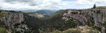
An unmissable hike in the region, accessible without a car.
Noiraigue - Les Rochats
 8.48 mi
+2,848 ft
-1,394 ft
6h 25
Moderate
Departure from Noiraigue (Canton of Neuchâtel)
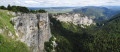
During this first stage, after the tedious climb up the 14 contours, you will be rewarded by the local geological curiosity, the Creux du Van. This Swiss version of the "Grand Canyon" is a large rocky cirque 1.5 km long and 200 m high.
At Soliat, you will enjoy a splendid panorama of Lake Neuchâtel.
The peaks of the Swiss Jura, from Noiraigue to Saint Cergue
 66.06 mi
+13,068 ft
-11,952 ft
6 days
Moderate
Departure from Noiraigue (Canton of Neuchâtel)
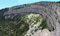
This magnificent route passes through peaceful forests, along long ridges and steep cliffs. Every day offers panoramic views of the peaks of the Alps, the lakes of Neuchâtel, Geneva and Joux, and curiosities such as the great Cirque du Creux du Van.
The Areuse Gorges
 14.52 mi
+2,812 ft
-2,815 ft
9h 05
Difficult
Departure from Noiraigue (Canton of Neuchâtel)
The small village of Noiraigue in the Val de Travers is the starting point for the magnificent Gorges de l’Areuse hike, the upper entrance to which is only about 1 km away.
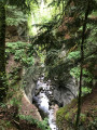
The route runs alongside the railway line and the valley narrows considerably. The impressive gorge, with its idyllic old stone bridge, is at Saut de Brot. Continuing towards Champ-du-Moulin along a small road, you will find another crossing via a section of path that leads you back into the gorges. Gigantic rock faces soar skywards. The path takes you over small bridges and through tunnels. Then, a power station marks the end of the spectacle; just one last bridge to cross and head towards Champ-du-Moulin for the return journey along a forest road and a view of Le Creux du Van.
Along the Areuse River in Switzerland.
 6.64 mi
+459 ft
-1,056 ft
3h 25
Moderate
Departure from Noiraigue (Canton of Neuchâtel)
A superb walk along the River Areuse with its various gradients and several bridges spanning it, leading out of the gorges to a magnificent view of Lake Neuchâtel and the Alps. The return journey from this hike will be by train from Bole station.
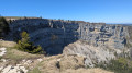
Le Creux du Van and the Saut de Brot
 8.66 mi
+2,628 ft
-2,602 ft
6h 15
Difficult
Departure from Noiraigue (Canton of Neuchâtel)
Le Creux du Van is a natural cirque located in the Swiss Jura. It was formed by the freezing and thawing action of a glacier. It is now accessible from several locations, such as from Noiraigue via the Sentier des Quatorze Contours. This hike has a significant climb over the first few kilometres. It is also possible to return via the Gorges de l’Areuse, at the Saut du Brot.
The Poucey Cave
4.98 mi
+1,129 ft
-1,102 ft
3h 15
Easy
Departure from Grand'Combe-Châteleu (Doubs)
A nice little walk featuring the farms of the watchmaking region, the Poucey Cave and a beautiful viewpoint called "La Roche aux Corbeaux" (Raven Rock), perfect for families!
 Simon Pion's horse riding trail
 1.86 mi
+151 ft
-151 ft
45 mins
Easy
Departure from Pontarlier (Doubs)
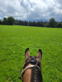
Short loop through the fields (no gates to open) on horseback, with the option of staying at the Brin d'Herbe equestrian lodge. Please note: this route is only possible when the hay has just been cut and the grass in the meadows is short.
Circular Creux du Van route via Ferme du Grand Vy and Fontaine Froide
7.80 mi
+1,811 ft
-1,831 ft
5h 10
Moderate
Departure from Noiraigue (Canton of Neuchâtel)
This beautiful hike in the Swiss Jura mountains will take you along the renowned Sentier des Quatorze Contours to the magnificent Creux du Van cirque with its steep cliffs, home to a herd of around twenty ibexes, which you’re almost certain to spot provided you keep a safe distance from them.
Pass the summit of Mont Soliat before reaching the Grand Vy farm and restaurant and beginning your descent.
You’ll then walk along the foot of these magnificent cliffs to the aptly named Fontaine Froide, before reaching the Ferme Robert – a seasonal relaxation area – and returning to your car park, your eyes still filled with images of this spectacular landscape.
Via Creux du Van and Soliat
 5.04 mi
+1,670 ft
-1,677 ft
3h 45
Moderate
Departure from Noiraigue (Canton of Neuchâtel)
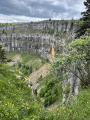
Le Creux du Van is one of the most famous geological formations in the Jura. This immense cirque with its impressive vertical cliffs offers steep landscapes that contrast with the gentle neighbouring pastures. This is the hike to do to discover the Val de Travers. It is very easy to see ibex here, as they are used to walkers.
Forests and pastures all the way to Les Papillons restaurant
 4.63 mi
+499 ft
-495 ft
2 hrs
Moderate
Departure from Pontarlier (Doubs)
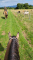
Starting from the Brin d'Herbe equestrian lodge, enjoy an unusual hike along forest paths, past cows and alpine landscapes. There is a magnificent view from the Ferme des Miroirs road, from where you can even see the Alps if the weather is not too cloudy! Enjoy a refreshing break or a good meal at the Les Papillons restaurant before returning through fields and forests.
NB: as this hike crosses several cow pastures, please be sure to dismount, open and, above all, close any gates you come across.
Grand'Combe-Châteleu - Remonot circular via the ridges
 9.25 mi
+2,159 ft
-2,162 ft
6h 10
Moderate
Departure from Grand'Combe-Châteleu (Doubs)
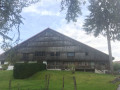
A somewhat physically demanding hike starting from Grand'Combe-Châteleu along the ridges, on the left bank of the Doubs on the way there and the right bank on the way back. Pass through Remonot and its cave chapel, the Grotte du Poucey, the Sapin Président in the Grand'Combe forest, with beautiful views and lovely farms typical of the region.
Le Chasseron and the Saut de l'Eau
 10.56 mi
+3,323 ft
-3,314 ft
7h 45
Difficult
Departure from Sainte-Croix (Canton de Vaud) (Vaud)
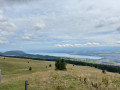
This is a fairly challenging hike with some wild sections and steep climbs, between forest and pastureland. There is a magnificent 360° view of Lake Neuchâtel and Lake Geneva from the Chasseron (altitude 1,607 m). You can also discover the Pierre de Paix (energy stone). There arefootbridges and steps at the Saut de l'Eau.
Le Chasseron via the Col des Etroits
 9.10 mi
+2,129 ft
-2,133 ft
6h 00
Moderate
Departure from Sainte-Croix (Canton de Vaud) (Vaud)
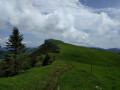
A beautiful hike through woods and pastures with stunning views, including a 360° view of Chasseron (1,606 m) on the French side and the Swiss side with the Romandy lakes of Neuchâtel and Geneva.
Depending on the weather conditions, you can see and admire the Bernese, Vaud and French Alps.
Sainte-Croix - Les Rochats
 11.53 mi
+2,310 ft
-2,251 ft
7h 20
Difficult
Departure from Sainte-Croix (Canton de Vaud) (Vaud)
Stage 5 From Les Rousses to Lake Constance via the Jura ridges.
From Sainte-Croix, the birthplace of music boxes and automatons, you set off across the vast pastures of the Vaud Jura towards La Casba and Les Avattes. The path then winds its way to Les Petites Roches before reaching the mysterious Pierre de la Paix, a place full of energy and serenity.
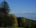
One last effort takes you to the summit of Chasseron, at an altitude of 1,608 metres, where a magnificent panorama opens up over Switzerland and France. At your feet lie Lake Neuchâtel and, further south, the majestic Lake Geneva. Nearly 250 kilometres of Alpine ridges stretch out on the horizon, creating a breathtaking natural fresco.
The descent is gentle to the hamlet of Les Rochats, at the start of the Les Cluds cross-country ski trail, where an old military barracks remains, a discreet witness to a forgotten past.
Circular Mont-Gaudichot starting from Montlebon
 5.62 mi
+909 ft
-909 ft
3h 25
Easy
Departure from Montlebon (Doubs)
A pleasant walk in the forest, passing 1,000 metres above Montlebon.
Sainte-Croix - Vallorbe
 14.41 mi
+2,126 ft
-3,192 ft
8h 30
Difficult
Departure from Sainte-Croix (Canton de Vaud) (Vaud)
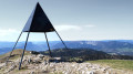
The highlight of this third stage will be the Suchet. At your feet, you will enjoy a panoramic view of Lake Neuchâtel. You will also be very close to the French-Swiss border. In Vallorbe, you will notice the presence of old railway crafts.
Remonot Discovery Route
2.27 mi
+318 ft
-325 ft
1h 20
Easy
Departure from Les Combes (Doubs)
Remonot is a small hamlet in the commune of Les Combes. Situated on the banks of the Doubs, in the Pays Horloger, this village has everything to offer: surrounded by the Jura mountains, it is a pleasure to stroll along these country lanes in search of little gems. The most remarkable heritage site is none other than the Chapel of Notre-Dame de Remonot, situated within a vast cavern 30 metres deep. Within this cavern are four springs, one of which is said to possess miraculous properties. The site is still used for worship today. The route also takes you past the Church of the Holy Spirit and, nearby, the Remonot viewpoint, which offers views of the highest gorges of the Doubs. The walk along the river’s right bank takes you past a drinking trough and a hand pump.
The Covatannaz Gorges and the Aiguilles Baulmes
 12.26 mi
+3,602 ft
-3,629 ft
6 hrs
 Very difficult
Departure from Sainte-Croix (Canton de Vaud) (Vaud)
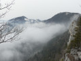
A walk along the Arnon, a river that, over time, has carved out the Covatannaz Gorges and its impressive cliffs. Passing through the village of Baulmes and following the Baumine river upstream towards the Aiguilles de Baulmes, a series of peaks rising to 1,560 m. The path along the ridge offers a magnificent 180° panorama of the Alps, Lake Neuchâtel, Lake Geneva and the Vaud plateau.
The Dames des Entreportes circular route via Le Larmont and Les Cernets
12.51 mi
+2,083 ft
-2,087 ft
7h 35
Difficult
Departure from Pontarlier (Doubs)
A beautiful Franco-Swiss walk starting from the picturesque site of Les Dames des Entreportes. From Larmont mountain, you’ll enjoy sweeping views of the Jura range and the Alps if the weather is ideal. After crossing magnificent mountain pastures and crossing the border, you’ll pass through Swiss hamlets and farms before returning to French territory and continuing your walk through the wild Vallon des Etraches.
The mirrors
 5.27 mi
+784 ft
-748 ft
3h 05
Easy
Departure from Pontarlier (Doubs)
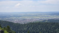
This hike will take you through a protected area and offer you a beautiful view of the town of Pontarlier.
Moderator's note A GPS device may be useful for this hike. See reviews.
Route de découverte de Morteau
2.90 mi
+131 ft
-151 ft
1h 25
Easy
Departure from Morteau (Doubs)
A small town of 6,000 inhabitants, Morteau is situated at an altitude of around 780 metres, in the Jura and the Watchmaking Region. There is also a museum dedicated to watchmaking in this town. It is a mid-mountain town situated on the banks of the Doubs. This route takes you to the town’s most interesting sights. It is also recommended to combine this visit with a trip to the hamlet of Remonot on the same day.
La Roche Jeannin in Morteau
 4.33 mi
+666 ft
-666 ft
2h 35
Easy
Departure from Morteau (Doubs)
A short walk starting from Morteau town centre, passing by the foot of Mont Vouillot and the town’s hills, then returning via the La Roche Jeannin viewpoint in the Bois Robert.
Les Aiguilles de Baulmes
 7.00 mi
+1,555 ft
-1,578 ft
5 hrs
Moderate
Departure from Sainte-Croix (Canton de Vaud) (Vaud)
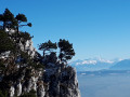
A circular hike that follows the ridge of the Aiguilles de Baulmes. Magnificent views all along the way of the Alps, which seem very close, and, at both ends, of some of the peaks of the Jura. It is not guaranteed that you will be able to follow the tracks all along the route.
The wind turbines of Sainte-Croix and the Sentier des Bornes trail
 11.49 mi
+1,175 ft
-1,194 ft
6h 20
Difficult
Departure from Les Fourgs (Doubs)
Set off to explore the two wind farm sites in Sainte-Croix, passing through hamlets, pastures, undergrowth and forest. You will pass Mont de la Chèvre, Mont des Cerfs (1,280 m) and its rural lodge, then make a round trip to see the Creux des Neiges chasm. The return journey is via the Sentier des Bornes trail.
Mont de l'Herba
 9.92 mi
+938 ft
-955 ft
5h 25
Moderate
Departure from Les Fourgs (Doubs)
A French-Swiss walk through the pastures of the "Toit du Doubs" towards these old alpine farms where the cowherd-cheesemaker stayed in the summer to look after the cattle and make cheese. Beautiful views of the Swiss mountains: the Chasseron, the Petites Roches, the Cochet and the Montagne de Baulmes.
The Sentier des Bornes at Les Fourgs
 Tourist office
 12.31 mi
+915 ft
-889 ft
6h 25
Easy
Departure from Les Fourgs (Doubs)
A themed trail that will take you on a journey across the Doubs region whilst following the border and its boundary markers.
 L’Herba
7.56 mi
+741 ft
-751 ft
5 hrs
Easy
Departure from Les Fourgs (Doubs)
A cross-country ski tour that allows you to explore areas rarely visited in winter and enjoy a sense of freedom on the descent.
Circular around Mont Vouillot
 4.41 mi
+561 ft
-561 ft
2h 30
Easy
Departure from Les Fins (Doubs)
Circular around Mont Vouillot via Chez Fraichot, Le Mausenet, Les Fins and Les Teurés.
The Roche Sarrasine viewpoint
 7.72 mi
+1,119 ft
-1,093 ft
4h 30
Moderate
Departure from Les Fourgs (Doubs)
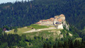
Typical farms, a chapel covered in wooden shingles, two superb viewpoints over La Cluse de Joux and its castle, a glimpse of Chasseron and the Aiguilles de Baulmes, fir trees and the invigorating air of the Haut-Doubs.
l'Herba via the Mijoux Chapel and La Seigne from Les Fourgs
 12.59 mi
+1,440 ft
-1,430 ft
7h 05
Moderate
Departure from Les Fourgs (Doubs)
An invigorating walk at an altitude of 1,000 metres, through pastures and forests with lovely landscapes typical of the Haut-Doubs. The stop at the biathlon centre (La Seigne) adds a touch of ‘discovery’ before the climb of around 2.5 km up to Mont de L’Herba.
The Saracen rock
 6.25 mi
+361 ft
-361 ft
3h 10
Easy
Departure from Les Fourgs (Doubs)
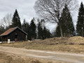
This route takes you to the Belvédère de la Roche Sarrasine viewpoint through woodland and back along a small road to the village of Les Fourgs.
The Mijoux Chapel
 3.19 mi
+236 ft
-207 ft
1h 40
Easy
Departure from Les Fourgs (Doubs)
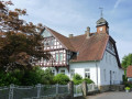
A short route that takes you through various landscapes of the Haut Doubs whilst staying on paths or even small roads.
You’ll pass through part of the village along Rue des Fourgs. Enjoy your walk.
Crêt Monniot variant
 4.12 mi
+574 ft
-577 ft
2h 25
Easy
Departure from La Chaux (Doubs)
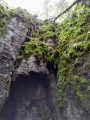
Crêt Moniot, with one or two "n"s, is well known for cross-country skiing and snowshoeing, but the site is also ideal for hiking and mountain biking.It offers typical Jura landscapes with sinkholes and sharp limestone pavement, snow all year round in the La Neigère valley, abundant wildlife and superb views of the Alps.
The Aiguilles de Baulmes
 7.46 mi
+2,133 ft
-2,103 ft
5h 15
Moderate
Departure from Baulmes (Vaud)
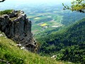
From bright, flower-filled mountain pastures, you will climb towards the ridges through the silent Bataillards forest, skirting its steep limestone cliffs, the first slopes of the Jura, cut into needles that offer views of the Alps, Mont Blanc, Lake Geneva and Lake Neuchâtel. On the other side, the panorama stretches from La Dôle to Chasseral, via the Knoll and the Dent de Vaulion.
The Aiguilles de Baulmes, passing above Baulmes
 8.45 mi
+2,753 ft
-2,756 ft
6h 15
Difficult
Departure from Baulmes (Vaud)
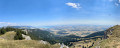
The Aiguilles de Baulmes form a range of ridges over 4 km long, running generally north-east to south-west between Mont de Baulmes and the Col de l’Aiguillon. The French-Swiss border runs 700 metres to the west of the western end of the Aiguilles. The altitude of the ridge varies between 1,080 and 1,560 metres. A wooden cross has stood on the summit since 1935. From there, one can enjoy a magnificent panorama stretching out to the south: Baulmes, the Swiss Plateau, Lake Neuchâtel and the Alps. This hike offers the opportunity to explore the ‘Cave Noire’ cave. Access is secured by chains (a head torch is essential).
Roche Moron and Tour Jurgensen at the start of the Col des Roches
 11.60 mi
+3,885 ft
-3,891 ft
8h 45
Difficult
Departure from Le Locle (Canton of Neuchâtel)
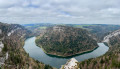
Set off to explore this magnificent trail, from La Roche and Côte de Moron, including the "Pillichody" trail (a high-altitude path, not suitable for children, impassable in winter) – sure-footedness is essential! The path is very narrow in places, with cables in place to secure the tricky sections.
The Jurgensen Tower, which is often open, is located along the route. There is a panoramic view of Villers-le-Lac, Les Brenets and the valley.
Do not attempt this hike in wet weather.
Le Crêt Monniot
 9.58 mi
+1,234 ft
-1,234 ft
5h 30
Moderate
Departure from Arc-sous-Cicon (Doubs)
You don't need to be as fit as an Alpine hunter to climb the high peaks and enjoy breathtaking views. This is a walk that is accessible to all. This 10km or 15km hike will take you to Crêt Monniot (1141m) where, on a clear day, a superb 360° panorama awaits you: lomont, the Loue valley, the Jura plateaus, the Vosges, Mont Blanc and the Bernese Alps. You will love this landscape of chaux (the medieval name for high-altitude wasteland) with its sinkholes and sharp limestone pavement.