The Mijoux Chapel

A short route that takes you through various landscapes of the Haut Doubs whilst staying on paths or even small roads.
You’ll pass through part of the village along Rue des Fourgs. Enjoy your walk.

Details

n°4
Creation:
Last update:
Last review:
  • Walking
    Activity: Walking
  • ↔
    Distance: 3.19 mi
  • ◔
    Average duration: 1h 40 
  • ▲
    Difficulty: Easy

  • ⚐
    Back to start: Yes
  • ↗
    Ascent: + 236 ft
  • ↘
    Descent: - 207 ft

  • ▲
    Highest point: 3,579 ft
  • ▼
    Lowest point: 3,343 ft

Photos

Description of the walk

(S/E) From the tourist information office, follow the main street to the village hall.

(1) Turn left immediately after the hall. The small road leads down to the little village of La Chapelle-Mijoux.

(2) Just before you reach it, turn left at the three-way junction and take the dirt track that climbs into the forest. Follow this track throughout the forest.

(3) When you reach a pasture, continue along the vehicle tracks towards the edge of the forest, and take this new track which runs alongside the forest before emerging into the middle of the pastures and turning into a road.
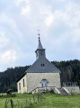
Head back to the village via the church at Les Fourgs.

(4) Leave the church on your right and walk past the cemetery before rejoining the main road; turn left to reach the tourist information office (S/E).

Waypoints

  1. S/E : mi 0 - alt. 3,550 ft - Car park in front of the tourist information centre
  2. 1 : mi 0.18 - alt. 3,543 ft - Village hall
  3. 2 : mi 1.39 - alt. 3,343 ft - Mijoux Chapel
  4. 3 : mi 1.72 - alt. 3,465 ft - Pasture
  5. 4 : mi 3.02 - alt. 3,570 ft - Church of the Assumption (Les Fourgs) - Eglise des Fourgs
  6. S/E : mi 3.19 - alt. 3,550 ft - Car park in front of the tourist information centre

Reviews and comments

3.6 / 5
Based on 3 reviews

Reliability of the description
3.3 / 5
Ease of following the route
4 / 5
Route interest
3.3 / 5
Jefff
Jefff

Hello,
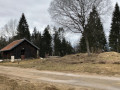
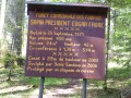
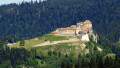
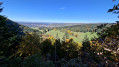
None of the photos posted relate to this walk.

Machine-translated

Testeur59
Testeur59

Overall rating : 3.3 / 5

Date of your route : Oct 21, 2024
Reliability of the description : ★★★☆☆ Average
Ease of following the route : ★★★★☆ Good
Route interest : ★★★☆☆ Average
Very busy route : No

Partly on the road with some cycle lanes, but a nice little route to warm up on 🤗

Machine-translated

Testeur59
Testeur59

Overall rating : 3.3 / 5

Date of your route : Oct 21, 2024
Reliability of the description : ★★★☆☆ Average
Ease of following the route : ★★★★☆ Good
Route interest : ★★★☆☆ Average
Very busy route : No

A section on the road with some cycle lanes

Machine-translated

encore1matin
encore1matin

Overall rating : 4 / 5

Date of your route : Sep 18, 2024
Reliability of the description : ★★★★☆ Good
Ease of following the route : ★★★★☆ Good
Route interest : ★★★★☆ Good
Very busy route : No

A lovely little walk, easy and well signposted.
We extended the walk on the way back from the viewpoint overlooking the lake.
We headed straight back up through the forest (near the chapel).
This made for a 9.4 km circular route with 173 m of elevation gain.

Machine-translated

Other walks in the area

For more walks, use our search engine .

The GPS track and description are the property of this route's author. Please do not copy them without permission.