Country:

 City:
City:


Park in the car park on Rue des Collèges.
(S/E) Head towards “la grande rue” and walk up it to the roundabout. At the roundabout, take Chemin de Placemont and start walking up a street. The route is marked in yellow.
At the signpost, follow “Corridor aux loups”. Cross the road and take Chemin de la Baume.
(1) About 150 m further on, do not follow Chemin de la Baume any further, but follow Chemin du Corridor aux Loups to reach this site.
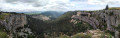
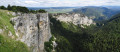
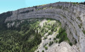
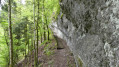
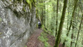
(2) The Corridor aux Loups is a geological curiosity. It is the result of erosion by various agents that constantly reshape the karst landscape, creating an impressive shelter covered by an overhanging ledge, within which you can walk upright for several hundred metres.
Begin a descent which may be slippery, but there is a handrail. When you reach a road, turn left towards Bas des Roches.
The road climbs, following the Le Sucre stream. Just after the bridge, take the path on the left and follow the stream and its small waterfalls. This stream flows into the Arreuse, which is a river.
(3) At the junction, stop following the stream and turn right onto the path that climbs, marked with yellow signposts. You’ll reach a pasture; keep to the left. After the farm, the path (just before this, there’s a table where you can take a break).
(4) At the junction with a road, turn right and follow the yellow markings towards Glacière de Monlési. Follow the hairpin bend to the left, then go straight on at the next hairpin bend to the right.
(5) Near a house, the path crosses through pastureland and is no longer very clearly marked on the ground. Follow the contour line until you reach the Route de la Brévine. At this junction, turn right and keep to the right-hand side for safety until you reach the junction with a car park.
(6) Turn left towards Glacière de Monlési and follow the Yellow route to the cave.
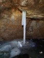
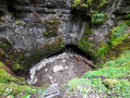
(7) The ice cave is a cave that retains ice and snow. You must descend into the main shaft via a very steep path and a ladder. Once you reach the bottom, you can only see the upper part of the ice cave. Don’t forget to bring a torch to go inside, but be careful – remember that you’ll be walking on ice, so there’s a risk of slipping!
Leave the cave path; do not follow the yellow markings any further, but take the south-facing path on the right. You’ll come to a clearing with a path leading up to the south-west – follow this to the woods.
(8) There is a pedestrian gap in the barbed wire as you enter the woodland; continue straight on until you reach the edge of the woodland. In the pasture, use the stone wall as a handrail, heading south-west until you reach the path, then turn left, following the yellow markings.
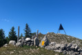
(9) At the signpost, head towards La Citadelle / Boveresse. Follow the yellow markings to the highest point, which is the Signal des Français, marked by a yellow signpost for La Citadelle.
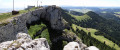
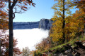
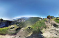
The Citadelle, also known as the Signal des Français, is a peak rising to 1,213 metres and offering a panoramic view of the Alps and the Jura. A few steps from the southern summit, a stone foundation marks the site of an old farm known as the ‘citadelle’ because it was fortified.
(10) Follow signs for Boveresse, head down the south-eastern pasture to the path and take it on the left.
(11) At the yellow signposts, follow signs for Boveresse; take care to head south-east after the Black Cross marked ‘Alexandrine Gräfin von Wesdehlen’ – a surprising find in the middle of the woods. As you leave the pasture, you’ll come to a road where there is a signpost.
(12) Head south-west towards Boveresse; do not take the road to Couvet. Follow the road for 600 m.
(13) Turn left into the field, following the yellow markings. Walk downhill for 1 km through the woods. You’ll come to a road.
(14) Take the path opposite towards Boveresse and go under the railway line. Walk downhill to the village of Boveresse. Continue to follow the yellow route until you come out of Ruelle du Temple (there are recycling bins).
(15) Do not follow the Yellow route any further; instead, take the road opposite. Go straight on, towards the sewage treatment works visible in the distance, slightly to the left. You’ll reach the banks of the Areuse.
(16) Turn left onto the track without crossing to the other side of the Areuse. Continue to the village of Couvet and follow the Yellow route to the end of Rue du Quarre.
(17) Continue straight on along Rue du Preyel, still following the Areuse. At the second bridge, a small lane climbs slightly to the left. Take this lane and, at the end of it on the left, you’ll find the car park (S/E).

 Visorando Member

 Difficult