The Glacière de Monlési and the Corridor aux Loups in the Val de Travers

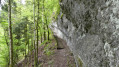
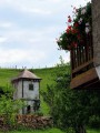
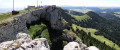
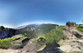
Set off to explore the Glacière de Monlési and the Corridor aux Loups, a wide, well-secured rock ledge. The Corridor aux Loups is a path carved by nature into a rocky outcrop; this long ledge has been eroded to such an extent that you can walk along it. Access poses no major difficulty; a chain runs the entire length of the corridor and four sets of steps – around 140 in total – are provided to make the walk easier. There is no evidence of a pack of wolves here, though some claim that this mysterious path leads to a place where witches and wizards used to meet. Spine-tingling!
A very well-signposted walk.

Details

n°45360298
Creation:
Last update:
Last review:
  • Walking
    Activity: Walking
  • ↔
    Distance: 11.63 mi
  • ◔
    Average duration: 7h 00 
  • ▲
    Difficulty: Moderate

  • ⚐
    Back to start: Yes
  • ↗
    Ascent: + 1,916 ft
  • ↘
    Descent: - 1,906 ft

  • ▲
    Highest point: 3,960 ft
  • ▼
    Lowest point: 2,585 ft

Photos

Description of the walk

Park at a place called Le Haut-de-la-Cheneau Grands Prés. There are several options: either near the restaurant, opposite the large farm, or in a grassy car park, which is the route’s recommended choice.

(S/E) Take the road leading uphill towards Les Bans; ignore thefirst pathon the left and continue until you reach a T-junction.

(1) Take the path on the left, still heading towards Les Bans. You’ll reach the riding centre; continue left to reach the crossroads at a place called Petite-Charbonnière.

(2) Turn right, still heading towards Les Bans, and join a tarmac road.

(3) Walk along it on the right-hand side, taking care to keep to the right, until you reach a four-way junction.

(4) Turn slightly to the right to reach the Glacière de Monlési.

(5) Return to the previous crossroads.

(4) Take the road on the right, then cross it quickly and carefully, and turn left onto the path leading uphill towards the houses at Vers-chez-Maublanc. Enjoy the lovely view here. Walk across a meadow, then along a road to reach a crossroads at a hairpin bend.

(6) Take this descending road to the right, negotiating a hairpin bend further on. You’ll reach the hamlet of La Roche.

(7) Take the path on the left and continue along a lovely track to cross the Bas des Roches. You’ll come to some steps and follow the stream known as Le Sucre and its small waterfalls before reaching the road. Cross the small bridge on the right to reach the junction with the Corridor aux Loups.

(8) Here, turn right to begin crossing this magnificent ledge with its four sets of steps before reaching the rock ledge. Continue, crouching low, beneath the ledge until you reach a pleasant path. You’ll come to a road at the entrance to the village of Couvet.

(9) Cross it with great care, as the bend is dangerous. Cross the road again immediately to take the path leading uphill; this is the old Plancemont path. Follow a lovely climb, ignoring all other paths to the right or left, until you reach the hamlet of Plancemont. Walk through it and, at the far end, you’ll come to a crossroads.

(10) Turn right onto this path and continue uphill to the Champs aux Lièvres chalet and its viewpoint.

(11) Enter the woods and continue the climb along a magnificent path running parallel to the road. Join the road, cross it carefully and continue to the left until you reach a triangular junction.

(12) Turn right onto the path to the left of the road heading towards La Roche. Stay parallel to the road until you reach a crossroads of paths at the edge of the woods.

(13) Turn left towards Monlési. You’ll reach the Vers-chez-Bordon farm.

(14) Carry on in the same direction. Note: when I was there, there were no dogs. Look out for the marker on a tree, go straight on and continue along this lovely path until you reach the Black Cross on the left.

(15) Turn right onto the path leading uphill, towards Les Citadelles. Walk round several farms, following the very well-marked path, and arrive at a place called La Citadelle.

(16) Head downhill to return to the junction you passed on the way there.

(1) Follow the route you took on the way there in the opposite direction to return to the grassy car park (S/E).
Waypoints

  1. S/E : mi 0 - alt. 3,691 ft - Grassy car park
  2. 1 : mi 0.4 - alt. 3,714 ft - Crossroads of the circular loop
  3. 2 : mi 1.13 - alt. 3,898 ft - Head towards Les Bans
  4. 3 : mi 2.14 - alt. 3,724 ft - Heading towards La Roche
  5. 4 : mi 2.44 - alt. 3,681 ft - Monlési Glacière crossroads
  6. 5 : mi 3.16 - alt. 3,727 ft - Monlési Glacière
  7. 6 : mi 4.82 - alt. 3,698 ft - Heading towards La Roche
  8. 7 : mi 5.56 - alt. 3,488 ft - Head towards Bas des Roches
  9. 8 : mi 6.83 - alt. 2,677 ft - Corridor aux Loups
  10. 9 : mi 7.34 - alt. 2,605 ft - Couvet
  11. 10 : mi 7.95 - alt. 2,972 ft - Plancemont
  12. 11 : mi 8.15 - alt. 3,123 ft - Champs aux Lièvres
  13. 12 : mi 8.64 - alt. 3,373 ft - Crossroads at Place
  14. 13 : mi 9.1 - alt. 3,468 ft - Heading towards Monlési
  15. 14 : mi 9.49 - alt. 3,599 ft - Towards Bordon
  16. 15 : mi 9.91 - alt. 3,704 ft - Turn right towards Les Citadelles
  17. 16 : mi 10.72 - alt. 3,914 ft - Les Citadelles
  18. S/E : mi 11.63 - alt. 3,691 ft - Grassy car park

Notes

Between (8) and (9): an ideal spot for a meal beneath the ledge of the Corridor aux Loups.
(11) The hut at Champs des Lièvres is available to walkers after Plancemont.
Hike completed in 4 hours 45 minutes.

Worth a visit

(5) Monlési ice cave: you can descend to the bottom of the ice cave; take care as the path is very slippery; there is a cable to help you, followed by a ladder.
Between (8) and (9) La Vire: the perfect spot for a coffee break.

Reviews and comments

5 / 5
Based on 1 review

Reliability of the description
5 / 5
Ease of following the route
5 / 5
Route interest
5 / 5
nature25
nature25

Hello
I'm glad you enjoyed the walk
Thanks for the comment
Sylvie

Machine-translated

Jonathan25
Jonathan25

Overall rating : 5 / 5

Date of your route : May 19, 2025
Reliability of the description : ★★★★★ Very good
Ease of following the route : ★★★★★ Very good
Route interest : ★★★★★ Very good
Very busy route : No

A very pleasant walk through pastures, mown or not, frequented by cows and their calves (be careful to keep well out of the way...) with a variety of mid-mountain landscapes.
Thanks for the discovery.

Machine-translated

Other walks in the area

For more walks, use our search engine .

The GPS track and description are the property of this route's author. Please do not copy them without permission.