Le Creux du Van, starting from Noiraigue

An unmissable hike in the region, accessible without a car.

Details

59314043
Creation:
Last update:
Last review:
  • Walking
    Activity: Walking
  • ↔
    Distance: 7.66 mi
  • ◔
    Average duration: 5h 50 
  • ▲
    Difficulty: Difficult

  • ⚐
    Back to start: Yes
  • ↗
    Ascent: + 2,621 ft
  • ↘
    Descent: - 2,621 ft

  • ▲
    Highest point: 4,780 ft
  • ▼
    Lowest point: 2,369 ft

Photos

Description of the walk

The easiest way to get there is by train (line R21, towards Travers, departing from Neuchâtel, approximately 20 mins, with a train every half hour). Alternatively, you can drive to the station car park.

(S/E) The walk starts at the station car park; simply follow ‘le creux du Van’. Take Rue des Tilleuls, heading due east, until it ends. Turn right to cross the level crossing, then the River Areuse.

(1) Just after crossing the river, turn left, pass Vers-chez-Joly and leave the road at the first junction. Go through a barrier of triangular concrete blocks (a remnant of theSecond World War defences).

(2) Start of the circular route. Head right towards “Les Œillons”, crossing a woodland. Head south-west, then west, until you reach Les Œillons Farm.

(3) Turn left (due south) and follow the winding path up to the summit.

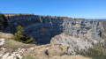
(4) At the summit, head due south along the path that skirts the cliff.

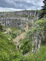
(:5) Once you reach the other end of the cliff, begin the descent along the winding path, following signs for “Ferme Robert”, which leads to Fontaine Froide (in the Creux du Van).

(6) Ignore the old, overgrown path; follow the track to the left, still winding down, towards “La Ferme Robert”

(7) After passing the farm and the Refuge du Van, turn left and follow the signs for “Noiraigue” to return to the start of the circular route and the road you took at the beginning.

(2) Turn right and, following the route back in the opposite direction to the outward journey, head for Noiraigue station (S/E).


Waypoints

  1. S/E : mi 0 - alt. 2,379 ft - Noiraigue station - Gare de Noiraigue
  2. 1 : mi 0.35 - alt. 2,375 ft - Junction after the river - Areuse (rivière) - Suisse - Affluent du lac de Neuchâtel
  3. 2 : mi 0.62 - alt. 2,566 ft - Defence line (ruins)
  4. 3 : mi 1.58 - alt. 3,337 ft - Les Œillons
  5. 4 : mi 2.98 - alt. 4,636 ft - Creux du Van
  6. 5 : mi 3.85 - alt. 4,675 ft - End of the cliff
  7. 6 : mi 5.11 - alt. 3,753 ft - Fontaine Froide
  8. 7 : mi 6.2 - alt. 3,196 ft - Robert Farm
  9. S/E : mi 7.66 - alt. 2,382 ft - Noiraigue station - Gare de Noiraigue

Notes

The signposting is excellent and the path is unambiguous. If you know which direction to follow, it’s almost impossible to get lost.

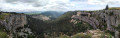
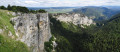
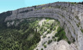
The cliff face appears suddenly. In most places, there is nothing to protect you from the drop. Keep a close eye on children and your dogs (which, in any case, are not allowed off the lead).

The ascent is a steady climb, with almost no respite or level sections. The descent is rather steep. Make sure your footwear is suitable.

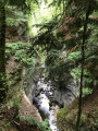
The ascent and descent are shaded; only the path round the cliff is in the sun.
The ascent and descent are not very busy. However, there are large crowds around the cliff.

Worth a visit

There are plenty of places to eat and drink: the station shop, the refreshment bar at the Ferme des Œuillons, a possible detour via the Ferme du Soliat (catering) and the Ferme Robert, which is a restaurant.

Reviews and comments

4.5 / 5
Based on 2 reviews

Reliability of the description
4.5 / 5
Ease of following the route
4.5 / 5
Route interest
4.5 / 5
User 25842845

Overall rating : 5 / 5

Date of your route : Oct 29, 2025
Reliability of the description : ★★★★★ Very good
Ease of following the route : ★★★★★ Very good
Route interest : ★★★★★ Very good
Very busy route : Yes

A superb hike, full of surprises that are a feast for the eyes. Definitely worth doing, and if the weather is good, make the most of it.

Machine-translated

richardd
richardd

Overall rating : 4 / 5

Date of your route : May 01, 2025
Reliability of the description : ★★★★☆ Good
Ease of following the route : ★★★★☆ Good
Route interest : ★★★★☆ Good
Very busy route : Yes

A very nice parish specific to Brittany with great 360° views.
Shame the car parks are not free.

Machine-translated

Zoltic
Zoltic
• Edited:

In fact, when you look at the details of the enlarged curve profile, there are some significant dips (including one of 60 metres) that do not correspond to the reality of the terrain.

The fact that the route follows a precipice must mean that the data recalculated is sometimes that of the bottom and sometimes that of the top. This distorts the calculation considerably, by around 180 D+.

As a result, I've reworked a few points on the route when it skirts the cliff, and it does indeed largely correct the overestimation of the difference in altitude and the duration of the route.

The estimate of 5h40 is probably still about 45 min too long.

Machine-translated

Zoltic
Zoltic
• Edited:

Perhaps the problem lies in the quality of the altimeter data.

The recalculation gives a difference in altitude of 900 m, whereas the difference between the high and low points is 727 m (with a very ordinary two-phase hiking profile).

The Val de Travers tourist office advertises the hike as taking 5 hours, but I easily completed it in 4.5 hours.

Usually, I'm free to change the estimated time, but strangely enough I wasn't!

Machine-translated

Netra
Netra ★
• Edited:

Hello Zoltic,

There's one thing you can do, on your phone or computer, and that's to recalculate the altitudes: on the route sheet, tab Actions/Recalculate altitudes.

That's what I've just done and the estimated difference in altitude is lower than it was originally. As a result, the estimated time has been reduced to 6h10.

The time shown on the route sheet is an estimate, based on an average speed of 3.5 km/h on flat ground and with a reduction in average speed according to the height difference. This estimate should not be taken as an absolute value! The pace of the climb, the average speed and, therefore, the duration vary enormously from one hiker to another: some (like you) will take less time, others more. The estimate is only an order of magnitude, to be put into perspective with your own abilities.

Machine-translated

Zoltic
Zoltic

I can't change the app's automatic time calculation.
The walk takes 5 hours, not 7.

Machine-translated

Other walks in the area

For more walks, use our search engine .

The GPS track and description are the property of this route's author. Please do not copy them without permission.