Refine your search for walks in Bézaudun-sur-Bîne
Bézaudun-sur-Bîne walks
Short Protestant route – Dieulefit-Bourdeaux region
A gentle walk offering a route through the countryside and a visit to the old village of Bourdeaux (La Viale).
Saint-Jean Chapel in the Dieulefit-Bourdeaux region
At the start of the circular route, the Soubrion river must be crossed by fording (the only authorised crossing point). However, if the water level does not allow for a safe crossing, the landowners permit use of their footbridge. Please respect this exception.
Circular Route of the Three Beaks via Fondoresse
A beautiful, long hike from Col de Gourdon with a significant elevation gain.Magnificent aerial view from the Trois Becs. The trail sometimes winds through heath, sometimes through pastures and also through undergrowth.
Please note that the route passes through a quiet zone for wild animals. Certain sections are closed between 15 May and 15 July. Special signage and a diversion from the GR®9 have been put in place to guide users, seehere.
Couspeau mountain: the Grand Delmas
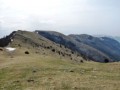
A circular walk on Couspeau mountain, with the summit of the Grand Delmas offering views over the surrounding mountains, particularly the 3 Becs.
The Gourdon Circuit – Dieulefit-Bourdeaux region
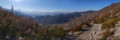
Although this circular walk can be done in either direction, in summer it is advisable to follow the route described to avoid the climb from Les Athénols to the Col de Gourdon, which is very exposed to the sun. It is possible to do just the Col de Gourdon–Fonderesse return walk via Floréal (6.6 km / +320 m / 2 hours 15 minutes).
To avoid disturbing the wildlife, dogs must be kept on a lead.
Le Pradou - Roche Rousse
This wild hike allows you to discover the south-eastern ridge of the Saoû Forest, passing by the peaks of Pradou and Roche Rousse with views of the southern Drôme mountains as far as Mont Ventoux.
Please note that the route passes through a quiet zone for wild animals. It is forbidden to use it between Pas de Floréal (6) and the bottom of Pré de l'Âne (8) between 15 May and 15 July.Specific signage and a diversion from the GR®9 have been put in place to guide users, seehere.
Serre Antoine - Saoû Forest
Sheltered by the imposing wall of the Saoû perched syncline, you will pass close to the ruins of Pradas and also enjoy unobstructed views over the Roubion valley.
⚠️ Between 1 July and 15 September, Prefectural Order DDT-SEF-2026-0176 of 4 June 2026 concerning temporary restrictions on access to the Saoû forest and the Ambel plateau in the event of a fire risk, assessed on a daily basis. A map is published every evening (around 5.30 pm) for the following day.
Les Trois Becs
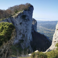
Visit the Trois Becs, the highest points in the Saou Forest.
⚠️ The route passes through a quiet zone for wildlife. Certain passages are closed between 15 May and 15 July.Specific signage and a diversion from the GR®9 have been put in place to guide users, see here.
Bois de Vache - Saoû Forest
The hilltop village of Le Poët-Célard offers a journey back in time as you wander through its medieval streets leading up to the castle. Then discover the local area, including the Château de Saint-André.
Les Sadous - Pays de Saillans
At the foot of the majestic Trois Becs massif and the Montagne de Couspeau, leave the charming village of La Chaudière for the Chapelle des Sadous, perched on a wooded spur.
Chapelle des Sadous - Montagne de Faraud
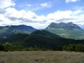
This is a wild hike to discover the little Chapelle des Sadous chapel through the ravines of the Vallon de la Coullance, followed by a crescendo climb to the summit of Montagne de Faraud.
From the top of this spur, you can enjoy views of the Trois Becs, the Grand Delmas and the Montagne de Couspeau, the Diois, the Dévoluy, the Vercors and the Grand Veymont.
La Chaudière - Col de la Baume
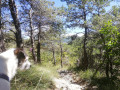
Hike opposite the Trois Becs massif, which forms the eastern slope of the Saou forest and its Perched syncline. Beautiful views of this magnificent rocky ridge.
Rochecourbe and Rocher de la Laveuse via Pas de Picourère
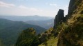
A beautiful hike to the summit of Rochecourbe (one of the 3 Becs) via one of the prettiest passes (Pas de Picourère) and back via the magnificent Rocher de la Laveuse and Pas de Siarra.Be careful, as the paths are steep and slippery, unmarked and close to cliffs. This route is therefore best suited to hikers who are used to this type of terrain.
Please note that the route passes through a wildlife sanctuary. Certain sections are closed between 15 May and 15 July. Special signage and a diversion from the GR®9 have been put in place to guide users, seehere.
Saoû Forest
A superb hike in the Saoû Forest, ideal for nature lovers and sports enthusiasts – a challenge for us as novice hikers. Despite the fairly long route, we were delighted and, above all, pleasantly surprised by the untamed beauty of the landscape and the view of the Trois Becs.
⚠️ 1 July 2026: Between 1 July and 15 September, Prefectural Order DDT-SEF-2026-0176 of 4 June 2026 concerning temporary restrictions on access to the Saoû Forest and the Ambel Plateau in the event of a fire risk , assessed on a daily basis. A map is published every evening (around 5.30 pm) for the following day.
Couspeau Mountain: Serre Delègue
This route starts in Rochefourchat and allows you to explore the Montagne de Couspeau by following the ridge that rises from the south from Serre Délégué (1,482 m) to the north, at its northern end, at Grand Delmas (highest point at 1,544 m). This hike offers views of the surrounding mountains from Diois to Baronnies, including the Trois Becs.
Hiking is prohibited by the owner (private property) during the summer grazing period, from 20 May to 31 October.
The Trois Becs via the Grande Combe
From the Auberge des Dauphins, a magnificent climb via the Grande Combe leads to the Rocher de la Laveuse and the Trois Becs – a legendary hike in the Saou Forest.
⚠️ The route passes through a wildlife sanctuary. Certain sections are off-limits between 15 May and 15 July. Specific signage and a diversion from the GR®9 have been put in place to guide walkers; see here.
⚠️ Between 1 July and 15 September, Prefectural Order DDT-SEF-2026-0176 of 4 June 2026 concerning the temporary restriction of access to the Saou Forest and the Ambel Plateau in the event of a fire risk, which is assessed daily. A map is published every evening (around 5.30 pm) for the following day.
The Saou Forest, returning via the Pas de la Motte
The heart of the Saou Forest has a very distinctive atmosphere for the region, with its dense vegetation, gorges and cliffs. You might feel as though you’re in another country. A few routes published on Visorando pass through this forest, but they all differ in terms of the return route. Here we suggest a relatively challenging route that will take you along the northern ridges and through its beautiful landscapes.
Please note that the route passes through a wildlife sanctuary. Certain sections are off-limits between 15 May and 15 July. Special signage and a diversion from the GR®9 have been put in place to guide walkers; seehere.
Les Pomerolle
Explore the south-western ridge of the famous Saou Forest.
⚠️ Between 1 July and 15 September, Prefectural Order DDT-SEF-2026-0176 of 4 June 2026 concerning temporary restrictions on access to the Saou Forest and the Ambel Plateau in the event of a fire risk, assessed on a daily basis. A map is published every evening (around 5.30 pm) for the following day.
In the footsteps of the Huguenots in the Saoû Forest
A lovely, gentle round-trip walk that will take you in the footsteps of the Huguenots through the Saoû Forest. The walk is fully accessible to all-terrain pushchairs.
Pré de l'Âne through the heart of the forest - Saoû Forest
A lovely walk where ‘diversity’ is the watchword! This superb route, winding its way between two cliffs, takes you gradually uphill via the Grande Combe, amidst lush vegetation. The Pas de Siara offers a glimpse of the southern Alpine meadows of the Trois Becs, where sheep from neighbouring valleys graze during the summer grazing season. The descent is gentle through the beech forest, typical of the montane zone.
⚠️ Between 1 July and 15 September,Prefectural Order DDT-SEF-2026-0176 of 4 June2026 concerning the temporary restriction of access to the Saoû forest and the Ambel plateau in the event of afirerisk, which is assessed daily. A map is published every evening (around 5.30 pm) for the following day.
Les Clos - Saoû Forest
A short circular path through the forest, perfect for enjoying the shade. You’ll walk through a splendid beech forest on a north-facing slope.Dogs must be kept on a lead.
Long circular in the Saou forest
This route offers a good introduction to this hilltop forest, its tranquillity and the birdsong. You’ll come close to the Trois Becs without actually climbing them. Just enough to make you want to come back and tackle them.
⚠️ The route passes through a wildlife sanctuary. Certain sections are off-limits between 15 May and 15 July. Specific signage and a diversion from the GR®9 have been put in place to guide walkers; see here.
⚠️ Between 1 July and 15 September, Prefectural Order DDT-SEF-2026-0176 of 4 June 2026 concerning the temporary restriction of access to the Saoû forest and the Ambel plateau in the event of a fire risk, assessed on a daily basis. A map is published every evening (around 5.30 pm) for the following day.
Les 3 Becs via the Grande Combe, then Pas de Picourère and Pas de la Laveuse
A beautiful, long hike that alternates between forest, alpine meadows and ridge paths before returning through the forest.A gentle climb through the forest via the Grande Combe, which zigzags between two cliffs. Then the view opens up between the Pas de Siara and the Pas de la Laveuse, passing by the Veyou and close to the other peaks of the Trois Becs. Descent through the beech forest.The effort is richly rewarded by the variety of landscapes and superb views over the Vercors and the Saou Forest syncline.
Please note: the route passes through a wildlife sanctuary. Certain sections are closed to the public between 15 May and 15 July. Special signage and a diversion from the GR®9 have been put in place to guide walkers; seehere.
Saou Forest via the Pas de la Motte, the Quatrième Bec and the Pomerolle
A hike with a significant elevation gain but no particular difficulty apart from its length; a good part of the route is shaded in case of hot weather.See Practical Information regarding the section near the cliffs.Reserved for experienced hikers.
Please note: the route passes through a wildlife sanctuary. Certain sections are off-limits between 15 May and 15 July.Specific signage and a diversion from the GR®9 have been put in place to guide users; seehere.
Bois Sec and banks of the Roubion in Francillon
This is an easy walk to stretch your legs while enjoying a beautiful variety of landscapes: panoramic views of the majestic syncline of the Saou Forest, dry pine forests, the cool banks of the Roubion inviting you to take a dip, and even lavender fields to finish off before crossing the pretty village of Francillon.
Bois Sec and Vaire - Saoû Forest
After swimming in the Roubion, you can finish the descent at nightfall: Vaire is a remarkable platform for stargazing, at the foot of the southern slope of the Saoû syncline.
Please note: the route is impassable when the Roubion is in flood.
Montagne de Saint-Maurice
On the border between Baronnies and Diois, Saint-Maurice is famous for its chapel and ridges. There is a beautiful view to the north with the forest of Saoû, the Trois Becs at Roche Colombe, the Grand Delmas and the Couspeau mountain in the background, and the Lance mountain to the south.
Montagne des Ventes
This is a short hike, mostly through wooded areas with regular openings offering beautiful views of the Dieulefit and Bourdeaux countryside. In particular, you can see the Romanesque church and the 12th-century (private) castle of Comps, the entire Saoû Forest, from Roche Colombe to Trois Becs and the Couspeau Mountain.
Les 3 Becs from Les Auberts via Col de la Motte
Another route across the ridges of the 3 Becs, which is quieter and more unspoilt.It is possible to do this without completing the return leg (a shorter route) by descending to the Col de la Chaudière; in this case, two cars are recommended (or hitchhiking).
⚠️ The route passes through a wildlife sanctuary. Certain sections are off-limits between 15 May and 15 July. Specific signage and a diversion from the GR®9 have been put in place to guide walkers; see here.
⚠️ Between 1 July and 15 September, Prefectural Order DDT-SEF-2026-0176 of 4 June 2026 concerning the temporary restriction of access to the Saoû forest and the Ambel plateau in the event of a fire risk, assessed on a daily basis. A map is published every evening (around 5.30 pm) for the following day.
In the footsteps of mule drivers and old farms in the Forest of Saoû
A 10 km circular route, the first part of which offers a pleasant walk in the shade through the beautiful Saoû Forest, whilst the second, sunnier part offers splendid panoramic views of the perched syncline.
⚠️ Between 1 July and 15 September, Prefectural Order DDT-SEF-2026-0176 of 4 June 2026 concerning the temporary restriction of access to the Saoû Forest and the Ambel Plateau in the event of a fire risk, assessed on a daily basis. A map is published every evening (around 5.30 pm) for the following day.
Grand Pomerolle via Pas de Berlhe and Pas Jossaud
A very beautiful walk for regular walkers which, in good weather, will allow you to discover the ridges of the Eyzahut rocks, Saint-Maurice, Mont Ventoux, the Lance massif, the Montagne d’Angèle, the Trois Becs and the Grand Delmas.
⚠️ 1 July 2026: Between 1 July and 15 September, Prefectural Order DDT-SEF-2026-0176 of 4 June 2026 concerning temporary restrictions on access to the Saoû Forest and the Ambel Plateau in the event of a fire risk , assessed on a daily basis. A map is published every evening (around 5.30 pm) for the following day.
The Saint-Médard Chapel
In the heart of the Diois region, the Saou Forest is home to some lovely treasures.The Saint-Médard Chapel is one of them: a viewpoint offering a unique vista of the Trois Becs. Although the path up is a bit steep, it makes for a lovely family walk.
⚠️ Between 1 July and 15 September, Prefectural Order DDT-SEF-2026-0176 of 4 June 2026 concerning temporary restrictions on access to the Saou Forest and the Ambel Plateau in the event of a fire risk, assessed on a daily basis. A map is published every evening (around 5.30 pm) for the following day.
In the footsteps of the mule drivers - Saoû Forest
This walk takes you along various historic routes through the Saoû Forest.You can start this circular walk from the Écogardes Office, heading towards Le Chemin de la Grande Combe, then follow the directions in the text.Dogs must be kept on a lead.
⚠️ Between 1 July and 15 September, Prefectural Order DDT-SEF-2026-0176 of 4 June 2026 concerning temporary restrictions on access to the Saoû Forest and the Ambel Plateau in the event of a fire risk, assessed on a daily basis. A map is published every evening (around 5.30 pm) for the following day.
The old farms - Forêt de Saoû
This walk will take you on a journey through the agricultural landscape of the Saoû Forest. The walk begins along the hay meadows at the foot of the forest. You will then pass close to the ruins of Raillon and Fuoc, remnants of the many farms that once stood at the foot of the forest. This walk is suitable for all-terrain pushchairs.Dogs must be kept on a lead.
⚠️ 1 July 2026: Between 1 July and 15 September,Prefectural Order DDT-SEF-2026-0176 of 4 June2026 concerning the temporary restriction of access to the Saoû Forest and the Ambel Plateau in the event of afirerisk, assessed on a daily basis. A map is published every evening (around 5.30 pm) for the following day.
Comps, tour of the Jabron Valley
A route taking in small roads and paths that allow you to discover the varied landscapes surrounding the village of Comps and the upper reaches of the Jabron Valley, from the Col de Ventebrun to the church at Comps via the Col de Boutière and the Col de Vesc.
Comps, around the Montagne des Ventes
A walk along small roads, tracks and paths, offering a chance to explore the varied landscapes surrounding the village of Comps, at the head of the Jabron valley, via its church and a circuit around the Montagne des Ventes.
Faraud Mountain and Sadous Chapel from Chastel-Arnaud
Montagne de Faraud offers magnificent views of the Trois Becs and all the surrounding mountains. This hike offers an alternative to the classic hike, starting from the hamlet of Saint-Moirans (Chastel-Arnaud) rather than La Chaudière. At the start, you will have the opportunity to visit the 12th-century Church of Saint-Moirans and, during the hike, the charming Chapelle des Sadous chapel. The hike follows good paths or tracks, with a few slightly steep sections.
Vesc "Le Peinard"
Hike around the Montagne du Ruy. View of the Jabron and Veyssanne valleys, as well as the Montagne de la Lance and part of the Montagne Angèle.
Grand and Petit Pomerolle
Climb up to the Grand and Petit Pomerolle from the Pas de Lestang, offering beautiful views of Saoû, its forest and its legendary three peaks.
Les Trois Becs and the Saou Forest
Like a ship, the massif rises at the foot of the Vercors and offers a panoramic view over the Drôme and Rhône valleys. In fine weather, you can see the snow-capped peaks of the Alps and, on the opposite side, the Cévennes. Several moments of contemplation are needed to take in these landscapes.
⚠️ The route passes through a wildlife sanctuary. Certain sections are off-limits between 15 May and 15 July. Specific signage and a diversion from the GR®9 have been put in place to guide walkers; see here.
⚠️ Between 1 July and 15 September, Prefectural Order DDT-SEF-2026-0176 of 4 June 2026 concerning the temporary restriction of access to the Saoû forest and the Ambel plateau in the event of a fire risk, which is assessed daily. A map is published every evening (around 5.30 pm) for the following day.
La Montagne du Ruy via the Sentier Caprin
A short 3½-hour hike with beautiful views.
La Bergerie des Pradaux
Beautiful hike on the slopes of Couspeau, above Saint-Nazaire-le-Désert. Unobstructed view of the Roanne basin, the Servelle, the Diois and Vercors mountains.
Saint-Sauveur-en-Diois
Walk through the Clairette de Die vineyards.
Views of the Trois Becs, the Glandasse, and the Drôme valley.
Grand tour of the Saou Forest
Head east to explore the tourist trail created by Maurice Burrus in 1930. The route passes at the foot of the Trois-Becs. To round off this walk, a descent along forest paths and tracks will make you forget the long climb.
The Saou Forest, acquired as part of the Sensitive Natural Areas policy, is the Department’s largest property. Listed as a protected site since 1942, it is managed in accordance with the principles of sustainable development, in consultation with local stakeholders.
⚠️ Between 1 July and 15 September, Prefectural Order DDT-SEF-2026-0176 of 4 June 2026 concerning the temporary restriction of access to the Saou Forest and the Ambel Plateau in the event of a fire risk, assessed on a daily basis. A map is published every evening (around 5.30 pm) for the following day.
Exploring the Saou Forest
A discovery trail in the heart of the Saou Forest, along easy paths and tracks suitable for the whole family. In the heart of the forest, don’t miss the Auberge des Dauphins and its remarkable architecture.The Saou Forest, acquired as part of the Sensitive Natural Areas policy, is the Department’s largest property (2,500 ha). Listed as a protected site since 1942, it is now managed in accordance with the principles of sustainable development, in consultation with local stakeholders.
⚠️ Between 1 July and 15 September, Prefectural Order DDT-SEF-2026-0176 of 4 June 2026 concerning the temporary restriction of access to the Saou Forest and the Ambel Plateau in the event of a fire risk, assessed on a daily basis. A map is published every evening (around 5.30 pm) for the following day.
L'Échelette in the Saou Forest
A challenging route, with a short section where you’ll need to carry your bike on the climb up to the Pas de l’Échelette. Enjoy the panoramic views of Crest, the Drôme valley and the Trois Becs!
⚠️ Between 1 July and 15 September, Prefectural Order DDT-SEF-2026-0176 of 4 June 2026 concerning temporary restrictions on access to the Saoû Forest and the Ambel Plateau in the event of a fire risk, assessed on a daily basis. A map is published every evening (around 5.30 pm) for the following day.
Le Muletier in the Saou Forest
A route in the Saou forest, where you’ll follow the tourist trail before heading down the Sentier Muletier. Please note that this descent is technical; some stony sections require caution!
Rochecolombe in the Saou Forest
A beautiful route that will take you through the Saou Forest, then to the foot of Rochecolombe Mountain. The route follows fun and varied paths through the woods.
⚠️ Between 1 July and 15 September, Prefectural Order DDT-SEF-2026-0176 of 4 June 2026 concerning temporary restrictions on access to the Saou Forest and the Ambel Plateau in the event of a fire risk, assessed on a daily basis. A map is published every evening (around 5.30 pm) for the following day.
Between Roc and Estang - Saoû Forest
At the foot of the Aiguilles, you will pass through a wide variety of environments. Wetlands and arid areas alternate between the Vèbre and the Mediterranean slopes of the Pas de l'Estang and the Palloir.
Saint-Michel - Pays de Saillans
On the foothills of the perched syncline of the Saoû forest and through vineyards, forests and ridges, this route offers beautiful views of the Trois Becs.
The cliffs of Roche Colombe
The west summit of Saou forest, which marks the beginning (or end) of this forest.
Roche Colombe in the Saoû Forest region
Roche Colombe is the stern of the great ship formed by the Saoû Forest, offering a remarkable view of the Vercors, the Drôme and the interior of the forest.
⚠️ Between 1 July and 15 September, Prefectural Order DDT-SEF-2026-0176 of 4 June 2026 concerning temporary restrictions on access to the Saoû Forest and the Ambel plateau in the event of a fire risk , assessed on a daily basis. A map is published every evening (around 5.30 pm) for the following day.
Roche Colombe
From the top of this cliff, you have a beautiful view of the Vercors, the foothills of the Ardèche, the Rhône valley and the entire Saoû forest with the Trois Becs at the other end.
The Saint-Médard Chapel from Piégros
A short exploratory walk through the Saou Forest on the northern side of the syncline and through the woodland.Beautiful views during the ascent and, at the end of the descent, of Piegros Castle, the Drôme valley and the Vercors foothills. A stunning 360° panorama from the Chapel of Saint-Médard.
⚠️Between 1 July and 15 September,Prefectural Order DDT-SEF-2026-0176 of 4 June2026 concerning the temporary restriction of access to the Saou Forest and the Ambel Plateau in the event of afirerisk, assessed on a daily basis. A map is published every evening (around 5.30 pm) for the following day.
The promontories and summit of Cresta
A beautiful hike above the village of Espenel, providing access to the three peaks on the Cresta ridges.
Bec de Jus
After a well-earned climb, an exceptional panorama rewards your efforts. 360° view of the surrounding mountains from Mont Ventoux to Couspeau and Les Trois Becs.
Saint-Maurice via the Combe
On the border between the Baronnies and the Diois, Saint-Maurice is famous for its chapel and ridges. There is a beautiful view to the north with the forest of Saoû, the Trois Becs at Roche Colombe, the Grand Delmas and the Montagne de Couspeau in the background, and to the south, the Montagne de la Lance and, on a clear day, Mont Ventoux.
Saint-Maurice via the ridges
The Montagne de Saint-Maurice is famous for its chapel and ridges. This route offers beautiful views of the Trois Becs, the Grand Delmas and the Montagne de Couspeau to the north, and the Montagne de la Lance to the south. On clear days, you can even see Mont Ventoux.
Montagne de Saint-Maurice via the track and the valley
Montagne de Saint-Maurice is famous for its chapel and ridges. This route takes you there via a track suitable for vehicles and offers a lovely view with a magnificent 360° panorama, with the Trois Becs, Grand Delmas and Montagne de Couspeau to the north, Montagne de la Lance to the south and, on a clear day, Mont Ventoux. The return journey follows a path through a beech forest, at the bottom of a wild valley.
Montagne de Saint-Maurice via the track
Montagne de Saint-Maurice is famous for its chapel and ridges. This route takes you there via a track suitable for vehicles, allowing you to enjoy a lovely viewpoint with a magnificent 360° panorama: to the north, the Trois Becs, the Grand Delmas and Montagne de Couspeau; to the south, Montagne de la Lance; and on a clear day, Mont Ventoux.
Comps Church and Col de la Pousterle
A lovely walk along the hills of the Dieulefit region.
Tour of the Rochers de Cresta and Auberts from Saillans
A beautiful but long hike around the Rochers de Cresta, with the added bonus, if you feel up to it, of climbing to the top of the ridges: breathtaking views of the Trois Becs massif, the Drôme valley, the Vercors, Glandasse, and even a glimpse of Grand Ferrand... But only do this in dry weather with very good footwear that grips well, as there are steep slopes and secure rocks...
The Chestnut Tree of Bellieux
During this hike, the land of Clairette wine offers us a surprising encounter with a centuries-old chestnut tree. Standing alone at the foot of the Trois Becs and the Rocher de la Laveuse, a sign indicates its age and characteristics. One cannot help but admire this witness to history, which was most certainly a contemporary of Joan of Arc!
Circular Three Passes Route from Saillans
This is a lovely walk, with a route that differs from the other itineraries starting from Saillans. The path takes you over three passes. You start off on the Chemin de la Clairette, then head via the Col des Beaux. The ridge walk, after the Col de Pourcheton, offers views of the Diois and the Rhône Valley. At the Col de Sauzet, you descend towards Jomare to join a wide path that leads back to the village.
Montagne de Faraud from Saint-Benoît-en-Diois
A beautiful circular leading to a summit offering stunning views of the Vercors, Diois and Trois Becs.
Les Balcons de La Roanne - Vallée de la Roanne
From Saint-Benoît, a hilltop village and strategic point, climb up the paths once used by farmers through the sunny south-facing slopes. They offer breathtaking views of the Roanne Gorges.
Around Paulhiet
This easy little loop allows you to discover the charming hamlet of Paulhiet. The route, with gentle slopes (both uphill and downhill), mainly follows wide paths and a few small, quiet roads. The route is mostly shaded, winding its way through woodland and hills. It is best to do this walk when the lavender is in bloom, as there are many lavender fields around Paulhiet.
Amidst lavender and chestnut trees – The Dieulefit-Bourdeaux region
Lavender fields, pine forests, chestnut trees, a stone hamlet and breathtaking views of La Lance mountain… You can enjoy all these landscapes and panoramic views to the full on this easy ride.
Saint-Christophe and Les Trois Bornes - Pays de Saillans
From the lively village of Saillans with its narrow streets, arcades and fountains, passing by the turquoise blue pools of Rieussec, climb up to the Saint-Christophe Chapel. It faces the Trois Becs!
Tour de Chabrier from Saillans to Pas de la Bernarde
An extension of the classic Tour de Chabrier hike, this figure-of-eight hike (with the Col des Vallons at its centre) takes you to the Pas de la Bernarde (magnificent views of the Vercors, Montagne de Glandasse and Drôme Valley on the Vercheny side) and into the Fond de Chabrier. In total, the Col des Vallons will have been explored from all four cardinal points!
Tour de Pégarnier
A lovely little hike to the summit of Pégarnier, which offers magnificent views of the villages of Espenel, Vercheny and Aurel en Diois.
Saracen Caves - Ruins of Béconne
The Saracen Caves at the ruins of the old village of Béconne provide a short walk through the woods and fields of lavender and lead you on an enjoyable route among the vestiges of the past and let you indulge your imagination.