Circular Route of the Three Beaks via Fondoresse

A beautiful, long hike from Col de Gourdon with a significant elevation gain.
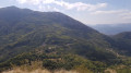
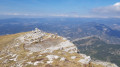
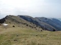
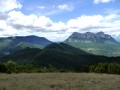
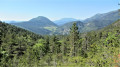
Magnificent aerial view from the Trois Becs. The trail sometimes winds through heath, sometimes through pastures and also through undergrowth.

Please note that the route passes through a quiet zone for wild animals. Certain sections are closed between 15 May and 15 July. Special signage and a diversion from the GR®9 have been put in place to guide users, seehere

Details

1488757
Creation:
Last update:
Last review:
  • Walking
    Activity: Walking
  • ↔
    Distance: 10.58 mi
  • ◔
    Average duration: 8h 30 
  • ▲
    Difficulty: Difficult

  • ⚐
    Back to start: Yes
  • ↗
    Ascent: + 4,216 ft
  • ↘
    Descent: - 4,252 ft

  • ▲
    Highest point: 5,161 ft
  • ▼
    Lowest point: 2,477 ft

Photos

Description of the walk

Park in the Col du Gourdon car park, located on the D156 below the Col de la Chaudière, on the Bourdeaux side.

(S/E) Follow the D156 uphill to Col de la Chaudière.

(1) Continue to the Siara car park.

(2) Climb up to the left to Pas de Siara via a rocky path, go around to the right and over Rocher de la Baume. Reach Pas de Siara.

(3) Turn right at the top, heading towards Les Trois Becs and then Le Veyou.

(4) Reach the other peak, Le Signal.

(5) Continue to Roche Courbe.

(6) Descend to Col des Auberts.

(7) Continue until you reach a large crossroads of trails.

(8) Climb a few metres to the right to Rocher de la Laveuse and back. On your return, take theGR®®9downhill to the right. At the track, continue left towards Pas de la Siara.

(9) Cross the Vèbre and, at a hairpin bend at a place called Virage du Pré de l’Âne, you will reach another crossroads with several directions.

(10) Continue along the almost horizontal track, which is still theGR®®9. You will reach the Bergerie de Bois-Vert.

(11) Continue along the wide forest path to Porte du Barry.

(12) Leave the track and take a path, an easy descent, heading south, to reach the houses of Fondoresse.

(13) Leave theGR®® here and turn left towards Floréal. At the first crossroads, turn right and follow a few bends to reach a forest road.

(14) Cross this track and begin a short climb towards the Col de Gourdon via the Roland stream. Ford the stream and shortly afterwards you will arrive at the Col du Gourdon car park (S/E).

Waypoints

  1. S/E : mi 0 - alt. 3,140 ft - Car park - Col du Gourdon (953m)
  2. 1 : mi 1.06 - alt. 3,428 ft - Col de la Chaudière (1048m)
  3. 2 : mi 1.32 - alt. 3,402 ft - Le Siara car park
  4. 3 : mi 1.98 - alt. 4,288 ft - No Siara
  5. 4 : mi 2.73 - alt. 5,141 ft - Veyou (le)
  6. 5 : mi 3.31 - alt. 5,046 ft - Signal (le)
  7. 6 : mi 3.95 - alt. 4,669 ft - Roche Courbe
  8. 7 : mi 4.42 - alt. 4,528 ft - Col des Auberts (1366m)
  9. 8 : mi 4.65 - alt. 4,501 ft - Rocher de la Laveuse
  10. 9 : mi 5.73 - alt. 4,009 ft - Vèbre (rivière) - Affluent du Roubion
  11. 10 : mi 6.19 - alt. 3,980 ft - Virage du Pré de l'Âne
  12. 11 : mi 6.89 - alt. 3,806 ft - Bergerie du Bois Vert
  13. 12 : mi 8.01 - alt. 3,445 ft - Porte du Barry
  14. 13 : mi 8.66 - alt. 2,822 ft - Fondoresse
  15. 14 : mi 9.44 - alt. 2,516 ft - Crossing the forest track
  16. S/E : mi 10.58 - alt. 3,133 ft - Col du Gourdon car park

Notes

No drinking water available.
Bring enough water as the hike is long!

Walking sticks are recommended.

Depending on the season, there may be sheep with their guard dogs. Follow the recommendations and avoid them by going around the flock.

Always be cautious and plan ahead when you're outdoors. Visorando and the author of this route cannot be held responsible for any accidents occurring on this route.

The GR® and PR® markings are the intellectual property of the Fédération Française de Randonnée Pédestre.

Reviews and comments

4.6 / 5
Based on 6 reviews

Reliability of the description
4.5 / 5
Ease of following the route
4.3 / 5
Route interest
4.8 / 5
regis777
regis777

Overall rating : 4.7 / 5

Date of your route : Mar 08, 2025
Reliability of the description : ★★★★★ Very good
Ease of following the route : ★★★★☆ Good
Route interest : ★★★★★ Very good
Very busy route : Yes

A very beautiful hike at a time when it is still quiet
Not too crowded and magnificent scenery

19km and 1100+ in the end in 4½ hours on two different watches

Machine-translated

Ma Mie
Ma Mie

Overall rating : 5 / 5

Date of your route : Jun 16, 2024
Reliability of the description : ★★★★★ Very good
Ease of following the route : ★★★★★ Very good
Route interest : ★★★★★ Very good
Very busy route : Yes

Superb hike. The peaks are hard to reach, but you won't be disappointed by the 360° panorama.
Unfortunately, there are many walkers, especially on the shorter part of the hike, which is the fate of all must-see hikes. It's a shame that it ends with an ascent, but you have to climb back up!

Machine-translated

oponcin
oponcin

Overall rating : 5 / 5

Date of your route : Jun 17, 2023
Reliability of the description : ★★★★★ Very good
Ease of following the route : ★★★★★ Very good
Route interest : ★★★★★ Very good
Very busy route : Yes

Les 3 Becs in pictures: https://youtu.be/-1YioN3SH7g
starting from the forest of Saoû
Lots of people at the summit, even in June

Machine-translated

Denis26
Denis26 ★

Due to private property on Couspeau Mountain, particularly the climb to Grand Delmas, the route has been modified and this section has been removed.
Kind regards.

Machine-translated

PfMC
PfMC

Overall rating : 5 / 5

Date of your route : Jan 22, 2022
Reliability of the description : ★★★★★ Very good
Ease of following the route : ★★★★★ Very good
Route interest : ★★★★★ Very good
Very busy route : No

Hike completed on 22/01

  • I chose to comment on this guidebook because I have already commented on the 3 Becs par la Grande Combe guidebook in the past

We chose to do the Becs via the Grande Combe, leaving the Grande Combe route at the Pas de Siarra, taking this hike guide in reverse, doing the Grand Delmas and returning to the original 3 Becs route via the combe, at the Porte de Barry.
It was very cold and the wind was icy on the Signal and the Veyou. In fact, the combe was covered with packed snow, as were the Becs.

The 360° panorama from the Grand Delmas is underrated; it was truly magnificent and a great reward after all that trudging. In fact, in my opinion, it is prettier than on the 3 Becs.
There were no major difficulties except for the length, the snow and the elevation gain. Be careful if you do the hike in the same direction as us, as the climb up Grand Delmas can be 500-550m of elevation gain in 2km. I must admit that the last climbs back to the Barry gate really tired me out, and the descent back to the Auberge des Dauphins seemed endless.

We started the hike at 5 a.m. with headlamps and returned to the Auberge des Dauphins at 3 p.m. with meal breaks. 33 km and 2,800 metres of elevation gain (3,000 on my watch, but that's an exaggeration...).

Thank you for the really great guide!

Machine-translated

Maryma
Maryma

Overall rating : 4.3 / 5

Date of your route : Jul 05, 2019
Reliability of the description : ★★★★☆ Good
Ease of following the route : ★★★★★ Very good
Route interest : ★★★★☆ Good

A very beautiful, challenging hike. Done in beautiful weather, I had plenty of time to admire the fabulous landscapes and flora, which is still very abundant, particularly martagon lilies. It had been a long time since I had hiked the Trois Becs. Almost all of the paths have been redone, and some are still under construction, particularly towards the Col de la Chaudière car park, but this does not prevent access. These zigzagging paths make the climb easier. The views are still breathtaking!
Well done to the workers, especially as I did it in over 25°C heat... and thank you to the General Council!
Once you reach Rocher de la Laveuse, you've completed the climb and can enjoy lunch with a unique view of Saillans!
The return trip from Fondoresse is very pleasant. The last 200 metres aren't too hard on the legs as the climb is gentle on ground without stones.
In short, this is a must-do hike for anyone who wants to tackle some elevation ;-)) It took me 7 hours (without running), covering 23 km with an elevation gain of 1,562 m. But of course, I hike regularly.
Thanks to Bernardino, without whom I would never have thought of or even dared to tackle all four peaks!

Machine-translated

Thierryb26
Thierryb26

Yes, I was responding specifically to regm973. Perhaps it is another hike that is involved...

Machine-translated

bernardino
bernardino ★

Hello
The author does not specify that this hike is in the Vercors Park; it is simply Regm973's comment that points this out. And since there are no details about the route, let's trust the author's GPS track.

Machine-translated

Thierryb26
Thierryb26

To my knowledge, neither the Grand Delmas nor the Trois Becs are in the Vercors Park....

Machine-translated

henri57
henri57 ★

Hello,

The Vercors Park has changed the trails and they are not up to date.

Did you follow the route using a GPS or a GPS application?

If so, can you send us the route?

Thank you

See you soon

Machine-translated

User 1248075

Overall rating : 3.3 / 5

Date of your route : Oct 04, 2018
Reliability of the description : ★★★☆☆ Average
Ease of following the route : ★★☆☆☆ Disappointing
Route interest : ★★★★★ Very good

The Vercors Park has changed the paths, which are not up to date.

Machine-translated

Other walks in the area

For more walks, use our search engine .

The GPS track and description are the property of this route's author. Please do not copy them without permission.