Couspeau Mountain via the Grand Delmas and its ridges

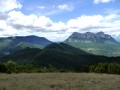
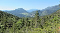
An idyllic, very quiet walk in magnificent surroundings with 360° panoramic views of all the mountain ranges in the region.
Hiking is prohibited by the landowner (private property) during the summer grazing season, from 20 May to 31 October.

Details

25475823
Creation:
Last update:
Last review:
  • Walking
    Activity: Walking
  • ↔
    Distance: 13.08 mi
  • ◔
    Duration according to the author: 8 hrs 
  • ▲
    Difficulty: Very difficult

  • ⚐
    Back to start: Yes
  • ↗
    Ascent: + 3,750 ft
  • ↘
    Descent: - 3,753 ft

  • ▲
    Highest point: 5,033 ft
  • ▼
    Lowest point: 2,753 ft

Description of the walk

Take the D156 to the Col du Gourdon and park there.

(S/E) From the car park, walk uphill for one kilometre along the tarmac road towards the Col de la Chaudière.

(1) Take the path on the right and climb steeply until you emerge from the forest to reach the ridge.

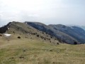
(2) Turn left, heading east, towards the summit of the Grand Delmas at an elevation of 1544.

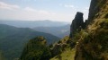
(3) At the summit, enjoy the view of the Trois Becs and continue along the ridge.

(4) Near the shepherd’s shelter at Pré du Bœuf, carry on straight ahead to the Col de Puzaou at an elevation of 1,439 metres.

(5) After a series of ascents and descents, you’ll reach a crossroads at an elevation of 1,427 metres (signpost and cairn).

(6) Carry on straight ahead to climb up to Serre Delègue.

(7) Turn back to the previous junction.

(6) At the signpost, veer slightly to the right onto the path – which is not very visible at first – and begin the descent, which is steep in places, to the Les Pradaux signpost.

(8) Turn left towards Rochefourchat until you reach the signpost.

(9) Turn left onto the track that climbs towards Col Jeannin.

(10) Continue along the track.

(11) At Serre de Minuit, continue along the track branching off to the left until you reach a small pass, then begin the descent to the Banchet signpost.

(12) Follow the track towards La Chaudière as far as the Bougeon marker.

(13) Continue descending to the green bridge.

(14) Just after the bridge, turn left onto the small path that climbs towards the Col de la Chaudière until you reach the Col de la Chaudière marker post at the end of the path.

(15) Turn left onto the D156 to reach the car park (S/E).

Waypoints

  1. S/E : mi 0 - alt. 3,140 ft - Car park - Col du Gourdon (953m)
  2. 1 : mi 0.65 - alt. 3,386 ft - Sign: ‘Grazing area – Couspeau Mountain’
  3. 2 : mi 1.59 - alt. 4,688 ft - Ridge emerging from the forest
  4. 3 : mi 1.87 - alt. 5,033 ft - Grand Dalmas (1544m)
  5. 4 : mi 2.8 - alt. 4,695 ft - Near the shepherd’s shelter
  6. 5 : mi 3.93 - alt. 4,715 ft - Col Puzaou (1439m)
  7. 6 : mi 4.76 - alt. 4,688 ft - Crossroads
  8. 7 : mi 5.19 - alt. 4,836 ft - Serre Delègue
  9. 8 : mi 6.48 - alt. 3,504 ft - Les Pradaux signpost
  10. 9 : mi 7.68 - alt. 2,785 ft - Rochefourchat
  11. 10 : mi 8.9 - alt. 3,350 ft - Col Jeannin
  12. 11 : mi 9.32 - alt. 3,425 ft - Serre de Minuit
  13. 12 : mi 10.45 - alt. 3,615 ft - Banchet
  14. 13 : mi 11.45 - alt. 3,222 ft - Bougeon
  15. 14 : mi 11.82 - alt. 3,150 ft - Bridge - Courance (rivière) à finaliser
  16. 15 : mi 12.16 - alt. 3,396 ft - D156 road - Col de la Chaudière (1048m)
  17. S/E : mi 13.08 - alt. 3,133 ft - Car park - Col du Gourdon (953m)

Notes

Hiking is prohibited between 20 May and 31 October.
Following wolf attacks, the livestock guard dogs on the mountain pasture have become more aggressive and react strongly to any new or unfamiliar stimuli (people, dogs, wildlife, etc.).

By undertaking this hike, you are exposing yourself to the risk of being bitten, even if you behave appropriately towards the dogs.
This is why you will see signs prohibiting access all year round; this is to ensure that the landowner is not held liable in the event of any problems.

(4) Shepherd’s hut on Couspeau Mountain and a few streams along the way.

Worth a visit

At (3), a view of the Trois Becs
At (7), a view of the Lance Miélandre and Angèle mountains.

Reviews and comments

5 / 5
Based on 2 reviews

Reliability of the description
5 / 5
Ease of following the route
5 / 5
Route interest
5 / 5
Randotrail
Randotrail

Overall rating : 5 / 5

Date of your route : Jan 04, 2024
Reliability of the description : ★★★★★ Very good
Ease of following the route : ★★★★★ Very good
Route interest : ★★★★★ Very good
Very busy route : No

A magnificent route – in my opinion, the Couspeau mountain ridge is well worth the effort, much more so than the Trois Becs hike, which I did in the summer. The second section, starting from the descent, is a little less interesting but still enjoyable. After Rochefourchat, there’s a wide, easy track that’s quite relaxing. (My Garmin with built-in altimeter recorded 1,223 m of elevation gain.)

Machine-translated

Denis26
Denis26 ★

Hello,
I have just added the restrictions in force between 20 May and 31 October for this walk during the summer grazing season. The landowner allows access at other times, but this is merely a concession.
Please do respect these restrictions.

Machine-translated

Montagne de Couspeau

Hello Denis_Nozieres, greggy26

Contrary to what is stated below, the status of the walk has not changed on this route.
Following a check today, it appears that ONE ‘no entry’ sign has indeed been removed by someone who may have thought that by taking it down, they were making the walk permitted again.
This is not the case, and the sign will be put back up as soon as possible
Kind regards

Machine-translated

Denis_Nozieres
Denis_Nozieres

Thanks, Grégory, I’ll be able to do that wonderful route again...

Machine-translated

greggy26
greggy26

Hello
There isn’t a single ‘no entry’ sign left along the route.
You just need to be mindful of any herds that may be on the mountain.
Have a nice day
Gregory

Machine-translated

Netra
Netra ★

Hello Denis,

Thank you for sharing your experience, even though it dates back two years.

What does the author say about it?

Machine-translated

Denis_Nozieres
Denis_Nozieres

Overall rating : 5 / 5

Date of your route : Sep 02, 2022
Reliability of the description : Not used / Not applicable
Ease of following the route : Not used / Not applicable
Route interest : ★★★★★ Very good
Very busy route : Yes

Hello, I haven’t walked this route recently, but two years ago there were lots of signs prohibiting walking there, as the land is private property and used for grazing; what’s the situation now?

Machine-translated

Other walks in the area

For more walks, use our search engine .

The GPS track and description are the property of this route's author. Please do not copy them without permission.