Les Pomerolle

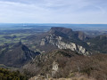
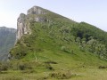
Discover the south-western ridge of the famous Saou Forest.

Details

25686
Creation:
Last update:
Last review:
  • Walking
    Activity: Walking
  • ↔
    Distance: 7.50 mi
  • ◔
    Average duration: 5h 25 
  • ▲
    Difficulty: Moderate

  • ⚐
    Back to start: Yes
  • ↗
    Ascent: + 2,244 ft
  • ↘
    Descent: - 2,238 ft

  • ▲
    Highest point: 3,471 ft
  • ▼
    Lowest point: 1,552 ft

Photos

Description of the walk

Park at the Dauphins car park in the Saou forest.

(S/E) Take the road that is closed to traffic and leads to the Trianon and the Auberge des Dauphins.

(1) Continue straight ahead, then turn right onto the track. Cross the Vèbre river on the concrete bridge (sign) and immediately turn left onto the widePR® (yellow) marked trail. Pass the horse riding centre and arrive at a meadow.

(2) Turn right and start a steep climb. At the fork, continue on the main path and ignore the path on the right. You will reach a fork (Les Coupes) with a forest track.

(3) Cross and continue climbing, veering slightly to the right. Join the carriage track.

(4) Cross and follow the forest track, turning left as you climb.
Reach the Berches crossroads.

(5) Take the forest path on the right (sign for Pomerolle), continue for about 150 m and find the start of a path on the left.

(6) Follow this path. After a steep climb, the path turns right and continues through the woods on almost flat ground. Reach the ridge at Pas de Jossaud.

(7) After enjoying the view, continue through the woods, pass Pas de Courbis (viewpoint) and you will reach the summit of Grand Pomerolle, clearly marked by a large cairn.

(8) Continue towards Petit Pomerolle, taking care as the descent is steep and can be slippery in wet weather. At the bottom of the descent, you will come to a fork at Pas de Berlhe.

(9) Begin a short climb to reach Petit Pomerolle, then descend to another fork (Petit Pomerolle signpost).

(10) Turn left for a short detour to the viewpoint at Pointe du Petit Pomerolle (be careful of the cliffs!).

(10) On your return, continue to the left. The trail winds downhill and turns into a forest path. Follow the contour line and you will rejoin the track.

(11) Follow this track, ignoring the paths that quickly branch off to the right and left. Stay on this track to return to the starting crossroads.

(1) Turn left and retrace your steps to return to the car park (S/E).

Waypoints

  1. S/E : mi 0 - alt. 1,552 ft - Dauphins car park
  2. 1 : mi 0.13 - alt. 1,572 ft - Auberge des Dauphins. Cross the - Vèbre (rivière) - Affluent du Roubion
  3. 2 : mi 0.52 - alt. 1,624 ft - Turn right into the forest.
  4. 3 : mi 1.08 - alt. 2,100 ft - Les Coupes, opposite, turning right
  5. 4 : mi 1.36 - alt. 2,352 ft - Les Fourneaux, track suitable for vehicles
  6. 5 : mi 1.84 - alt. 2,726 ft - Les Berches, fork in the road, turn right.
  7. 6 : mi 1.93 - alt. 2,710 ft - Path on the right
  8. 7 : mi 2.51 - alt. 3,182 ft - No Jossaud
  9. 8 : mi 3.86 - alt. 3,451 ft - Le Grand Pomerolle
  10. 9 : mi 4.24 - alt. 2,894 ft - No Berlhe
  11. 10 : mi 4.53 - alt. 2,694 ft - Small pass
  12. 11 : mi 6.21 - alt. 1,893 ft - Forest track
  13. S/E : mi 7.5 - alt. 1,552 ft

Notes

There is no water on the route. You will need plenty as the walk is quite long and it gets very hot in summer.

Worth a visit

Visit (from the outside only) the Trianon, the work of Maurice Burrus, an Alsatian industrialist who specialised in tobacco.
Saou, a typical village at the entrance to the forest.

Always be cautious and plan ahead when you're outdoors. Visorando and the author of this route cannot be held responsible for any accidents occurring on this route.

The GR® and PR® markings are the intellectual property of the Fédération Française de Randonnée Pédestre.

Reviews and comments

4.8 / 5
Based on 70 reviews

Reliability of the description
4.8 / 5
Ease of following the route
4.8 / 5
Route interest
4.8 / 5
oldevant
oldevant

Overall rating : 5 / 5

Date of your route : May 26, 2026
Reliability of the description : ★★★★★ Very good
Ease of following the route : ★★★★★ Very good
Route interest : ★★★★★ Very good
Very busy route : No

We did it the other way round to avoid the steep slope and the intense heat. It was a very good decision to tackle the climb in the morning and save the shadier section for the afternoon.
We saw vultures on the cliffs.
A lovely walk that I’d highly recommend. The route description is very clear.

Machine-translated

User 29006579

Overall rating : 4.7 / 5

Date of your route : Apr 20, 2026
Reliability of the description : ★★★★★ Very good
Ease of following the route : ★★★★★ Very good
Route interest : ★★★★☆ Good
Very busy route : No

The first part is a pleasant climb through the woods.
Arrival at the top with a magnificent view!
The descent back down is very narrow and very uneven at the start! Loads of stones! Then it becomes monotonous.
But a hike well worth doing for the superb view at Les Pommeroles!!
Completed in 3 hours 15 minutes without a break (except to admire the view at the summit) and at a brisk pace!

Machine-translated

User 6638501

Overall rating : 5 / 5

Date of your route : Mar 19, 2026
Reliability of the description : ★★★★★ Very good
Ease of following the route : ★★★★★ Very good
Route interest : ★★★★★ Very good
Very busy route : Yes

A lovely walk, with ascents and descents through the woods.
A magnificent view.

Machine-translated

monpotenico
monpotenico

Overall rating : 5 / 5

Date of your route : Feb 22, 2026
Reliability of the description : ★★★★★ Very good
Ease of following the route : ★★★★★ Very good
Route interest : ★★★★★ Very good
Very busy route : No

A very beautiful hike, combining woodland and ridges. Exceptional views from the heights, perfect for enjoying a sandwich. The only major difficulty is the descent between the two Pomerolle peaks, which is very steep (and very dangerous in wet weather).

Machine-translated

Liru
Liru

Overall rating : 4.7 / 5

Date of your route : Dec 28, 2025
Reliability of the description : ★★★★★ Very good
Ease of following the route : ★★★★★ Very good
Route interest : ★★★★☆ Good
Very busy route : No

We did this hike at the end of December in freezing cold weather and thick fog, except at the summits where we had the privilege of admiring a beautiful sea of clouds. The sea of clouds prevented us from seeing the other surrounding peaks and the different mountain landscapes. That will have to wait for another time.
We did the route in reverse, which is actually preferable because the section between Grand Pomerolle and Petit Pomerolle is quite steep and can be very slippery (we had a little snow and ice).
The walk through the forest on the way there and back can certainly be very pleasant on hot, sunny days, but in winter and in the fog, we found it rather long and boring.

Machine-translated

User 13527072

Overall rating : 4.3 / 5

Date of your route : Dec 29, 2025
Reliability of the description : ★★★★☆ Good
Ease of following the route : ★★★★☆ Good
Route interest : ★★★★★ Very good
Very busy route : No

Between Grand Pomerolle and Petit Pomerolle, there is a very steep descent, which is a bit challenging... Not recommended if the ground is wet.

Machine-translated

User 17997309

Overall rating : 4.7 / 5

Date of your route : Sep 11, 2025
Reliability of the description : ★★★★★ Very good
Ease of following the route : ★★★★★ Very good
Route interest : ★★★★☆ Good
Very busy route : No

Very pleasant hike, beautiful views upon arrival at Grand Pomer after the forest.
The route is well marked, so there's no risk of getting lost. The climb is steady and a little tough for those who aren't used to it, but no problem for those who hike regularly.

Machine-translated

phb51
phb51

Overall rating : 5 / 5

Date of your route : Aug 25, 2025
Reliability of the description : ★★★★★ Very good
Ease of following the route : ★★★★★ Very good
Route interest : ★★★★★ Very good
Very busy route : No

Thank you to the creator of this tour. We enjoyed the views of the mountains and the plains.

Machine-translated

jnnicolas
jnnicolas
• Edited:

Overall rating : 5 / 5

Date of your route : Aug 05, 2025
Reliability of the description : ★★★★★ Very good
Ease of following the route : ★★★★★ Very good
Route interest : ★★★★★ Very good
Very busy route : No

A very beautiful route, done on a fairly warm day in early August, starting in the morning, with a picnic near Grand Pommerole and numerous breaks. We encountered a few hikers, but the trail was not very crowded.
We took our time and went in the opposite direction to the signs (starting at Petit Pomerolle), which was a good decision. The climb between Petit and Grand Pomerolle has some really steep sections and is certainly long and difficult on the way down.
The route is very shady, except towards the ridges, but there the view is fantastic in all directions.
In the foreground is the Saou forest (which is worth turning around to look at during the climb), and the Vercors in the background, the three Becs at the far end, then Roche Colombe, with the Rhône valley and the Ardèche mountains in the background. We were lucky enough to see some vultures flying overhead. The view from the Grand Pomerolle towards the south is also magnificent, with Mont Ventoux on the horizon.
The return trip, which is a bit long, is completely shaded.

Machine-translated

afaurie
afaurie

Overall rating : 5 / 5

Date of your route : Jul 21, 2025
Reliability of the description : ★★★★★ Very good
Ease of following the route : ★★★★★ Very good
Route interest : ★★★★★ Very good
Very busy route : No

i made the mistake of taking a shortcut on the way up to Petite Pomerolle. The exit was vertical, and I would have been faster taking the usual route
in strong winds, the circuit is fairly sheltered, even on the ridge

Machine-translated

NOAMCHACHA
NOAMCHACHA

Overall rating : 4.3 / 5

Date of your route : May 01, 2025
Reliability of the description : ★★★★☆ Good
Ease of following the route : ★★★★☆ Good
Route interest : ★★★★★ Very good
Very busy route : No

Lovely walk in the SAOU forest, followed by fine views at GRAND POMEROLLE;

Machine-translated

Dorando
Dorando

Overall rating : 4.7 / 5

Date of your route : Jul 15, 2024
Reliability of the description : ★★★★★ Very good
Ease of following the route : ★★★★☆ Good
Route interest : ★★★★★ Very good
Very busy route : No

A beautiful hike. At the top we admired the lavender fields in bloom, scattered among the other green fields.
We hiked in the opposite direction because the terrain was wet and slippery (it had rained the previous few days). It was a good idea!
Thanks to the author of this walk.

Machine-translated

ptitnain
ptitnain

Overall rating : 5 / 5

Date of your route : Apr 16, 2024
Reliability of the description : ★★★★★ Very good
Ease of following the route : ★★★★★ Very good
Route interest : ★★★★★ Very good
Very busy route : No

Very steep descent in the direction of the route. Personally, I wouldn't have preferred to do it the other way round.
Apart from this minor technical difficulty, the view is superb.

Machine-translated

maran04
maran04

Overall rating : 4.3 / 5

Date of your route : Mar 18, 2024
Reliability of the description : ★★★★★ Very good
Ease of following the route : ★★★★☆ Good
Route interest : ★★★★☆ Good
Very busy route : Yes

The descent is very steep if you do it in the direction indicated on the route.
Otherwise, there's a fine view from the majestic Saou forest.

Machine-translated

ludof
ludof

Overall rating : 4.7 / 5

Date of your route : Jul 13, 2023
Reliability of the description : ★★★★★ Very good
Ease of following the route : ★★★★★ Very good
Route interest : ★★★★☆ Good
Very busy route : No

I did this walk in three hours (I walked at a good pace with about 15 minutes of breaks in total), in the opposite direction to the description, in order to avoid the steep descent between grand and petit pomerolle.

The only drawback is that the best view of the route (view of the Saou syncline from the path between Pas de Berthe and Grand Pomerolle) is at your back, so don't forget to turn around.

The vast majority of the route is undergrown, which is great in hot weather (the only exposed parts are between points 7 and 9).

Many thanks to the author for this beautiful walk!

Machine-translated

Other walks in the area

For more walks, use our search engine .

The GPS track and description are the property of this route's author. Please do not copy them without permission.