


 Country:

 City:
City:


Set off from the Silo car park (the last car park before the end of the D136).
(S/E) From the car park, go round the barrier and take the road that goes straight up towards the start of the walks.
(1). Walk past the Auberge des Dauphins and the Maison des Éco-gardes to reach the sign for the Bureau des Éco-gardes. From there, follow the signs for Chemin de la Grande Combe and Virage du Pré de l’Âne, which climbs straight up through an avenue of tall fir trees. 50 metres further on, at the junction with the Chemin de la Grande Combe, carry straight on towards the Virage du Pré de l’Âne. The path will wind its way into the valley until it reaches the sign for Les Douglas; follow the signs for the Virage du Pré de l’Âne. The path winds deeper into the valley, sometimes gently sloping, sometimes steeper, alternating between stony and earthy sections. Traces of human activity are visible at times (low walls, ruins of huts, fords, etc.), remnants of a past of intensive forestry.
After a good 3 kilometres in the cool of the valley, the path joins a forest track at Virage du Pré de l’Âne.
(2) Turn left onto thisGR®® (red and white) marked track, heading towards the Fontaine des Oiseaux and La Laveuse.
(3) When you reach the junction at La Fontaine des Oiseaux, take the track that climbs to the right towards La Laveuse. The climb is steep in places, then opens out onto a grassy stretch. 100 metres further up, a cairn indicates that theGR®® route leaves the track and heads left onto a path; follow this. Then, a further 150 metres on, another cairn marks another path; this time, continue straight on along theGR®® to reach the ‘Pas de la Laveuse’ sign.
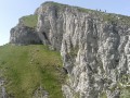
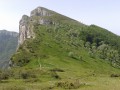
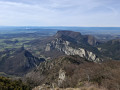
(4) As you approach the cliffs on the left, you can see the Rocher de la Laveuse, a magnificent opening in the rock. From there, stunning panoramic views accompany your walk along the ridges of the Trois Becs. Return to the ‘Pas de la Laveuse’ signpost.
(4) Turn left towards Roche Courbe – Le Veyou and Pas de Siara. There are no longer any painted markings, but cairns here and there indicate the way.
Access to Roche Courbe is via a path laid out as a stone staircase.
(5) At a junction, turn left towards the summit of Roche Courbe, ignoring the path on the right which leads directly to Picourère. You’ll reach the summit, marked by a large cairn.
(6) Follow the path down to the right towards the Pas de Picourère, go through a small wooden gate to rejoin the path you left earlier. Turn left to go through another small gate, then at a Fork in the road, take the path that climbs steeply to the left. You’ll reach the summit of Le Signal.
(7) At the large cairn, turn right onto the path which runs along a ledge for a while before descending. Once at the bottom, the path climbs again, skirting the cliff, to reach the summit of the Veyou.
(8) From the summit, head back down a few dozen metres along the same path, then turn left onto a path that resembles a trench. Further down, a path branches off to the left, but stones and yellow markings indicate you should not take it and should continue the descent to the right. The path winds its way down in hairpin bends towards the Pas de Siara.
(9) At the Pas de Siara signpost, continue the descent for 100 metres towards the Virage du Pré de l’Âne, then turn right, continuing in the same direction. Further down, ignore the left-hand turn towards the Pas de Floréal and continue straight down. When you reach a Fork in the road, turn left to reach the signpost for the Virage du Pré de l’Âne.
(2) From there, head left onto theGR®®-marked track towards the Bergerie de Bois Vert. Pass it and follow the signs for Porte du Barry and Auberge des Dauphins, staying on the track.
(10) When you reach the Porte du Barry junction, another viewpoint opens up. Take the track leading down to the right towards Virage des Princes and Auberge des Dauphins. Walk past the refuge and head for the Virage des Princes junction.
(11) Leave the track and continue straight on along theGR®® towards Les Berches and Auberge des Dauphins.
(12) At the sign for Les Berches, carry on straight on towards Les Fourneaux and the Auberge des Dauphins.
(13) At Les Fourneaux, the path rejoins the track you left behind further up. Continue the descent along the track on the right, marked in yellow, towards Piste des Coupes and Auberge des Dauphins (ignore the track opposite and to the left).
(14) At the Piste des Coupes junction, do not take the first track branching off to the left, but the second one which descends towards the Halte Équestre and Auberge des Dauphins. The track leads out onto a clearing.
(15) Turn left to reach the Halte Équestre junction, then continue along this path towards the concrete bridge and the Auberge des Dauphins, skirting a clearing.
(16) When you reach the bridge, cross it on the right-hand side and head towards the Auberge des Dauphins.
(1) Take the road leading down to the left to reach the car park (S/E).




 Visorando Member
 Moderate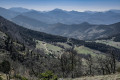
 Local authority
 Easy
Easy 
 Very difficult
