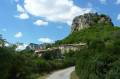
Bois Sec and banks of the Roubion in Francillon

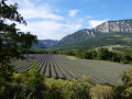
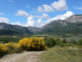
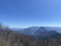
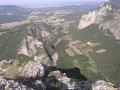
This is an easy walk to stretch your legs while enjoying a beautiful variety of landscapes: panoramic views of the majestic syncline of the Saou Forest, dry pine forests, the cool banks of the Roubion inviting you to take a dip, and even lavender fields to finish off before crossing the pretty village of Francillon.

Details

1447525
Creation:
Last update:
Last review:
  • Walking
    Activity: Walking
  • ↔
    Distance: 3.07 mi
  • ◔
    Average duration: 1h 45 
  • ▲
    Difficulty: Easy

  • ⚐
    Back to start: Yes
  • ↗
    Ascent: + 384 ft
  • ↘
    Descent: - 400 ft

  • ▲
    Highest point: 1,421 ft
  • ▼
    Lowest point: 1,099 ft

Photos

Description of the walk

Depart from the car park located at the southern exit of the village (above the sign indicating the end of the built-up area).

(S/E) Head towards the centre of the village, pass the war memorial and take the road climbing up to the right.

(1) At the top of the village, turn immediately right onto a gravel track that climbs uphill.
Follow this track as it climbs up to the plateau before running alongside the pine forest. Keep right at all junctions. After a slight descent alongside a copse on the right, you will come to a junction of four tracks with a small iron calvary.

(2) Take the track that descends to the left and cross a stream (dry in summer).

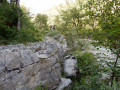
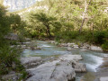
(3) At the three-way junction, go up along the woods on the right until you reach another fork. Take the track that descends to the left and becomes a path in the woods. Reach the banks of the Roubion.
For those tempted by a dip, there are numerous large slabs to sit on throughout this section of the route
Follow the yellow markings, which sometimes climb up the slabs, then leave the riverbank and head back up into the woods to join a track that leads to the village, passing a large lavender field on your right.

(4) At the crossroads, turn right to join the track below and avoid the private property at the end of the path. Follow the track on the left, which becomes a road when you reach the village.

(5) Cross the pretty village to return to the car park where you started (S/E).

Waypoints

  1. S/E : mi 0 - alt. 1,181 ft - Car park near the war memorial
  2. 1 : mi 0.14 - alt. 1,211 ft - Track
  3. 2 : mi 0.96 - alt. 1,368 ft - Calvary
  4. 3 : mi 1.18 - alt. 1,421 ft - Undergrowth. Towards - Roubion (rivière)
  5. 4 : mi 2.48 - alt. 1,135 ft - Path after large field
  6. 5 : mi 2.87 - alt. 1,165 ft - Village entrance
  7. S/E : mi 3.07 - alt. 1,181 ft - Car park near the war memorial

Notes

This is an easy hike, except for a few steep steps along the river. Be careful, as the limestone slabs can be slippery in wet weather.

Worth a visit

Bring your swimsuit and towel, or even a picnic, for a break by the Roubion.

Reviews and comments

4.4 / 5
Based on 35 reviews

Reliability of the description
4.2 / 5
Ease of following the route
4.4 / 5
Route interest
4.5 / 5
mancusoagnes
mancusoagnes

Not a very helpful comment!!

Machine-translated

User 19662495

Overall rating : 3.3 / 5

Date of your route : May 18, 2026
Reliability of the description : ★★★☆☆ Average
Ease of following the route : ★★★☆☆ Average
Route interest : ★★★★☆ Good
Very busy route : Yes

BLABLA

Machine-translated

mancusoagnes
mancusoagnes

Overall rating : 5 / 5

Date of your route : Apr 06, 2026
Reliability of the description : ★★★★★ Very good
Ease of following the route : ★★★★★ Very good
Route interest : ★★★★★ Very good
Very busy route : No

A lovely walk in glorious sunshine. Beautiful views of the peaks, a pleasant path with no major difficulties. A short climb in full sun at the start, then the route descends through the woods in the shade. Very pleasant along the stream with tiny little climbs over the rocks. That’s when we came across the most people, no doubt due to the heat that day, as it was very refreshing following the Roubion.

Machine-translated

Ouh là là
Ouh là là

Overall rating : 4.7 / 5

Date of your route : Mar 21, 2026
Reliability of the description : ★★★★★ Very good
Ease of following the route : ★★★★☆ Good
Route interest : ★★★★★ Very good
Very busy route : Yes

A lovely walk, though still muddy in places following the very wet winter months we’ve had this year. There’s just one spot that’s tricky to spot: the sign saying ‘always follow the path on the right’ is accurate, but in this case, it’s more of a field’s edge than a proper path, which can be confusing.
Otherwise, it’s all very pleasant: the thousands of spring flowers (primroses, violets, pasque flowers) in the undergrowth, the cascading broom, and the famous “slabs”, which can be quite impressive when they stand almost vertically!

Machine-translated

glaciers
glaciers

Overall rating : 5 / 5

Date of your route : Oct 16, 2025
Reliability of the description : ★★★★★ Very good
Ease of following the route : ★★★★★ Very good
Route interest : ★★★★★ Very good
Very busy route : No

A pleasant hike enjoyed by nine seniors.
The autumn colours are at their best at this time of year.
Be sure to follow the yellow trail along the Roubion, which helps with the progression, which is not always obvious.
Be careful not to stray from it and turn left when you leave the riverbank to go uphill.
The few "steps" are nothing insurmountable...
Note that there are a few picnic tables in the car park at the bottom of the village, with a pleasant view.
Thanks to the author for sharing.

Machine-translated

Calirette
Calirette

Overall rating : 4 / 5

Date of your route : Sep 02, 2025
Reliability of the description : ★★★★☆ Good
Ease of following the route : ★★★★☆ Good
Route interest : ★★★★☆ Good
Very busy route : No

Very good along the Roubion with its large stone slabs!

Machine-translated

Francoisroelens
Francoisroelens

Overall rating : 5 / 5

Date of your route : Mar 30, 2025
Reliability of the description : ★★★★★ Very good
Ease of following the route : ★★★★★ Very good
Route interest : ★★★★★ Very good
Very busy route : No

A very pretty little route that takes us along the banks of the Roubion.
A few steps are a little tricky for older walkers, but nothing insurmountable.
The surroundings of the Roubion are really beautiful, and you'll want to take a dip...

Machine-translated

DenisV26740
DenisV26740

Overall rating : 4.7 / 5

Date of your route : Feb 03, 2025
Reliability of the description : ★★★★★ Very good
Ease of following the route : ★★★★★ Very good
Route interest : ★★★★☆ Good
Very busy route : No

Hike done in winter, the path is well marked, but after heavy rain, be careful in some places as the path is very muddy. The view is pleasant, ideal for families.

Machine-translated

Balaitou
Balaitou

Overall rating : 4.7 / 5

Date of your route : Dec 21, 2024
Reliability of the description : ★★★★★ Very good
Ease of following the route : ★★★★★ Very good
Route interest : ★★★★☆ Good
Very busy route : No

A pleasant hike from the start, with views of the Saou and Couspeau mountains, which were snow-capped on the day we visited. The wide path allows for easy conversation until you reach the intersection with the Calvary. A big blue sky makes the route through the woods along the Roubion river bucolic, with clear markings (yellow lines).
NB: For information, a third place has just opened behind the town hall. It was closed when we passed by.

Machine-translated

philma
philma

Overall rating : 4 / 5

Date of your route : Nov 04, 2024
Reliability of the description : ★★★★☆ Good
Ease of following the route : ★★★★☆ Good
Route interest : ★★★★☆ Good
Very busy route : No

We took this route on 3 November 2024.
For parking in a camper van, it is best to use the north car park, as the south car park is reserved for cars and blocked off by a barrier.
We followed the route using the Visorando app without any problems.
The left bank of the Roubion is more uncertain but there are yellow markings.
Be careful of wet rocks, which are sometimes hidden by leaves.
In summary, a pleasant hike.

Machine-translated

François59
François59

Overall rating : 4 / 5

Date of your route : Aug 19, 2024
Reliability of the description : ★★★★☆ Good
Ease of following the route : ★★★★☆ Good
Route interest : ★★★★☆ Good
Very busy route : No

Beautiful hike with views of the surrounding mountains and a pleasant walk along the Roubion river

Machine-translated

Kika21
Kika21

Overall rating : 4.7 / 5

Date of your route : Jul 25, 2024
Reliability of the description : ★★★★★ Very good
Ease of following the route : ★★★★☆ Good
Route interest : ★★★★★ Very good
Very busy route : No

Excellent hike, better than the one I did... a family hike that takes you through various landscapes (mountains, woods, rivers...).
There are only two places where the route doesn't correspond exactly to the path, but it's impossible to get lost as there are no other paths.
I did it with a 4-year-old girl who walked the whole way, but in that case, double the time if you also want to swim in the Roubion.
Highly recommended.

Machine-translated

AUDIN
AUDIN

Overall rating : 5 / 5

Date of your route : Jul 28, 2024
Reliability of the description : ★★★★★ Very good
Ease of following the route : ★★★★★ Very good
Route interest : ★★★★★ Very good
Very busy route : No

A very pleasant route, partly shaded in summer when the weather is dry. Otherwise, in wet weather, you can expect mud in quite a few places. It is therefore best to visit in summer when the weather is dry.

Machine-translated

HervM
HervM

Overall rating : 4.7 / 5

Date of your route : Jul 22, 2024
Reliability of the description : ★★★★☆ Good
Ease of following the route : ★★★★★ Very good
Route interest : ★★★★★ Very good
Very busy route : No

A very pleasant, easy walk. The direct descent to Roubion has been replaced by a path that zigzags along the old path, and the return route has also been slightly modified, but this does not change the description much. At Roubion, a road nearby causes a little noise, but this does not detract from the pleasure of swimming in summer, which is much more enjoyable after the hike than arriving directly by car.

Machine-translated

Freddemb
Freddemb

Overall rating : 4.3 / 5

Date of your route : May 20, 2024
Reliability of the description : ★★★★☆ Good
Ease of following the route : ★★★★☆ Good
Route interest : ★★★★★ Very good
Very busy route : No

A beautiful walk that is accessible for families. Make sure you wear suitable footwear in spring after heavy rain, as many sections are very muddy. Don't hesitate to walk a little further to find flat rocks where you can picnic by the Roubion.

Machine-translated

Other walks in the area

For more walks, use our search engine .

The GPS track and description are the property of this route's author. Please do not copy them without permission.