Tour de Chabrier from Saillans to Pas de la Bernarde

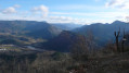
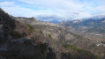
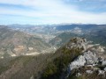
An extension of the classic Tour de Chabrier hike, this figure-of-eight hike (with the Col des Vallons at its centre) takes you to the Pas de la Bernarde (magnificent views of the Vercors, Montagne de Glandasse and Drôme Valley on the Vercheny side) and into the Fond de Chabrier. In total, the Col des Vallons will have been explored from all four cardinal points!

Details

2994265
Creation:
Last update:
Last review:
  • Walking
    Activity: Walking
  • ↔
    Distance: 8.64 mi
  • ◔
    Average duration: 6h 15 
  • ▲
    Difficulty: Moderate

  • ⚐
    Back to start: Yes
  • ↗
    Ascent: + 2,612 ft
  • ↘
    Descent: - 2,612 ft

  • ▲
    Highest point: 2,625 ft
  • ▼
    Lowest point: 883 ft

Photos

Description of the walk

The hike starts at the Saillans Tourist Office.

Yellow markings

(S/E) At the "Tourist Office" signpost, follow the signs for Chapelle Saint-Christophe and, about 50 metres further on, at the signpost for the pedestrian and mountain biking routes, follow the signs for "Tour de Chabrier" (Chemin de Trélaville). Just after the cemetery, there is another signpost; turn right onto the path towards "Tour de Chabrier". More than 2.5 km after the start, ignore a path on the right (not marked on the map) and continue straight ahead. Continue for another 500 m and you will find a path on the left marked in orange (not marked on the map).

(1) Ignore this path and continue straight ahead. Then ignore a path on the left and continue until you reach a wide track suitable for vehicles.

(2) Turn right and reach a fork above Riou des Vallons. Continue to the right and climb up to Col des Vallons.

Unmarked section

(3) Turn left, pass in front of the house (respect the premises), and continue along the path. About a hundred metres further on, you will come to a path on the right. Ignore it, as this will be the path for the return journey.

(4) Continue straight ahead on the pleasant path that gradually climbs up the shoulder.

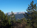
(5) At the fork with a cairn, follow the path on the right that turns south. Enjoy the beautiful views of Chabrier, the Trois-Becs massif and then, after a long passage along the hillside, you will arrive at a crossroads on the shoulder where you can enjoy views of the Montagne de Glandasse and the Vercors.

(6) Do not take the path on the left, but the one opposite, which swings over to the eastern flank. This wide path towards Pas de la Bernarde offers magnificent views. Continue for about 200 m.

Follow the white signposts marked "Saillans" in red letters.

(7) Turn right onto the path towards "Saillans" (red letters on a white sign). After a beautiful stretch on the south-facing slope above Baume Rousse, you will come to a fork just before the shoulder.

(8) Turn right (signposted Saillans). The path passes the shoulder and continues westwards along the hillside.

(9) At the fork, turn left onto a new shoulder. This time, the path descends and, after a few hairpin bends, reaches a wide track.

(10) Then turn right. A very beautiful descent on the track through the pine trees (several hairpin bends), then the track turns north (passing a stone shelter after about 300 m), then northeast to pass through a valley before returning west and reaching the Prairie de Liotard (the "Saillans" signs are sometimes missing, so stay on the main track and do not take the tracks to the right or left). When you reach the river at the end of the descent, cross the bridge (house visible on the right) and look for a small cairn on the right about 20 metres from the bridge, near a small recess.

Unmarked section

(11) Leave the track perpendicularly onto a barely visible path. Climb about ten metres to reach a small rocky outcrop, then turn sharply to the right (the path is still discreet) and stay roughly parallel to the river while climbing slightly. After about 200 metres, at the house visible below, the path joins a circular good trail (not marked on the map). Continue straight ahead (do not descend to the right).

(12) This good path climbs up the valley and, after an elevation gain of about 140 metres, joins the path taken on the way up.

Yellow markings

(4) Pass in front of the house again and reach the Col des Vallons.

(3) Take the track on the left and pass the chain (No Entry road sign). After a gradual 700 m climb, once the track widens and before you reach the houses in Chabrier, look for a path on the right (marked with a post and mountain bike signs).

(13) Follow this path. After a less pleasant stretch through rubble, the path turns south, passes above Chabrier (superb view of the Trois-Becs massif), then descends in beautiful circular loops to Saillans (views of the town and the Drôme Valley). The mountain bike trail crosses the path several times: be vigilant and cautious.
When you reach the cemetery, turn left to find the Tourist Office (S/E).

Waypoints

  1. S/E : mi 0 - alt. 883 ft - Tourist Office
  2. 1 : mi 1.34 - alt. 1,818 ft - Go straight ahead (ignore the path on the left).
  3. 2 : mi 2.05 - alt. 1,824 ft - Fork in the road, turn right.
  4. 3 : mi 2.76 - alt. 2,247 ft - Turn left towards the house. - Col des Vallons (688m)
  5. 4 : mi 2.84 - alt. 2,241 ft - Arrival on the path on the right, straight ahead.
  6. 5 : mi 3.23 - alt. 2,575 ft - Cairn, on the right
  7. 6 : mi 3.93 - alt. 2,539 ft - Fork in the road, opposite
  8. 7 : mi 4.06 - alt. 2,444 ft - On the right, sign indicating Saillans.
  9. 8 : mi 4.3 - alt. 2,395 ft - On the right, towards Saillans.
  10. 9 : mi 4.42 - alt. 2,359 ft - On the left, towards Saillans.
  11. 10 : mi 4.55 - alt. 2,146 ft - Track, right towards Saillans
  12. 11 : mi 5.19 - alt. 1,716 ft - Path on the right (cairn)
  13. 12 : mi 5.28 - alt. 1,795 ft - Junction with a good path on the left.
  14. 13 : mi 6.07 - alt. 2,388 ft - Path on the right
  15. S/E : mi 8.64 - alt. 883 ft - Tourist Office

Notes

All amenities in Saillans.
No water sources along the way.

Worth a visit

Panoramic views of the Vercors, Montagne de Glandasse, Serre-Chauvière, La Servelle, Montagne de Couspeau, Massif de Saoû and Trois-Becs, and the Drôme Valley on the Vercheny and Saillans/Crest sides.

The town of Saillans.

Reviews and comments

4.7 / 5
Based on 10 reviews

Reliability of the description
4.8 / 5
Ease of following the route
4.7 / 5
Route interest
4.7 / 5
TOULAUD'RANDO
TOULAUD'RANDO

Not yet done; scheduled for 17 April.

Machine-translated

CHAREYRON PHILIPPE
CHAREYRON PHILIPPE

Overall rating : 4.3 / 5

Date of your route : Mar 04, 2024
Reliability of the description : ★★★★☆ Good
Ease of following the route : ★★★★☆ Good
Route interest : ★★★★★ Very good
Very busy route : No

Chabrier's house is undergoing renovation and the new owners have closed off the path around the house. A gate blocks the trail. We go around it and continue our walk. A very nice outing.

Machine-translated

oponcin
oponcin

Overall rating : 4.7 / 5

Date of your route : Sep 24, 2023
Reliability of the description : ★★★★★ Very good
Ease of following the route : ★★★★★ Very good
Route interest : ★★★★☆ Good
Very busy route : No

https://youtu.be/NpQsSrEOteg?si=z7DNZub2...

Machine-translated

Pbubu
Pbubu

Overall rating : 5 / 5

Date of your route : Jul 11, 2022
Reliability of the description : ★★★★★ Very good
Ease of following the route : Not used / Not applicable
Route interest : ★★★★★ Very good
Very busy route : No

A very beautiful hike that took 5 hours of actual walking (6 hours including lunch).
The hike does not present any major difficulties, unlike some other hikes that are much rockier, especially on the descents.
This one is excellent in every way. Thank you to the author.

Machine-translated

nicovercors
nicovercors

Overall rating : 5 / 5

Date of your route : Mar 21, 2022
Reliability of the description : ★★★★★ Very good
Ease of following the route : ★★★★★ Very good
Route interest : ★★★★★ Very good
Very busy route : No

Thank you for this beautiful hike, which is one of my favourites.

Machine-translated

Gavroche07
Gavroche07

Overall rating : 4.7 / 5

Date of your route : Apr 05, 2021
Reliability of the description : ★★★★★ Very good
Ease of following the route : ★★★★★ Very good
Route interest : ★★★★☆ Good
Very busy route : No

Lovely outing and beautiful views

Machine-translated

alain v
alain v

Machine-translated

alain v
alain v

Thank you, but not yet completed.

Machine-translated

armandmoraillon
armandmoraillon

Overall rating : 4.3 / 5

Date of your route : Aug 13, 2020
Reliability of the description : ★★★★☆ Good
Ease of following the route : ★★★★☆ Good
Route interest : ★★★★★ Very good
Very busy route : No

8-shaped route, with the hunters' lodge at the centre of the 8. Beautiful views from the start and throughout the route.Small errors are possible at point 5, and at point 11, it is better to follow the wide water collection path for 50 metres and then join the trail on the left to avoid the start of the path, which is barely visible and overgrown with thorns, and probably always avoided by hikers. The climb is steep up to the hunters' lodge.
On the way back, the winding descent leads to a fork. The right branch leads to the starting point as indicated, while the left branch joins the old "Saillans-Die" road and the tunnel, following the Echarenne stream. The return journey then follows the tunnel with superb views of the Drôme river, bathers, boats and other holidaymakers. I recommend this more enjoyable route to reach the car park.

Machine-translated

irenesaussac@gmail.com
• Edited:

Overall rating : 5 / 5

Date of your route : Jul 03, 2020
Reliability of the description : ★★★★★ Very good
Ease of following the route : ★★★★★ Very good
Route interest : ★★★★★ Very good
Very busy route : No

beautiful hike with magnificent views all along the way

Machine-translated

Marcheur du Val
Marcheur du Val

Overall rating : 4.3 / 5

Date of your route : Jun 17, 2020
Reliability of the description : ★★★★★ Very good
Ease of following the route : ★★★★☆ Good
Route interest : ★★★★☆ Good
Very busy route : No

This route, taken on a beautiful early summer's day, was very pleasant. Neither difficult nor long, with beautiful views of the Drôme and Roanne. Probably not recommended on a hot summer's day.

Machine-translated

yacedlehcim
yacedlehcim

Overall rating : 5 / 5

Date of your route : Mar 12, 2020
Reliability of the description : ★★★★★ Very good
Ease of following the route : ★★★★★ Very good
Route interest : ★★★★★ Very good

A beautiful outing with superb views of the 3 Becs and the Vercors.

Machine-translated

BARNAVON
BARNAVON

Overall rating : 5 / 5

Date of your route : Mar 03, 2020
Reliability of the description : ★★★★★ Very good
Ease of following the route : ★★★★★ Very good
Route interest : ★★★★★ Very good

Hello,

Today's hike took 3 hours and 45 minutes with an elevation gain of 850 metres, and the weather was not very good. We were familiar with part of the route but not particularly with the second circular of the 8.

I'm not sure this hike should still be classified as moderately difficult. I think difficult would be more accurate, especially for those who will be doing this hike in summer.

Very pretty scenery with almost 360° views. The route is well described and easy to follow. Well done.

Machine-translated

Other walks in the area

For more walks, use our search engine .

The GPS track and description are the property of this route's author. Please do not copy them without permission.