Les Trois Becs

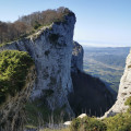
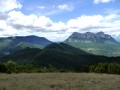
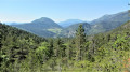
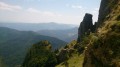
Visit the Trois Becs, the highest points in the Saou Forest.

⚠️ The route passes through a quiet zone for wildlife. Certain passages are closed between 15 May and 15 July.Specific signage and a diversion from the GR®9 have been put in place to guide users, see here.

Details

25700
Creation:
Last update:
Last review:
  • Walking
    Activity: Walking
  • ↔
    Distance: 6.54 mi
  • ◔
    Average duration: 6h 30 
  • ▲
    Difficulty: Difficult

  • ⚐
    Back to start: Yes
  • ↗
    Ascent: + 4,052 ft
  • ↘
    Descent: - 4,065 ft

  • ▲
    Highest point: 5,161 ft
  • ▼
    Lowest point: 3,386 ft

Photos

Description of the walk

Departure from the Col de la Chaudière car park (Siarra car park).

(S/E) Take the path opposite the car park. This yellow-marked trail (PR®®) has recently been redeveloped by the Drôme department. Wind your way through the box trees until you reach Pas de Siarra.

(2) Turn right onto the refurbished trail in the mountain pasture. You will reach a new crossroads at a hairpin bend.

(3) Continue to the right to reach the first peak: Le Veyou (highest point).

(4) Descend along the ridge, then climb back up the ridge to the second peak: Le Signal.

(5) Begin another descent to Pas de Picourère and climb back up to the third peak: La Pelle or Roche Courbe.

(6) Descend via a redeveloped path to reach Col des Auberts and then theGR®®9crossroads.

(7) Turn right and walk uphill for about 20 metres to see the Rocher de la Laveuse (a hole in a rock offering a view of the village of Saillans). Then return to the previous junction.

(7) Take the path on the right, which becomes a forest track. Cross the Vèbre and arrive at the forest road. Continue left until you reach the Pré de l'Âne bend.

(8) Leave theGR®® and take thePR®® (sign) on the left to return via the mountain pasture to Pas de Siarra.

(2) Descend by retracing your steps to return to the car park (S/E).

Waypoints

  1. S/E : mi 0 - alt. 3,399 ft - Siarra car park - Col de la Chaudière (1048m)
  2. 1 : mi 0.08 - alt. 3,428 ft - Start of the refurbished PR trail
  3. 2 : mi 0.73 - alt. 4,318 ft - Pas de Siarra
  4. 3 : mi 1.2 - alt. 4,843 ft - Crossroads with a hairpin bend
  5. 4 : mi 1.58 - alt. 5,138 ft - Veyou (le)
  6. 5 : mi 2.28 - alt. 5,039 ft - Signal (le)
  7. 6 : mi 3.09 - alt. 4,281 ft - Roche Courbe
  8. 7 : mi 3.72 - alt. 4,501 ft - GR9 junction
  9. 8 : mi 5.29 - alt. 3,976 ft - Virage du Pas de l’Ane
  10. S/E : mi 6.54 - alt. 3,399 ft - Siarra car park. Near the - Courance (rivière) à finaliser

Notes

There is no water on this route.
Bring enough with you.
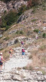
The Pas de Siarra trail was reopened in 2012 following major works. Closed since 2004 following two fatal accidents, it is now completely safe. For those taking children on this hike, it is still advisable to exercise extreme caution in the area leading up to the pass. A dry stone wall protects against the drop and the trail is wide at this point, but there should be no jostling as the fall would be fatal. Also be careful on the ridge section, as the cliff is particularly high.
One last point: the Pas de Siarra trail is off-limits to our fellow hikers: horse riders and mountain bikers.
Comments made by hikers who have completed this route and which deserve attention for future hikers: the trail is paved with steps, which are very tiring for the legs.

Please take care to respect the:
TEMPORARY QUIET ZONES IN THE SAOÛ FOREST between 15 May and 15 July 2025
WHY THIS MEASURE?
The establishment of these temporary quiet zones aims to preserve wildlife and its
habitats, particularly during critical periods. At the end of spring, chamois give birth
and are particularly vulnerable to disturbance. The females' food requirements
are increased: they must feed abundantly to prepare for and then ensure the suckling of
young. Human presence can cause stress and lead to young being abandoned. Faced
multiple pressures (hiking, presence of dogs, etc.), these zones offer a refuge for wildlife
wildlife by limiting disturbances from 15 May to 15 July. They are part of a management
of the Sensitive Natural Area, where the balance between preserving biodiversity
and human activities is a priority for the Department. Beyond the protection of
chamois, these areas benefit all wildlife species and help
maintaining ecosystem diversity. We invite you to adapt your practices by staying
outside these areas to limit your impact. These areas are monitored by
the Department's eco-guards who are present in the field and available to answer your
questions.
PRACTICAL INFORMATION
When? From 15 May to 15 July inclusive
Where? Between Pas de Floréal and Pas de Siara & Between Pas de la Motte and Passage de Picourère
How? By staying on the marked trails outside of temporary quiet zones.
Who is affected? Everyone!

Worth a visit

The Drôme Valley with its large towns of Crest, Saillans and Die.
The Saou forest.

Always be cautious and plan ahead when you're outdoors. Visorando and the author of this route cannot be held responsible for any accidents occurring on this route.

The GR® and PR® markings are the intellectual property of the Fédération Française de Randonnée Pédestre.

Reviews and comments

4.7 / 5
Based on 323 reviews

Reliability of the description
4.7 / 5
Ease of following the route
4.6 / 5
Route interest
4.9 / 5
poupix
poupix

Overall rating : 5 / 5

Date of your route : Sep 11, 2026
Reliability of the description : ★★★★★ Very good
Ease of following the route : ★★★★★ Very good
Route interest : ★★★★★ Very good
Very busy route : No

A superb hike that I’d definitely recommend!!!
There are plenty of steps to climb, but whilst it’s quite a physical challenge, it’s enjoyable from start to finish.
Stunning views of the mountain ranges. We set off at 10.30 am and only came across two couples.
Make sure you take plenty of water if it’s hot, and be warned: the wind is cold and blows strongly at the summit, so don’t forget a windbreaker!
Go for it – it’s undoubtedly the most beautiful, if not one of the most beautiful, hikes in the Drôme.

Machine-translated

User 30975869

Overall rating : 4.3 / 5

Date of your route : Sep 11, 2026
Reliability of the description : ★★★★★ Very good
Ease of following the route : ★★★☆☆ Average
Route interest : ★★★★★ Very good
Very busy route : Yes

A magnificent walk! I’m afraid of heights, but apart from a few very gentle sections, I wasn’t scared. It’s a challenging walk that requires you to be in good physical shape (= no knee pain, no difficulty walking).
We completed the walk in 4 hours and 15 minutes.
The views are absolutely stunning! It’s so beautiful! Do go! Make sure you take plenty of water and a little snack for when you start to feel a bit tired☺️
We went there in early September and were practically on our own – it was brilliant!! Watch out for the wind at altitude – it’s a real head-winder!!

Machine-translated

GéraldL
GéraldL

Overall rating : 4.7 / 5

Date of your route : Aug 23, 2026
Reliability of the description : ★★★★★ Very good
Ease of following the route : ★★★★☆ Good
Route interest : ★★★★★ Very good
Very busy route : Yes

A superb hike I did with my wife in just under 5 hours, including breaks. The climb up to Le Veyou is long and gruelling but not at all dangerous; make sure you set off when it’s still cool and take plenty of water with you. The view is magnificent from the successive summits, with vultures, jackdaws and ravens adding to the spectacle. However, don’t expect to be alone up there – the route is quite busy. On the other hand, on the second part of the circular route (after the 3rd Bec), we hardly came across anyone.
A note regarding the route: point 6 does not have a return route as one might think, and at the next junction, the path appears to head into the mountain pasture without any clear trail. We preferred to follow the path shown on the map, which is much more practical and descends gently through a lovely forest, offering a beautiful view of the cliff.

Machine-translated

User 24424625

Overall rating : 5 / 5

Date of your route : Aug 22, 2026
Reliability of the description : ★★★★★ Very good
Ease of following the route : ★★★★★ Very good
Route interest : ★★★★★ Very good
Very busy route : No

So, from the Siara car park to the Col du Veyou and back, the whole round trip took us 3 hours and 10 minutes, as we took plenty of breaks and walked at a leisurely pace. It’s absolutely stunning!

And the walk isn’t dangerous at all!!
That said, my calves did ache for three days afterwards (lots of walking).

Machine-translated

User 3829243

Overall rating : 5 / 5

Date of your route : Aug 16, 2026
Reliability of the description : ★★★★★ Very good
Ease of following the route : ★★★★★ Very good
Route interest : ★★★★★ Very good
Very busy route : No

Brilliant. An absolute must if you’re visiting the Drôme. In my opinion, the ‘very difficult’ rating is no longer accurate now that the paths have been upgraded. It’s a shame, as it can put people off for no good reason. The Grand and Petit Pomerolle seemed to us to be at least as difficult as this hike. Just over 1,000 metres of elevation gain by the finish. A lovely forest ranger on the Veyou. More vultures to be seen compared to the Rocher du Caire. Magnificent views.

Machine-translated

User 1052825

Overall rating : 5 / 5

Date of your route : Jul 22, 2026
Reliability of the description : ★★★★★ Very good
Ease of following the route : ★★★★★ Very good
Route interest : ★★★★★ Very good
Very busy route : No

A lovely walk exploring the 3 Becs. Superb views – on one side of the syncline and the plain, and on the other of the mountains. At this time of year, set off early in the morning as the temperature rises quickly. Part of the path is laid out as steps. There were several groups of walkers on the route that morning.
Thank you for the description.

Machine-translated

Lioneldu69
Lioneldu69

Overall rating : 5 / 5

Date of your route : Jun 24, 2026
Reliability of the description : ★★★★★ Very good
Ease of following the route : ★★★★★ Very good
Route interest : ★★★★★ Very good
Very busy route : No

A really lovely route, with some lovely open sections...
Cut short by the temporary closure of the 3rd Bec...
Views limited by the heat haze;
To be repeated at an earlier time of year

Machine-translated

Indien66
Indien66

Overall rating : 5 / 5

Date of your route : Jun 06, 2026
Reliability of the description : ★★★★★ Very good
Ease of following the route : ★★★★★ Very good
Route interest : ★★★★★ Very good
Very busy route : Yes

Don’t underestimate the challenging terrain and the water hazard. If you need to take it easy on your knees, this hike isn’t for you!

Machine-translated

User 29299694

Overall rating : 5 / 5

Date of your route : May 09, 2026
Reliability of the description : ★★★★★ Very good
Ease of following the route : ★★★★★ Very good
Route interest : ★★★★★ Very good
Very busy route : No

Machine-translated

Kevengwen
Kevengwen

Overall rating : 4.3 / 5

Date of your route : Apr 27, 2026
Reliability of the description : ★★★★☆ Good
Ease of following the route : ★★★★☆ Good
Route interest : ★★★★★ Very good
Very busy route : Yes

A truly beautiful hike with breathtaking views. The climb up to the first peak is the most strenuous part as there are lots of steps. After the other two peaks, we passed through the ‘Trou de la Laveuse’ before rejoining the GR4. A must-do hike!
Thanks to Visio Randonneur for this lovely outing.

Machine-translated

User 9544711

Overall rating : 5 / 5

Date of your route : Apr 16, 2026
Reliability of the description : ★★★★★ Very good
Ease of following the route : ★★★★★ Very good
Route interest : ★★★★★ Very good
Very busy route : Yes

A truly stunning view all around the forest – it was magnificent
Walking poles recommended due to the steep terrain

Machine-translated

Doremi 13
Doremi 13

Overall rating : 4.3 / 5

Date of your route : Apr 14, 2026
Reliability of the description : ★★★★☆ Good
Ease of following the route : ★★★★☆ Good
Route interest : ★★★★★ Very good
Very busy route : Yes

A superb hike, which I strongly recommend doing on weekdays rather than at weekends or on public holidays, as it’s a classic route in the Saou Forest and therefore very busy. There’s a significant elevation gain over a short distance, with quite a few steps. But the effort is more than rewarded by the breathtaking views from the summits: the Saou Forest on one side and the Vercors and the Alps on the other.

Machine-translated

User 13066767

Overall rating : 5 / 5

Date of your route : Mar 23, 2026
Reliability of the description : ★★★★★ Very good
Ease of following the route : ★★★★★ Very good
Route interest : ★★★★★ Very good
Very busy route : Yes

Great – these route ideas always make us want to get out and explore.

Machine-translated

User 20432577

Overall rating : 4.3 / 5

Date of your route : Oct 28, 2025
Reliability of the description : ★★★★☆ Good
Ease of following the route : ★★★★☆ Good
Route interest : ★★★★★ Very good
Very busy route : Yes

A beautiful sunny day 🌞 with views 😎 of snow-capped mountain ranges.
The climb, which starts from the Col de la Chaudière car park, allows you to warm up gently before arriving at Pas de Siara at 1,300 metres. Here, you will need to be patient as the steps break up the rhythm a little, but the views during the short breaks are well worth the effort and will keep you breathless as soon as you arrive at the first peak.
The picnic break is the icing on the cake! Enjoy Mother Nature.
The second and third peaks are just as surprising. The return route takes you through the forest to complete the circular loop and return to Pas de Siara before descending to the car park. Be careful ⚠️ and take care when descending.

Machine-translated

sylviane henner
sylviane henner

Overall rating : 5 / 5

Date of your route : Oct 21, 2025
Reliability of the description : ★★★★★ Very good
Ease of following the route : ★★★★★ Very good
Route interest : ★★★★★ Very good
Very busy route : No

A very beautiful hike. No particular difficulty. The trail has been improved and the climb to the first peak, Le Veyou, consists mainly of uneven steps. 360° view at the summit. A very beautiful hike. Don't forget to continue for about twenty metres to the Rocher de la Laveuse before descending towards the Pas de Siara after the last peak, Roche Courbe. No more patou on the horizon at this time of year.

Machine-translated

Other walks in the area

For more walks, use our search engine .

The GPS track and description are the property of this route's author. Please do not copy them without permission.