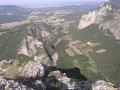
After swimming in the Roubion, you can finish the descent at nightfall: Vaire is a remarkable platform for stargazing, at the foot of the southern slope of the Saoû syncline.
Please note: the route is impassable when the Roubion is in flood.
Departure from the car park at Francillon-sur-Roubion Town Hall.
(S/E) With your back to the car park, take the street on the left towards Bois Sec via Roubion and turn right at the hairpin bend to cross the village via Rue de l'Église.
(1) Turn right (north-east) onto the wide Chemin de la Tollière. It runs alongside fields and then crosses the woods overlooking Roubion.
(2) At the bottom of the field, the path narrows and turns left, becoming a trail that descends towards Roubion. Follow the river upstream for 600 metres.
(3) After a rocky section (dangerous during high water!), the path begins to climb and veers off to the right. Cross the meadow before climbing into the undergrowth.
(4) After a few bends, you will reach the edge of a field and arrive at Bois Sec. Take a sharp turn onto the dirt track on the right (west-northwest). Walk along the field, ford the stream and continue straight ahead.
(5) At the cross, turn right (north-north-west), climb up and cross the bare plateau of Vaire. Continue north-west, pass by the Virgin Mary statue and descend to Francillon. At the houses, take the street on the left and return to the car park (S/E).
Waypoints
S/E : mi 0 - alt. 1,188 ft - Car park at Francillon-sur-Roubion Town Hall
1 : mi 0.15 - alt. 1,175 ft - Chemin de la Tollière
2 : mi 0.78 - alt. 1,224 ft - Path leading down to the - Roubion (rivière)
3 : mi 1.31 - alt. 1,168 ft - Rocky passage
4 : mi 1.59 - alt. 1,378 ft - Bois Sec
5 : mi 1.9 - alt. 1,368 ft - Cross
S/E : mi 2.78 - alt. 1,188 ft - Car park at Francillon-sur-Roubion Town Hall
Notes
Please note: the route is impassable when the Roubion river is in flood.
We strongly recommend that you take IGN map no. 3138OT with you. Bring sufficient water and food and wear suitable clothing for walking. Hikers must be self-sufficient, but professional guides are available if needed. Emergency numbers: 18 or 112.
Information from the Val de Drôme Tourist Office: +33 (0)4 75 63 10 88 / valleedeladrome-tourisme.com
Worth a visit
FAUNA - The southern barbel.
The Roubion is a natural breeding ground for a variety of fish such as brown trout, minnow, bleak and chub, but it is the southern barbel that attracts the most attention. Listed as rare in the Red Book of Threatened Freshwater Fish Species, compiled by the International Union for Conservation of Nature, this species is a remnant of the fauna that existed before the ice ages. Common in the Upper Roubion and living at the bottom of the river, it is easily distinguishable from trout thanks to its stocky shape and four barbels, and from common barbel by its marbling and lateral line.
Reviews and comments
4.5 / 5
Based on 8 reviews
Reliability of the description 4.4 / 5
Ease of following the route 4.6 / 5
Route interest 4.6 / 5
poupix
Overall rating :
4.7 / 5
Date of your route : Sep 10, 2026 Reliability of the description : ★★★★★ Very good Ease of following the route : ★★★★★ Very good Route interest : ★★★★☆ Good Very busy route : No
A lovely route to explore.
I strongly recommend doing the circular route in the opposite direction to make the most of this walk.
Machine-translated
mwerlen
Overall rating :
4 / 5
Date of your route : Apr 15, 2026 Reliability of the description : ★★★☆☆ Average Ease of following the route : ★★★★☆ Good Route interest : ★★★★★ Very good Very busy route : No
A lovely walk. The banks of the Roubion are very pleasant in spring.
Machine-translated
Jean Raffort
Overall rating :
5 / 5
Date of your route : Jul 19, 2024 Reliability of the description : ★★★★★ Very good Ease of following the route : ★★★★★ Very good Route interest : ★★★★★ Very good Very busy route : No
A very pleasant short hike to do with children. Plenty of shade and the proximity of the Roubion river to cool off make this route ideal in summer under the sun.
Machine-translated
Ma.com
Overall rating :
5 / 5
Date of your route : Sep 04, 2023 Reliability of the description : ★★★★★ Very good Ease of following the route : ★★★★★ Very good Route interest : ★★★★★ Very good Very busy route : No
An easy and very pleasant walk.
The route is very well described and allows you to enjoy a variety of landscapes.
Francillon sur Roubion is a charming village: a wonderful discovery!
And of course, a break in Roubion is almost mandatory in summer to enjoy a little coolness.
Machine-translated
délia
Overall rating :
4.3 / 5
Date of your route : Jul 27, 2021 Reliability of the description : ★★★★☆ Good Ease of following the route : ★★★★☆ Good Route interest : ★★★★★ Very good Very busy route : No
I followed MMG84 visorandonneur's advice:
I did the hike in the direction of Plateau de Vaire, Bois Sec, Roubion.
The trail is downhill, and in hot weather it's very nice to end the walk with a quick dip in the river.
GPX is a perfect tool for geolocating yourself during the hike.
There are beautiful landscapes to admire.
Machine-translated
parastat
Overall rating :
4.7 / 5
Date of your route : Mar 03, 2021 Reliability of the description : ★★★★★ Very good Ease of following the route : ★★★★★ Very good Route interest : ★★★★☆ Good Very busy route : No
Hello,
A beautiful, easy and varied hike.
Perhaps requires a little caution with young children on the section near Roubion.
Machine-translated
mmg84
Overall rating :
4.7 / 5
Date of your route : Aug 21, 2020 Reliability of the description : ★★★★☆ Good Ease of following the route : ★★★★★ Very good Route interest : ★★★★★ Very good Very busy route : No
Do this in the opposite direction, especially if it is very hot. To take a dip in the Roubion. The end of the route in the given direction is quite difficult on the arid plateau, especially if it is very hot.
Machine-translated
georgespo
Overall rating :
4 / 5
Date of your route : Feb 28, 2020 Reliability of the description : ★★★★☆ Good Ease of following the route : ★★★★☆ Good Route interest : ★★★★☆ Good
From the 1 (Chemin de la Tollière), just follow the well-marked yellow signs. I started from Saou, which makes for a 17-18 km hike. You can also do the hike in the other direction (more interesting for picnicking on the banks of the Roubion).
To open this route on your smartphone, you must have the Visorando app installed. If not, got to the Apple Store (iPhone) or Google Play Store (Android) to download the app.



 Country:

 City:
City:







 Visorando Member

 Local authority
 Moderate
 Difficult