


zbh0170

 Visorando Member
 Premium user
 - Gender: man
Sign up:
Published route(s)
 Tour du Flumen via La Roche Blanche and Sur les Grès
 8.51 mi
 +3,789 ft
 -3,760 ft
 7h 15
7h 15
 Difficult
 Departure from Villard-Saint-Sauveur (Jura)
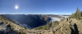
This loop will allow you to discover the bottom of the Flumen valley (and its waterfalls) as well as the ridges above it.
Lac Genin from Oyonnax
 9.61 mi
+1,883 ft
-1,867 ft
6h 05
Difficult
Departure from Oyonnax (Ain)
9.61 mi
+1,883 ft
-1,867 ft
6h 05
Difficult
Departure from Oyonnax (Ain)
The aim of this hike is to take you to Lac Genin from the centre of Oyonnax. The route is mainly a loop. Once you arrive at the lake, you are free to spend as much time there as you like.
The Gorges de l'Abîme, the Crêt Pourri and the hamlet of Vaucluse
 5.95 mi
+1,926 ft
-1,900 ft
4h 25
Difficult
Departure from Saint-Claude (Jura)
5.95 mi
+1,926 ft
-1,900 ft
4h 25
Difficult
Departure from Saint-Claude (Jura)
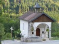
This circular walk will introduce you to some of the Jura’s attractions around the town of Saint-Claude. From the Gorges de l’Abîme, you’ll take a path towards the Crêt Pourri, then, after negotiating a few slopes, you’ll reach a plateau. On the way back, you’ll be able to admire the charming hamlet of Vaucluse.
The Gorges de l’Abîme route has been accessible again since 4 July 2026 (for the record, it was previously closed under a municipal by-law dated 4 December 2023).
Crêt de Chalam from Chézery-Forens
 8.94 mi
+3,287 ft
-3,274 ft
7h 00
Difficult
Departure from Chézery-Forens (Ain)
8.94 mi
+3,287 ft
-3,274 ft
7h 00
Difficult
Departure from Chézery-Forens (Ain)
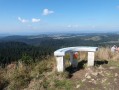
The aim of this hike is to reach Crêt de Chalam (1,545 m) from Chézery-Forens, covering a circular route of approximately 14 km. Although the path to the summit is a little steep, the return journey is gentler but longer.
Overlooking the Gorges de l'Albarine: Lacoux - Nantuy
 11.41 mi
+1,647 ft
-1,640 ft
6h 40
Difficult
Departure from Hauteville-Lompnes (Ain)
11.41 mi
+1,647 ft
-1,640 ft
6h 40
Difficult
Departure from Hauteville-Lompnes (Ain)
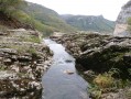
This hike takes you on a loop through the heart of the Bugey region around Hauteville-Lompnes, on the edge of the plateau overlooking the Gorges de l'Albarine, with relatively little elevation gain.
Le Reculet - La Valserine
 10.63 mi
+3,947 ft
-3,970 ft
8h 20
Difficult
Departure from Chézery-Forens (Ain)
10.63 mi
+3,947 ft
-3,970 ft
8h 20
Difficult
Departure from Chézery-Forens (Ain)
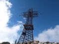
This circular route will take you to Reculet, the second highest peak in the Jura. Although 2 metres lower than Crêt de la Neige, it is more picturesque. From here, you can enjoy magnificent views all the way to Mont Blanc. The return journey takes you along the banks of the Valserine, one of the wildest rivers in France.
Crêtes du Mont Chabot à partir de Saint-Claude
 2.49 mi
+1,480 ft
-1,480 ft
2h 25
Difficult
Departure from Saint-Claude (Jura)
2.49 mi
+1,480 ft
-1,480 ft
2h 25
Difficult
Departure from Saint-Claude (Jura)
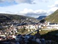
Le Mont Chabot est une des montagnes-phare dominant la ville de Saint-Claude.Il s'agira d'accéder à sa crête en empruntant un parcours en boucle partielle permettant de visualiser de superbes points de vues sur la ville et les alentours. La randonnée est assez courte, mais attention certains passages sont relativement raides et peuvent s’avérer glissants.Attention : le parcours présenté en 2016 vient d'être partiellement remanié (lire § Infos pratiques).
Around the Combe d'Orvaz
 7.19 mi
+2,064 ft
-2,064 ft
5h 05
7.19 mi
+2,064 ft
-2,064 ft
5h 05
 Very difficult
Departure from Belleydoux (Ain)
Very difficult
Departure from Belleydoux (Ain)
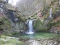
This is a circular route around the Combe d’Orvaz which is quite challenging: the main points of interest are the banks of the River Sémine and its waterfalls, the plateau around the Combe d’Évuaz, and then the Roches d’Orvaz and its cirque.
Tour of the Cerdon heights
 7.98 mi
+1,736 ft
-1,713 ft
5h 10
7.98 mi
+1,736 ft
-1,713 ft
5h 10
 Moderate
Departure from Cerdon (Ain)
Moderate
Departure from Cerdon (Ain)
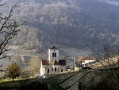
The aim of the route is to complete a beautiful loop overlooking the Cerdon: after crossing the vineyards overlooking the valley, the route continues on the plateaus of Saint-Alban and Labalme, returning to the starting point via the Combe Cugnat and a slight detour via Mont Carmier.
Overhangs of the Bienne Valley – Longchaumois Plateau
 15.80 mi
+3,671 ft
-3,678 ft
7 hrs
Very difficult
Departure from Saint-Claude (Jura)
15.80 mi
+3,671 ft
-3,678 ft
7 hrs
Very difficult
Departure from Saint-Claude (Jura)
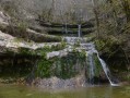
This hike (which is somewhat demanding) aims to take in a varied route at different altitudes in the Bienne Valley to the north of Saint-Claude, as well as on the plateau overlooking it around Longchaumois. The route is mostly circular, passing close to two waterfalls and a cave.
Le Reculet via Le Rosset, Le Gralet, and the Grotte de la Marie du Jura
 9.97 mi
+3,904 ft
-3,930 ft
8h 00
Very difficult
Departure from Chézery-Forens (Ain)
9.97 mi
+3,904 ft
-3,930 ft
8h 00
Very difficult
Departure from Chézery-Forens (Ain)
Here is a second circular route to the Reculet (the first route can be viewed here). You’ll be treated to numerous views of the Valserine Valley and Lake Geneva (including Geneva and Mont Blanc). I can only say one thing: the scenery is truly magnificent.
Overhangs of the Ain Gorges: Bolozon - Balvay - Solomiat - Napt
 7.81 mi
+1,854 ft
-1,837 ft
5h 10
Moderate
Departure from Bolozon (Ain)
7.81 mi
+1,854 ft
-1,837 ft
5h 10
Moderate
Departure from Bolozon (Ain)
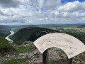
This is a circular route from Bolozon, passing through pretty villages (Balvay, Solomiat and Napt) and overlooking the Gorges de l'Ain.
This is a "classic" route (often suggested in the opposite direction) that does not present any major difficulties.
Saint-Romain-de-Roche via Vaux-Lès-Saint-Claude
 4.07 mi
+1,358 ft
-1,348 ft
3h 05
Difficult
Departure from Vaux-lès-Saint-Claude (Jura)
4.07 mi
+1,358 ft
-1,348 ft
3h 05
Difficult
Departure from Vaux-lès-Saint-Claude (Jura)
The route suggested, starting from Vaux-Lès-Saint-Claude, leads to Saint-Romain-de-Roche and its plateau.
It is a relatively short walk but involves a strenuous climb (somewhat challenging). As a result, it has been classified as difficult; the section on the plateau itself is fairly easy.
Around Oignin
 7.34 mi
+453 ft
-476 ft
3h 45
Moderate
Departure from Izernore (Ain)
7.34 mi
+453 ft
-476 ft
3h 45
Moderate
Departure from Izernore (Ain)
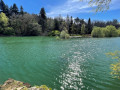
The route follows the course of the Oignin river on the edge of the Gorges de l'Enfer, then goes around the Lac de l'Oignin, all with some pretty nice scenery!
Tour du plateau d'Hostiaz à partir de Tenay
 11.02 mi
+3,202 ft
-3,202 ft
7h 50
Difficult
Departure from Tenay (Ain)
11.02 mi
+3,202 ft
-3,202 ft
7h 50
Difficult
Departure from Tenay (Ain)
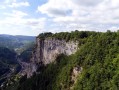
Le parcours, proposé en quasi boucle, permet de réaliser un bon tour sur le plateau d'Hostiaz avec un point de départ en fond de vallée à Tenay. De très jolies prairies (surtout au printemps) et de nombreux points de vue sur la vallée de l'Albarine et de la Cluse des Hôpitaux sont les points forts de la randonnée.
La Faucille - Colomby de Gex - Mont Rond
 10.22 mi
+2,890 ft
-2,894 ft
7h 15
Difficult
Departure from Gex (Ain)
10.22 mi
+2,890 ft
-2,894 ft
7h 15
Difficult
Departure from Gex (Ain)
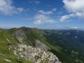
Je vous propose de réaliser un parcours en boucle au départ des environs du Col de la Faucille (parking du Pailly) afin d’accéder au Colomby de Gex : à l'aller le tracé évolue sous les Monts Jura et au retour sur ses crêtes avec une succession de montées et descentes.
Certaines parties du parcours sont situées en zones de quiétude de la faune sauvage et il ne sera ainsi pas possible de le parcourir du 15/12 au 15/05 (à lire ci dessous)
Grand Crêt d'Eau via the Crête du Fort l'Écluse
 8.75 mi
+3,717 ft
-3,730 ft
5 hrs
Very difficult
Departure from Léaz (Ain)
8.75 mi
+3,717 ft
-3,730 ft
5 hrs
Very difficult
Departure from Léaz (Ain)
The aim of the route is to reach the Crêt de la Goutte via the Crête du Fort l'Écluse.
The main difficulty will be encountered during the ascent; the slope is quite steep up to the red and white high-voltage pylon, and at times you will need to use your hands (avoid this when descending and on wet ground).
From Chalet Bizot, the route is straightforward.
Urban walk in Lyon Croix Rousse: its slopes and plateau
 6.37 mi
+449 ft
-436 ft
3h 20
6.37 mi
+449 ft
-436 ft
3h 20
 Easy
Departure from Lyon (Rhône)
Easy
Departure from Lyon (Rhône)
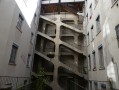
The aim of the route is to stroll through a few streets in the city of Lyon, between the north of the Presqu'île (Place des Terreaux) and the plateau of the Colline de la Croix-Rousse, while enjoying beautiful views (on the Rhône and Saône sides) at times.
Le Glandasse from Chatillon-en-Diois via the Fontaine des Tuiles
 13.70 mi
+5,535 ft
-5,535 ft
7 hrs
Very difficult
Departure from Châtillon-en-Diois (Drôme)
13.70 mi
+5,535 ft
-5,535 ft
7 hrs
Very difficult
Departure from Châtillon-en-Diois (Drôme)
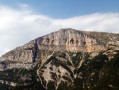
The aim of the route is to reach the summit of Glandasse mountain (known as the Dôme or Pié Ferré - 2,041 metres above sea level) via an alternative routeto the GR®91: Pié de Boeuf, near the Col de Caux (overlooking the Baïn valley), Fontaine des Tuiles (dominated by the Roc d'Ambane). The return journey is via theGR®91.
Torcieu - Mont Charvet - Château des Allymes - Croix des Moines
 12.03 mi
+3,458 ft
-3,445 ft
8h 35
Difficult
Departure from Torcieu (Ain)
12.03 mi
+3,458 ft
-3,445 ft
8h 35
Difficult
Departure from Torcieu (Ain)
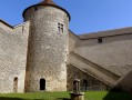
The proposed route, which is almost circular, provides access to the Château des Allymes from Torcieu.
This is a somewhat challenging hike with two distinct sections:
- steep sections above Torcieu (requiring the use of your hands at times),
- long stretches with a series of ascents and descents without excessive gradients.
Most of the route is through woodland (with limited views).
Walking poles are recommended, especially in wet conditions.
From Béon to Grand Colombier
 15.19 mi
+5,174 ft
-5,194 ft
11h 30
Difficult
Departure from Béon (Ain)
15.19 mi
+5,174 ft
-5,194 ft
11h 30
Difficult
Departure from Béon (Ain)
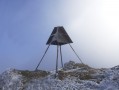
The walk, starting from Béon, aims to reach the summit of the Grand Colombier (1,534 m) via a circular route. It can be classified as somewhat challenging due to the elevation gain and the distance covered.The ascent includes a few slopes that are rather steep on the whole. Otherwise, there are no major difficulties (at most, it is worth noting that finding your way may be tricky around point (9) and that the markings are less precise towards the end of the route).
Tour of the Chamoise Plateau
 8.21 mi
+2,201 ft
-2,185 ft
5h 40
Difficult
Departure from Nantua (Ain)
8.21 mi
+2,201 ft
-2,185 ft
5h 40
Difficult
Departure from Nantua (Ain)
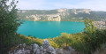
The aim of this suggested route, starting from Nantua, is to take a journey across the Chamoise Plateau. It is an alternative to another route featured on the website: the Roche d’Au-Delà, the link for which is provided below.Whilst the climb up to the Monts d’Ain is a bit of a challenge at times, the rest of the walk is generally gentler.
On the Cleyzieu plateau in the Bugey region
 11.28 mi
+2,087 ft
-2,087 ft
7h 00
Difficult
Departure from Torcieu (Ain)
11.28 mi
+2,087 ft
-2,087 ft
7h 00
Difficult
Departure from Torcieu (Ain)
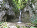
This walk offers a lovely route across the Cleyzieu plateau, starting from Montferrand (Torcieu).The main challenge is the climb up to the Grottes du Crochet, where you’ll need to be careful in wet weather (trekking poles recommended).Given the length of the route, the walk has been classified as ‘Difficult’.
Pointe de Rognier and its surroundings
 9.52 mi
+5,692 ft
-5,692 ft
8 hrs
Very difficult
Departure from Presle (Savoie)
9.52 mi
+5,692 ft
-5,692 ft
8 hrs
Very difficult
Departure from Presle (Savoie)
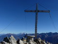
The aim of the hike is to reach Pointe de Rognier (2,341 m) while enjoying a pleasant walk in the surrounding area, via a partial circular route starting from Col de la Perche.
This is a fairly physically demanding hike given the distance and total elevation gain.
From Saint-Claude to Septmoncel via the Chemin des Cascades
 9.32 mi
+3,245 ft
-3,238 ft
7h 05
Difficult
Departure from Saint-Claude (Jura)
9.32 mi
+3,245 ft
-3,238 ft
7h 05
Difficult
Departure from Saint-Claude (Jura)
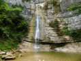
This hike takes you to the Queue d'Âne and Queue de Cheval waterfalls, then climbs a little to the Septmoncel area, via a good circular route that is a little physically demanding at times.Please note that some sections can be tricky due to wet ground, particularly the section between (9) and (10), which is quite steep.
From Châtillon-en-Diois to Ravel-et-Ferriers via the six passes
 11.58 mi
+4,177 ft
-4,173 ft
9h 00
Difficult
Departure from Châtillon-en-Diois (Drôme)
11.58 mi
+4,177 ft
-4,173 ft
9h 00
Difficult
Departure from Châtillon-en-Diois (Drôme)
The aim of this hike is to follow a good circular route from Châtillon-en-Diois to the hamlets of Ravel-et-Ferrier, then return via Serre Chanuit (1,430m), crossing six passes in the process, including the Col du Pinet.
Route de la Pierre qui Vire in Dortan
 5.47 mi
+1,463 ft
-1,453 ft
3h 45
Difficult
Departure from Dortan (Ain)
5.47 mi
+1,463 ft
-1,453 ft
3h 45
Difficult
Departure from Dortan (Ain)
The aim of the hike is to complete a circular route overlooking the village of Dortan and Lake Coiselet. There are many beautiful viewpoints along the way.
Lake Chanon starting from Chancia
 14.53 mi
+2,654 ft
-2,651 ft
9h 00
Difficult
Departure from Chancia (Jura)
14.53 mi
+2,654 ft
-2,651 ft
9h 00
Difficult
Departure from Chancia (Jura)
The aim is to complete a good, almost circular route across the plateaus around Montcusel and Chanon.The starting point is in Chancia: the main difficulty is the distance covered (at most, there is a short steep climb towards Lake Chanon). Along the way, there are some lovely views.
Route of Mont Bayard starting from Saint-Claude
 4.18 mi
+1,680 ft
-1,667 ft
3h 25
Difficult
Departure from Saint-Claude (Jura)
4.18 mi
+1,680 ft
-1,667 ft
3h 25
Difficult
Departure from Saint-Claude (Jura)
Starting from Saint-Claude, this is a short hike in terms of distance but quite challenging during the climb up Mont Bayard. Walking poles are recommended in wet conditions.
Molard de Netru from Chancia
 1.94 mi
+581 ft
-581 ft
1h 25
Moderate
Departure from Chancia (Jura)
1.94 mi
+581 ft
-581 ft
1h 25
Moderate
Departure from Chancia (Jura)
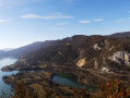
I suggest a short hike (about 1 hour) from Chancia to the small summit of Molard de Netru (491 m). There are some beautiful views to discover.
Along the Valserine at the start of the Pont des Pierres
 7.59 mi
+1,578 ft
-1,585 ft
4h 50
Difficult
Departure from Montanges (Ain)
7.59 mi
+1,578 ft
-1,585 ft
4h 50
Difficult
Departure from Montanges (Ain)
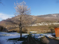
The route is designed to form a circular route in the Valserine Valley between Montanges (Pont des Pierres) and Champfromier. The outward leg follows the River Valserine. The return leg follows the route of the Lancrans–Chézery tramway. Along the way, you will pass through two small tunnels.There are a few challenging sections between points (1) and (2) on a path that is moderately passable at times. The rest of the route presents no major difficulties.
Boucle d'Oyonnax à la Prairie d'Échallon
 15.19 mi
+3,570 ft
-3,576 ft
6 hrs
Very difficult
Departure from Oyonnax (Ain)
15.19 mi
+3,570 ft
-3,576 ft
6 hrs
Very difficult
Departure from Oyonnax (Ain)
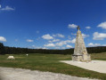
Il est proposé un parcours en boucle un peu sportif, dont la finalité est de rejoindre à partir d'Oyonnax la Prairie d'Echallon, puis de revenir via le Lac Sous les Mousses (et à proximité du lac de Viry) puis le Mont de la Chaux et la Pointe de Biez.
Crêt de Chalam via Montagne des Moines
 7.04 mi
+3,232 ft
-3,215 ft
6h 05
Difficult
Departure from Chézery-Forens (Ain)
7.04 mi
+3,232 ft
-3,215 ft
6h 05
Difficult
Departure from Chézery-Forens (Ain)
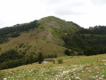
Here is a circular route to reach Crêt de Chalam from Chézery-Forens: the outward journey follows a little-known route via Montagne des Moines (you won't meet many people). The return journey follows the "classic" route.
From Bourdeau to Hautecombe overlooking Lake Bourget
 13.41 mi
+3,802 ft
-3,799 ft
9h 30
Difficult
Departure from Bourdeau (Savoie)
13.41 mi
+3,802 ft
-3,799 ft
9h 30
Difficult
Departure from Bourdeau (Savoie)
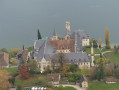
Here is a good route connecting Bourdeau to Hautecombe Abbey.
The outward journey takes you above the wild shores of Lake Bourget with numerous viewpoints, all on a somewhat rugged route.
After climbing a little higher, the return route takes you in the shadow of Mont de la Charvaz before coming back via the Col du Chat.
From Lac de Coiselet to Pic d'Oliferne
 7.14 mi
+1,768 ft
-1,755 ft
4h 50
Moderate
Departure from Condes (Jura)
7.14 mi
+1,768 ft
-1,755 ft
4h 50
Moderate
Departure from Condes (Jura)
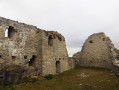
I suggest a circular route, with some lovely views, taking you to the Pic d’Oliferne from Lac de Coiselet (Condes).There are no major difficulties to be encountered. At most, there are a few sections where caution is advised if the ground is slippery (see below).
Circular route via Mont Pécloz, Mont d'Arménaz and Pointe de la Fougère
 9.19 mi
+5,118 ft
-5,098 ft
7 hrs
Very difficult
Departure from École (Savoie)
9.19 mi
+5,118 ft
-5,098 ft
7 hrs
Very difficult
Departure from École (Savoie)
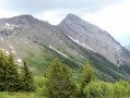
I recommend a lovely circular hike via Mont Pécloz, Mont d’Arménaz and Pointe de la Fougère.
Warning! Some sections are tricky, particularly the descent from Mont Pécloz towards Col d'Armène and the ridge between Mont d'Armenaz and Pointe de la Fougère
See the practical information section.
Places of interest around the Hautes Combes de Septmoncel – Lac de Lamoura – Lajoux
 16.76 mi
+2,671 ft
-2,694 ft
8 hrs
Very difficult
Departure from Septmoncel (Jura)
16.76 mi
+2,671 ft
-2,694 ft
8 hrs
Very difficult
Departure from Septmoncel (Jura)
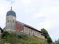
I suggest a long circular route starting from Septmoncel, allowing you to discover some very pretty landscapes in the Jura.
From Lélex to La Borne au Lion circular loop
 14.00 mi
+2,795 ft
-2,802 ft
8h 50
Difficult
Departure from Lélex (Ain)
14.00 mi
+2,795 ft
-2,802 ft
8h 50
Difficult
Departure from Lélex (Ain)
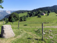
I suggest a long hike from Lélex to Borne au Lion to discover the beautiful landscapes of the Haut Jura.
The Keys to the Tournette Tour
 8.32 mi
+4,633 ft
-4,633 ft
7h 50
Very difficult
Departure from Les Clefs (Haute-Savoie)
8.32 mi
+4,633 ft
-4,633 ft
7h 50
Very difficult
Departure from Les Clefs (Haute-Savoie)
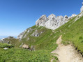
I suggest a good hike, partly circular, starting from Les Clefs and heading to La Tournette through areas that are not too busy.There are no major technical difficulties along the route: at most, there are a few slippery sections in places and access to the summit of La Tournette via a few ladders and cables
Le Jocou from the Col de Menée
 8.18 mi
+3,448 ft
-3,438 ft
6h 45
Difficult
Departure from Treschenu-Creyers (Drôme)
8.18 mi
+3,448 ft
-3,438 ft
6h 45
Difficult
Departure from Treschenu-Creyers (Drôme)
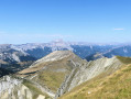
I recommend a very beautiful route to reach the summit of Jocou from the Col de Menée. This route mainly follows ridgelines (via Mont Barral) on the border between the Diois and Trièves regions, offering stunning panoramic views of the Vercors, Dévoluy and Écrins massifs.
Circular route from the foot of the Dents de Lanfon to Pointe de Talamarche
 8.76 mi
+5,125 ft
-5,148 ft
6 hrs
Very difficult
Departure from Alex (Haute-Savoie)
8.76 mi
+5,125 ft
-5,148 ft
6 hrs
Very difficult
Departure from Alex (Haute-Savoie)
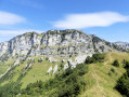
I suggest a circular route from the foot of the Dents de Laffon to the Pointe de Talamarche, all set against a backdrop of beautiful and varied scenery.There are challenging sections in two areas:- below the Dents de Lanfon in the scree slope: moderate navigation in an area exposed to rockfalls.- access to the Trou de la Chapelle: sections equipped with chains and rungs,A torch is strongly recommended for the crossing of the Grotte de la Chapelle. This route is best undertaken outside periods when snow is present and ideally on dry ground.Please read the Practical Information carefully.Three alternative routes are available: please also read the practical information.
From the Col de la Colombière to the Pointe d’Almet via a series of ridges
 7.46 mi
+2,917 ft
-2,900 ft
4 hrs
Very difficult
Departure from Le Reposoir (Haute-Savoie)
7.46 mi
+2,917 ft
-2,900 ft
4 hrs
Very difficult
Departure from Le Reposoir (Haute-Savoie)
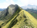
I’d like to suggest a lovely, almost circular route, the aim of which is to reach the Pointe d’Almet from the Col de la Colombière, mainly along ridges via ‘unofficial’ paths. All along the way, there are some very pretty views to enjoy.
Please note: there are two tricky, steep sections which require caution (see the description below).
This hike is not recommended for those who are not sure-footed or who suffer from vertigo.
Hauteurs du Revermont between Signal de Nivigne and Mont Myon
 8.95 mi
+2,165 ft
-2,152 ft
6h 00
Difficult
Departure from Pouillat (Ain)
8.95 mi
+2,165 ft
-2,152 ft
6h 00
Difficult
Departure from Pouillat (Ain)
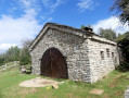
I suggest a lovely circular route in the Revermont area, which ends at the Signal de Nivigne and Mont Myon and offers some beautiful panoramic views. There is one difficult section after the Grotte à l'Ours on a fairly steep passage (secured by ropes).
From Jeurre to Saint-Romain de Roche (circular)
 9.40 mi
+1,811 ft
-1,821 ft
5h 55
Difficult
Departure from Jeurre (Jura)
9.40 mi
+1,811 ft
-1,821 ft
5h 55
Difficult
Departure from Jeurre (Jura)
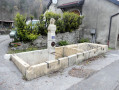
Starting from the village of Jeurre, I suggest a hike that partly follows a circular route to reach Saint-Romain-de-Roche.After a short detour to the Grotte de Nerbier, the route follows the course of the Bienne from a distance, then climbs slightly onto the plateau between Petit Châtel and Saint-Romain-de-Roche via a few winding paths.
Petit tour de Granges à Heyriat
 4.99 mi
+1,112 ft
-1,099 ft
3h 15
Moderate
Departure from Matafelon-Granges (Ain)
4.99 mi
+1,112 ft
-1,099 ft
3h 15
Moderate
Departure from Matafelon-Granges (Ain)
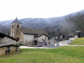
Je vous propose un petit parcours permettant de rejoindre Heyriat à partir de Granges situé pas très loin des bords de l'Ain.
The Grand Tour via Lake Genin
 13.89 mi
+3,051 ft
-3,035 ft
6 hrs
Very difficult
Departure from Oyonnax (Ain)
13.89 mi
+3,051 ft
-3,035 ft
6 hrs
Very difficult
Departure from Oyonnax (Ain)
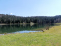
I suggest a good route that takes you from Oyonnax to Lac Genin and the Prairie d'Échallon.
Throughout the route, the varied landscapes are reminiscent of a small Canada.
The main difficulty is the length of the route.
Tour of the Montagne d'Émondeaux
 14.63 mi
+2,884 ft
-2,881 ft
7 hrs
Very difficult
Departure from Samognat (Ain)
14.63 mi
+2,884 ft
-2,881 ft
7 hrs
Very difficult
Departure from Samognat (Ain)
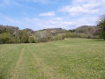
Starting from the Coiselet dam, I suggest a good route around the Montagne d’Émondeau leading to Dortan. The route takes place mainly in a wooded area interspersed with some lovely scenery. The route is generally easy and the main difficulty is its length.Three alternative routes are available.
Around the Chaux-des-Crotenay plateau
 10.47 mi
+1,713 ft
-1,693 ft
6h 20
Difficult
Departure from Syam (Jura)
10.47 mi
+1,713 ft
-1,693 ft
6h 20
Difficult
Departure from Syam (Jura)
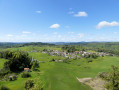
I’d like to suggest a lovely walk in the heart of the Jura, between Syam and the Chaux-des-Crotenay plateau, through an area of interest to some archaeologists.
There are two points of difficulty to note: access to the Belvédère du Rachet and the short walk through the Grotte de la Grande Cheminée. The rest of the route presents no difficulty.
Circuit of the Parmelan plateau via the Pertuis Valley
 11.25 mi
+4,396 ft
-4,400 ft
9h 00
Difficult
Departure from Villaz (Haute-Savoie)
11.25 mi
+4,396 ft
-4,400 ft
9h 00
Difficult
Departure from Villaz (Haute-Savoie)
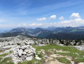
I suggest you take a lovely walk around the Parmelan plateau, situated between the Fier Valley (to the south) and the Fillière Valley (to the north), near Annecy and its lake.
The route, which can be challenging at times, winds through a landscape strongly characterised by limestone and its Urgonian sharp limestone pavement, all set against a backdrop of magnificent scenery.
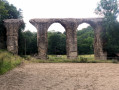
Route of the Gier Aqueduct from Chaponost
 10.37 mi
+906 ft
-915 ft
5h 35
Moderate
Departure from Chaponost (Rhône)
10.37 mi
+906 ft
-915 ft
5h 35
Moderate
Departure from Chaponost (Rhône)
I will take you on a route between Chaponost and Brignais to see some ancient remains of the Gier Aqueduct, built almost 2,000 years ago.
The main difficulty of the route is its relative length.