Mont Fier, starting from the Belvédère des Maquisards

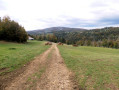
A lovely circular route in the vicinity of Les Rousses: starting from the Belvédère des Maquisards, the route climbs to Mont Fier via the valley of the same name, then returns via the Croix de la Teppe and the village of Prémanon. The short sections of difficulty are minimal overall.

Details

n°109222220
Creation:
Last update:
Last review:
–
  • Walking
    Activity: Walking
  • ↔
    Distance: 9.69 mi
  • ◔
    Average duration: 6h 00 
  • ▲
    Difficulty: Moderate

  • ⚐
    Back to start: Yes
  • ↗
    Ascent: + 1,778 ft
  • ↘
    Descent: - 1,772 ft

  • ▲
    Highest point: 4,196 ft
  • ▼
    Lowest point: 2,785 ft

Photos

Description of the walk

Start from the Belvédère des Maquisards car park (RD25 road from Prémanon to Morez).

(S/E) After perhaps taking a quick look at the Belvédère des Maquisards, cross the road carefully and follow the path towards “Sur le Belvédère”. Quite soon, continue along the path to the right.

(1) Carry on straight ahead towards Prémanon.

(2) Turn right onto the path towards the Chemin des Arcets. After a short descent, you’ll reach a junction; follow the path to the left (the path to the right leads to the road a short distance away). You’ll soon come to a meadow. Continue down the slope.

(3) Turn left onto the road, which goes downhill and then uphill after you’ve crossed a bridge.

(4) At the junction, go straight on along the path towards “Sous les Pellas” and “de Prémanon”.

(5) Carry on straight ahead at the hamlet of Les Crottes and, after crossing the meadow, continue uphill through the woodland. You’ll come to a road.

(6) Follow this road to the right until you reach the nearby buildings. Turn left onto a path leading up the Combe du Mont Fier, then further up, keep right at a junction.

(7) You’ll reach another junction a little further on. Carry on straight towards Mont Fier, avoiding the other paths (follow the yellow markings).

(8) You’ll reach the Mont Fier viewpoint, offering lovely views towards Les Rousses and La Dôle. Retrace your steps back to the junction.

(7) Turn right towards “Longchaumois”. Further down, turn left at a clearly signposted junction.

(9) Quite soon after, turn left at another junction at a place called Les Vieux Bois.

(10) A little further on, turn right onto a footpath, then carry on straight ahead at the junction with a track.

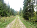
(11) Join a forest track and carry on straight ahead until you reach the hamlet of La Croix de la Teppe.

(12) At this point, numerous paths cross; take the first one on the left towards Prémanon. After a short descent, follow a road to the left and enter the village of Prémanon.

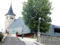
(13) When you reach the Musée de l’Espace Polaire, carry on straight ahead and take the second street on the left leading to the church and the town hall. Quite soon, turn right onto Rue du Pont Perroud, then continue along a footpath for a short while until you reach a junction with a road, which you should follow to the left.

(14) Continue along the road, taking care to watch out for any passing vehicles. Further on, join the RD25 road and carry on straight ahead along the track.

(2) Turn right and follow the route back in the opposite direction to the starting point (S/E).

Waypoints

  1. S/E : mi 0 - alt. 3,100 ft - Car park - Belvédère des Maquisards (Prémanon)
  2. 1 : mi 0.2 - alt. 3,179 ft - At the Belvédère
  3. 2 : mi 0.46 - alt. 3,258 ft - Junction of the circular loop
  4. 3 : mi 0.86 - alt. 2,828 ft - Chemin des Arcets
  5. 4 : mi 1.37 - alt. 2,877 ft - Chemin des Crottes
  6. 5 : mi 1.74 - alt. 3,130 ft - Les Crottes
  7. 6 : mi 2.36 - alt. 3,550 ft - Road junction
  8. 7 : mi 3.54 - alt. 4,114 ft - Combe du Mont Fier
  9. 8 : mi 4.09 - alt. 4,173 ft - Mont Fier
  10. 9 : mi 5.22 - alt. 3,927 ft - Les Vieux Bois
  11. 10 : mi 5.53 - alt. 4,098 ft - Bayard’s Path of Life
  12. 11 : mi 5.9 - alt. 4,167 ft - Forest track junction
  13. 12 : mi 6.36 - alt. 4,150 ft - The Teppe Cross
  14. 13 : mi 7.72 - alt. 3,652 ft - Prémanon - Espaces des Mondes Polaires
  15. 14 : mi 8.7 - alt. 3,333 ft - On the Goulet
  16. S/E : mi 9.69 - alt. 3,104 ft - Car park - Belvédère des Maquisards (Prémanon)

Notes

The starting point can be viewed on Google Maps.

Good walking boots and walking poles are recommended.

Please take your rubbish away with you – nature cannot break it down.

The walk takes place in wooded areas where access may be restricted due to forestry work.

Below is a difficulty rating by section (a route is not uniform):
- Green: fairly easy walking with no significant elevation gain or difficulty.
- Blue: steeper slopes and/or greater elevation changes on a well-marked route.
- Orange: routes presenting some technical difficulties and/or poor route conditions (markings or visibility of the path).

The route is generally straightforward with minimal difficulties. Additionally:

From (S/E) to (2): Green difficulty
Section marked in yellow + signposts.

From (2) to (3): Blue difficulty
Sector marked in yellow + signposts, with the exception of the final section leading to the Chemin des Arcets.

From (3) to (4): Green difficulty
Section marked in yellow + signposts.

From (4) to (6): Blue difficulty
Route marked in yellow + signposts.

From (6) to (8) – Blue difficulty
A short stretch of road is followed by a footpath, where the main challenge is the higher density of junctions (the markings on site make it easy to find your way).
Sector marked in yellow + signposts.

From (7) to (10) – Green difficulty
Sector marked in yellow + signposts. Please note: at point (10), there are no markings directing you to the left on this route.

From (10) to (11): Blue difficulty
Section marked in yellow.

From (11) to (12): Green difficulty
Sector marked in yellow + signposts.

From (12) to (13) – Blue difficulty
The route follows a gently sloping path.
GR® de Pays section with discreet yellow and red markings + signposts.

From (13) to (14) – Blue difficulty
Section marked in yellow.

From (14) to (2) – Green difficulty
Sector marked in yellow.

From (14) to (S/E) – Blue difficulty
Sector marked in yellow.

This route passes through a protected area, which may be subject to special regulations:

Worth a visit

  • Polar Regions Museum in Prémanon: to find out more, visit the official website by clicking here.
  • Fort des Rousses: this is a military fortification built during the Second Empire. To find out more, read the Wikipedia article.

Always be cautious and plan ahead when you're outdoors. Visorando and the author of this route cannot be held responsible for any accidents occurring on this route.

The GR® and PR® markings are the intellectual property of the Fédération Française de Randonnée Pédestre.

Other walks in the area

For more walks, use our search engine .

The GPS track and description are the property of this route's author. Please do not copy them without permission.