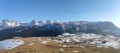
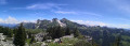
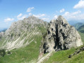
Le Môle from Marignier

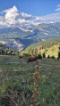
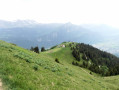
Like a lighthouse, the Mont du Môle, standing at 1,863 metres, towers over the Arve and Giffre valleys. I suggest climbing it from Marignier, which involves a considerable elevation gain. The outward leg follows the Chemin de l’Eponnet, and the return route goes via Les Granges. On the upper part of the route, there are numerous vantage points to enjoy.

Details

22210005
Creation:
Last update:
Last review:
  • Walking
    Activity: Walking
  • ↔
    Distance: 8.05 mi
  • ◔
    Average duration: 8h 00 
  • ▲
    Difficulty: Very difficult

  • ⚐
    Back to start: Yes
  • ↗
    Ascent: + 4,911 ft
  • ↘
    Descent: - 4,902 ft

  • ▲
    Highest point: 6,106 ft
  • ▼
    Lowest point: 1,604 ft

Photos

Description of the walk

Update by the author on 12/08/2026: a note has been added to the ‘Practical Information’ section recommending that the walk be undertaken in the direction indicated.

The walk starts in Marignier from Impasse des Perrières. A few parking spaces are available (you can also find some behind the church or near the library).

(S/E) Head towards La Möle and, quite soon, turn right onto a wide path.

(1) At the first junction, carry on straight ahead. When you reach a cleared area, continue straight ahead and uphill (no visible signposting). A little further up, turn right at a fork, following the markings (yellow arrow). You’ll reach the Pecheux junction.

(2) Carry on straight ahead, south-west, towards L’Éponnet along a gently sloping path. After a short while, ignore a path on the left.

(3) The path runs above a few houses. Reach the Éponnet reservoir: carry on straight ahead towards Le Martinet along a small tarmac road. Not far on, take a path on the right (no signpost). After a short, steep stretch over scree, the walk is quite pleasant, with no excessive gradient and a few views. A little further up, at around 1,100 m, the gradient steepens along a route with numerous fairly short hairpin bends.

Suddenly, the path levels out almost completely. You’ll reach a wide, open spot offering a lovely view (there’s a bench here).

(4) Continue to the left, due north, following the ascent, through a less wooded area along a path that is more like a narrow track on a somewhat steep slope. A little further up, you’ll reach a wide, open meadow where the Rionffer ridge is clearly visible.

(5) The trail suddenly disappears. You should then head straight up a fairly steep grassy ridge for a vertical climb of about 60 metres (at this point, be quite careful and avoid going too far to the right as there is a ravine). See below for further details.
Once you reach the ridge, follow a clearly visible path to the left and head for a small pass at elevation 1587.

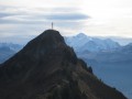
(6) Continue straight on towards the summit of Le Môle: the route follows the ridge along a wide path, with a few steep sections in places. You’ll reach the Croix du Môle.

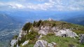
(7) Carry on straight ahead. You’ll soon reach the summit of Le Môle (where there’s a bench).

(8) Carry on straight ahead along the path, which initially winds its way up some steep slopes over grassy ground. You will then join the main path.

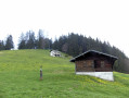
(9) Carry on almost straight ahead, then turn left at the next fork: the Petit Môle is clearly visible, with chalets in the area (several routes are possible in this sector). You’ll reach the small pass near the Petit Môle, which takes about 5 minutes to reach.

(10) Turn left below a chalet and continue along a wide path (recently upgraded) that follows a gentle gradient up to the 1587-metre mark, at the crossroads you passed on the way out.

(6) Carry on straight ahead towards Marignier (via Les Granges). After a long descent, the path then continues for a short while with no significant change in elevation.
You’ll reach a clearly marked pass (with chalets) at a place called Les Granges.

(11) Carry on almost straight ahead towards Marignier, across the vast meadow along a gently descending path. Enter the forest and, not long after, the nature of the path changes abruptly, plunging to the right over some fairly steep slopes for quite a while (take care).
Reach the Pecheux junction, which you passed on the way out.

(2) Continue to the left towards Marignier, taking the opposite route to the one you took on the way there (S/E).

Waypoints

  1. S/E : mi 0 - alt. 1,604 ft - Marignier – Perrières
  2. 1 : mi 0.06 - alt. 1,673 ft - On to Perrières
  3. 2 : mi 0.93 - alt. 2,766 ft - Le Pecheux – Junction of the lower circular loop
  4. 3 : mi 1.65 - alt. 2,585 ft - L’Éponnet (reservoir)
  5. 4 : mi 2.68 - alt. 4,488 ft - Viewpoint
  6. 5 : mi 2.89 - alt. 5,023 ft - Rionffer
  7. 6 : mi 3.26 - alt. 5,197 ft - Junction of the upper circular loop
  8. 7 : mi 3.77 - alt. 6,096 ft - The Môle Cross
  9. 8 : mi 3.94 - alt. 6,086 ft - Le Môle (1863m)l
  10. 9 : mi 4.07 - alt. 5,850 ft - Below Le Môle
  11. 10 : mi 4.88 - alt. 5,033 ft - La Lardère
  12. 11 : mi 6.12 - alt. 4,600 ft - Les Granges
  13. S/E : mi 8.06 - alt. 1,604 ft - Marignier – Perrières

Notes

The starting point can be viewed on Google Maps: click here

Good walking boots and walking poles are recommended.

Please note: there are some challenging sections on a short stretch, just before the Rionffer ridge.

The route is best tackled in the direction indicated and when the ground is dry, particularly in the Rionffer area:

  • between points (4) and (5): the path is visible but steep,
  • between point (5) and the ridge: a short off-trail section on a very steep slope through grassy terrain, best tackled when ascending.

Be aware of the presence of sheepdogs guarding the flocks from June to September in the Alpage du Môle (between points (5) and (6).

Nature struggles to break down your rubbish. Please take it away with you!

The area around the summit of Le Môle is quite busy.

From (S/E) to (3): blue difficulty.
The trail is in fairly good condition
Marked with yellow arrows + signposts (except at the fork in the cleared area)

From (3) to (4), blue difficulty.
The trail is generally in good condition. The route is less clearly defined over a short section through scree.
There are no markings or signposts.

From (4) to (6): red difficulty
The route initially follows a path, then a narrow track winding up a somewhat steep grassy slope.
The difficulty arises when approaching the ridge line, where no path or track is visible (contrary to what the maps suggest): you should therefore climb as best you can through grassy terrain with fairly steep slopes, keeping slightly to the left
Once the ridge line is reached, the route follows a path that presents no difficulty.
No visible markings.

From (6) to (8): blue difficulty.
The ascent to the summit follows a wide path with a few steep sections.
Signposts are present.

From (8) to (10): blue difficulty.
You’ll initially encounter a short, steep section (it’s possible to avoid this by retracing your steps and turning right at thefirst fork). After a steep descent, the route becomes gentler. The final few metres follow a more direct slope to La Lardère (other alternative routes are also possible in this area).
Marked with yellow arrows and signposts.

From (10) to (6) – green difficulty
The route is fairly easy on this section (note that it has recently been upgraded and widened).
Signs at the start but no markings along the route.

From (6) to (11): blue difficulty.
After a short descent, the route then turns to the right with a slight gradient.
Signposts are in place.

From (11) to (2): orange difficulty
Whilst the start of this section is straightforward, it becomes much more challenging further on, with steep slopes that are somewhat uneven in places (take care).
There are no markings, but finding your way is not a problem.

This route passes through multiple protected areas, which may be subject to special regulations:

Worth a visit

Le Môle: read more here

Daffodils are in abundance throughout April and May. You may pick as many as you can hold in one hand.

Reviews and comments

4.3 / 5
Based on 2 reviews

Reliability of the description
4.5 / 5
Ease of following the route
4 / 5
Route interest
4.5 / 5
zbh0170
zbh0170

Hello,

Thank you for your feedback.
It was indeed better to return via the same route after the point (6): depending on your fitness level, it might have been difficult or even tricky.
I’ve just added a note recommending that you follow the route in the direction indicated (it was an oversight on my part not to mention the reverse direction in some of my descriptions).
NB: I recommend visiting the Rionffer ridge, which is a very lovely area; however, it can be reached without any significant difficulty.

Kind regards

Machine-translated

User 29492624
• Edited:

Overall rating : 3.7 / 5

Date of your route : Aug 01, 2026
Reliability of the description : ★★★★☆ Good
Ease of following the route : ★★★☆☆ Average
Route interest : ★★★★☆ Good
Very busy route : Yes

An interesting walking route, but one that clearly deserves its ‘very difficult’ rating.

I walked the route in the opposite direction to that indicated. I couldn’t find the path leading to point 5. At that point, I encountered several obstacles: a barely visible path, an extremely steep slope, a lack of safety barriers, and fences marking the boundaries of the pastures and mountain pastures. So I didn’t venture any further and turned back to the previous junction. I’m not even sure I would have felt comfortable taking that route on the way up. I didn’t come across anyone on this part of the route.

Also worth noting: the first 800 metres of ascent are really steep (for me, this was the start of the hike as I did it in reverse). A high level of fitness is definitely recommended, as are walking poles!

Otherwise, the view from the summit of Le Môle is stunning. You’ll come across quite a few walkers on the section between roughly 1,300 and 1,800 metres in altitude, but very few people on the rest of the route.

Machine-translated

kaolak1
kaolak1
• Edited:

Thank you for your reply!
Actually, I do think it’s best to classify it as ‘very difficult’, even though, unfortunately, that might put some people off. However, having done several ‘difficult’ hikes myself, I found them more manageable than this one.

I’ll make a note of your suggested hike because, as it happens, I was just looking for one to do this weekend to make the most of the last days of summer. What’s more, I know far too little about the Jura region, so this is the perfect opportunity. Thanks, zbh0170!

Machine-translated

zbh0170
zbh0170

Hello,

Thank you for your feedback.

I can confirm that the climb between points (4) and (6) is indeed a bit tough (bearing in mind that you still have to reach the summit afterwards)... but the reward is well worth it if the sky is clear! (particularly the views of Mont Blanc, the Aravis range and the Bargy range). I have no qualms about increasing the difficulty.

NB: If you enjoy this sort of route, I’d encourage you to try one that’s similar in terms of difficulty (but quite different in terms of scenery), which I’ve also suggested on this site: this involves reaching the Crêt de la Goutte via Fort l’Ecluse and, if you wish, returning via Collonges to make it a bit more challenging (link in the practical information). In this area, I’m not suggesting the route to the Crêt de Chalam, which you’ve already done, as mentioned in the other post about this route. That’s a good one too!

Kind regards

Machine-translated

Netra
Netra ★

Hello kaolak1, thank you for your feedback.

You’re right: the elevation gain (> 1,400 m) and some of the author’s comments justify a ‘Very Difficult’ rating. The rating has just been updated accordingly.

Machine-translated

kaolak1
kaolak1
• Edited:

Overall rating : 5 / 5

Date of your route : Sep 02, 2024
Reliability of the description : ★★★★★ Very good
Ease of following the route : ★★★★★ Very good
Route interest : ★★★★★ Very good
Very busy route : No

It was a very demanding hike, but I really do recommend it as a way to explore a large part of the pier.
I really enjoyed this walk as it was quite challenging, but the circular route also offered some magnificent views.

I did it without walking poles but I regretted it because the section from 4 to 6 is extremely steep!

Perhaps it’s only classified as ‘difficult’ because it’s meant to take 8 hours with plenty of breaks, but for my part, I tried to maintain a steady pace and completed it in about 4 hours (not counting breaks), though from point 4 onwards I really struggled. That’s why I found it “very difficult”.

Be careful, because between sections 5 and 6 there’s a mountain pasture and a flock of sheep guarded by dogs that bark in a circular pattern if you get too close – even though it’s the hiking trail! So it’s best to keep your distance in the grass, even if they’re just protecting their flock.

In any case, thanks for this route – it’s really brilliant!

Machine-translated

Other walks in the area

For more walks, use our search engine .

The GPS track and description are the property of this route's author. Please do not copy them without permission.