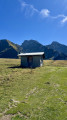
Country:

 City:


Access via the D12 leading from Bonneville to Le Grand Bornand. The route starts at the end of the Route de Domptaz, at a place called Chez Bernard. Parking here is limited to two vehicles, just past the last building on the left. If no spaces are available, you can park further up, either at the side of the forest track, where there are a few spaces (please note that the track is rather stony), or at its end at (15), where there are plenty of options. A little further down the track, parking is not very straightforward.
(S/E) Take the forest road uphill until you reach a junction at a hairpin bend.
(1) At the junction (signpost), turn sharply right towards Solaison. After a short climb, the route continues at roughly the same altitude, heading south, for a considerable distance (around 1.7 km). After a left-hand bend, look out for a forest track branching off to the left at the next bend.
(2) Take this forest track, which is quite steep. Shortly afterwards, cross a path and continue the climb south-eastwards. Take a sharp left-hand bend and head north-east up the slope until you reach a junction.
(3) Carry on straight ahead, due north, for a short while, along a path with no significant gradient (which was quite overgrown with grass when I was there). As you approach the cliffs straight ahead, whilst the path is ascending, look out for a footpath (marked with a Blue Arrow) right at the far right.
(4) Take this path; the start of the section is relatively straightforward, but the first difficulties arise quite quickly, so great caution is required. Follow a narrow track along the edge of ravines and up steep slopes, where you’ll need to use your hands at times. Two sections, equipped with a rope, help you make your way up, then the ascent continues to the right of a long gully to reach a grassy ridge. See the ‘Practical Information’ section for further details.
(5) Continue to the right, following the ridge, and, after a few metres, pass a signpost pointing towards Solaison (on the left, on a tree). Carry on straight ahead along a path through a wooded area, where the going is much easier than before. After joining another path on the left, walk alongside a pasture before reaching it shortly afterwards. From there, climb straight ahead (the slope is not too steep), veering slightly to the right, then enter a short wooded section. You’ll reach a large open area which is a pasture. Continue straight ahead towards a watering trough, then to a second one just after it, marked as a spring on the IGN map.
(6) Carry on straight ahead, following a moderately visible path, keeping slightly to the right of the grassy area. Further up, join a track; follow it straight ahead along a fairly obvious route. Shortly afterwards, continue along a path leading to the Col de Solaison.
(7) At the pass, head right towards the Solaison car park, about a 5-minute walk away.
(8) Walk up the car park on the left, then, at the roundabout, turn left towards the Pointe d’Andey. Pass a path on your right, then, as you come out of the wide right-hand bend, keep right. Keep left onto the path that curves widely to the left to reach a junction marked by a signpost (towards Pointe d’Andey).
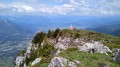
(9) Turn right; the slope is quite steep in places, but presents no technical difficulty. After just over 1 km, you’ll reach a secondary summit of the Pointe d’Andey, marked by a cross and a statue of the Virgin Mary.
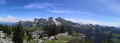
Enjoy stunning panoramic views of the Rochers de Leschaux, Lake Geneva, the Bargy Range and the Arve Valley all the way to Mont Blanc. Caution: the cliffs are not far away.
(10) Continue towards the nearby summit. Follow the well-marked path below and, after a few minutes, you’ll reach the Col d’Andey.
(11) Take the path on the right; the descent becomes quite steep fairly quickly. Follow it north-west for over 1 km; whilst there are no major technical difficulties, you should remain reasonably vigilant. You’ll reach an unnamed pass.
(12) From the pass, the route is fairly easy. Ignore a junction on the right (towards Bonneville); the ridge walk, which is gentle at first, then becomes quite steep as it leads to a more open area.
(13) Pass a chalet and carry on straight ahead until you reach the edge of a lovely viewpoint (La Torche), then turn left. A little further on, after a few hundred metres, you’ll come across a large chalet and some facilities.
(14) Carry on along the path, via a few hairpin bends and some fairly steep slopes in places. After about 2 km, you’ll reach, much lower down, a relatively large open area at the end of a forest track (a potential place to park).
(15) Carry on straight ahead until you reach a junction you passed at the start of the walk.
(1) Carry on straight ahead along the forest track, in the opposite direction to the outward journey, and return to the starting point (S/E).

 Visorando Member
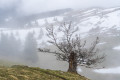
 Difficult

 Moderate