


kerheol

 Visorando Member
 Premium user
 Sign up:
Published route(s)
 Tro Ménez Bré
 6.46 mi
 +574 ft
 -600 ft
 3h 30
3h 30
 Moderate
 Departure from Pédernec (Côtes-d'Armor)
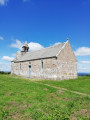
This walk offers nothing less than the chance to climb the highest point in the Côtes d’Armor and enjoy a completely unobstructed 360° view. On a clear day, it’s even said that you can see the sea!
From Paimpol to Frynaudour
 8.70 mi
+630 ft
-551 ft
4h 35
Moderate
Departure from Paimpol (Côtes-d'Armor)
8.70 mi
+630 ft
-551 ft
4h 35
Moderate
Departure from Paimpol (Côtes-d'Armor)
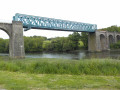
A walk between the sea and the forest offering a wide variety of geographical and historical points of interest: a route along the Trieux beach, a stop at Traounez Manor (a key location in the Seznec affair) and, to finish, the blue Frynaudour viaduct.
A circular walk, returning by TER.
From Camarel to the Château de la Roche Jagu
 6.21 mi
+541 ft
-351 ft
3h 20
Moderate
Departure from Pleudaniel (Côtes-d'Armor)
6.21 mi
+541 ft
-351 ft
3h 20
Moderate
Departure from Pleudaniel (Côtes-d'Armor)
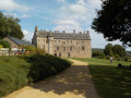
A unique walk set mainly within the commune of Pleudaniel, offering scenic views along the left bank of the Trieux and culminating in the grounds of the Château de la Roche Jagu.
It requires two cars: one parked in the château car park and the other at the starting point in a small car park at the far end of Anse de Camarel.
This walk is best undertaken outside the rainy months due to muddy sections.
Circular Trieux starting from Guingamp
 5.78 mi
+417 ft
-387 ft
3h 00
5.78 mi
+417 ft
-387 ft
3h 00
 Easy
Departure from Guingamp (Côtes-d'Armor)
Easy
Departure from Guingamp (Côtes-d'Armor)
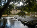
This walk starts in the town of Guingamp and leads to the Kerhé mill, which has now been converted into a campsite. Most of the route is covered by dirt tracks situated equally between the parishes of Plouisy and Pabu.
This route includes sections that are very muddy in winter and spring.
Best undertaken between May and October to enjoy it to the full.
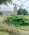
Country walk in Goudelin
 5.59 mi
+240 ft
-249 ft
2h 45
Easy
Departure from Goudelin (Côtes-d'Armor)
5.59 mi
+240 ft
-249 ft
2h 45
Easy
Departure from Goudelin (Côtes-d'Armor)
Starting from the Notre-Dame-de-l'Isle Chapel, walk through the countryside towards Leff.
A relatively easy walk which, as you pass through woodland and along rivers and streams, will allow you to discover the typical Breton countryside.
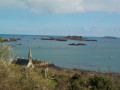
From Paimpol to Loguivy de la Mer via Pointe de l'Arcouest
 8.08 mi
+715 ft
-715 ft
4h 20
Moderate
Departure from Ploubazlanec (Côtes-d'Armor)
8.08 mi
+715 ft
-715 ft
4h 20
Moderate
Departure from Ploubazlanec (Côtes-d'Armor)
This hike offers fabulous scenery from start to finish, with some particularly remarkable viewpoints.
Requires two vehicles, one in the small car park at the start of Kerpalud, the other at the port of Loguivy de la Mer. Otherwise, return via country roads and an additional 4 km.
The path is accessible in all seasons but requires a good level of fitness due to the five climbs involved.
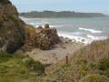
From Saint Samson to Bréhec
 5.42 mi
+574 ft
-554 ft
3h 00
Moderate
Departure from Plouha (Côtes-d'Armor)
5.42 mi
+574 ft
-554 ft
3h 00
Moderate
Departure from Plouha (Côtes-d'Armor)
Starting from the Chapelle Saint-Samson, take the famous Shelburn network aviators’ path to reach Brehec Beach.
Between sea and countryside in Trégastel
 7.89 mi
+262 ft
-269 ft
3h 50
Moderate
Departure from Trégastel (Côtes-d'Armor)
7.89 mi
+262 ft
-269 ft
3h 50
Moderate
Departure from Trégastel (Côtes-d'Armor)
A walk in one of the most beautiful parishes of the Côtes d’Armor. Between two stretches along the shore, after passing two megalithic monuments, you will explore a natural wonder: the Traouierio Valley, which, following a stream through a pile of rocks, will reveal all its secrets.
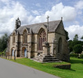
Circular from Saint-Jacques Chapel via Lanleff Temple
 5.10 mi
+476 ft
-479 ft
2h 45
Easy
Departure from Tréméven (Côtes-d'Armor)
5.10 mi
+476 ft
-479 ft
2h 45
Easy
Departure from Tréméven (Côtes-d'Armor)
This rural route in Goëlo, along a hilly route, half of which is in the woods, offers the chance to discover elements of heritage of great historical interest, such as the Saint-Jacques Chapel and the Lanleff Temple.Please note that from Crec'h Lanleff onwards, the route is not signposted, so it is essential to use the Visorando app with its GPS pin.
This walk is best done between May and October as the route can be very muddy.
From Beauport Abbey to the village of Kerfot through the woods
 5.41 mi
+354 ft
-341 ft
2h 50
Easy
Departure from Paimpol (Côtes-d'Armor)
5.41 mi
+354 ft
-341 ft
2h 50
Easy
Departure from Paimpol (Côtes-d'Armor)
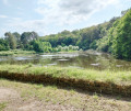
A walk along the Ruisseau du Correc that will take you from Beauport Abbey to the village of Kerfot.
You will walk almost exclusively through woodland on wide paths.
Best undertaken between May and October, as some paths may be muddy in winter and early spring.
From Beauport Abbey to Pointe de Guilben
 5.68 mi
+148 ft
-144 ft
2h 45
Easy
Departure from Paimpol (Côtes-d'Armor)
5.68 mi
+148 ft
-144 ft
2h 45
Easy
Departure from Paimpol (Côtes-d'Armor)
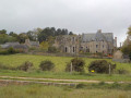
This is an easy hike. Running along the shore, it offers breathtaking views of Beauport and Paimpol bays.
From Traounez to Frynaudour in the Bois de Penhoat-Lancerf
 6.21 mi
+518 ft
-525 ft
3h 20
Moderate
Departure from Plourivo (Côtes-d'Armor)
6.21 mi
+518 ft
-525 ft
3h 20
Moderate
Departure from Plourivo (Côtes-d'Armor)
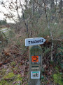
A relatively easy hike, but with some elevation changes. Half of the route runs along the Trieux River, with higher sections offering views of Château de la Roche Jagu and even the Lézardrieux bridge in the distance.
Between sea and countryside in Larmor-Pleubian
 6.22 mi
+171 ft
-144 ft
3h 00
Easy
Departure from Pleubian (Côtes-d'Armor)
6.22 mi
+171 ft
-144 ft
3h 00
Easy
Departure from Pleubian (Côtes-d'Armor)
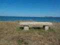
An easy circular walk, much of which follows the beach.
This walk is all the more rewarding at high tide, as the sea recedes very far out at this point along the coast.
In the hills of Calblanque Park
 5.41 mi
+574 ft
-581 ft
3h 00
Moderate
Departure from Cartagena (Region of Murcia)
5.41 mi
+574 ft
-581 ft
3h 00
Moderate
Departure from Cartagena (Region of Murcia)
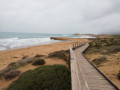
A walk in a nature reserve near Cartagena in southern Spain.
Between land and river at Quemper-Guézennec
 6.84 mi
+492 ft
-492 ft
3h 35
Moderate
Departure from Quemper-Guézennec (Côtes-d'Armor)
6.84 mi
+492 ft
-492 ft
3h 35
Moderate
Departure from Quemper-Guézennec (Côtes-d'Armor)
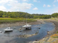
Starting from the heights of the village of Qemper-Guézennec, a long descent through the fields will take you to the Trieux.
Then, from the port of Goas Vilinic, following the towpath for almost two kilometres, you will reach the confluence of the Leff and the Trieux, spanned by a blue viaduct.
Sea and countryside in Plounez
 6.21 mi
+354 ft
-361 ft
3h 10
Moderate
Departure from Paimpol (Côtes-d'Armor)
6.21 mi
+354 ft
-361 ft
3h 10
Moderate
Departure from Paimpol (Côtes-d'Armor)
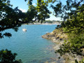
After leaving the town of Paimpol, you’ll head down through the fields to the mouth of the Trieux, opposite the port of Lézardrieux. A walk along the edge of what is effectively a lake at high tide awaits you at the Ledano. Finally, a long climb through the Plounez countryside will take you back to Paimpol. This route combines the agricultural and coastal landscapes typical of this corner of the Goëlo.
From Lédano to Lancerf, following the Trieux
 4.97 mi
+144 ft
-148 ft
2h 25
Easy
Departure from Paimpol (Côtes-d'Armor)
4.97 mi
+144 ft
-148 ft
2h 25
Easy
Departure from Paimpol (Côtes-d'Armor)
An easy walk along the water’s edge through a landscape typical of Goëlo. Half the route follows the banks of the Ria du Trieux, which is flooded by the sea with the tides.In the second part, you’ll walk through fields of vegetables (artichokes, cauliflowers, potatoes...) – crops that are emblematic of this rich agricultural region.Please note that parts of this route may be impassable during high tides.
From Kermaria to Bréhec
 4.41 mi
+82 ft
-282 ft
2h 05
Easy
Departure from Plouha (Côtes-d'Armor)
4.41 mi
+82 ft
-282 ft
2h 05
Easy
Departure from Plouha (Côtes-d'Armor)
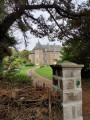
A short, easy walk that takes you through the Goelo countryside and gently down to Bréhec beach.The only requirement is to have two cars. Best undertaken with friends.
From the village of Plounez to the Trieux
 4.97 mi
+249 ft
-253 ft
2h 30
Easy
Departure from Paimpol (Côtes-d'Armor)
4.97 mi
+249 ft
-253 ft
2h 30
Easy
Departure from Paimpol (Côtes-d'Armor)
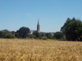
This typical Goëlo landscape perfectly blends land and sea. From the heights of its rich agricultural land (cauliflowers, artichokes, potatoes, etc.), you’ll enjoy a sweeping view of the Trieux estuary with the port and the Lézardrieux bridge, then you’ll walk close to the water between the (6) and the (7).
The Trieux and its tributary, the Leff: between sea and countryside
 5.50 mi
+459 ft
-466 ft
2h 55
Moderate
Departure from Quemper-Guézennec (Côtes-d'Armor)
5.50 mi
+459 ft
-466 ft
2h 55
Moderate
Departure from Quemper-Guézennec (Côtes-d'Armor)
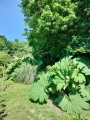
This hike has three parts, each offering a different landscape. First, there is a long walk along the Trieux. This leads to the remarkable site of Frynaudour (confluence, blue viaduct, wreck).
The trail then follows the banks of the Leff with a few slopes. Finally, a walk along sunken paths and small roads will take you to the Trieux.
Tro-Brehat off the beaten track
 9.51 mi
+486 ft
-463 ft
4h 50
Moderate
Departure from Île-de-Bréhat (Côtes-d'Armor)
9.51 mi
+486 ft
-463 ft
4h 50
Moderate
Departure from Île-de-Bréhat (Côtes-d'Armor)
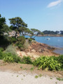
If you take this hike, even during the tourist season, you will encounter few people as it follows the island's shoreline as closely as possible.
However, you will see all the island's must-see sights: Guerzido Beach, Paon Lighthouse, Saint-Michel Chapel, Birlot Mill, the Fort...
This hike should be done with the help of a GPS or the Visorando app, which is the price you pay for getting off the beaten track.
If necessary, there will always be a helpful sign to guide you back to the harbour.
From Plourhan to the sea
 7.02 mi
+371 ft
-371 ft
3h 35
Moderate
Departure from Plourhan (Côtes-d'Armor)
7.02 mi
+371 ft
-371 ft
3h 35
Moderate
Departure from Plourhan (Côtes-d'Armor)
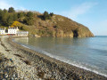
Apart from a few unavoidable sections on tarmac roads, most of the walk follows farm tracks, sometimes through woodland. The reward for this approach route is the walk along Palus Beach, followed by theGR®34 trail.
A somewhat steep route offering views of the cliffs at Plouha and the Pointe de Bec de Vir.
The Trieux Mills, starting from Pontrieux
 5.59 mi
+404 ft
-387 ft
2h 55
Easy
Departure from Pontrieux (Côtes-d'Armor)
5.59 mi
+404 ft
-387 ft
2h 55
Easy
Departure from Pontrieux (Côtes-d'Armor)
Pontrieux, a charming little town, serves as the starting point for this idyllic walk along the Trieux upstream.
There used to be twenty-five mills between Pontrieux and Guingamp. Many of them still remain. Let’s set off to explore this river.
From Bréhec to Minard
 5.15 mi
+243 ft
-240 ft
2h 35
Moderate
Departure from Plouézec (Côtes-d'Armor)
5.15 mi
+243 ft
-240 ft
2h 35
Moderate
Departure from Plouézec (Côtes-d'Armor)
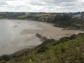
From the coastal road overlooking Bréhec harbour to Pointe de Minard, this route offers breathtaking views of Saint-Brieuc Bay throughout. Once you reach Pointe de Minard, you’ll see Paimpol Bay and the Île de Bréhat. The return journey is along the road with virtually no change in elevation.
From Moulin de Craca to Beauport Abbey
 4.97 mi
+407 ft
-417 ft
2h 40
Moderate
Departure from Plouézec (Côtes-d'Armor)
4.97 mi
+407 ft
-417 ft
2h 40
Moderate
Departure from Plouézec (Côtes-d'Armor)
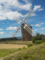
This section ofthe GR®34connects the Moulin de Craca on the heights of Plouézec to Beauport Abbey.
To return to your starting point, take the road back, which offers views of Paimpol Bay and Bréhat Island. Once you have climbed back up to the plateau and passed Sainte-Barbe Chapel, follow the small, flat roads back to the mill.
Grand Tour of Bréhec
 5.75 mi
+512 ft
-502 ft
3h 05
Moderate
Departure from Plouézec (Côtes-d'Armor)
5.75 mi
+512 ft
-502 ft
3h 05
Moderate
Departure from Plouézec (Côtes-d'Armor)
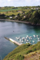
From the famous beach at Bréhec, climb up the cliff and follow the route of the narrow-gauge railway to reach the picturesque village of Lanloup.
You’ll then follow a route through the countryside back to Bréhec.
Right at the start of the walk, you’ll come across Anse de Bréhec, a wide opening onto the sea between Pointe de la Tour and the cliffs of Plouézec.
The final stretch is the Bréhec coastal path facing Pointe de la Tour, with the whole beach and bay in full view.
Short Tour of Bréhec
 3.38 mi
+262 ft
-262 ft
1h 45
Easy
Departure from Plouézec (Côtes-d'Armor)
3.38 mi
+262 ft
-262 ft
1h 45
Easy
Departure from Plouézec (Côtes-d'Armor)
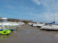
This walk, which is of modest length and difficulty, will allow you to appreciate the richness of the seascape and the hinterland of the well-known site of Bréhec.
After passing a cliff overlooking the beach, you’ll reach the picturesque village of Lanloup, and then a long, gently sloping walk will take you back to the starting point.
From Mormoiron to the Notre-Dame des Anges chapel
 5.35 mi
+945 ft
-965 ft
3h 15
Moderate
Departure from Mormoiron (Vaucluse)
5.35 mi
+945 ft
-965 ft
3h 15
Moderate
Departure from Mormoiron (Vaucluse)
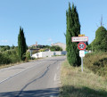
Climbing the hill of Notre-Dame des Anges from the typical village of Mormoiron offers a magnificent view of the Giant of Provence (Mont Ventoux). The varied route includes an ascent that resembles a mid-range mountain. The asphalt descent on the return journey takes you back to the village of Mormoiron, facing the Ventoux, with all the villages at the foot of the Ventoux in view: Mormoiron, Flassan, Bedoin, Caromb, Villes sur Auzon, etc.
In the footsteps of the Shelburn Network in Plouha
 4.35 mi
+591 ft
-604 ft
2h 30
Moderate
Departure from Plouha (Côtes-d'Armor)
4.35 mi
+591 ft
-604 ft
2h 30
Moderate
Departure from Plouha (Côtes-d'Armor)
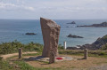
This short hike follows the coastal path (GR®34) and allows you to discover the incredible story of the Shelburn Network. This organisation, rooted in the Plouhatine community, enabled 144 people to escape to England in 1944. You will follow in the footsteps of the airmen who travelled these paths in the dark nights of the occupation.
Walk through the heart of Trégor between Pouldouran and Troguéry
 4.91 mi
+171 ft
-154 ft
2h 25
Easy
Departure from Pouldouran (Côtes-d'Armor)
4.91 mi
+171 ft
-154 ft
2h 25
Easy
Departure from Pouldouran (Côtes-d'Armor)
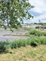
An easy walk offering typical landscapes between the river and the countryside, as well as numerous examples of Trégor’s heritage, including the famous flax-drying sheds, the cultivation of which brought prosperity to this corner of Trégor.
The quarries of Bédoin
 3.73 mi
+272 ft
-249 ft
1h 55
Easy
Departure from Bédoin (Vaucluse)
3.73 mi
+272 ft
-249 ft
1h 55
Easy
Departure from Bédoin (Vaucluse)
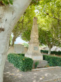
A short, easy hike starting from Bédoin. A long walk under the pine trees amid the old ochre quarries, revealing shades of red, orange and yellow.
Circular Pors Even in Ploubazlanec
 5.58 mi
+374 ft
-377 ft
2h 55
Moderate
Departure from Paimpol (Côtes-d'Armor)
5.58 mi
+374 ft
-377 ft
2h 55
Moderate
Departure from Paimpol (Côtes-d'Armor)
This hike is worth doing in any season, given the rich heritage you will encounter. It is even better in spring and summer when the coastline is particularly flowery (agapanthus, hydrangeas, etc.).
The Méaugon circular around Lac du Gouet
 4.44 mi
+364 ft
-387 ft
2h 20
Easy
Departure from La Méaugon (Côtes-d'Armor)
4.44 mi
+364 ft
-387 ft
2h 20
Easy
Departure from La Méaugon (Côtes-d'Armor)
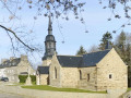
A walk starting from the small and charming village of La Méaugon, through the woods on wide paths accessible all year round. You will have a constant view of the Gouet reservoir with viewpoints offering multiple photo opportunities.
The Charcoal Burners’ Route in the Bois d’Avougour
 4.54 mi
+167 ft
-138 ft
2h 15
Easy
Departure from Saint-Péver (Côtes-d'Armor)
4.54 mi
+167 ft
-138 ft
2h 15
Easy
Departure from Saint-Péver (Côtes-d'Armor)
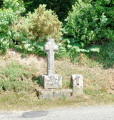
You won’t see any charcoal burners. However, as you enjoy this gentle walk, which can be done in any season, you’ll be able to imagine their lives in this forest of majestic trees. There’s no need to worry about getting lost – the route is clearly signposted.
From the Léguer to the heights of Servel in Lannion
 4.60 mi
+279 ft
-282 ft
2h 20
Easy
Departure from Lannion (Côtes-d'Armor)
4.60 mi
+279 ft
-282 ft
2h 20
Easy
Departure from Lannion (Côtes-d'Armor)
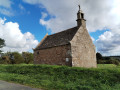
First, a long walk along the Léguer on the towpath, then you’ll reach the heights of Servel via a steep path. After walking along a quiet country lane, offering views of the valley and the town of Lannion, take a path down through the woodland to rejoin the towpath.
Saint-Samson to Lanloup circular
 4.04 mi
+381 ft
-374 ft
2h 10
Easy
Departure from Plouha (Côtes-d'Armor)
4.04 mi
+381 ft
-374 ft
2h 10
Easy
Departure from Plouha (Côtes-d'Armor)
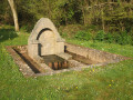
Discover Bréhec Bay from the top of the cliffs, descend to the Red Rocks beach, walk over red, yellow and green stones dating back 600 million years, then climb back up to the plateau to return to your car in Saint-Samson.
From the Belvédère to Crillon-le-Brave
 3.95 mi
+604 ft
-604 ft
2h 20
Easy
Departure from Crillon-le-Brave (Vaucluse)
3.95 mi
+604 ft
-604 ft
2h 20
Easy
Departure from Crillon-le-Brave (Vaucluse)
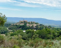
This hike takes you from the recently opened bar-restaurant "Le Belvédère" to the hilltop village of Crillon-le-Brave. While the first part is not particularly difficult, the return journey involves a long, sometimes quite steep climb along the Torrent de Pié Blanc. Only the descent to Crillon is marked with red and yellow signs. After that, don't hesitate to use a GPS or the Visorando app.
Circular of Palus via Pointe de Plouha
 5.46 mi
+545 ft
-535 ft
3h 00
Moderate
Departure from Plouha (Côtes-d'Armor)
5.46 mi
+545 ft
-535 ft
3h 00
Moderate
Departure from Plouha (Côtes-d'Armor)
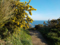
A hike that begins with a gentle climb on a tarmac road, allowing you to warm up before following the GR®34, which is more rugged. The last third of the hike offers breathtaking views of the sea as you pass by Pointe de Plouha (the highest cliff in Brittany).
Like any circular, it can also be done in the opposite direction, thus avoiding a descent down stairs that may be considered problematic. In this case, you will need to make a significant effort from the outset.
From the village of Lanmodez to the banks of the Trieux
 3.82 mi
+144 ft
-141 ft
1h 50
Easy
Departure from Lanmodez (Côtes-d'Armor)
3.82 mi
+144 ft
-141 ft
1h 50
Easy
Departure from Lanmodez (Côtes-d'Armor)
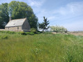
A walk that begins with a stroll through the typical Trégor countryside, continuing for 40% of the route along the banks of the Trieux ria, before returning to the village of Lanmodez. Much of the walk follows grassy paths between fields and along the shore.
The path is poorly signposted, so don’t hesitate to use your GPS.
A circular loop around the Combe de Canaud, starting from Flassan
 5.64 mi
+1,122 ft
-1,122 ft
3h 35
Moderate
Departure from Flassan (Vaucluse)
5.64 mi
+1,122 ft
-1,122 ft
3h 35
Moderate
Departure from Flassan (Vaucluse)
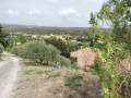
Explore the mysterious Combe de Canaud, starting from the village of Flassan. This walk offers magnificent views, as well as the chance to discover old sheepfolds (known as ‘jas’ in the Provençal language).