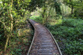
From the village of Ploumagoar to the Kerlosquer viaduct

A walk through the western part of this commune. Walking along quiet country lanes, you’ll reach the banks of the Trieux to discover a structure as unusual as it is spectacular: the viaduct of the former Guingamp–Saint-Nicolas-du-Pélem railway line.

Details

n°18665413
Creation:
Last update:
Last review:
  • Walking
    Activity: Walking
  • ↔
    Distance: 6.21 mi
  • ◔
    Average duration: 3h 10 
  • ▲
    Difficulty: Easy

  • ⚐
    Back to start: Yes
  • ↗
    Ascent: + 315 ft
  • ↘
    Descent: - 312 ft

  • ▲
    Highest point: 427 ft
  • ▼
    Lowest point: 269 ft
  • ⚐ Country: France
  • ⚐ City: Ploumagoar (22970)
  • ⚑
    Start/End: N 48.544781° / W 3.132132°
  • ❏
    IGN map(s): Ref. 0816SB
  • Hour-by-hour weather

Photos

Description of the walk

Park in the village square between the town hall and the church.

(S/E) On leaving the car park (Place du 8 Mai 1945), turn left onto Rue de Pors Pirien, Rue Vincent Auriol and Rue Roglazou for 700 m until you reach the junction with Impasse de Roglazou; take this and continue to the D767.

(1) Turn left and continue for 120 metres, then turn right onto Rue Théo Pin. Walk through the Runiou neighbourhood until you reach the edge of the woods.

(2) Turn left onto Rue des Ajoncs d’Or. After the last houses, continue along the road for 230 metres.

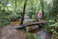
(3) At the junction of the road and the footpath, turn right onto the grassy path, follow it, cross the stream and carry on until you reach a junction.

(4) At the junction of the footpath and Route de Bel Air, turn right and, at the first crossroads, carry on straight ahead downhill to the next crossroads. Turn left towards Bois l’Abbé and head for Kerlidiguez.

(5) Walk through the village, then take the small road on the right at the sign for Kerlosquer. Follow this road, which has some steep ascents and descents, overlooking the River Trieux. At the first Fork in the road, keep left and begin the climb. At the first bend, you’ll find the start of the path, which follows the route of the old railway line leading to the Kerlosquer viaduct.

(6) Walk there and back (200 m one way) along this wide, clear path to reach the start of the viaduct
Access beyond a gate is strictly prohibited.

(7) Retrace your steps back to the road.

(6) Turn right and walk uphill through the hamlet of Kerlosquer. At the bend at the top of the hill, turn left onto the small tarmac road leading to Saint-Hernin and continue through the village.

(8) At the wash house, continue along Rue Joseph Derrien towards the D767.

(9) Cross the road known as Rue de l’Argoat with care and take Rue Lino Ventura opposite. Turn left onto Rue de Park Rouzes, walk past the cemetery and then the sports ground, and you’ll reach the village square (S/E).

Waypoints

  1. S/E : mi 0 - alt. 384 ft - Village square - Église Saint-Pierre (Ploumagoar)
  2. 1 : mi 0.58 - alt. 361 ft - Impasse de Roglazou x D767
  3. 2 : mi 0.87 - alt. 335 ft - Lower Runiou
  4. 3 : mi 1.2 - alt. 354 ft - Route des Ajoncs d’Or x Trail
  5. 4 : mi 1.67 - alt. 390 ft - Path x Route de Bel Air
  6. 5 : mi 3.19 - alt. 390 ft - The village of Kerlidiguez
  7. 6 : mi 3.89 - alt. 338 ft - Path on the right towards the Kerlosquer Viaduct
  8. 7 : mi 4.05 - alt. 318 ft - Viaduc de Kerlosquer
  9. 8 : mi 5.31 - alt. 390 ft - Saint-Hernin’s fountain and washhouse
  10. 9 : mi 5.64 - alt. 420 ft - Crossing the D767
  11. S/E : mi 6.21 - alt. 387 ft - Village square - Église Saint-Pierre (Ploumagoar)

Notes

This walk can be undertaken in all seasons, as the vast majority of the route is on tarmac.
Take extra care at the two crossings of the D767 (Guingamp–Corlay road), which is very busy.

The section that is likely to be very muddy in winter can be avoided between points 3 and 4 by going via Saint Hernin (point 8).

Worth a visit

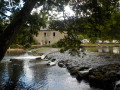
As well as a long stretch through the countryside on quiet country lanes, the main attraction of this easy walk is the chance to explore the Kerlosquer viaduct. This 17-metre-high, 133-metre-long curved structure enabled the narrow-gauge railway to cross the River Trieux; the Northern Coast Railway line operated from 1924 to 1938.

Important reminder: access to the viaduct deck beyond the gate is strictly prohibited

Reviews and comments

3.7 / 5
Based on 2 reviews

Reliability of the description
3.5 / 5
Ease of following the route
4.5 / 5
Route interest
3 / 5
ogel jean-jacques
ogel jean-jacques

I haven't done the route yet.

Machine-translated

MYLG
MYLG

Overall rating : 4.7 / 5

Date of your route : Jul 01, 2024
Reliability of the description : ★★★★☆ Good
Ease of following the route : ★★★★★ Very good
Route interest : ★★★★★ Very good
Very busy route : No

Explanations about the history of the Kerlosquer viaduct should be considered, and signposting along the route should be considered

Machine-translated

Owen
Owen

Overall rating : 2.7 / 5

Date of your route : Jun 06, 2022
Reliability of the description : ★★★☆☆ Average
Ease of following the route : ★★★★☆ Good
Route interest : ★☆☆☆☆ Very disappointing
Very busy route : No

A disappointing walk – mostly along the road, no signposting, the path to the viaduct was barely passable, and to top it all off, you can’t even see the viaduct – disappointing.

Machine-translated

Other walks in the area

For more walks, use our search engine .

The GPS track and description are the property of this route's author. Please do not copy them without permission.