Medium-length walk around Brehec

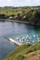
A gentle walk combining long stretches through woodland with a final section along the one-kilometre-long Brehec beach. This walk must be done at low tide; otherwise, you’ll miss the most beautiful part and will be forced to turn back.

Details

n°23991708
Creation:
Last update:
Last review:
  • Walking
    Activity: Walking
  • ↔
    Distance: 4.66 mi
  • ◔
    Average duration: 2h 30 
  • ▲
    Difficulty: Easy

  • ⚐
    Back to start: Yes
  • ↗
    Ascent: + 377 ft
  • ↘
    Descent: - 384 ft

  • ▲
    Highest point: 299 ft
  • ▼
    Lowest point: -3 ft
  • ⚐ Country: France
  • ⚐ City: Plouézec (22470)
  • ⚑
    Start/End: N 48.726967° / W 2.952174°
  • ❏
    IGN map(s): Ref. 0814OT, 0815SB, 0916OT
  • Hour-by-hour weather

Photos

Description of the walk

Park in the large car park by the beach.

(S/E) Turn left towards Lanloup and follow the pavement on the right for 100 m.

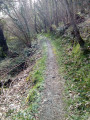
(1) Leave the tarmac and turn right into the woodland. Carry on, ignoring a path on the left, and at the next junction, turn left. Cross the stream over a wooden bridge. You’ll reach the end of the dirt track at a very old stone bridge known as the ‘Roman bridge’. An information board provides all the necessary details.

(2) Turn left onto the tarmac road and follow it for just under a hundred metres. Turn left onto a wide path, climbing between two embankments, known as the “Roman road”. Take the tarmac road, pass the gate of the Goaz Froment manor house and continue straight on until you reach a house on your right.

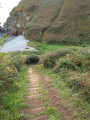
(3) In front of the house, opposite the “Kernordou” sign accompanied by a “path” sign, turn left onto a narrow, sunken path leading down to the bottom of the valley. Continue to the left until you reach the next junction.

(4) Turn right and cross the stream over the stone. You’ll immediately reach the Brehec/Lanloup road,
at the bottom of the village, and turn right onto the uphill street. Walk through the village of Lanloup, going round the church on the left.

(5) Turn left onto Rue de Saint-Roch and continue uphill.

(6) Before reaching the top of the hill, a sign on the right points to the path leading to the
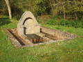
Golven. Follow it and, once you reach the end, admire the fully restored fountain and washhouse, situated about 150 metres away. Retrace your steps.

(6) Resume your walk by heading straight ahead between the houses. Continue along a wide farm track, between fields. Pass by the foot of the mobile phone mast and follow the road to the left. Turn right onto the Chemin de Kerjolis and head for the crossroads.
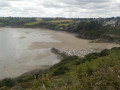
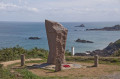
(7) Take the Chemin de Padel straight ahead, continuing along the farm track between the fields. As you walk down this farm track, you’ll enjoy a magnificent view of Brehec Bay. Follow the GR®34 signposts all the way down to where you reach the foreshore.

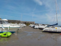
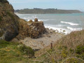
(8) From this access point, known as ‘les rochers rouges’, set off on a walk of about 1 km along the wet sand, with the little harbour of Brehec in view. Then walk back up the road to the car park (S/E).

Waypoints

  1. S/E : mi 0 - alt. 36 ft - Bréhec beach car park
  2. 1 : mi 0.2 - alt. 46 ft - Access to the woodland trail
  3. 2 : mi 1.05 - alt. 151 ft - Road junction
  4. 3 : mi 1.8 - alt. 269 ft - Junction of the road and the descending path
  5. 4 : mi 1.98 - alt. 138 ft - Kergolot Stream
  6. 5 : mi 2.2 - alt. 190 ft - Junction, turn left
  7. 6 : mi 2.52 - alt. 253 ft - Access to the Golven Fountain
  8. 7 : mi 3.17 - alt. 249 ft - Crossroads with Chemin de Padel
  9. 8 : mi 3.78 - alt. 20 ft - The Red Rocks
  10. S/E : mi 4.66 - alt. 36 ft - Bréhec beach car park

Notes

Check the tide table; if the tide is high, you’ll miss out on the main attraction of this walk.
Given the long stretches through woodland, this walk is best undertaken between May and October.

Worth a visit

- Roman bridge rebuilt in 1838.
- An uphill path known as the ‘Roman road’.
- The village of Lanloup.
- Golven Fountain.
- The red rocks.

- Ruins of the Padel fishery

Always be cautious and plan ahead when you're outdoors. Visorando and the author of this route cannot be held responsible for any accidents occurring on this route.

The GR® and PR® markings are the intellectual property of the Fédération Française de Randonnée Pédestre.

Reviews and comments

4.7 / 5
Based on 1 review

Reliability of the description
5 / 5
Ease of following the route
5 / 5
Route interest
4 / 5
fcmimi
fcmimi

Overall rating : 4.7 / 5

Date of your route : Jul 10, 2024
Reliability of the description : ★★★★★ Very good
Ease of following the route : ★★★★★ Very good
Route interest : ★★★★☆ Good
Very busy route : No

a lovely, easy walk

Machine-translated

Other walks in the area

For more walks, use our search engine .

The GPS track and description are the property of this route's author. Please do not copy them without permission.