In the hills of Calblanque Park

A walk in a nature reserve near Cartagena in southern Spain.

Details

20317056
Creation:
Last update:
Last review:
  • Walking
    Activity: Walking
  • ↔
    Distance: 5.41 mi
  • ◔
    Average duration: 3h 00 
  • ▲
    Difficulty: Moderate

  • ⚐
    Back to start: Yes
  • ↗
    Ascent: + 574 ft
  • ↘
    Descent: - 581 ft

  • ▲
    Highest point: 315 ft
  • ▼
    Lowest point: -3 ft

Photos

Description of the walk

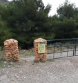
Park in the car park at a place called Cobaticas. The office is usually manned by a park employee.
No particular difficulties apart from the fact that there are no signposts. There is no risk of getting lost provided you follow the GPS route on the app.

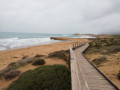
(S/E) Take the wide concrete road leading down towards the beaches.

(1) Keep to the left and follow the dry stream bed known as the Rambla de Cobaticas. At the bottom of this section, walk past some steps.

(2) Turn left and take the path running parallel to the coast,the GR®, marked with red and white signposts.

(3) Walk alongside the old Rasall salt flats, now converted into a bird sanctuary, with an observation post on your right.

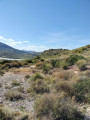
(4) Leave theGR® and turn left up into the hillside, climbing along a mountain path.

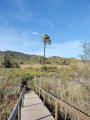
(5) Reach a pass offering a superb view of the Mediterranean with its dunes and beaches. Begin the descent by following the path. Join a wide track and continue past the old, abandoned mining buildings.

(6) Turn left onto a path that climbs gently between the hills. Reach a pass at an altitude of around 100 m and begin the descent to the left of large cultivated fields to reach a road suitable for vehicles.

(7) Follow it to the left.

(8) Leave the road and turn left onto a wide track. Pass two houses on the left-hand side of the track, known as Los Pacos. Return to the car park at the park’s visitor centre (S/E).


Waypoints

  1. S/E : mi 0 - alt. 220 ft - Cobiticas car park
  2. 1 : mi 0.31 - alt. 128 ft - Junction
  3. 2 : mi 0.85 - alt. 26 ft - Fork in the road
  4. 3 : mi 1.56 - alt. 7 ft - Former Rasall salt flats
  5. 4 : mi 2.43 - alt. 43 ft - GR junction with a mountain path
  6. 5 : mi 2.84 - alt. 259 ft - Pass
  7. 6 : mi 3.82 - alt. 121 ft - Mountain trail x Path
  8. 7 : mi 4.94 - alt. 177 ft - Access by road
  9. 8 : mi 5.1 - alt. 213 ft - The hamlet of Los Pacos
  10. S/E : mi 5.41 - alt. 220 ft - Cobaticas car park

Worth a visit

The former Rasall salt flats, now converted into a bird sanctuary. Birdwatching is possible from a designated viewing point.
A small pass between two rocks offering a magnificent view of the Mediterranean, the dunes and the beaches.
Abandoned former mining buildings.

Always be cautious and plan ahead when you're outdoors. Visorando and the author of this route cannot be held responsible for any accidents occurring on this route.

The GR® and PR® markings are the intellectual property of the Fédération Française de Randonnée Pédestre.

Reviews and comments

4.6 / 5
Based on 3 reviews

Reliability of the description
4.7 / 5
Ease of following the route
4.3 / 5
Route interest
4.7 / 5
montcel
montcel

Overall rating : 4.3 / 5

Date of your route : Feb 16, 2026
Reliability of the description : ★★★★★ Very good
Ease of following the route : ★★★☆☆ Average
Route interest : ★★★★★ Very good
Very busy route : No

The start is difficult to find, so we did it in reverse.
But for us, going in the opposite direction, the last section was very difficult because the markings were
were complicated or absent, so we relied on our landmarks to find the interpretation centre.
Otherwise, it was a beautiful hike with two lovely surprises!

Machine-translated

User 19661418

Overall rating : 4.3 / 5

Date of your route : Jan 05, 2026
Reliability of the description : ★★★★☆ Good
Ease of following the route : ★★★★★ Very good
Route interest : ★★★★☆ Good
Very busy route : No

enjoy your hike

Machine-translated

ODEND'HAL
ODEND'HAL

Overall rating : 5 / 5

Date of your route : Jun 10, 2024
Reliability of the description : ★★★★★ Very good
Ease of following the route : ★★★★★ Very good
Route interest : ★★★★★ Very good
Very busy route : Yes

Thank you!

Machine-translated

For more walks, use our search engine .

The GPS track and description are the property of this route's author. Please do not copy them without permission.