From Landebaëron to Kermoroc’h via the Perrier Valley

A short, leisurely walk along a stream to the village of Kermoroc’h, starting from Landebaëron.
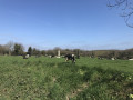
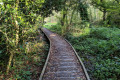
Much of the route runs through woodland on a well-maintained path, before returning to Landebaëron along a quiet road offering sweeping views of the Breton countryside.

Details

n°35054250
Creation:
Last update:
Last review:
  • Walking
    Activity: Walking
  • ↔
    Distance: 2.98 mi
  • ◔
    Average duration: 1h 30 
  • ▲
    Difficulty: Easy

  • ⚐
    Back to start: Yes
  • ↗
    Ascent: + 177 ft
  • ↘
    Descent: - 157 ft

  • ▲
    Highest point: 374 ft
  • ▼
    Lowest point: 223 ft
  • ⚐ Country: France
  • ⚐ City: Landebaëron (22140)
  • ⚑
    Start/End: N 48.635318° / W 3.212851°
  • ❏
    IGN map(s): Ref. 0815SB, 0816SB
  • Hour-by-hour weather

Photos

Description of the walk

Park in the small car park at the bottom of the village, the starting point for the valley trail.
GPS: N 48.635318° / W 3.212851°

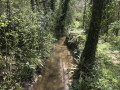
(S/E) Set off along the wide, well-maintained path, listening to the sound of the Ruisseau du Perrier as you walk.

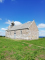
(1) You’ll reach the small Notre-Dame-de-Pitié Chapel, or Chapel Nevez, at the side of the path. Through small holes in the chapel door, you can glimpse the interior. Carry on straight ahead until you reach a junction with two wooden benches on the left.

(2) Pass this and carry on straight ahead. You’ll reach the car park at the end of the route, which opens onto the D32 and is marked by a signpost.

(3) Retrace your steps along the path you took on the way there, until you reach the junction you passed earlier.

(2) Turn right onto an uphill path and keep to the right. At the top of this climb, you’ll arrive directly at the foot of the bell tower of Kermoroc’h church.

(4) You’ll emerge into the village square of Kermoroc’h. Take a look at a very original and rare pendulum mechanism, which is quite unusual in Brittany. Turn left onto the road towards Landebaëron and, after 1.3 km, you’ll reach the small village of Landebaëron.

(5) Walk round the church at Landebaëron on the left and, at the bottom of the village, head for the car park (S/E).

Waypoints

  1. S/E : mi 0 - alt. 223 ft - Car park providing access to the valley
  2. 1 : mi 0.63 - alt. 249 ft - Chapel of Our Lady of Mercy or Chapel Nevez
  3. 2 : mi 0.84 - alt. 253 ft - Junction for both outbound and return routes
  4. 3 : mi 1.26 - alt. 308 ft - End of the route. Signpost
  5. 4 : mi 1.98 - alt. 374 ft - Village of Kermoroc’h
  6. 5 : mi 2.85 - alt. 259 ft - Village of Landebaëron
  7. S/E : mi 2.98 - alt. 223 ft - Car park providing access to the valley

Worth a visit

- Landebaëron churchyard.
- Nevez Chapel.
- The village of Kermoroc’h with its swing well.
- Saint Maudez fountain in Landebaëron

Reviews and comments

5 / 5
Based on 1 review

Reliability of the description
5 / 5
Ease of following the route
5 / 5
Route interest
5 / 5
fgr1dorge
fgr1dorge
• Edited:

Overall rating : 5 / 5

Date of your route : Sep 24, 2023
Reliability of the description : ★★★★★ Very good
Ease of following the route : ★★★★★ Very good
Route interest : ★★★★★ Very good
Very busy route : No

The perfect route for beginner walkers and for a stroll with children (two play areas, picnic tables).
The only issue encountered was people walking their dogs off the lead, even though the information signs at each entrance to the walk state that dogs must be kept on a lead.

Machine-translated

Other walks in the area

For more walks, use our search engine .

The GPS track and description are the property of this route's author. Please do not copy them without permission.