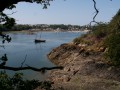
From Camarel to the Château de la Roche Jagu

A unique walk set mainly within the commune of Pleudaniel, offering scenic views along the left bank of the Trieux and culminating in the grounds of the Château de la Roche Jagu.

It requires two cars: one parked in the château car park and the other at the starting point in a small car park at the far end of Anse de Camarel.

This walk is best undertaken outside the rainy months due to muddy sections.

Details

n°3457776
Creation:
Last update:
Last review:
  • Walking
    Activity: Walking
  • ↔
    Distance: 6.21 mi
  • ◔
    Average duration: 3h 20 
  • ▲
    Difficulty: Average

  • ⚐
    Back to start: No
  • ↗
    Ascent: + 541 ft
  • ↘
    Descent: - 351 ft

  • ▲
    Highest point: 236 ft
  • ▼
    Lowest point: 13 ft
  • ⚐ Country: France
  • ⚐ City: Pleudaniel (22740)
  • ⚑
    Start: N 48.772845° / W 3.127934°
  • ⚑
    End: N 48.73261° / W 3.155499°
  • ❏
    IGN map(s): Ref. 0814OT, 0815SB
  • Hour-by-hour weather

Photos

Description of the walk

Park near a forest information board at the far end of Anse de Camarel (in the commune of Pleudaniel).
GPS: N 48.772845°/W 3.127934°

Unmarked walk.

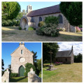
(S) Walk along the cove until you reach the Notre-Dame de Goz-Iliz chapel.
Continue along the path and follow the stream for 200 m. Cross the tarmac road and continue along the grassy path opposite.

(1) At the junction with the tarmac road, turn left and head down to Convenant Folory.
Turn onto the path on the left and follow it until you reach a road.

(2) Take the tarmac road towards Porz Lec’h, then turn left immediately to reach the beach. You are directly opposite Lancerf station (on the Guingamp to Paimpol line). Continue to the right.

(3) Walk through the middle of an oyster farm and follow the path along the River Trieux.

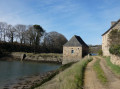
(4) Before reaching the Traou Meur tide mill, go up a short path and follow the stony road (the mill is private property and cannot be accessed).
Turn left at a place called Le Passage, take the path to the junction and take the tarmac road on the left. Follow this road through the hamlets of Traou Meur and then Ty Guen.

(5) Walk past a large lodge and turn left immediately. On your left, you’ll come across a small chapel (Saint-Antoine) which is completely hidden from view from the paths and the river.
Follow the path uphill to the hamlet of Boloï.

(6) Join the RD 787 county road and follow it to the left for 100 m until you come to a small road leading downhill on the left. Follow this road to a house, which is followed by a path and then another road leading to a place known as Le Bayon.

(7) Take the path leading down to the left as you enter the woods towards the Trieux and follow the marked path along the riverbank to the Roche Jagu jetty.

(8) Walk up the wide path from the landing stage, where you can admire a small palm grove – quite unusual in this corner of Brittany – and, on the left, a series of basins known as ‘routoirs à lin’.

(9) Take the hairpin bend to the right and, at the top of the path, you’ll find yourself facing the château, which offers a magnificent view of the meandering Trieux. Head to the château’s large car parks to retrieve your second vehicle (E).


Waypoints

  1. S : mi 0 - alt. 20 ft - Camarel
  2. 1 : mi 0.45 - alt. 141 ft - Road junction
  3. 2 : mi 1.17 - alt. 92 ft - Road junction
  4. 3 : mi 1.53 - alt. 16 ft - Oyster farmer
  5. 4 : mi 1.7 - alt. 16 ft - Traou Meur Mill
  6. 5 : mi 2.97 - alt. 98 ft - Saint Antoine Chapel
  7. 6 : mi 3.98 - alt. 213 ft - D787 road – Boloï
  8. 7 : mi 4.97 - alt. 194 ft - Le Bayon
  9. 8 : mi 5.69 - alt. 26 ft - Cale de la Roche Jagu
  10. 9 : mi 5.98 - alt. 177 ft - Hairpin junction
  11. E : mi 6.21 - alt. 236 ft - Castle car parks

Worth a visit

Reviews and comments

4.3 / 5
Based on 2 reviews

Reliability of the description
4.5 / 5
Ease of following the route
4 / 5
Route interest
4.5 / 5
kerheol
kerheol

Thank you for your feedback. I don’t understand what the problem is with number 7. To the left of the house, you take a path leading down into the château woods towards the Trieux. This route follows 50 metres of private road near the tidal mill. Kind regards

Machine-translated

Momo22
Momo22

Overall rating : 3.7 / 5

Date of your route : Sep 18, 2023
Reliability of the description : ★★★★☆ Good
Ease of following the route : ★★★☆☆ Average
Route interest : ★★★★☆ Good
Very busy route : No

The route is well signposted. At number 7, the path is overgrown and impossible to access. Furthermore, it is private property. This needs reviewing; had it not been for the owners’ kindness, we would not have been able to get through.

Machine-translated

alyette
alyette

Overall rating : 5 / 5

Date of your route : Jul 31, 2021
Reliability of the description : ★★★★★ Very good
Ease of following the route : ★★★★★ Very good
Route interest : ★★★★★ Very good
Very busy route : No

I find it rather amusing that this route has finally been put online, as I live at the tide mill mentioned in the description, and I take visiting friends on this walk at least once a year. I’d suggested to the local council that they should signpost it to raise its profile; well, now it’s been done!
Well done

Machine-translated

Other walks in the area

For more walks, use our search engine .

The GPS track and description are the property of this route's author. Please do not copy them without permission.