From the Léguer to the heights of Servel in Lannion

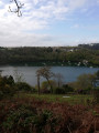
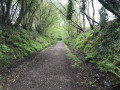
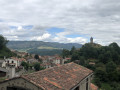
First, a long walk along the Léguer on the towpath, then you’ll reach the heights of Servel via a steep path. After walking along a quiet country lane, offering views of the valley and the town of Lannion, take a path down through the woodland to rejoin the towpath.

Details

56998678
Creation:
Last update:
Last review:
  • Walking
    Activity: Walking
  • ↔
    Distance: 4.60 mi
  • ◔
    Average duration: 2h 20 
  • ▲
    Difficulty: Easy

  • ⚐
    Back to start: Yes
  • ↗
    Ascent: + 279 ft
  • ↘
    Descent: - 282 ft

  • ▲
    Highest point: 299 ft
  • ▼
    Lowest point: -3 ft
  • ⚐ Country: France
  • ⚐ City: Lannion (22300)
  • ⚑
    Start/End: N 48.737882° / W 3.469574°
  • ❏
    IGN map(s): Ref. 0714OT
  • Hour-by-hour weather

Photos

Description of the walk

Lannion: Quai de la Corderie car park (GPS coordinates: N 48.73800° / W 3.469622°).

(S/E) Take the towpath, which is for pedestrians only.

(1) Pass the junction with the descending path on your right – which you’ll take on the return journey – and continue along the river.

(2) After passing the 3.5 km marker, leave theGR®34and turn right onto a path with steps, heading towards Traou Léguer. At the end of this somewhat steep climb, you’ll come out onto a small tarmac road.

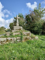
(3) Turn left. Continue along this ascending road, between two embankments, until you reach a crossroads. Ignore the paths branching off to the right and left to reach a very old stone cross.

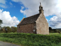
(4) Turn right, leaving the cross on your right. Follow the tarmac road, known as Hent ar Voudenn, for 850 metres, passing through the hamlet of La Motte, until you reach the Chapel of Saint Nicodème.

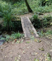
(5) Keep the chapel on your right and continue to the hamlet of Cosquerou. Keep to the right at the end of the tarmac road and take a descending path laid out as steps. Ignore the first path on the right and cross the stream via a wooden bridge.

(6) Keep to the right to follow a slightly steep path downhill. At the end of this path, rejoin the towpath.

(1) Turn left to reach the car park at Quai de la Corderie (S/E).
Waypoints

  1. S/E : mi 0 - alt. 20 ft - Car park at Quai de la Corderie - Léguer (le)
  2. 1 : mi 0.65 - alt. 16 ft - Junction with the return path
  3. 2 : mi 2.13 - alt. 16 ft - Junction towards Traou Léguer
  4. 3 : mi 2.29 - alt. 184 ft - Traou Léguer
  5. 4 : mi 2.49 - alt. 256 ft - Ancient stone cross
  6. 5 : mi 2.99 - alt. 299 ft - Saint-Nicodème Chapel
  7. 6 : mi 3.58 - alt. 141 ft - Wooden bridge over the stream - Église Saint-Pierre (Servel)
  8. S/E : mi 4.6 - alt. 16 ft - Car park at Quai de la Corderie

Notes

The route is partially signposted (yellow tape); if in doubt, use the GPS pin.

Worth a visit

- Towpath along the River Léguer.
- Ancient stone cross.
- Saint-Nicodème Chapel.
- The imposing church at Servel.

Always be cautious and plan ahead when you're outdoors. Visorando and the author of this route cannot be held responsible for any accidents occurring on this route.

The GR® and PR® markings are the intellectual property of the Fédération Française de Randonnée Pédestre.

Reviews and comments

4.7 / 5
Based on 2 reviews

Reliability of the description
5 / 5
Ease of following the route
5 / 5
Route interest
4 / 5
randonnee76
randonnee76

Overall rating : 4.7 / 5

Date of your route : Aug 31, 2026
Reliability of the description : ★★★★★ Very good
Ease of following the route : ★★★★★ Very good
Route interest : ★★★★☆ Good
Very busy route : Yes

A lovely route, which I tweaked from point 6 of the description – I went straight on to avoid retracing my steps along the towpath. That’s also a good option.

Machine-translated

Thedy
Thedy

Overall rating : 4.7 / 5

Date of your route : Aug 07, 2025
Reliability of the description : ★★★★★ Very good
Ease of following the route : ★★★★★ Very good
Route interest : ★★★★☆ Good
Very busy route : No

At first, you walk along the Leguier, then climb up into the woods. Pleasant and fairly easy. We didn't see the view of Lannion.

Machine-translated

Other walks in the area

For more walks, use our search engine .

The GPS track and description are the property of this route's author. Please do not copy them without permission.