


Refine your search for walks in Pont-Scorff
Pont-Scorff walks


 Route from Saint-Urchaut to Pont-Scorff
 Local authority
 8.17 mi
 +371 ft
 -377 ft
 4h 05
4h 05
 Moderate
 Departure from Pont-Scorff (Morbihan)
From the Scorff estuary to the Scave.
Starting from the historic town of Pont-Scorff, explore the Scorff and Scave valleys with their wild and unspoilt landscapes, home to protected species such as salmon. On your return, stroll through the narrow streets, discover the Cour des Métiers d’Art and its artisans, the contemporary art spaces, and the landscaped gardens of this town, which has been awarded the ‘Petite Cité de Caractère’ label.
Circular Pont-Scorff: the Scorff Valley, Sainte-Flamine and the greenway
 Visorando Member
 12.06 mi
+561 ft
-571 ft
6h 00
12.06 mi
+561 ft
-571 ft
6h 00
 Difficult
Departure from Pont-Scorff (Morbihan)
Difficult
Departure from Pont-Scorff (Morbihan)
From the charming village of Pont-Scorff, the walk descends through the Scorff valley and its highlights (Saint-Urchaud, Rocher du Corbeau), then winds through varied landscapes punctuated by the many chapels marking the various hamlets along the way.
Route from Coët Letune to Cléguer
 5.54 mi
+410 ft
-440 ft
2h 55
5.54 mi
+410 ft
-440 ft
2h 55
 Easy
Departure from Cléguer (Morbihan)
Easy
Departure from Cléguer (Morbihan)
Linking the village of Cléguer with Bas Pont-Scorff, the Coët Letune route takes you through the Cléguer countryside, past woodland and meadows, alongside the River Scorff and its streams. Don’t miss the partly Romanesque Saint-Gérand Church and the heritage sites in Bas Pont-Scorff, notably the Notre-Dame de Bonne Nouvelle Chapel and its 13th-century recumbent statue. The walk will also give you the chance to discover heritage linked to water, including a fountain, a washhouse, a mill and a brewery…
Between Pont-Scorff and Quéven on the banks of the Scave and the Scorff
 6.22 mi
+266 ft
-276 ft
3h 05
Moderate
Departure from Pont-Scorff (Morbihan)
6.22 mi
+266 ft
-276 ft
3h 05
Moderate
Departure from Pont-Scorff (Morbihan)
Between Pont-Scorff and Quéven, in the heart of the countryside, alongside the Scave and Scorff rivers and a stream. Sheltered by trees for most of the route, with minimal elevation gain.A shorter version of the Saint-Urchaut to Pont-Scorff route.
Circular route following the Scave stream and the Scorff river
8.53 mi
+325 ft
-328 ft
4h 10
Moderate
Departure from Quéven (Morbihan)
A beautiful hike through the woods in the communes of Quéven and Gestel, following the course of the Scave stream and the Scorff river.
The route has been adapted to take into account sunlight and weather conditions (muddy valley floors).
It is advisable to do this hike when the tide is high in the Scorff river (beautiful scenery), avoiding spring tides with a coefficient > 95.
The Golf Course Route in Quéven
 3.69 mi
+230 ft
-226 ft
1h 55
Easy
Departure from Quéven (Morbihan)
3.69 mi
+230 ft
-226 ft
1h 55
Easy
Departure from Quéven (Morbihan)
Close to the town of Quéven, this walk takes you along paths around the Val Quéven Golf Course, through woods and fields and alongside streams. You’ll be able to explore the former seigneury of Kerrousseau, situated on a promontory overlooking the lush Scave Valley.
Cléguer station route
 6.02 mi
+472 ft
-469 ft
3h 10
Easy
Departure from Cléguer (Morbihan)
6.02 mi
+472 ft
-469 ft
3h 10
Easy
Departure from Cléguer (Morbihan)
A beautiful, shaded walk between the Crano stream and the Scorff.
The ‘Du Lain au Verger’ Route in Gestel
 4.06 mi
+102 ft
-102 ft
1h 55
Easy
Departure from Gestel (Morbihan)
4.06 mi
+102 ft
-102 ft
1h 55
Easy
Departure from Gestel (Morbihan)
From the Domaine du Lain to the Étang du Verger, along the Scave and the Ruisseau du Moulin de Kerrousseau, wander through the woods and shaded paths. Discover the natural and historical heritage of these protected areas. On your return, take a leisurely stroll through the estate’s park and admire its variety of trees, including remarkable specimens over a century old.
Around the Val Quéven Golf Course
 4.12 mi
+141 ft
-154 ft
2h 00
Easy
Departure from Quéven (Morbihan)
4.12 mi
+141 ft
-154 ft
2h 00
Easy
Departure from Quéven (Morbihan)
A short, easy walk with no significant elevation gain, suitable for everyone, around the Val Quéven Golf Course.
Le Pont du Verger via Kerousseau
 6.99 mi
+243 ft
-269 ft
3h 25
Moderate
Departure from Quéven (Morbihan)
6.99 mi
+243 ft
-269 ft
3h 25
Moderate
Departure from Quéven (Morbihan)
A beautiful walk through the woods along a stream and around a small pond, with no particular difficulties.
The Scave to Scorff Route in Quéven
 6.68 mi
+312 ft
-312 ft
3h 20
Moderate
Departure from Quéven (Morbihan)
6.68 mi
+312 ft
-312 ft
3h 20
Moderate
Departure from Quéven (Morbihan)
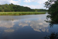
A Natura 2000 site, the Scorff estuary is a haven of peace just a stone’s throw from Lorient. Through woods, salt marshes and reed beds, let yourself be guided between fresh and salt water along the unspoilt banks of the Scorff and Scave. A walk in the heart of nature amidst enchanting landscapes.
Grand Tour of Rédéné via the fountains
 6.27 mi
+299 ft
-315 ft
3h 10
Moderate
Departure from Rédené (Finistère)
6.27 mi
+299 ft
-315 ft
3h 10
Moderate
Departure from Rédené (Finistère)
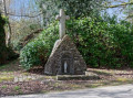
Rédéné is a commune in Finistère. It is situated in the Vannetais region, 8 km from Quimperlé. This grand tour of Rédéné is designed to provide a 10 km route for runners. But it also allows all walkers visiting Rédéné to explore the neighbourhoods of this charming Breton village. Setting out in search of the village’s three fountains adds a little extra interest.
The Lec’h to Calan Route
 5.27 mi
+115 ft
-115 ft
2h 30
Easy
Departure from Calan (Morbihan)
5.27 mi
+115 ft
-115 ft
2h 30
Easy
Departure from Calan (Morbihan)
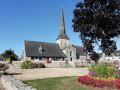
The Lec’h route will take you along streams, through sunken paths and villages, as you explore the Calan countryside. It’s a chance to discover the rural heritage and the lec’h at Kerandiot, a Gallic funerary stele. Don’t miss the Church of the Trinity, a masterpiece of Breton Romanesque art: nave, carved capitals and murals, Gothic choir and ossuary gallery.
The Scorff at Pont Kerlo
 5.33 mi
+479 ft
-482 ft
2h 50
Easy
Departure from Finistère
5.33 mi
+479 ft
-482 ft
2h 50
Easy
Departure from Finistère
Starting from Kerlo Bridge, a short hike of about 10km will take you along the right bank of the Scorff to the Moulin du Roc'h site and its motte-and-bailey castle. Then, climbing up to the plateau, you will discover the chapels of Locmaria-Grâce and Sainte-Anne, which overlook the valley. The return journey follows the opposite bank of the Scorff.
Between Scorff and Ellé in Arzano
 11.65 mi
+833 ft
-830 ft
6h 05
Moderate
Departure from Finistère
11.65 mi
+833 ft
-830 ft
6h 05
Moderate
Departure from Finistère
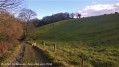
This route will take you on a tour of two beautiful Breton rivers, the Scorff and the Ellé, and three old mills: the Kerlégant, Mohot and Stall mills.
Tro kreiz ker Gwidel
 3.52 mi
+174 ft
-180 ft
1h 45
Easy
Departure from Guidel (Morbihan)
3.52 mi
+174 ft
-180 ft
1h 45
Easy
Departure from Guidel (Morbihan)
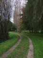
This route, also known as the “pedestrian ring road”, was initiated by the town of Guidel.
It allows you to walk around the town centre (kreiz ker in Breton) via wooded paths, lovely lanes bordering meadows and routes through residential neighbourhoods.
The pleasant route, mostly through woodland, is clearly signposted with posts bearing a green arrow and the words "périphérique pédestre".
A lovely way to discover another side of Guidel.
The Sentier des Vallons and the Chemin des Fées
 Association / Club / Walk leader5.40 mi
+276 ft
-302 ft
2h 45
Easy
Departure from Lorient (Morbihan)
Association / Club / Walk leader5.40 mi
+276 ft
-302 ft
2h 45
Easy
Departure from Lorient (Morbihan)
Hiking trail of approximately 9 km proposed by Keryadine on 23 June 2019, starting from the Church of Sainte-Thérèse in Lorient.
Circular walk starting from Keryado
8.86 mi
+554 ft
-564 ft
4h 35
Moderate
Departure from Lorient (Morbihan)
Walk starting from the Church of Sainte-Thérèse, in Lorient.
Goden Marsh and banks of the Blavet
 4.72 mi
+108 ft
-108 ft
2h 15
Easy
Departure from Lanester (Morbihan)
4.72 mi
+108 ft
-108 ft
2h 15
Easy
Departure from Lanester (Morbihan)
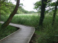
A peaceful walk on the outskirts of Lanester around the Marais de la Goden, whose banks have been developed so you can walk without getting your feet wet, then along the Ria du Ruisseau du Plessis.Pass by the little Chapel of Saint-Guénaël and its fountain, then the banks of the Blavet opposite Pen Mané Bay, where the two rivers of Lorient—the Blavet and the Scorff—meet.
Saudraye circular in Guidel
3.05 mi
+43 ft
-49 ft
1h 25
Moderate
Departure from Guidel (Morbihan)
A rolling route suitable for trail running. The series of ascents and descents on technical terrain is a real pleasure in this peaceful valley along the Saudraye, which feeds into the Loch pond. Depending on the season, the terrain can be muddy and slippery.
The Hingair Route in Hennebont
 3.12 mi
+449 ft
-440 ft
1h 50
Moderate
Departure from Hennebont (Morbihan)
3.12 mi
+449 ft
-440 ft
1h 50
Moderate
Departure from Hennebont (Morbihan)
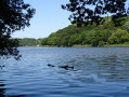
Starting from the banks of the Blavet in Saint-Caradec, walk beneath the canopy of the Bois du Hingair. Follow its wide paths and narrow forest trails, crossing the streams. Walk along the estuary and enjoy the magnificent views of the valley and the meandering river below.
 Lorient - Languidic
21.41 mi
+256 ft
-233 ft
5 hrs
Moderate
Departure from Lorient (Morbihan)
From the Bay of Lorient to the Bay of Saint-Brieuc, Cycle Route 8 (188 km) crosses the Breton countryside on towpaths and peaceful little roads lined with water points.
The V8 first follows shared paths, passing through pretty residential neighbourhoods in the city, then through the countryside, before reaching the Blavet towpath, which meanders between the wooded hills of a green valley. Route 8 then continues along the quiet and winding Hilvern canal, which has been converted into a greenway, to join the Nantes-Brest stream at Allineuc.
Around Hennebont and the towpath
 9.90 mi
+249 ft
-249 ft
4h 45
Moderate
Departure from Hennebont (Morbihan)
9.90 mi
+249 ft
-249 ft
4h 45
Moderate
Departure from Hennebont (Morbihan)
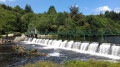
An easy loop starting from Hennebont. Pass through Saint-Antoine, Saint-Gilles, the Quelennec lock, and return to Hennebont via the towpath through Lochrist.
9/08/2023 Message from the moderator: following feedback, the hike has been modified at point 9 to avoid passing through private property.
Route du Goden Marsh in Lanester
 3.34 mi
+36 ft
-33 ft
1h 35
Easy
Departure from Lanester (Morbihan)
3.34 mi
+36 ft
-33 ft
1h 35
Easy
Departure from Lanester (Morbihan)
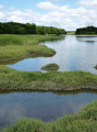
A stone’s throw from the Blavet, nestled between woodland and salt meadows, the Goden Marsh route will introduce you to magnificent landscapes shaped by the sea. Where the fresh waters of the Plessis stream meet the rising tides of the sea, you can observe the flora and fauna of these natural habitats.
From Hennebont to Pontivy via the towpath
36.87 mi
+233 ft
-85 ft
3 hrs
Moderate
Departure from Hennebont (Morbihan)
Or how to take a leisurely trip from Hennebont to Pontivy? There are a few sections with cars and lots of pedestrians at the start and finish, but otherwise it's just hikers and cyclists. It's a peaceful route for walking or cycling.The landscape changes as you follow the river, making this a peaceful walk, but it can be challenging: 60 km there (and possibly the same back).Here and there, you will find places to quench your thirst and eat, but make sure you take everything you need with you. Enjoy the peace and quiet and the countryside.
From the Parc du Plessis to the Château du Diable through woods and marshes to Lanester
7.14 mi
+171 ft
-148 ft
3h 25
Moderate
Departure from Lanester (Morbihan)
This walk takes you through wooded parks, the Marais de la Goden, the Parc à Bois on the Scorff, and past wash houses and fountains.
Route of the Park and the Plessis Stream
 2.80 mi
+49 ft
-49 ft
1h 20
Easy
Departure from Lanester (Morbihan)
2.80 mi
+49 ft
-49 ft
1h 20
Easy
Departure from Lanester (Morbihan)
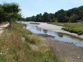
In the heart of Lanester, enjoy a family walk in Parc du Plessis, the city's green lung, then along the Ria du Ruisseau du Plessis, whose waters merge with those of the Blavet to reach the sea.
Kerhervy boat cemetery circular
 8.27 mi
+318 ft
-318 ft
4h 05
Moderate
Departure from Lanester (Morbihan)
8.27 mi
+318 ft
-318 ft
4h 05
Moderate
Departure from Lanester (Morbihan)
This walk takes you along the Blavet estuary, between woodlands and salted meadows. Beautiful landscapes, fauna, flora, and a fascinating boat cemetery.
Route from the Kerhervy ship graveyard to Lanester
 8.99 mi
+344 ft
-325 ft
4h 25
Moderate
Departure from Lanester (Morbihan)
8.99 mi
+344 ft
-325 ft
4h 25
Moderate
Departure from Lanester (Morbihan)
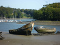
Explore the Blavet estuary, with its magnificent landscapes shaped by the sea. Discover the flora and fauna of the woodlands and salt meadows, as well as the historical heritage, including bridges, chapels and fountains… Lose yourself in reverie as you gaze upon the fascinating ship graveyard, with its old Groix tuna boats and their masts abandoned after 1945 in Kerhervy Cove.
Tro Ploue in Plouay
 10.91 mi
+469 ft
-463 ft
5h 25
Difficult
Departure from Plouay (Morbihan)
10.91 mi
+469 ft
-463 ft
5h 25
Difficult
Departure from Plouay (Morbihan)
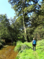
Le Tro Ploue invites you to explore the paths around the village and between the towns. A nature walk through Manehouarn Park, Bois Coët Fao and the Saint-Sauveur valley. A historical walk to discover religious buildings, crosses, fountains, etc.
Route de Manéhouarn à Scorff in Plouay
 7.59 mi
+482 ft
-466 ft
3h 55
Moderate
Departure from Plouay (Morbihan)
7.59 mi
+482 ft
-466 ft
3h 55
Moderate
Departure from Plouay (Morbihan)
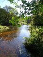
Crossing the Domaine de Manehouarn, following the old railway line, through woods and sunken paths, you reach the steep-sided valley of Pontkalleg where the wild and turbulent River Scorff winds its way. A magnificent walk in the heart of nature, exploring local heritage and history.
Plouay route via the Coët Cren Mill
 8.13 mi
+807 ft
-814 ft
4h 25
Moderate
Departure from Plouay (Morbihan)
8.13 mi
+807 ft
-814 ft
4h 25
Moderate
Departure from Plouay (Morbihan)
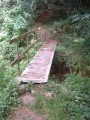
A walk through the woodlands of Plouay, following the River Scorff, with a detour into the Pont-Callec National Forest, and ending with a stroll through the Plouay Cycle Park.
Towards the Sainte-Anne-du-Scorff Chapel from Guilligomarc'h
 10.15 mi
+722 ft
-699 ft
5h 20
Moderate
Departure from Guilligomarc'h (Finistère)
10.15 mi
+722 ft
-699 ft
5h 20
Moderate
Departure from Guilligomarc'h (Finistère)
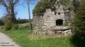
Starting from Guilligomarc'h, this 16km hike follows both banks of the Scorff between Moulin du Stang and Pont Kerlo, passing by the Sainte-Anne-du-Scorff chapel and the old Paou paper mill.
It will allow you to discover a beautiful wild river with cool, fast-flowing waters
Route d'art et d'histoire de Lorient
 3.97 mi
+36 ft
-36 ft
1h 50
Easy
Departure from Lorient (Morbihan)
3.97 mi
+36 ft
-36 ft
1h 50
Easy
Departure from Lorient (Morbihan)
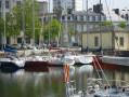
Discover the history of Lorient, from its origins in the era of the Compagnie des Indes – founded in 1664 by Colbert to facilitate trade with Asia – through to post-war reconstruction and the conversion of former military sites. An unusual urban walk in the heart of a maritime city.
The Bay of Lorient on foot and by water bus
 9.69 mi
+30 ft
-30 ft
4h 30
Moderate
Departure from Lorient (Morbihan)
9.69 mi
+30 ft
-30 ft
4h 30
Moderate
Departure from Lorient (Morbihan)
This hike combines walking (12 km) and water bus crossings. Board the boat to Pen Mané and follow the coastal path to the ramparts of Port Louis. Board the boat again to reach Keroman and walk through the streets of Lorient to Quai des Indes.
Remember to check the water bus timetable in advance (see the link in the practical information section).
You will be hiking through natural and private sites. Stay on the marked paths and respect nature, facilities and cultivated land. For your comfort and safety, make sure you have the appropriate hiking equipment.
The estuaries from Lorient to Locmiquélic
 11.91 mi
+318 ft
-305 ft
5h 45
Difficult
Departure from Lorient (Morbihan)
11.91 mi
+318 ft
-305 ft
5h 45
Difficult
Departure from Lorient (Morbihan)
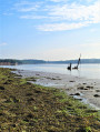
Discover the natural and built heritage of Lorient harbour along the GR®34. From the historic port of Lorient, you will walk along the Scorff before reaching the Blavet estuary, which offers beautiful views of the maritime landscape.
The walking loop ends at the Pen Mané pier in Locmiquélic. A water bus will take you back to your starting point in Lorient in 8 minutes. Remember to check the water bus timetable in advance.
You will be walking through natural and private sites. Stay on the marked paths and respect nature, facilities and cultivated land. For your comfort and safety, make sure you have the appropriate hiking equipment.
Route along the banks of the Ter in Ploemeur
 4.28 mi
+23 ft
-23 ft
2h 00
Easy
Departure from Ploemeur (Morbihan)
4.28 mi
+23 ft
-23 ft
2h 00
Easy
Departure from Ploemeur (Morbihan)
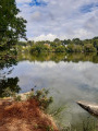
Close to the town centre of Lorient and the sea, this walk is ideal for families: it will take you through 89 hectares of natural environments, along paths built in the 1970s around two lakes. You will appreciate the contrast between the shady green lanes and the mirror of the sea reflecting the blue sky.
Tro an Oriant in Lorient
 14.26 mi
+213 ft
-200 ft
6h 45
Difficult
Departure from Lorient (Morbihan)
14.26 mi
+213 ft
-200 ft
6h 45
Difficult
Departure from Lorient (Morbihan)
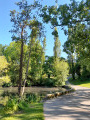
This beautiful circular route around Lorient will allow you to discover the different neighbourhoods as well as its maritime and riverfronts. The diversity of the landscapes, the architectural curiosities and the charm of the hidden paths among the urban areas will make you appreciate this route with its changing atmospheres.
Loch trail in Guidel (Sentier des Loch)
 6.08 mi
+236 ft
-236 ft
3h 00
Easy
Departure from Guidel (Morbihan)
6.08 mi
+236 ft
-236 ft
3h 00
Easy
Departure from Guidel (Morbihan)
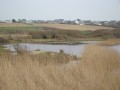
This route takes in the Loch Reserve. A former arm of the sea that has been reclaimed and transformed into marshland.It's home to many species of flora and fauna. You'll cross reedy wetlands and enjoy birdwatching.
The Loc'h ponds
5.07 mi
+197 ft
-197 ft
2h 30
Easy
Departure from Guidel (Morbihan)
A stone’s throw from the Laïta estuary, the Loc’h ponds are a former ria that has been separated from the ocean by a sandbar. Once reclaimed, this area has regained a very natural appearance, and the path that winds around it allows you to discover this little gem.
Étang de Lannénec and the coast at Fort Bloqué
 4.35 mi
+39 ft
-39 ft
2h 00
Easy
Departure from Ploemeur (Morbihan)
4.35 mi
+39 ft
-39 ft
2h 00
Easy
Departure from Ploemeur (Morbihan)
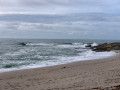
A short hike along the edge of a pond inland, then back along the coast at Fort Bloqué. Enjoy the countryside and seaside atmosphere on this route, which also passes by the Chapel of Saint Jude