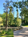
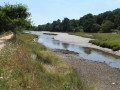
Circular walk starting from Keryado

Walk starting from the Church of Sainte-Thérèse, in Lorient.

Details

2018615
Creation:
Last update:
Last review:
  • Walking
    Activity: Walking
  • ↔
    Distance: 8.86 mi
  • ◔
    Average duration: 4h 35 
  • ▲
    Difficulty: Moderate

  • ⚐
    Back to start: Yes
  • ↗
    Ascent: + 554 ft
  • ↘
    Descent: - 564 ft

  • ▲
    Highest point: 154 ft
  • ▼
    Lowest point: 7 ft
  • ⚐ Country: France
  • ⚐ City: Lorient (56100)
  • ⚑
    Start/End: N 47.761068° / W 3.380416°
  • ❏
    IGN map(s): Ref. 0720ET
  • Hour-by-hour weather

Description of the walk

Start from the presbytery of Sainte-Thérèse Church in Lorient.

(S/E) From the presbytery, turn right onto Rue Jean Stephan towards Avenue Lénine. Cross the avenue and, opposite the roundabout, follow Rue du Bois du Château. Turn left at the next roundabout to cross over the Lorient bypass.

(1) After the bridge, turn immediately right onto the Sentier des Vallons.
Carry on straight ahead and cross the playground to continue along the path; shortly afterwards, turn right, passing close to a new children’s playground.

(2) At the steps, cross the road and continue along the Sentier des Vallons. Walk round the Kerulvé community orchard. Continue in the same direction, passing close to the football pitches. Go through the gate on the right, then reach a road on the right after the changing rooms.

(3) Turn right onto the access road to the Manoir du Pouillot, then walk alongside it. After the manor house, turn right, head straight down and cross the footbridge. Reach the expressway bridge, cross it and enter the residential area of Kergavalan.
Follow the Kerdual road to the left, then, at the three-way junction, turn right into Rue Monier, which continues as a footpath.

(4) Head straight down towards the sewage treatment works. Go round it on the right, cross the access road and take the path on the left. At the three-way junction, turn left (do not go through the barrier). At the public bench, go up to the right and then continue straight on.

(5) Turn left onto the road, then turn right after 20 metres. After 100 metres, turn left towards the housing estate.

(6) Turn right onto the path before the housing estate. At the wooden teepee, take the path on the left.

(7) Turn right before the housing estate, then turn left onto the path.

(8) Turn right onto the path to join the road and follow it to the right. At the junction, turn right, then take thefirst left, towards “Bon Secours”.
At the hamlet known as “Kercadorét”, turn left towards “Bon Secours”.
Carry on straight ahead along the road until you reach the car park.

(9) Cross the car park to join the path and head slightly to the left.

(10) Signpost: “Hike in the Bois de Kercadored”; turn left towards “Bon Secours”

(11) Hiking signpost: turn right towards “Chemin du bas” (along the banks of the Scorff)
Walk alongside the Scorff for about 1 km.

(12) Turn right, then left at the junction, then carry on straight ahead along the road. At a place called Le Roz, turn left at the junction, then take the path opposite.

(13) Carry on straight ahead, then head down to the left and cross the footbridge. At the road, carry on straight ahead, then at the “give way” sign, take the path slightly to the left
At the three-way junction, head down to the left, then, after the small car park, follow the road to the left for about a hundred metres. At the barrier, turn right onto the path that leads uphill. Keep slightly to the right at the end of the field.

(14) Follow the road to the right, then take the path on the left by the rocks. Follow this path and, at the three-way junction, veer to the right to join the Chemin des Fées. At the end, turn right into a street for a few metres, then turn right again into Rue du Vieux Moulin. Follow this street until the next path which branches off to the left at the bend.

(15) Take this path, then follow the road to the left, cross the bridge (expressway) and continue straight on.

(2) Take the path on the left from the start of the walk in the opposite direction to return to the presbytery of Sainte-Thérèse Church (S/E).

Waypoints

  1. S/E : mi 0 - alt. 92 ft - Rectory car park - Église Sainte-Thérèse (Lorient)
  2. 1 : mi 0.24 - alt. 66 ft - Common junction for out-and-back route
  3. 2 : mi 0.86 - alt. 26 ft - Junction of the circular loop
  4. 3 : mi 1.38 - alt. 95 ft - Turn right onto the road
  5. 4 : mi 2.43 - alt. 59 ft - Carry on straight ahead to the sewage treatment works
  6. 5 : mi 3.01 - alt. 135 ft - Turn left onto the road
  7. 6 : mi 3.29 - alt. 138 ft - Turn right before the housing estate
  8. 7 : mi 3.55 - alt. 128 ft - Turn right before the housing estate
  9. 8 : mi 3.68 - alt. 151 ft - Path on the right towards the road
  10. 9 : mi 4.54 - alt. 85 ft - Cross the car park to reach the path
  11. 10 : mi 4.71 - alt. 49 ft - Towards Bon Secours
  12. 11 : mi 4.76 - alt. 16 ft - Turn right towards “Chemin du Bas” – Follow the - Scorff (fleuve)
  13. 12 : mi 5.52 - alt. 108 ft - Turn right, then left at the junction
  14. 13 : mi 5.88 - alt. 43 ft - Go straight on, then head down to the left
  15. 14 : mi 6.71 - alt. 56 ft - Turn right onto the road, then take the path on the left
  16. 15 : mi 7.75 - alt. 59 ft - Path on the left at the bend
  17. S/E : mi 8.86 - alt. 92 ft - Rectory car park - Église Sainte-Thérèse (Lorient)

Notes

(6) (7) (8) This part of the route has lots of small paths, but don’t worry – they all join up with the road at (8).

Reviews and comments

4 / 5
Based on 4 reviews

Reliability of the description
3.8 / 5
Ease of following the route
4.3 / 5
Route interest
4 / 5
Sldm
Sldm

Overall rating : 4 / 5

Date of your route : Dec 11, 2022
Reliability of the description : ★★★★☆ Good
Ease of following the route : ★★★★☆ Good
Route interest : ★★★★☆ Good
Very busy route : Yes

A lovely walk in the countryside just outside Lorient.
It’s a shame the route doesn’t take in the Bon Secours Chapel… though we went there anyway!
Very pretty

Machine-translated

BernardDu
BernardDu

Overall rating : 4.7 / 5

Date of your route : Feb 17, 2021
Reliability of the description : ★★★★☆ Good
Ease of following the route : ★★★★★ Very good
Route interest : ★★★★★ Very good
Very busy route : No

We set off from the northern end of the shopping centre car park (opposite Gifi) rather than from the church, to avoid going through the town. The route is very pleasant, with one section through the forest and the other running alongside the Scorff (this route is 12 km long).
I think the route is quite tricky to follow without using the GPX file. The GPX track is spot on.

Machine-translated

Lulu56
Lulu56

Overall rating : 4 / 5

Date of your route : Dec 07, 2020
Reliability of the description : ★★★★☆ Good
Ease of following the route : ★★★★★ Very good
Route interest : ★★★☆☆ Average
Very busy route : No

A lovely route on the outskirts of LORIENT, through woods, countryside and a park

Machine-translated

keryadine
keryadine

I’m sorry that you weren’t entirely satisfied with the walk.

I’ll see what I can do to improve the description

Have a nice day

Machine-translated

SALTOFILOUSE
SALTOFILOUSE

Overall rating : 3.3 / 5

Date of your route : Jul 01, 2019
Reliability of the description : ★★★☆☆ Average
Ease of following the route : ★★★☆☆ Average
Route interest : ★★★★☆ Good

I had trouble finding certain landmarks: for example, the wooden teepee??? I never found it, and the ‘three-way junction’ sign is unclear
To sum up, I got lost twice and couldn’t find my way back on the right path
It’s a shame, as the route is lovely

Machine-translated

Other walks in the area

For more walks, use our search engine .

The GPS track and description are the property of this route's author. Please do not copy them without permission.