Route from Coët Letune to Cléguer

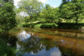
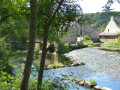
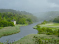
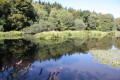
Linking the village of Cléguer with Bas Pont-Scorff, the Coët Letune route takes you through the Cléguer countryside, past woodland and meadows, alongside the River Scorff and its streams. Don’t miss the partly Romanesque Saint-Gérand Church and the heritage sites in Bas Pont-Scorff, notably the Notre-Dame de Bonne Nouvelle Chapel and its 13th-century recumbent statue. The walk will also give you the chance to discover heritage linked to water, including a fountain, a washhouse, a mill and a brewery…

Details

61684892
Creation:
Last update:
Last review:
  • Walking
    Activity: Walking
  • ↔
    Distance: 5.54 mi
  • ◔
    Average duration: 2h 55 
  • ▲
    Difficulty: Easy

  • ⚐
    Back to start: Yes
  • ↗
    Ascent: + 410 ft
  • ↘
    Descent: - 440 ft

  • ▲
    Highest point: 190 ft
  • ▼
    Lowest point: 10 ft
  • ⚐ Country: France
  • ⚐ City: Cléguer (56620)
  • ⚑
    Start/End: N 47.85391° / W 3.38547°
  • ❏
    IGN map(s): Ref. 0720ET
  • Hour-by-hour weather

Photos

Description of the walk

Start: the village of Cléguer, Saint-Gérand Church. Start sign to the left of the porch. Car park nearby.

(S/E) Turn left after the church porch and the start sign. Cross Louis Le Couriaud Square and turn left. Turn right into Rue des Pins until you reach Allée du Bois.

(1) Turn left, then right to enter the Bois de Ker René. Carry on straight ahead, then turn right onto the path running alongside the embankment and the housing estates. Continue to the left, then to the right, and go straight on through the housing estate until you reach Rue Anne de Bretagne.

(2) Turn right onto the street. At the junction, follow Rue des Étangs (left) then Rue du Doued (left).

(3) At the roundabout, after the wash house, carry on straight ahead along the protected path, then turn right onto the footpath. Follow the stream, ignoring the paths on the right, until you reach the Pont Person car park.

(4) Turn left before Pont Person and cross over the footbridges. Continue straight on along the path that climbs towards the village of Kernaud.

(5) At the road, turn left, then right onto the path that leads to Bas Pont-Scorff via the path heading towards Rue de Golménic.

(6) At the junction, turn left to explore Bas Pont-Scorff (section not marked in yellow). Walk down to the chapel. Go round it on the left to visit it, then cross over and head down Rue du Pont Romain opposite until you reach the Scorff. Before the bridge, turn right before the Malterie and follow the Scorff. Head up to the right before the Pont Neuf, then left onto Rue des Moulins.

(7) Turn right, then left before the chapel to head back up towards Golmenic and rejoin the path at the end of Rue de Golménic on the way out of Bas Pont-Scorff.

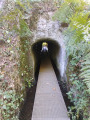
(6) At the junction, go straight on into the sunken lane, pass through the village of Poulmorvan, then cross the road (take care). Opposite, then slightly to your right, take the path which narrows and descends towards the site of the Moulin de Saint-Yves.

(8) Turn right, following the spillway, then turn left after the bend to take the sunken lane. Before Pont Person, cross the footbridge and follow the path which climbs to the left. Walk along the fence on the left, then head back down the steep path to the left. Turn right along the embankment and join the path running parallel to the Scorff through the meadows of Coët Letune.

(9) Continue along the wetland. At the Kereven pumping station, turn right and carry on along the edge of the woodland (straight on, then right) until you reach the road. Turn left, then take the second left after the bend. Cross over and continue straight ahead along the housing estate. Turn right at Kerhello to reach Saint-Gérand Church (S/E).

Waypoints

  1. S/E : mi 0 - alt. 177 ft - Saint-Gérand Church
  2. 1 : mi 0.2 - alt. 164 ft - Allée du Bois
  3. 2 : mi 0.66 - alt. 190 ft - Rue Anne de Bretagne
  4. 3 : mi 0.97 - alt. 138 ft - Rue du Doued
  5. 4 : mi 1.64 - alt. 62 ft - Pont Person
  6. 5 : mi 2.03 - alt. 177 ft - Kernaud
  7. 6 : mi 2.49 - alt. 118 ft - Le Bas Pont-Scorff
  8. 7 : mi 2.84 - alt. 30 ft - The Pont Neuf
  9. 8 : mi 3.63 - alt. 26 ft - Saint-Yves Mill
  10. 9 : mi 4.4 - alt. 26 ft - Coët Letune
  11. S/E : mi 5.54 - alt. 174 ft - Saint-Gérand Church

Notes

This route is organised by Lorient Agglomération

This route is included in the Morbihan Departmental Plan for Walking and Hiking Routes and has been accredited by the French Hiking Federation. You can follow the yellow signposts. There is an information board with a map and details of heritage sites at the start.

Worth a visit

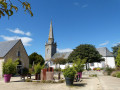
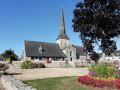
- Saint-Gérand Church: rebuilt in 1888, with a neoclassical bell tower and porch, and a12th-century Romanesque nave.
- Lavoir du Bourg: late19th century.
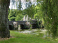
- Pont Person: a single-arch bridge dating from the late19th century.
- Le Bas Pont-Scorff: Notre-Dame de Bonne Nouvelle Chapel (13th–19th centuries), banks of the Scorff; the first crossing point over the Scorff from the sea, dating from Roman times until 1822; St-Jean Bridge (16th century); Malterie (19th-century brewery); Pont Neuf (1851).
- The Saint-Yves mill: a grain mill and weir dating from 1669, converted into a brewery in the late19th century.
- Coët Létune (meaning ‘the goblin’s wood’ in Breton): a Natura 2000 site and the Kereven drinking-water pumping station,
which has supplied Lorient since 1911 and the surrounding towns since 1957.

Reviews and comments

4.6 / 5
Based on 3 reviews

Reliability of the description
5 / 5
Ease of following the route
5 / 5
Route interest
3.7 / 5
User 1597712

Overall rating : 4.7 / 5

Date of your route : Dec 29, 2025
Reliability of the description : ★★★★★ Very good
Ease of following the route : ★★★★★ Very good
Route interest : ★★★★☆ Good
Very busy route : Yes

Very beautiful route

Machine-translated

bernard coulomb
bernard coulomb

Overall rating : 3.5 / 5

Date of your route : Sep 22, 2025
Reliability of the description : Not used / Not applicable
Ease of following the route : ★★★★★ Very good
Route interest : ★★☆☆☆ Disappointing
Very busy route : No

A simple Sunday stroll to tire out the kids and dogs. Only the Person Bridge area is worth seeing.
Fortunately, on the way back, the old town centre of Pont Scorff and its small village of artisans will make us glad we came to the area.

Machine-translated

User 1326882

Overall rating : 5 / 5

Date of your route : Aug 15, 2025
Reliability of the description : ★★★★★ Very good
Ease of following the route : ★★★★★ Very good
Route interest : ★★★★★ Very good
Very busy route : No

Very pleasant hike. Beautiful trails through the woods (which was perfect for this morning when the temperature was rising). Nice spot for a picnic or snack break along the Scorff River at the bottom of Pont-Scorff behind the Malterie. The route is very well marked.

Machine-translated

Other walks in the area

For more walks, use our search engine .

The GPS track and description are the property of this route's author. Please do not copy them without permission.