From the Parc du Plessis to the Château du Diable through woods and marshes to Lanester

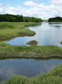
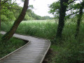
This walk takes you through wooded parks, the Marais de la Goden, the Parc à Bois on the Scorff, and past wash houses and fountains.

Details

335637
Creation:
Last update:
Last review:
  • Walking
    Activity: Walking
  • ↔
    Distance: 7.14 mi
  • ◔
    Average duration: 3h 25 
  • ▲
    Difficulty: Moderate

  • ⚐
    Back to start: Yes
  • ↗
    Ascent: + 171 ft
  • ↘
    Descent: - 148 ft

  • ▲
    Highest point: 98 ft
  • ▼
    Lowest point: 3 ft
  • ⚐ Country: France
  • ⚐ City: Lanester (56600)
  • ⚑
    Start/End: N 47.760176° / W 3.336764°
  • ❏
    IGN map(s): Ref. 0720ET
  • Hour-by-hour weather

Description of the walk

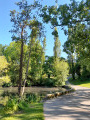
(S/E) The walk starts opposite No. 104 Rue Jules Guesde. Enter the park through the west gate. Walk around the ponds and follow the park’s fitness trail.
Follow theGR®34(red and white markings), walk past the Le Coutaller care home and cross the street of the same name, then continue to follow theGR® opposite. Cross Avenue Président Allendé and, opposite, take theGR® along a disused railway line. Enter the woods whilst following theGR®, which leads to the Pont du Bouc on the D194.

(1) Cross this departmental road, follow it to the right as far as the railway line and the marshes. Turn left to walk alongside the marshes without crossing them, following the yellow markings. Continue along this path, leaving a residential area on your left. After the last house, turn left towards Rue Jules Romain. Turn left, then right onto Rue André Malraux, and left onto Rue Jean Rostand. Turn right onto Avenue Ho Chi Minh, cross a large level crossing, then turn left into the residential area and follow Rue Louis Avry.

(2) Turn left, then right onto Rue Eugène Fichoux. Cross Rue de La Guern, then turn right onto Rue Jean-Baptiste Clément. Immediately afterwards, on the left, take a path leading to Rue André Gide. At the end, on the right in a small square, a path between the houses leads to Rue Jean-Baptiste Clément.
Turn left onto this street and continue until you reach Rue Paul Claudel. Turn right onto it and take the path running alongside a care home.

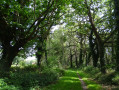
(3) At the end, take the street opposite, then turn left and right twice. At the traffic lights, cross Rue Ambroise Croizat. Opposite, take Rue Diderot and, once you reach the countryside, turn onto the first path on the left. Follow this path through the woods, crossing the wide Allée du Manoir de Kervélèan.
Opposite, slightly to the left, take a path heading west. Just to the right is the manor’s wash house and well (take a short detour to visit them).

(4) Continue along the track, heading roughly west.

(5) Pass close to the Manébos stele. When you reach a road, cross a small bridge and then the road; on your right you’ll find the Parc du Château du Diable.

(6) Walk around the park. At the top of the hill are the ruins of the castle and a noria.

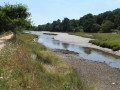
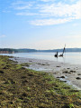
(6) After visiting the park, return to the park entrance; on your right is the River Scorff and, opposite, Lorient. Follow the path along the River Scorff, pass under the Saint Christophe Bridge (Rue Jean Jaurès) and continue along the river. Walk alongside the two-century-old submerged woodland, clearly visible at low tide.

(7) Continue along the River Scorff. After a large roundabout and before the large Pont des Indes bridge over the River Scorff, turn left across Avenue Gabriel Péri and enter a landscaped garden (playground, footbridge, toilets at the entrance). Cross it heading north-east, turn right onto Rue Casanova and, at the end of the street, you’ll see some wash houses.

(8) Turn right onto Rue Albert Thomas and then immediately left onto a footpath which leads to Rue Maupassant. Note the Kerhonno Battery.

(9). Take Rue Maupassant on the left, then take the first footpath on the right until you reach Rue Guillemot, and turn left onto this street until you reach the level crossing. Turn left to walk alongside the railway line, then turn right, cross the railway line, walk past a café-restaurant and turn left onto the path running alongside another railway line to reach the Îlot des Coups de Poings. Note the marks left by the old wash houses.

(10) Take Rue Gutenberg, then turn left onto the footpath leading to Rue Pasteur. Turn right onto this street, then left onto Avenue de Stalingrad and take the first right.
Walk through a wooded area to reach a car park serving a block of flats. Walk northwards alongside the block of flats furthest to your right.

(11) When you reach Avenue du Colonel Fabien, turn right, then right, left and right into Rue Sourdille, and immediately left onto the footpath leading to Rue Jules Guesde, opposite Parc du Plessis.
Turn right onto this street to return to the car park (S/E).

Waypoints

  1. S/E : mi 0 - alt. 52 ft - Parc du Plessis car park, Rue Jules Guesde
  2. 1 : mi 1.08 - alt. 16 ft - Pont du Bouc, Goden Marshes
  3. 2 : mi 2.06 - alt. 49 ft - Turn left, then right
  4. 3 : mi 2.65 - alt. 66 ft - Take the street opposite
  5. 4 : mi 3.26 - alt. 36 ft - Kervéléan’s well and wash houses
  6. 5 : mi 3.55 - alt. 33 ft - Manébos memorial
  7. 6 : mi 3.77 - alt. 10 ft - Devil’s Castle Park and waterwheel
  8. 7 : mi 5.3 - alt. 13 ft - Submerged timber yard on the - Scorff (fleuve)
  9. 8 : mi 6.01 - alt. 13 ft - Kerhono fountain and wash house
  10. 9 : mi 6.09 - alt. 23 ft - Kerhonno Battery, 18th century
  11. 10 : mi 6.4 - alt. 30 ft - Washing houses at the shipyards on the Îlot des Coups des Poings
  12. 11 : mi 6.89 - alt. 72 ft - Avenue du Colonel Fabien
  13. S/E : mi 7.14 - alt. 52 ft - Parc du Plessis car park, Rue Jules Guesde

Worth a visit

In the Parc du Plessis there is a section of circular wall featuring the nesting boxes of a dovecote.

(4) The Kervéléan washhouse fountain in the Guieysse family’s private grounds (open to pedestrians). In 1790, Pierre Guieysse’s wife had a complex comprising a fountain, a reservoir and two washhouses built. A flight of steps leads down to the water-drawing area. The fountain’s basin is protected by a small dome resting on four pillars.

(9) The Kerhonno battery: part of a defensive network built in the 18th century to protect the shipyard of the Compagnie des Indes. The granite battery, measuring 56m by 24m, was never used; it was designed following the battle with the British in 1746. The British had landed at Le Pouldu Guidel.

Always be cautious and plan ahead when you're outdoors. Visorando and the author of this route cannot be held responsible for any accidents occurring on this route.

The GR® and PR® markings are the intellectual property of the Fédération Française de Randonnée Pédestre.

Reviews and comments

3.9 / 5
Based on 4 reviews

Reliability of the description
4 / 5
Ease of following the route
4.3 / 5
Route interest
3.5 / 5
jean-yves.baudet46@orange.fr

Overall rating : 3.3 / 5

Date of your route : Aug 26, 2024
Reliability of the description : ★★★☆☆ Average
Ease of following the route : ★★★☆☆ Average
Route interest : ★★★★☆ Good
Very busy route : No

Machine-translated

nelsonetanne056
nelsonetanne056

Overall rating : 3.5 / 5

Date of your route : Jun 11, 2020
Reliability of the description : ★★★★☆ Good
Ease of following the route : Not used / Not applicable
Route interest : ★★★☆☆ Average
Very busy route : No

An interesting part, but too much of the town, and finding your way around Plessis Park is a bit of a faff, so
Could be improved

Machine-translated

Lulu 56
Lulu 56

Overall rating : 4.3 / 5

Date of your route : Jan 13, 2020
Reliability of the description : ★★★★☆ Good
Ease of following the route : ★★★★★ Very good
Route interest : ★★★★☆ Good

Very little of the route is on tarmac pavements; a significant section runs along the banks of the Scorff.
A lovely walk

Machine-translated

marco56550
marco56550

Overall rating : 4.3 / 5

Date of your route : Jan 06, 2017
Reliability of the description : ★★★★★ Very good
Ease of following the route : ★★★★★ Very good
Route interest : ★★★☆☆ Average

A route that’s half in town, half in the countryside. Not particularly of cultural interest, but a pleasant walk. Best done in spring rather than winter; the ground is often muddy, and along the banks of the Scorff, watch out for the tide. There’s a risk of the path being flooded. Also, at the manor house, local residents don’t take kindly to people coming near the wash house and the fountain. Private property.

Enjoy your walk, everyone

Machine-translated

Other walks in the area

For more walks, use our search engine .

The GPS track and description are the property of this route's author. Please do not copy them without permission.