Around Hennebont and the towpath

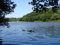
An easy loop starting from Hennebont. Pass through Saint-Antoine, Saint-Gilles, the Quelennec lock, and return to Hennebont via the towpath through Lochrist.
9/08/2023 Message from the moderator: following feedback, the hike has been modified at point 9 to avoid passing through private property.

Details

28109
Creation:
Last update:
Last review:
  • Walking
    Activity: Walking
  • ↔
    Distance: 9.90 mi
  • ◔
    Average duration: 4h 45 
  • ▲
    Difficulty: Moderate

  • ⚐
    Back to start: Yes
  • ↗
    Ascent: + 249 ft
  • ↘
    Descent: - 249 ft

  • ▲
    Highest point: 259 ft
  • ▼
    Lowest point: 10 ft
  • ⚐ Country: France
  • ⚐ City: Hennebont (56700)
  • ⚑
    Start/End: N 47.806005° / W 3.28181°
  • ❏
    IGN map(s): Ref. 0720ET, 0820SB
  • Hour-by-hour weather

Photos

Description of the walk

Departure from the car park at the bottom of the ramparts of Hennebont, along the towpath.

(S) Follow the left bank of the Blavet towards the sea.

(1) Cross the crossroads towards Port-Louis, still following the Blavet.

(2) Go up the stairs on the left that lead to the Kerihouais neighbourhood. Continue straight ahead for 400 metres.

(3) At the roundabout, take the first road on the right. About 50 metres further on, take the small dirt track that runs alongside the sports ground. Cross two tarmac roads

(4) Take the second road on the left. After about 500 metres, continue along this small road until you reach a road with a tunnel underneath. Continue to the hamlet of Saint-Antoine.

(5) Take the road behind the chapel for 300 metres and continue straight ahead along a dirt track until you reach the D765, which you cross at a pedestrian crossing. After about ten metres, take the tarmac road towards Saint-Gilles, which you leave at the bottom of the hill.

(6) Take a sunken lane on the right. Cross the hamlet of Le Braigno.

(7) Take the path on the left in the bend, between the houses.

(8) After the hamlet of Kerhuët, you can visit the church of Saint-Gilles and then return. Take the small country road opposite the road from Kerhuët towards Saint-Germain. At the next crossroads, turn left onto the road that joins the D724 400 metres further on.

(9) Turn left and follow the D724 until you reach the junction with the Route du Belanne on the right. Continue along this road until you reach the junction with Rue du Quelennec.

(10) Turn right and continue along this road. Pass the Quelennec dairy farm.

(11) Continue on this road, which leads directly to the Quelennec lock.

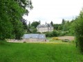
(12) Turn left onto the towpath, passing the castle of the same name. Follow this path to Lochrist for 2 km.

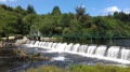
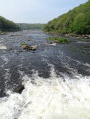
(13) When you arrive in Langroix, cross the Blavet on the footbridge to reach the island of Locastel and its white water park. You can picnic on the island. Leave the island via one of the two bridges and follow the Blavet for about 800 metres. Climb the stairs opposite the forge museum.
You can take a very interesting tour of the eco-museum (allow two hours). If you take the tour, continue along the road to the right. If you don't take the tour, take the road on the left to reach the "Grand Barrage" lock.

(14) Cross the Blavet at the "Grand barrage" lock.
Continue along the towpath, first westwards then southwards, to reach Hennebont after about 3 km. Just after the last house, take a small steep path (a few metres) which joins a dirt track built on the old railway line that used to supply the forges with coal and scrap metal. This path runs alongside the towpath 1 to 3 metres above it and, in several places, it is possible to switch from one to the other. Continue to the car park where you started (E).

Waypoints

  1. S/E : mi 0 - alt. 10 ft - Parking is available at the bottom of the ramparts in Hennebont - Blavet (fleuve)
  2. 1 : mi 0.3 - alt. 16 ft - Cross the crossroads towards Port-Louis
  3. 2 : mi 0.53 - alt. 13 ft - Climb the stairs on the left
  4. 3 : mi 0.73 - alt. 112 ft - At the roundabout, take the first road on the right
  5. 4 : mi 1.13 - alt. 131 ft - Take the second road on the left
  6. 5 : mi 1.7 - alt. 161 ft - Take the road behind the chapel
  7. 6 : mi 2.19 - alt. 174 ft - Take the sunken path on the right
  8. 7 : mi 2.57 - alt. 226 ft - Take the path on the left between the houses
  9. 8 : mi 3.43 - alt. 203 ft - Take the country road opposite the church
  10. 9 : mi 4.08 - alt. 223 ft - Crossroads with the D724
  11. 10 : mi 4.33 - alt. 233 ft - T-junction
  12. 11 : mi 4.84 - alt. 223 ft - Quellennec dairy farm
  13. 12 : mi 5.56 - alt. 36 ft - Take the towpath to the left
  14. 13 : mi 6.78 - alt. 30 ft - Cross the Blavet river on the footbridge
  15. 14 : mi 7.8 - alt. 26 ft - Cross the Blavet River at the "Grand Barrage" lock
  16. S/E : mi 9.9 - alt. 10 ft - Parking is available at the bottom of the ramparts in Hennebont

Notes

Trainers are sufficient for this walk.

Worth a visit

Start the loop in the morning with a short detour to discover the Romanesque church of Saint-Gilles, picnic on the island of Locastel in Lochrist, visit the forge eco-museum, then return to Hennebont at the end of the afternoon.
The visit to the eco-museum, which lasts about two hours, takes you on a journey through the industrial history of the Lorient region in the 19th and 20th centuries, in a company that once employed up to 3,000 people (see http://www.inzinzac-lochrist.fr/Ecomusee... ).

Reviews and comments

4.5 / 5
Based on 27 reviews

Reliability of the description
4.6 / 5
Ease of following the route
4.4 / 5
Route interest
4.4 / 5
louis35
louis35

Overall rating : 4.7 / 5

Date of your route : Apr 11, 2025
Reliability of the description : ★★★★★ Very good
Ease of following the route : ★★★★★ Very good
Route interest : ★★★★☆ Good
Very busy route : No

Pleasant route: At the end of the port, the steps on the left are the only difficult part of this route. We encountered a hare in the woods, which looked at us without panicking. It was a little crowded after the eco-museum, but it is the holiday season and the towpath is ideal for holidaymakers. The car park at the end of the ramparts is large and free.

Machine-translated

MIZDUCHAT
MIZDUCHAT
• Edited:

Overall rating : 4.7 / 5

Date of your route : May 10, 2024
Reliability of the description : ★★★★☆ Good
Ease of following the route : ★★★★★ Very good
Route interest : ★★★★★ Very good
Very busy route : No

This hike is quite long, at 15.97 km. I split it into three sections of about 5 km each and did it backwards. I had no trouble following the directions provided by the hiker who suggested this route. It's very interesting for anyone who wants to discover Hennebont. I recommend this walk, which combines urban areas, riverbanks and countryside. Thefirst part, from the towpath to the village of St Antoine, is the prettiest. I will do this walk again next autumn.

Machine-translated

gerardluda
gerardluda

Overall rating : 3.7 / 5

Date of your route : Jan 08, 2024
Reliability of the description : ★★★★☆ Good
Ease of following the route : ★★★★☆ Good
Route interest : ★★★☆☆ Average
Very busy route : No

easy route but too many sections on tarmac roads.

Machine-translated

Plucdec
Plucdec

Overall rating : 4 / 5

Date of your route : Sep 08, 2023
Reliability of the description : ★★★★☆ Good
Ease of following the route : ★★★★☆ Good
Route interest : ★★★★☆ Good
Very busy route : Yes

Hello
I left the forges behind as I already knew them and stayed on the towpath. No difficulties, but the path that leaves the D145 towards Braigno is starting to get a bit messy. Watch out for ticks!
Thanks to the creator of this walk.

Machine-translated

Didier Nebout
Didier Nebout

Overall rating : 4 / 5

Date of your route : Aug 09, 2023
Reliability of the description : ★★★★☆ Good
Ease of following the route : ★★★★☆ Good
Route interest : ★★★★☆ Good
Very busy route : Yes

At point 9, the path through the woods no longer exists. It is private property.
You have to walk along the D724, which is very busy, to find the road that leads to Belanne and the dairy farm in Quélennec. There you will find the route again at point 10.
Other than that, it's a lovely walk. Walking along the Blavet is nice. Watch out for the many bicycles.
During mushroom season, you can find chanterelles on the outskirts of Hennebont.

Machine-translated

M@lher56%
M@lher56%

Overall rating : 3.3 / 5

Date of your route : Apr 05, 2021
Reliability of the description : ★★★☆☆ Average
Ease of following the route : ★★★☆☆ Average
Route interest : ★★★★☆ Good
Very busy route : No

the signposting had to be changed.
there are no more signposts from "Le Braigno". We took the road to Kerhuet and then Maison Neuve.
There, the road has changed and you can no longer cross the woods before the D724, and the same applies at No. 9
We took the Belann road, then turned right onto the Quelennec road until we reached the lock....
Far too much road
return via the towpath
total 17 km
luckily, the weather was nice

Machine-translated

cathy86
cathy86

Overall rating : 4.7 / 5

Date of your route : Aug 17, 2020
Reliability of the description : ★★★★★ Very good
Ease of following the route : ★★★★★ Very good
Route interest : ★★★★☆ Good
Very busy route : Yes

We didn't do the whole loop, but we did a long round trip along the towpath.
The towpath along the Blavet is not straight and has remained wild.
No locks were open in August 2020 except for the Gorets lock.

Machine-translated

Peps56
Peps56

Overall rating : 4.3 / 5

Date of your route : May 29, 2020
Reliability of the description : ★★★★★ Very good
Ease of following the route : ★★★★☆ Good
Route interest : ★★★★☆ Good
Very busy route : No

The section between No. 9 and No. 10 needs to be completely redone.
It's difficult to find the path; it looks like hardly anyone has ever been down this trail.
Without the barrier, we wouldn't have found it.
Otherwise, the rest of the hike is very pleasant and easy to follow.

Machine-translated

Annie.Sylvain
Annie.Sylvain

Overall rating : 4.3 / 5

Date of your route : May 24, 2020
Reliability of the description : ★★★★☆ Good
Ease of following the route : ★★★★☆ Good
Route interest : ★★★★★ Very good
Very busy route : No

A small sign at the end of the dirt road (5) did not indicate to take the road on the left to join the D765.
The little extra: a rustic bar at the lock. The route is physically easy and offers varied scenery (plains, forest and riverside).

Machine-translated

Christele29
Christele29

Overall rating : 5 / 5

Date of your route : Oct 26, 2019
Reliability of the description : ★★★★★ Very good
Ease of following the route : ★★★★★ Very good
Route interest : ★★★★★ Very good

Very beautiful hike. Thank you.

Machine-translated

luc.desmoulins
luc.desmoulins

Overall rating : 4.3 / 5

Date of your route : Jul 01, 2019
Reliability of the description : ★★★★☆ Good
Ease of following the route : ★★★★☆ Good
Route interest : ★★★★★ Very good

Very beautiful route, easy and pleasant

Machine-translated

EBELLANGER
EBELLANGER

Overall rating : 5 / 5

Date of your route : Jul 13, 2019
Reliability of the description : ★★★★★ Very good
Ease of following the route : ★★★★★ Very good
Route interest : ★★★★★ Very good

A beautiful walk inland before a particularly pleasant return trip along the banks of the Blavet.

Machine-translated

Mardep
Mardep

Overall rating : 4.7 / 5

Date of your route : Jun 17, 2019
Reliability of the description : ★★★★★ Very good
Ease of following the route : ★★★★★ Very good
Route interest : ★★★★☆ Good

Good balance between urban landscapes (a few new housing developments that somewhat disrupt the description), countryside and towpath.

Machine-translated

Mardep
Mardep

Overall rating : 4.7 / 5

Date of your route : Jun 17, 2019
Reliability of the description : ★★★★★ Very good
Ease of following the route : ★★★★★ Very good
Route interest : ★★★★☆ Good

Good balance between urban landscapes, countryside and towpaths.

Machine-translated

fred56diato
fred56diato

Overall rating : 4.7 / 5

Date of your route : Feb 28, 2019
Reliability of the description : ★★★★★ Very good
Ease of following the route : ★★★★☆ Good
Route interest : ★★★★★ Very good

A very beautiful hike offering varied terrain and scenery. However, there was one downside between points 8 and 9, where it was difficult to find the small path below, but we eventually found the trail to the lock. The names of some hamlets are not always indicated, which makes it more difficult to find your way around on the map.

Machine-translated

Other walks in the area

For more walks, use our search engine .

The GPS track and description are the property of this route's author. Please do not copy them without permission.